| Tornado Outbreak of March 22, 2005 |
Severe Weather Outbreak – March 22, 2005
A strong upper-level weather system in the lower Mississippi Valley coupled with warm, moist, unstable air across southern Alabama, southern Georgia, and the Florida Big Bend and Panhandle produced numerous reports of severe weather across southern Alabama and Georgia.
The Storm Prediction Center's (SPC) Day 1 Outlook at 8 am EST (Figure 1), Tuesday morning, March 22nd showed a slight risk for severe weather across much of the Southeast U.S. A moderate risk covered northern Mississippi, most of Alabama, and southwest Georgia.
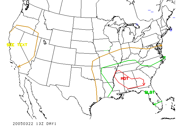
Figure 1. SPC Day 1 Outlook.
The atmosphere was very favorable for tornadic supercells. Surface features are shown in Figure 2. The warm front was north of Tallahassee in southern Georgia. The center of low pressure was back in eastern Oklahoma with a trailing cold front extending down through Louisiana into the Gulf of Mexico.

Figure 2. Surface analysis at 1500 UTC (1000 am EST), 22 March 2005 with surface pressure and frontal locations.
The extensive radar activity is evident in Figure 3 extending from near Douglas, Georgia in Coffee County back to the west near Camilla and Colquitt, Georgia, then between Dothan, Alabama and Marianna, Florida on into the Gulf of Mexico near Destin, Florida.
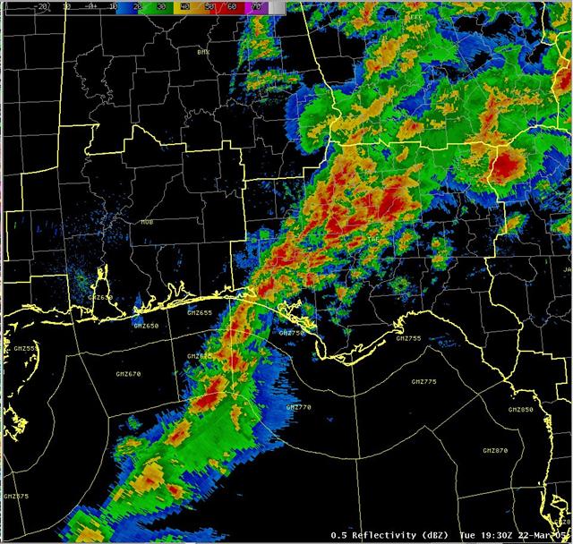
Figure 3. Radar reflectivity mosaic at 1930 UTC (2:30pm EST), March 22, 2005.
One of the strongest tornadic supercells (circled area) in recent memory can be seen in Figure 4 crossing the Chattahoochee River and entering Seminole and Early Counties in Georgia.
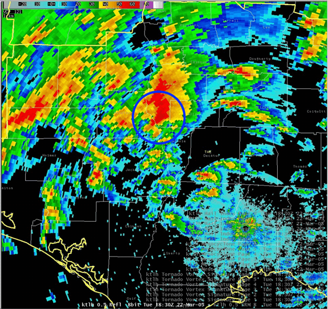
Figure 3. KTLH radar reflectivity image at 1830 UTC (1:30pm EST), March 22, 2005.
Examining the storm-relative velocity image (Figure 4), we see a couplet of reds and blues that stand out significantly from the surrounding areas. The shear in this storm compares with storms that occur in the springtime out on the Great Plains. The gate-to-gate shear is nearly 160 knots.
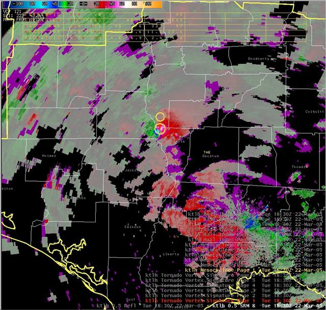
Figure 4. Radar storm relative velocity image at 1830 UTC (1:30pm EST), March 22, 2005.
A preliminary storm track in shown in Figure 5. The Seminole-Miller County tornado was rated as high as F3 in one location. Wind speeds in an F3 tornado are in the range of 158 to 206 mph. Damage from an F3 tornado is rated as severe and may include roofs and some walls torn off well-constructed houses...trains overturned...most trees uprooted...and heavy cars lifted from the ground. The Pansey, Alabama tornado was rated as high as F2 along its path. Wind speeds in an F2 tornado are in the range of 113 to 157 mph. Damage from an F2 tornado is considerable and may include roofs torn off framed houses...mobile homes demolished...boxcars overturned...large trees snapped or uprooted...light objects missiles generated...and cars lifted off the ground. The Sale City, Georgia tornado was rated F0. Winds speeds in an F0 tornado are in the range of 40 to 72 mph.
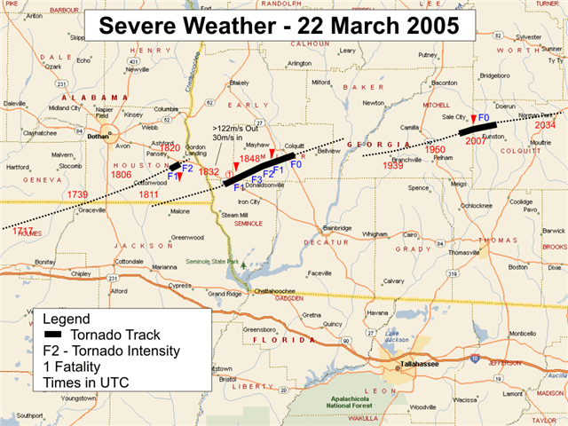
Figure 5. Storm tracks and tornadoes with preliminary F-scale intensities.


 Follow us on YouTube