
Station Digest (information about our area)
Welcome to the National Weather Service office at Morristown, Tennessee, in the foothills of the beautiful Smoky Mountains. The mission of our agency, the National Weather Service (NWS), is to provide weather, hydrologic, and climate forecasts and warnings for the protection of life and property and the enhancement of the national economy.
The mission of our office (KMRX) parallels that of the NWS. We are designated a Weather Forecast Office (WFO) and are responsible for issuing forecasts, watches and warnings for counties in our County Warning Area (CWA) and hydrological forecasts and warnings for rivers and basins in our Hydrological Service Area. Some of our specific responsibilities include routinely issuing Terminal Aerodrome Forecasts (TAF's) for three local airports, namely Chattanooga, Tri-Cities, and Knoxville. These forecasts are issued every six hours and cover a period of 24 hours. We also routinely issue zone forecasts at least twice a day for our CWA and provide area forecast discussions four times a day explaining the reasoning behind the forecast. Fire weather forecasts are issued daily which provide local forestry officials with specific information needed for fire suppression and management. A more recent focus in our agency and at our office is Impact-Based Decision Support Services (IDSS). IDSS are essentially forecast advice and interpretative services the NWS provides to help core partners, such as emergency personnel and public safety officials. IDSS's main focus is to help these core partners make decisions when water, weather, and climate impacts the livelihoods of Americans.
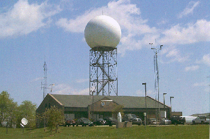
KMRX also formulates and disseminates non-routine products such as statements, watches and warnings. Local Storm Spotters may be called upon for help when warning for severe weather, which includes tornadoes, floods/flash floods, and severe thunderstorms. Watches and warnings may also be issued for winter storms, freezes, and non-precipitation events (such as high winds or dense fog). Statements are issued for special weather events, severe weather events, and flood/flash flood events. Moreover, advisories are also produced for high winds, excessive heat, and dense fog. Our most frequently issued non-routine product is the short-term forecast. This forecast covers the next 24 to 36-hours with near-term updates for the next 6 to 12-hours. Updates are generally issued when precipitation is falling in the KMRX CWA and focus on how the forecast differs from current conditions. The product typically describes mesoscale weather features and is often based on WSR-88D Doppler radar data. All these products are routinely broadcast on NOAA Weather Radio.
Aiding with these forecast and warning responsibilities is the Advanced Weather Interactive Processing System (AWIPS). This network of computer workstations integrates several different data sources at one workstation. These data include those from surface and upper air observations, radar, satellite, wind profiler, aircraft, and lightning platforms. The greatly enhanced computer power of AWIPS workstations enables rapid access and display of products from other recently modernized systems, such as the WSR-88D, GOES satellite, ASOS surface observing, and high-resolution numerical forecast models. There are also various online sources that can aid in situational awareness and forecasting.


 Local Radar
 Huntsville Radar
 Regional Satellite
 Graphical Forecast
 Weather Map
 Daily Graphics
 Follow us on YouTube