
Lake effect snow will continue downwind of the Lower Great Lakes through Wednesday, with accumulations of 4 to 8 inches possible for portions of Upstate New York and the Adirondacks. Gusty winds and dry conditions will result in critical fire weather conditions in the Southwest and Southern Plains Wednesday through Friday. Red Flag Warnings have been issued. Read More >
|
Reporting Severe Weather to the National Weather Service at Greenville-Spartanburg By phone: 1-800-267-8101. Leave a message describing your report
Your reports can be a vital component of our decision to issue vs. not to issue warnings for hazardous weather. It's important that you provide information that is as accurate as possible:
The following weather events meet reporting criteria:
Severe Weather Reports Real Time Reports
Historic Reports |


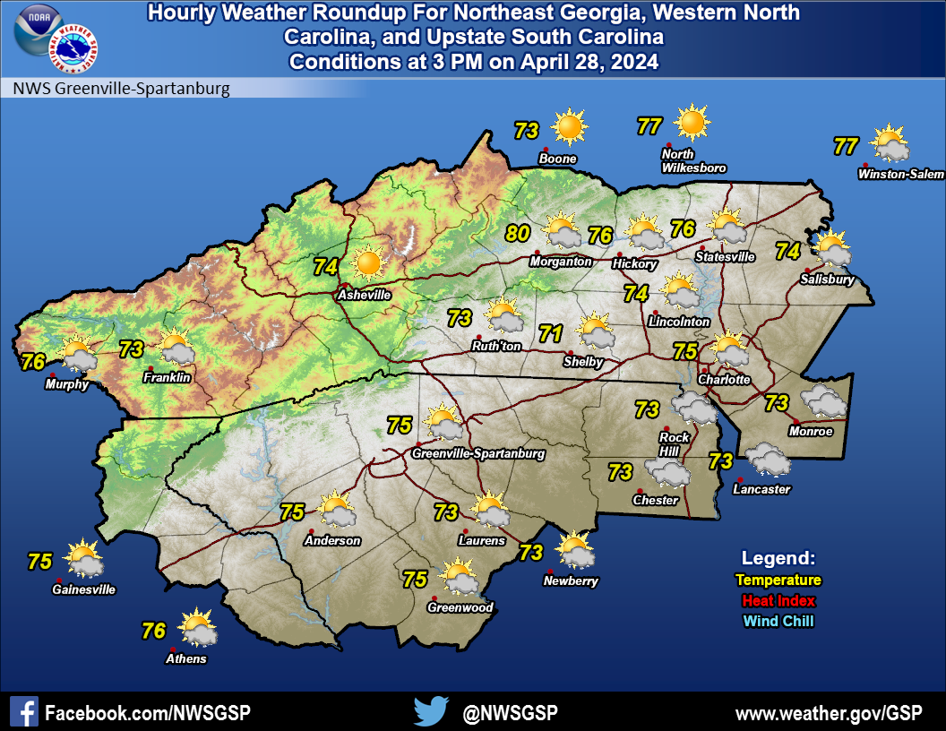 Current Conditions Map