
Thunderstorms may bring heavy to excessive rainfall and the potential for flooding over South Texas late Wednesday through Friday. A Moderate Risk (level 3 of 4) of excessive rainfall has been issued for portions of South Texas. A Pacific storm will begin to impact the Pacific Northwest Wednesday, bringing strong winds, heavy showers and the potential for severe thunderstorms. Read More >
Greenville-Spartanburg, SC
Weather Forecast Office
|
|
Forecast
Hourly Forecast Graph
Weather Activity Planner
Text Forecasts and Hazards
Graphical Forecasts
Aviation
Fire Weather
Lake Forecasts
Mountain Forecasts
Weather Prediction Center
Model Data
Hazards
Hazardous Weather Outlook
Severe Thunderstorms
Heavy Rainfall and Flooding
Tropical Weather
Reporting Severe Wx
Storm Prediction Center
National Hurricane Center
Space Weather
Office Programs
Local Research
Newsletter
NOAA Weather Radio
Skywarn
Cooperative Observers
CoCoRaHS
StormReady
WRN Ambassadors
Office Staff
US Dept of Commerce
National Oceanic and Atmospheric Administration
National Weather Service
Greenville-Spartanburg, SC
GSP International Airport
1549 GSP Drive
Greer, SC 29651
(864) 848-3859
Comments? Questions? Please Contact Us.


 Tropical Weather
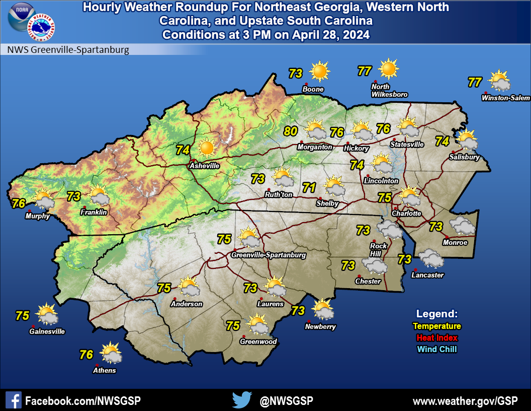 Current Conditions Map