Overview
|
The fast moving weather disturbance Monday night into early Tuesday morning produced significant snowfall across most of the Front Range foothills. Much lighter amounts fell in the I-25 Urban Corridor, with no snow over the northeastern Colorado plains. The latest snowfall map can be found below. NWS Boulder sends a big thanks to all the Weather Spotters, COOP observers, CoCoRaHS observers, and public for all your reports! More local storm reports can be found here. |
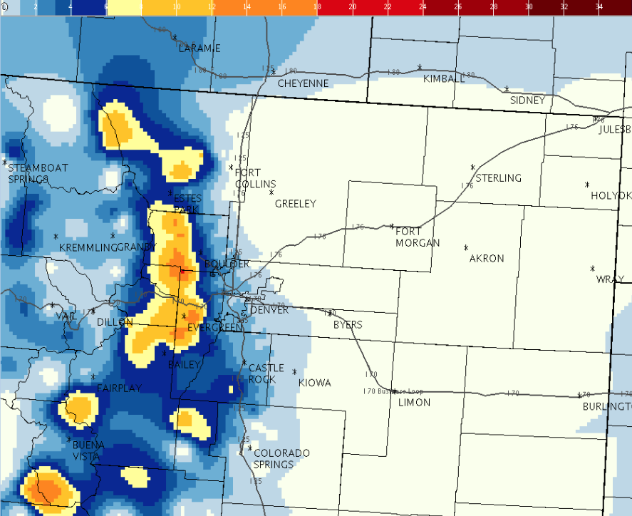 February 23 Snow StormTotal Map |
Snow/Ice Totals (Inches)
3 WNW Pinecliffe 15 inches
4 NE Nederland 15 inches
5 NE Ward 14.6 inches
3 SE Pinecliffe 12 inches
Genesee 12 inches
1 S Evergreen 11 inches
1 SSE Bergen Park 10.7 inches
1 NNW Evergreen 10.7 inches
4 SSE Brookvale 9 inches
11 SSW Georgetown 8.8 inches
4 NE Ward 8.1 inches
 |
Media use of NWS Web News Stories is encouraged! Please acknowledge the NWS as the source of any news information accessed from this site. |
|


 Follow us on YouTube