National Weather Service United States Department of Commerce

NAM Initial and Forecast Winds Aloft Images

These products are from the NAM atmospheric model at levels which are significant to the Aviation Community. The initial images are valid at either 00 or 12 UTC and the forecast maps are valid +06 or +12 hours from those initial times.

Initial Geopotential Heights and Winds

Forecast Winds Aloft (+06 hour)

Forecast Winds Aloft (+12 hour)

NCEP Winds Aloft Forecasts for Alaska - Model based upper level winds produced by NCEP in a text format. WMO Product ID: FBAK31 KWNO.


NEW

The AAWU is transitioning to new Winds Aloft Images that provide more detail.  If you are a user of the images above, please check out our new images below and send any comments, questions or concerns to the web authors via the link at the bottom of the page.  At some point in the future the products above will no longer be available.  NOTE:  While we're experimenting with these new charts, please check the valid times to be sure they are current.


Upper Air Wind Charts

These products are from the NAM atmospheric model at Flight Level (in 100s of feet). These images are updated four times a day following the model runs at 00, 06, 12 or 18 UTC. Three sets of forecast charts valid at model run plus +3, +9 and +15 hours from the initial model time.


Forecast Winds Aloft (+03 hour)

FLT030 | FLT060 | FLT090 | FLT120 | FLT150 | FLT180 | FLT210 | FLT240 | FLT270 | FLT300 | FLT340 | FLT390 | FLT440 | FLT520


Forecast Winds Aloft (+09 hour)

FLT030 | FLT060 | FLT090 | FLT120 | FLT150 | FLT180 | FLT210 | FLT240 | FLT270 | FLT300 | FLT340 | FLT390 | FLT440 | FLT520


Forecast Winds Aloft (+15 hour)
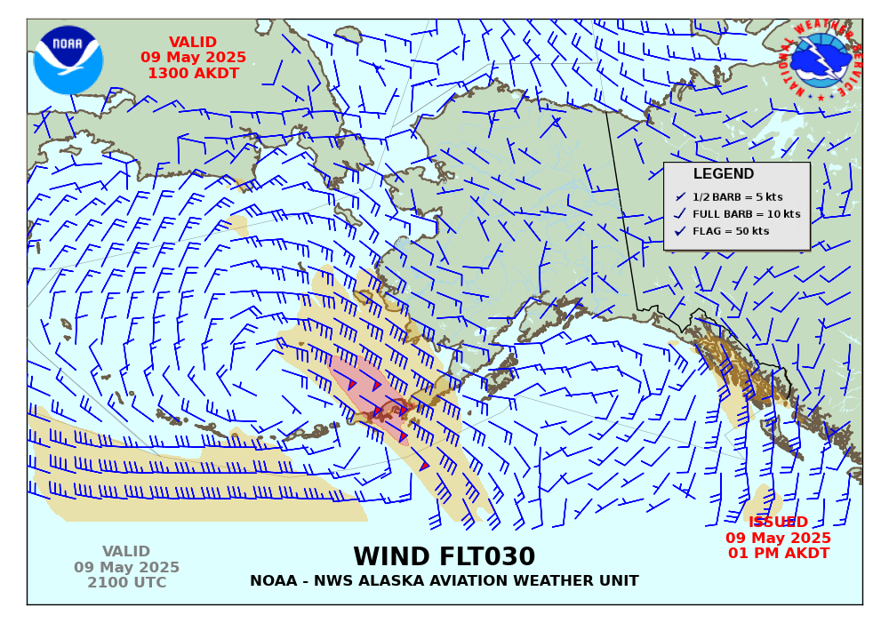
FLT030 | FLT060 | FLT090 | FLT120 | FLT150 | FLT180 | FLT210 | FLT240 | FLT270 | FLT300 | FLT340 | FLT390 | FLT440 | FLT520