
Multiple corridors of severe thunderstorms are expected across the Upper Midwest on Monday into Monday night, with a regional severe weather outbreak possible. The most dangerous period is likely during the late afternoon and evening when strong tornado potential should be maximized. Scattered large to very large hail and damaging winds are likely as well. Read More >
Atlanta
Center Weather Service Unit
| ZTL Airspace Summary / KMCN TAF For ATC Planning Purposes Only | |||
|---|---|---|---|
|
Updated:
|
MCN METAR:
|
||
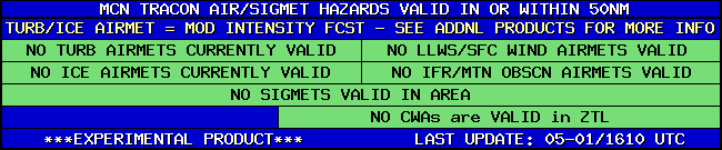
| MCN TRACON HAZARDS | |
|---|---|
|
| Forecast Surface Map Loop / Collaborative Convective Forecast Product / Vertical Wind Profile | ||
|---|---|---|
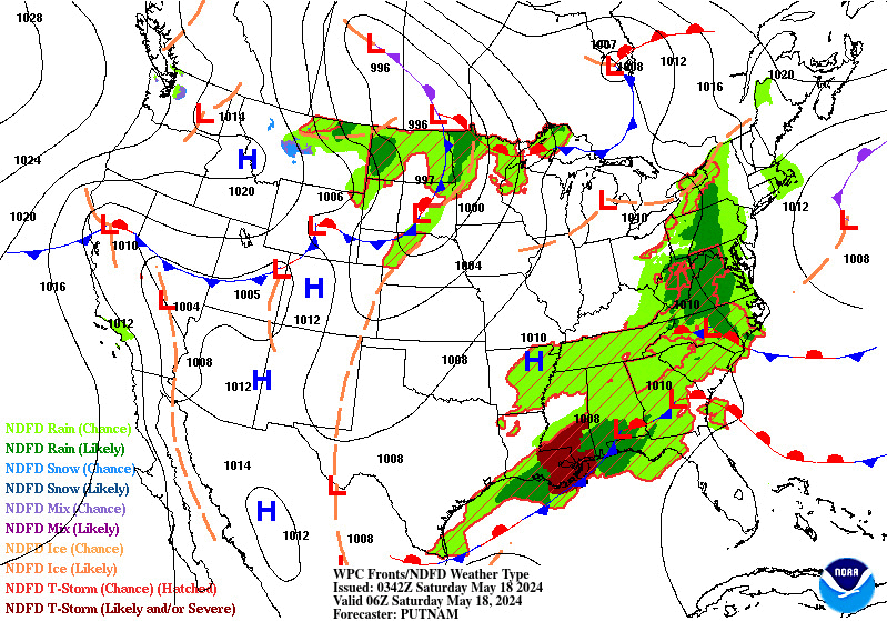 |
 |
|
| AIRMETs & SIGMETS/ Southeast Radar loop / Satellite Image (click on image to enlarge) | ||
|---|---|---|
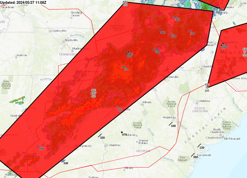 |
 |
|
2
US Dept of Commerce
National Oceanic and Atmospheric Administration
National Weather Service
Atlanta
299 Woolsey Road
Hampton, GA 30228
770.210.7693
Comments? Questions? Please Contact Us.


