
Thunderstorms, some severe, may produce heavy to excessive rainfall and isolated flooding over portions of the Southern Plains today and Saturday. Dry conditions, combined with gusty winds and low relative humidities will continue to support an elevated to critical fire weather threat in the Desert Southwest into to early next week. Read More >
Atlanta
Center Weather Service Unit
| ZTL Airspace Summary / KAVL TAF For ATC Planning Purposes Only | |||
|---|---|---|---|
|
Updated:
|
AVL METAR:
|
||
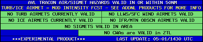
| AVL TRACON HAZARDS | |
|---|---|
|
| Forecast Surface Map Loop / Collaborative Convective Forecast Product / Vertical Wind Profile | ||
|---|---|---|
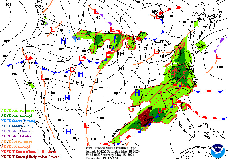 |
 |
|
| AIRMETs & SIGMETS/ Southeast Radar loop / Satellite Image (click on image to enlarge) | ||
|---|---|---|
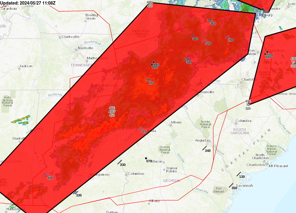 |
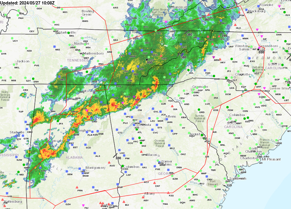 |
|
US Dept of Commerce
National Oceanic and Atmospheric Administration
National Weather Service
Atlanta
299 Woolsey Road
Hampton, GA 30228
770.210.7693
Comments? Questions? Please Contact Us.
Thank you for visiting a National Oceanic and Atmospheric Administration (NOAA) website. The link you have selected will take you to a non-U.S. Government website for additional information.
NOAA is not responsible for the content of any linked website not operated by NOAA. This link is provided solely for your information and convenience, and does not imply any endorsement by NOAA or the U.S. Department of Commerce of the linked website or any information, products, or services contained therein.
You will be redirected to:


