
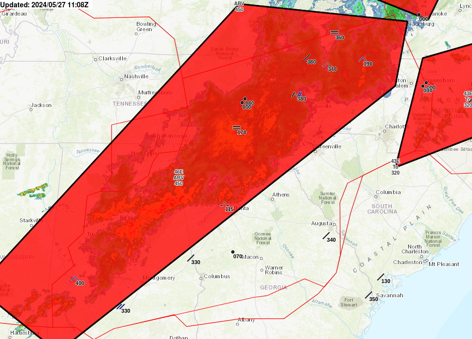
A cold front lingering over Florida will continue to bring showers and thunderstorms to the state and a flash flooding threat to the east coast over the next couple of days. Fire weather concerns are expected in portions of the Florida panhandle into southeastern Georgia. A Kona Low is expected to bring strong winds, widespread heavy rainfall, and flooding concerns to Hawaii through the weekend. Read More >
Atlanta
Center Weather Service Unit
| Hover over or click station to get METAR and TAF (if available). | VFR MVFR IFR LIFR |
 |
 |
 |
 |
 |
 |
|
|
|
|
|
|
|
US Dept of Commerce
National Oceanic and Atmospheric Administration
National Weather Service
Atlanta
299 Woolsey Road
Hampton, GA 30228
770.210.7693
Comments? Questions? Please Contact Us.


 PreDuty Weather Briefing
 Pirep TDA
 Daily Weather Briefing
 Convective Forecast
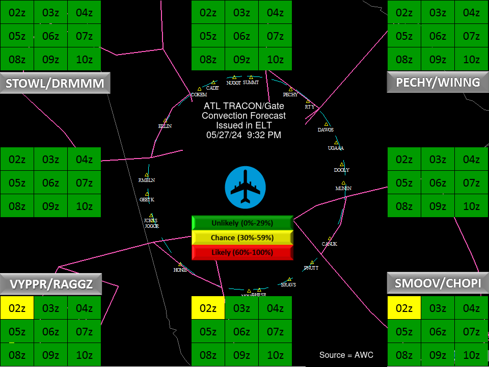
 ATL TRACON Briefing
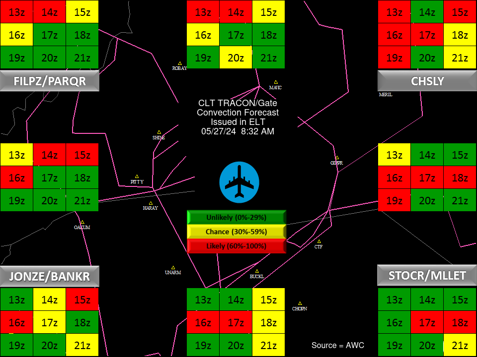
 CLT TRACON Briefing