
Heat expands across the Desert Southwest, Plains, Mississippi Valley and Midwest into Monday. Fire weather concerns continue for portions of the Intermountain West. Active monsoonal moisture fuels thunderstorms over the Southwest with possible flash flooding. Tropical cyclone Fausto in the Pacific, should weaken as it approaches Hawaii; Dangerous surf, swells and rip currents are expected. Read More >
Rapid City, SD
Weather Forecast Office
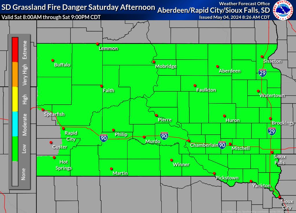
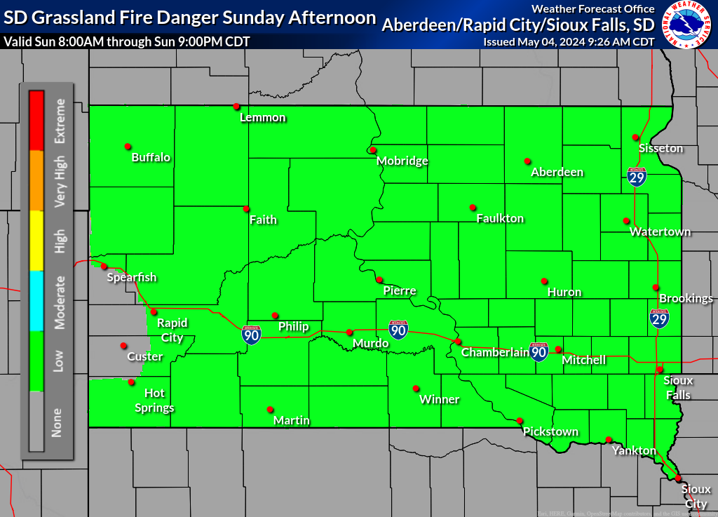
Please use the South Dakota Grassland Fire Danger Map in conjunction with the text products above to assess the Grassland Fire Danger for South Dakota. Please note that text products will be issued daily by 5:00 AM during the fire-weather season or when high, very high, or extreme grassland fire danger is forecast.
What is the Grassland Fire Danger Index?
US Dept of Commerce
National Oceanic and Atmospheric Administration
National Weather Service
Rapid City, SD
300 East Signal Drive
Rapid City, SD 57701-3800
605-341-9271
Comments? Questions? Please Contact Us.

