
A cold front lingering over Florida will continue to bring showers and thunderstorms to the state and a flash flooding threat to the east coast over the next couple of days. Fire weather concerns are expected in portions of the Florida panhandle into southeastern Georgia. A Kona Low is expected to bring strong winds, widespread heavy rainfall, and flooding concerns to Hawaii through the weekend. Read More >
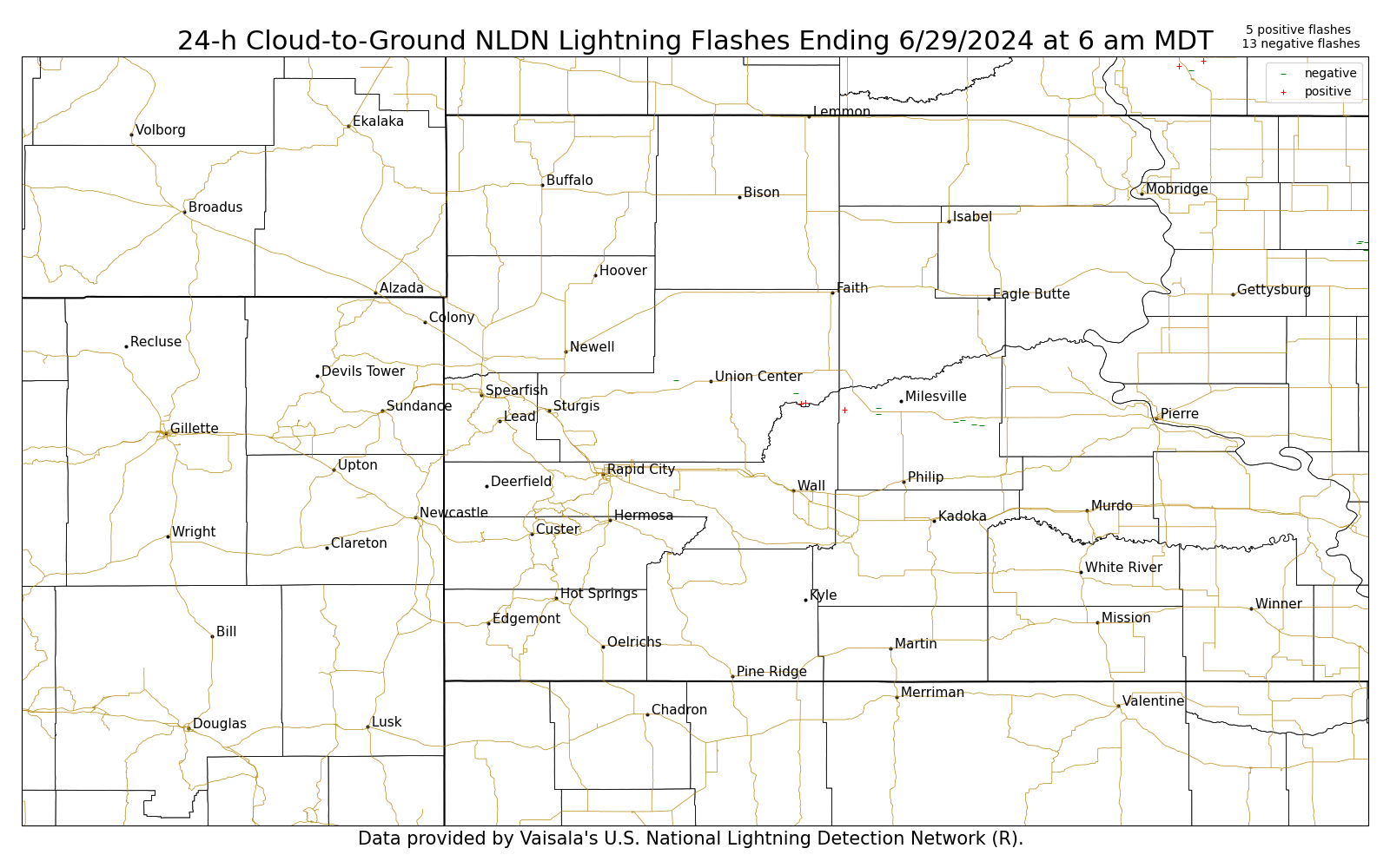
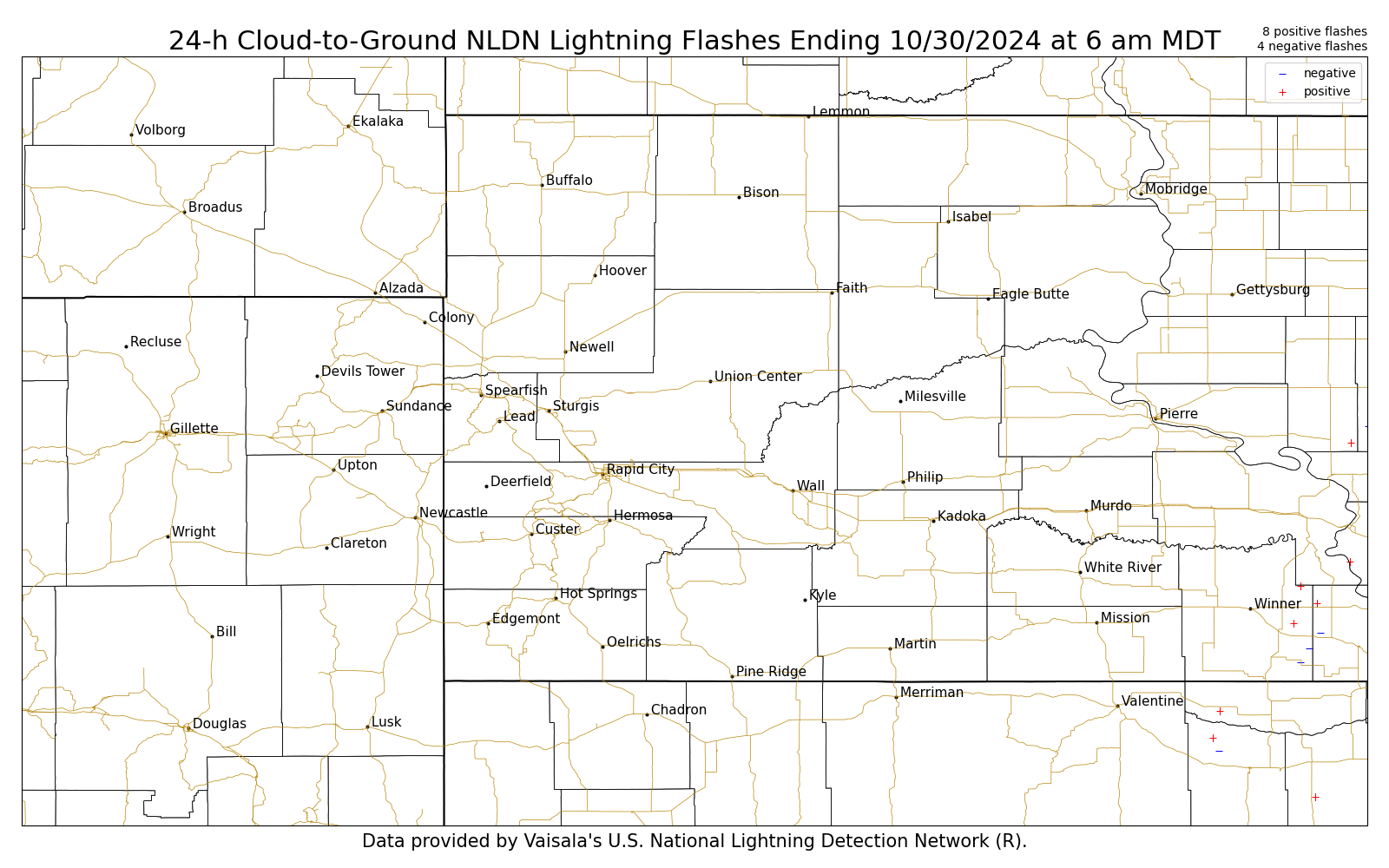
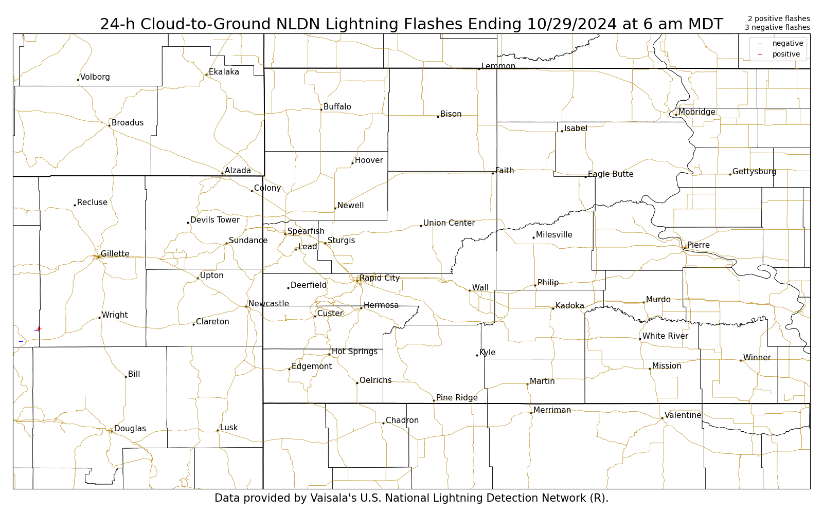
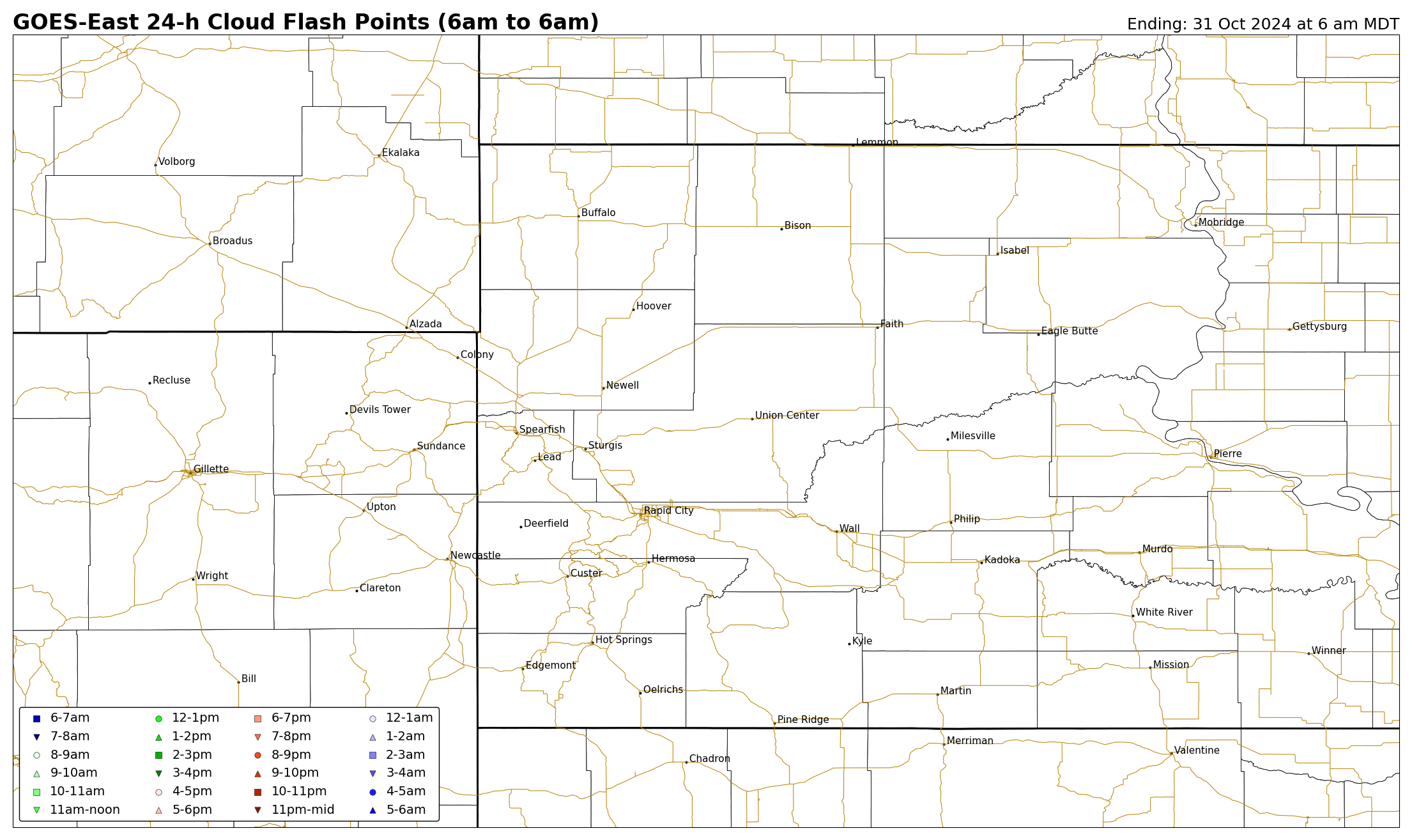
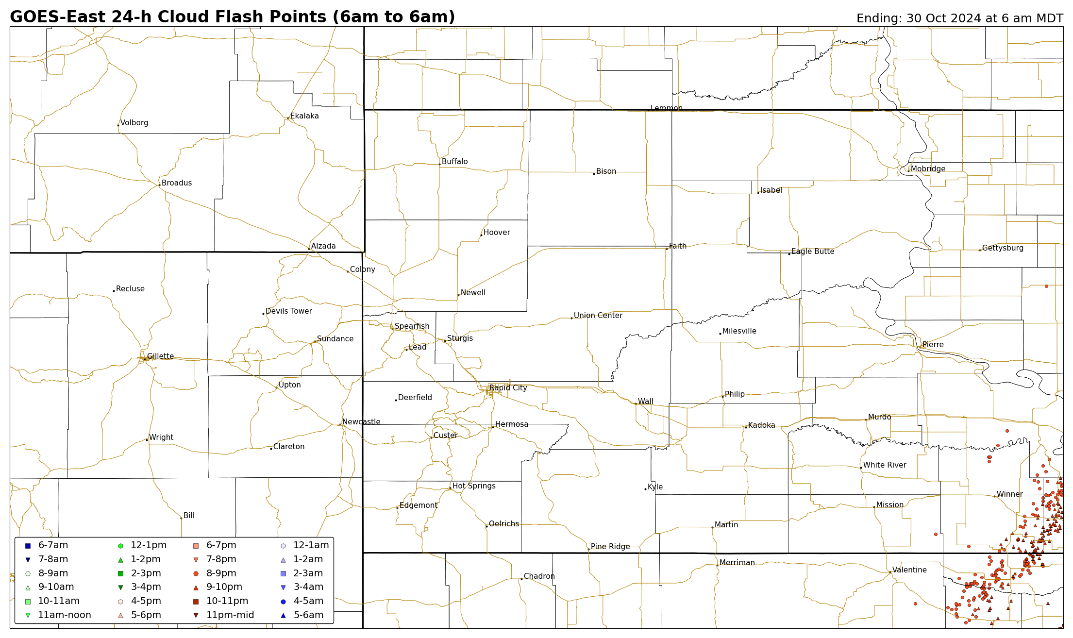
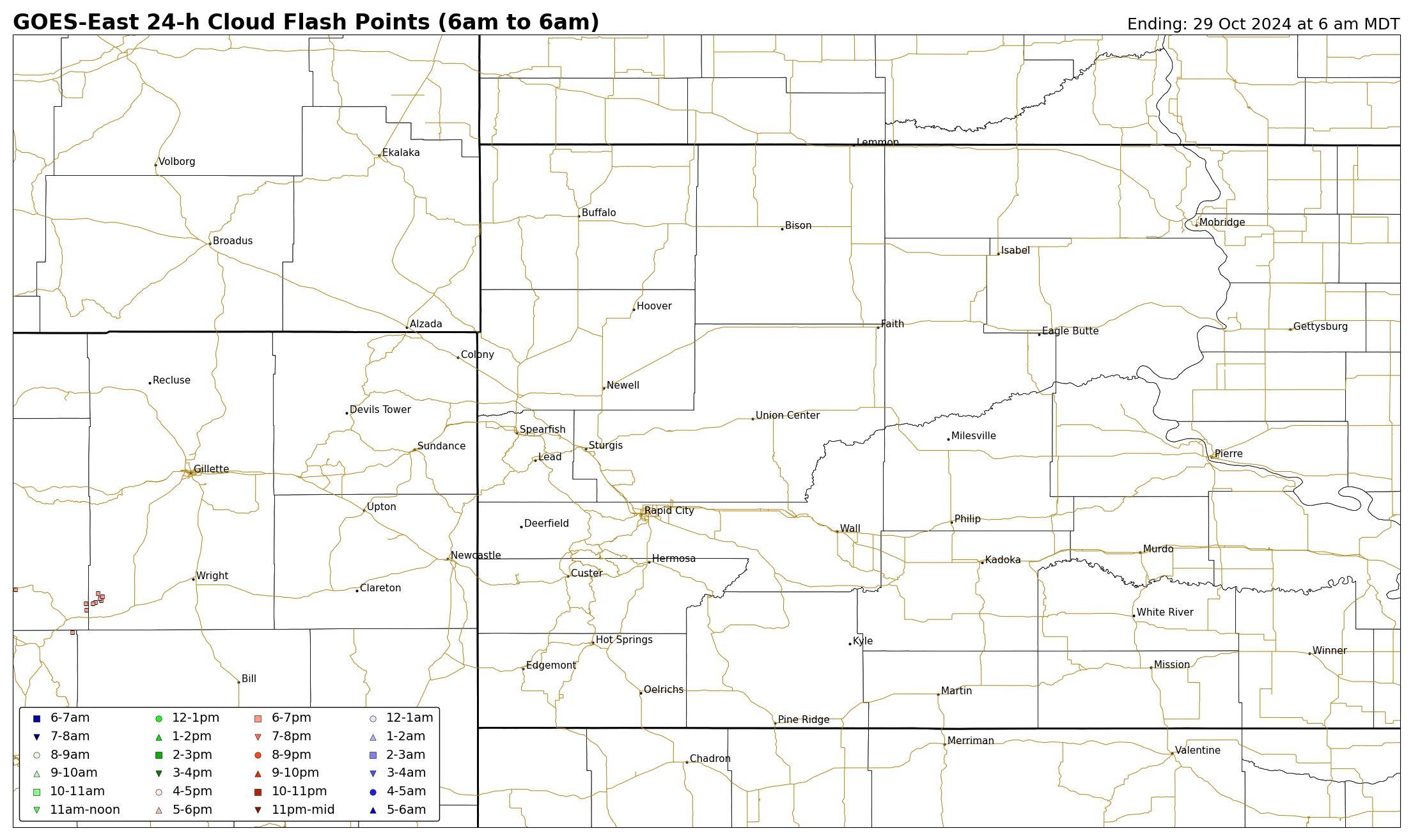
The lightning images below are updated daily around 7:30–8:30 AM and contain 24-h accumulations of lightning ending at 6 am MDT (5 am MST) each day. There are two sets of images for (1) NLDN cloud-to-ground flashes only and (2) GOES-East Lightning Mapper (GLM) cloud flash points. Option #1 only represents cloud-to-ground lightning flashes, and is based on a surface detection network. Option #2 does not discriminate between cloud-to-ground versus in-cloud flashes (i.e., it represents the total lightning) and is based on satellite. In-cloud lightning flashes can comprise 60–90% of the total lightning (i.e., most lightning does not reach the ground). Satellite-based lightning detection also does not depict the exact location where the flash occurred because of an issue known as "parallax." Mouse over each day to view the 24-h cumulative lightning flash maps. Printable versions are at the bottom of each of the three map segments.
| 24-h Cumulative NLDN Cloud-to-Ground Lightning Flashes |
Yesterday | 2 Days Ago | 3 Days Ago | 4 Days Ago | 5 Days Ago | 6 Days Ago | 7 Days Ago | 8 Days Ago |
 |
||||||||
Printable: Yesterday, 2 Day Ago, 3 Days Ago, 4 Days Ago, 5 Days Ago, 6 Days Ago, 7 Days Ago, 8 Days Ago
| 24-h Cumulative GLM Cloud Flash Points |
Yesterday | 2 Days Ago | 3 Days Ago | 4 Days Ago | 5 Days Ago | 6 Days Ago | 7 Days Ago | 8 Days Ago |
 |
||||||||
Printable: Yesterday, 2 Day Ago, 3 Days Ago, 4 Days Ago, 5 Days Ago, 6 Days Ago, 7 Days Ago, 8 Days Ago

