
A heat wave over the Southwest will intensify this week, peaking and expanding into the Intermountain West and northern High Plains this weekend. Critical to extremely critical fire weather conditions are forecast from the Northwest and the northern Great Basin this weekend. Particularly Dangerous Situation Red Flag Warnings have been issued. Read More >
Overview
|
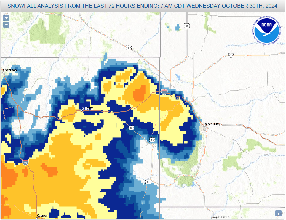
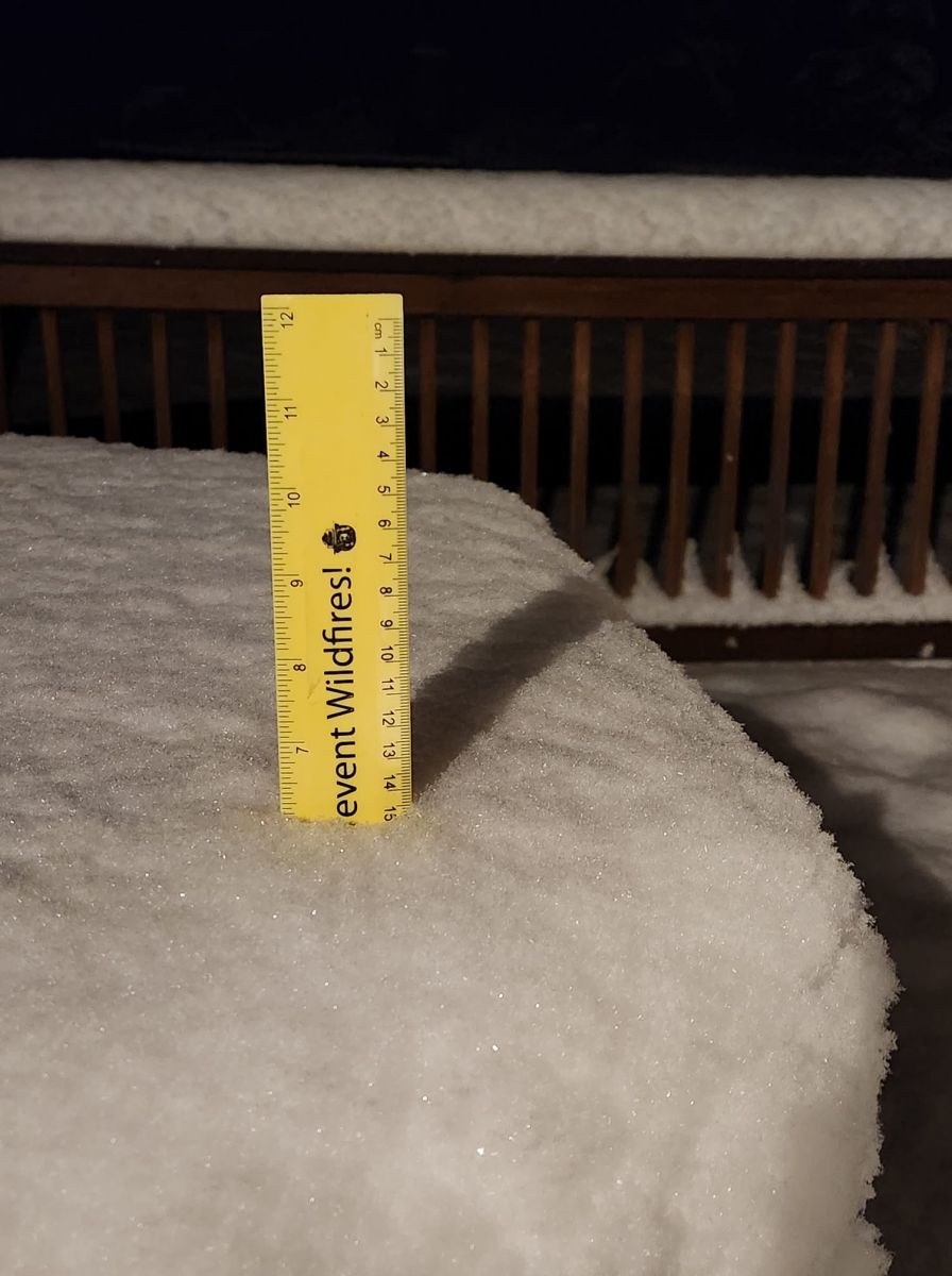
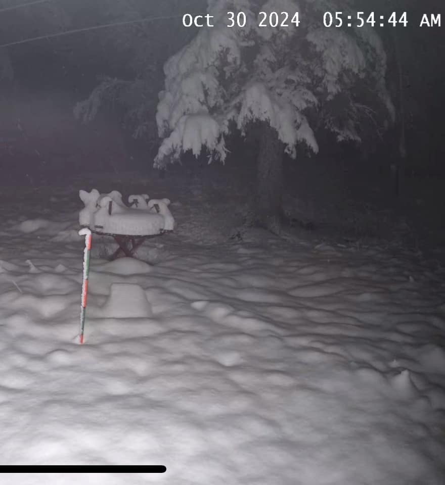
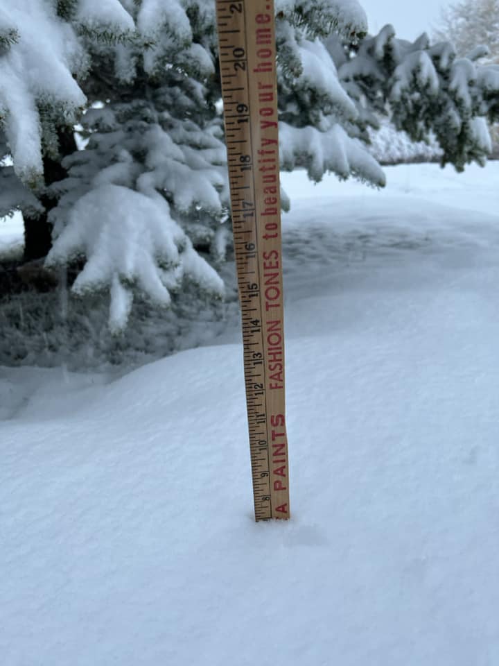
The first snow of the season began Tuesday, October 29 and gradually ended on Wednesday, October 30. The heaviest snow occurred across southern Campbell County, where up to 14 inches of snow was reported. Around the Gillette area, snowfall amounts were mainly between 5 to 7 inches, with snowfall amounts of 6 to 12 inches in the higher elevations of the Black Hills. Much needed rain fell in some locations in far western South Dakota and northeastern Wyoming. Around 1.5" of rain was reported around Spearfish, Sundance and Alva, with amounts over an inch from Spearfish to Bison. |
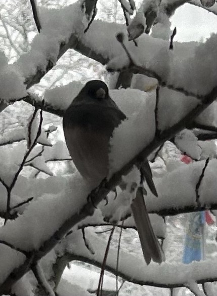 Photo By: Cathy Enderby |
Snow
 |
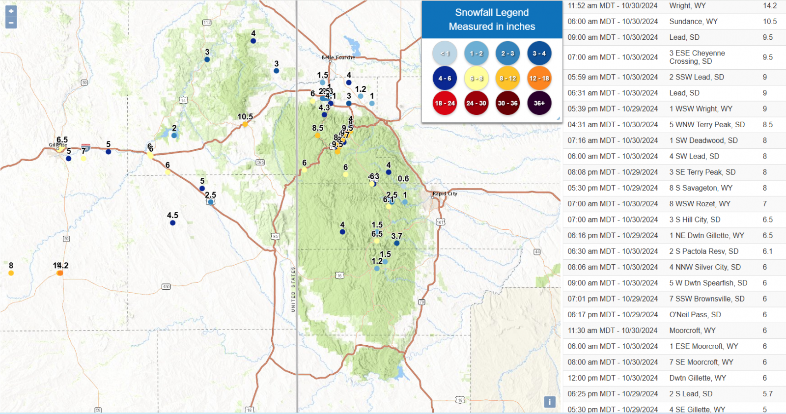 |
| Snowfall Analysis | Snowfall Amounts |
...PRELIMINARY SNOW AND SLEET TOTALS (AT LEAST 0.5 INCH) SORTED BY MAGNITUDE...

LOCATION                      SNOWFALL    COMMENTS
                               IN/S/

Wright WY                      14.2       1152 AM 10/30/2024
Sundance WY                    10.5        600 AM 10/30/2024
3 ESE Cheyenne Crossing SD      9.5        700 AM 10/30/2024
Lead SD                         9.5        900 AM 10/30/2024
2 SSW Lead SD                   9.0        559 AM 10/30/2024
5 WNW Terry Peak SD             8.5        431 AM 10/30/2024
1 SW Deadwood SD                8.0        716 AM 10/30/2024
4 SW Lead SD                    8.0        600 AM 10/30/2024
8 WSW Rozet WY                  7.1        700 AM 10/30/2024
3 S Hill City SD                6.5        700 AM 10/30/2024
2 S Pactola Resv SD             6.1        630 AM 10/30/2024
4 NNW Silver City SD            6.0        806 AM 10/30/2024
1 ESE Moorcroft WY              6.0        600 AM 10/30/2024
7 SE Moorcroft WY               6.0        800 AM 10/30/2024
Moorcroft WY                    6.0       1130 AM 10/30/2024
5 W Dwtn Spearfish SD           6.0        900 AM 10/30/2024
Dwtn Gillette WY                6.0       1200 PM 10/30/2024
1 N Upton WY                    5.0        800 AM 10/30/2024
1 SSE Dwtn Spearfish SD         4.1        800 AM 10/30/2024
8 ENE Alva WY                   4.0        700 AM 10/30/2024
Nemo SD                         4.0        900 AM 10/30/2024
Mount Rushmore SD               3.7       1258 AM 10/30/2024
4 SSW Saint Onge SD             3.0        700 AM 10/30/2024
2 WNW Dwtn Spearfish SD         2.5        900 AM 10/30/2024
1 ESE Pactola Resv SD           2.5        900 AM 10/30/2024
4 SE Upton WY                   2.5        700 AM 10/30/2024
1 NNW Dwtn Spearfish SD         2.3       1000 AM 10/30/2024
5 ENE Custer SD                 1.5        700 AM 10/30/2024
6 NNW Dwtn Spearfish SD         1.5        700 AM 10/30/2024
3 SE Saint Onge SD              1.2        615 AM 10/30/2024
1 ENE Custer SD                 1.2        700 AM 10/30/2024
2 N Dwtn Spearfish SD           1.0        500 AM 10/30/2024
1 N Hisega SD                   1.0        700 AM 10/30/2024
3 NNE Johnson Siding SD         0.5        700 AM 10/30/2024
Rain
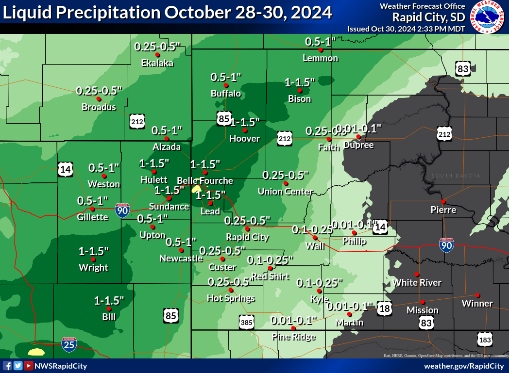
...PRELIMINARY RAINFALL TOTALS (AT LEAST 0.50 INCH) SORTED BY MAGNITUDE...

LOCATION                      TOTAL RAIN  COMMENTS
                               IN/S/

8 ENE Alva WY                  1.92        700 AM 10/30/2024
1 SSE Dwtn Spearfish SD        1.80        800 AM 10/30/2024
Sundance WY                    1.53        600 AM 10/30/2024
2 WNW Dwtn Spearfish SD        1.47        700 AM 10/30/2024
1 S Belle Fourche SD           1.38        800 AM 10/30/2024
1 NNW Dwtn Spearfish SD        1.37       1000 AM 10/30/2024
3 SE Saint Onge SD             1.33        615 AM 10/30/2024
1 ESE Moorcroft WY             1.31        600 AM 10/30/2024
8 ESE Prairie City SD          1.30        700 AM 10/30/2024
6 NNW Dwtn Spearfish SD        1.22        700 AM 10/30/2024
3 SE Nisland SD                1.18        800 AM 10/30/2024
9 SE Meadow SD                 1.16        700 AM 10/30/2024
4 SSW Saint Onge SD            1.11        700 AM 10/30/2024
8 WSW Rozet WY                 1.09        700 AM 10/30/2024
2 E Vale SD                    1.01        800 AM 10/30/2024
Wright WY                      1.01        700 AM 10/30/2024
Lead SD                        0.98        900 AM 10/30/2024
4 NNW Sturgis SD               0.98        700 AM 10/30/2024
7 SE Moorcroft WY              0.95        800 AM 10/30/2024
20 WSW Usta SD                 0.90        700 AM 10/30/2024
5 ENE Newell SD                0.90        700 AM 10/30/2024
4 SE Upton WY                  0.87        700 AM 10/30/2024
Newell SD                      0.87        900 AM 10/30/2024
3 ESE Cheyenne Crossing SD     0.84        700 AM 10/30/2024
1 N Upton WY                   0.84        800 AM 10/30/2024
8 SE Mud Butte SD              0.82        900 AM 10/30/2024
11 NNE Weston WY               0.79        700 AM 10/30/2024
Tilford SD                     0.77        700 AM 10/30/2024
1 NNW Piedmont SD              0.75       1258 AM 10/30/2024
10 W Jewel Cave SD             0.70        700 AM 10/30/2024
8 WNW Usta SD                  0.70        700 AM 10/30/2024
6 SSW Fairpoint SD             0.69        700 AM 10/30/2024
11 NE Morrisey WY              0.65        700 AM 10/30/2024
6 WSW Opal SD                  0.64        700 AM 10/30/2024
1 N Hisega SD                  0.64        700 AM 10/30/2024
6 NE Summerset SD              0.62        700 AM 10/30/2024
3 NNE Johnson Siding SD        0.62        700 AM 10/30/2024
2 WNW Dwtn Rapid City SD       0.59        700 AM 10/30/2024
6 WNW Union Center SD          0.57        700 AM 10/30/2024
4 NW Dwtn Rapid City SD        0.55        700 AM 10/30/2024
1 WSW Newcastle WY             0.54        700 AM 10/30/2024
14 NW Edgemont SD              0.50        800 AM 10/30/2024
Mount Rushmore SD              0.50       1258 AM 10/30/2024
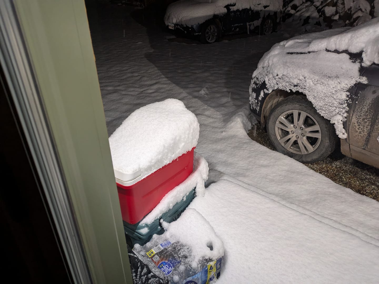
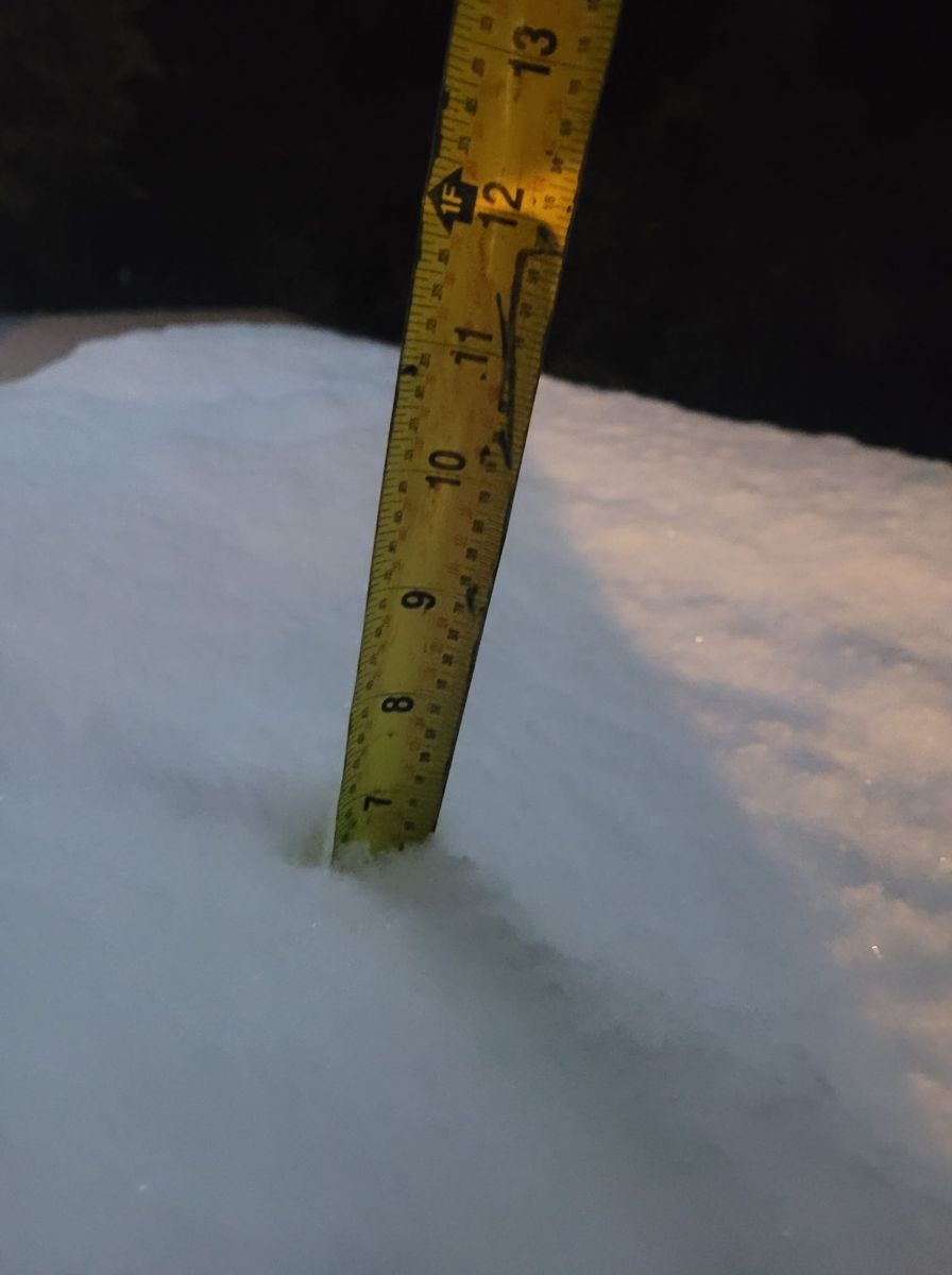
Photos & Video
Header
 |
 |
 |
 |
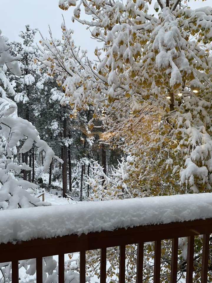
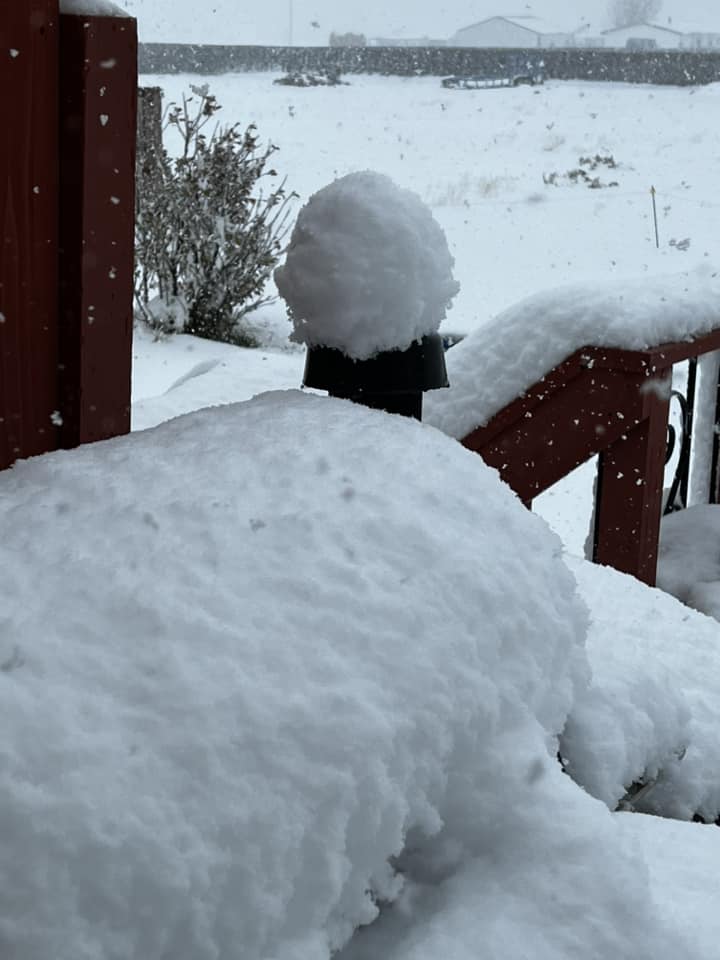
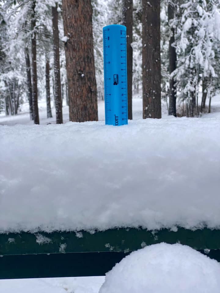
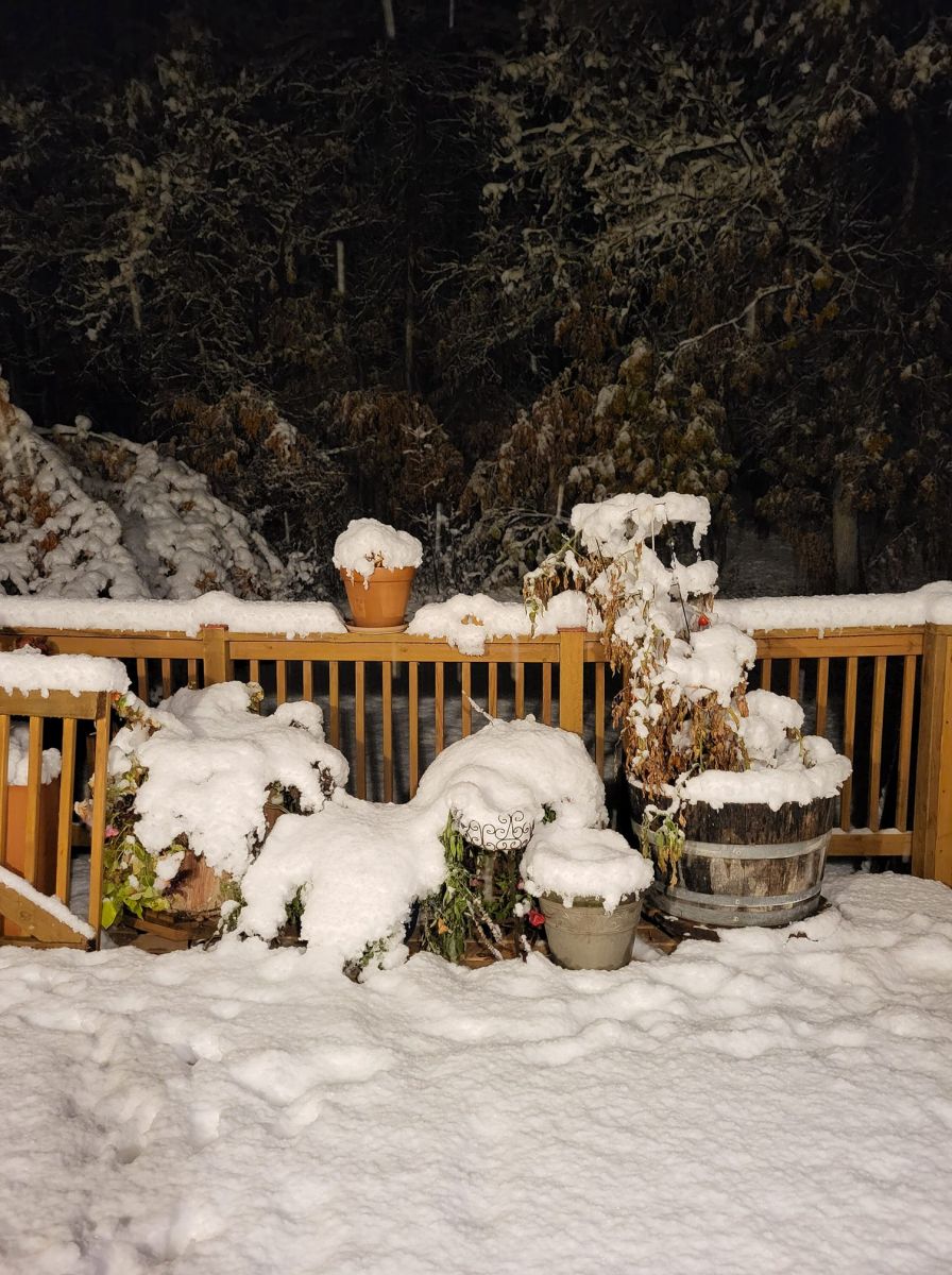
| 3 miles south of Hill City Barbara D |
Rozet, Wy Brittney H |
Southeast of Spearfish Brenda B |
Wright, WY Brenda C |
 |
 |
 |
 |
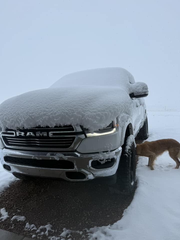
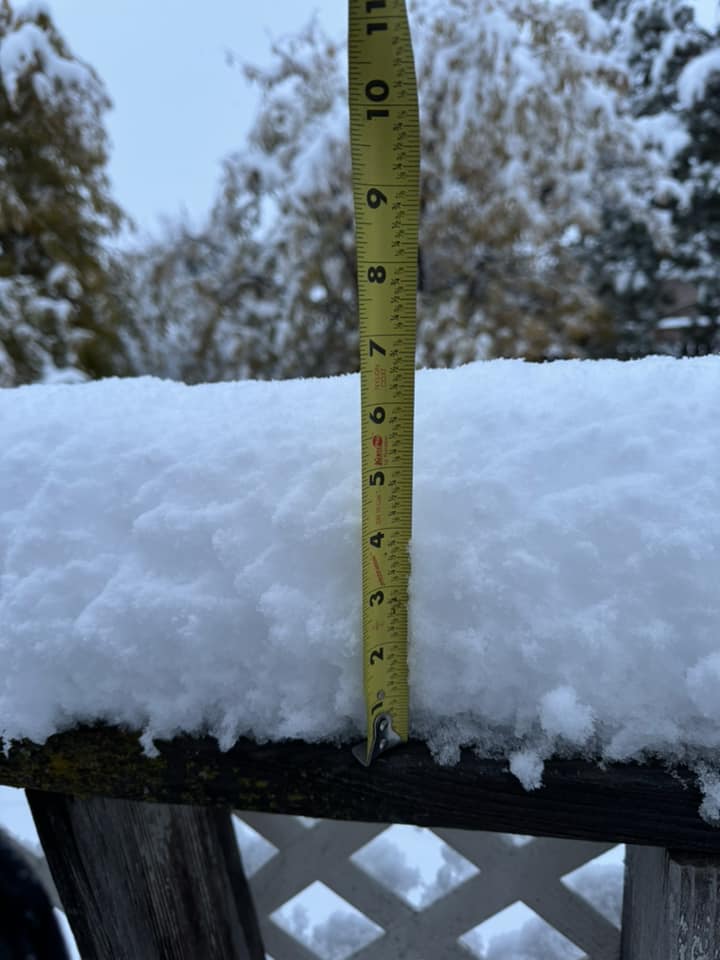
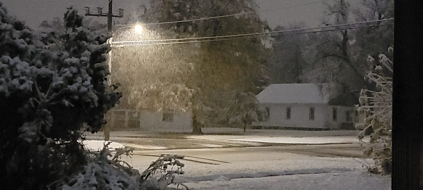
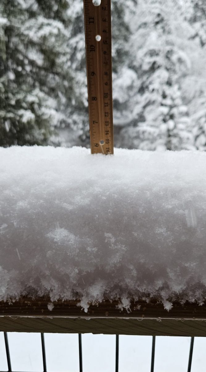
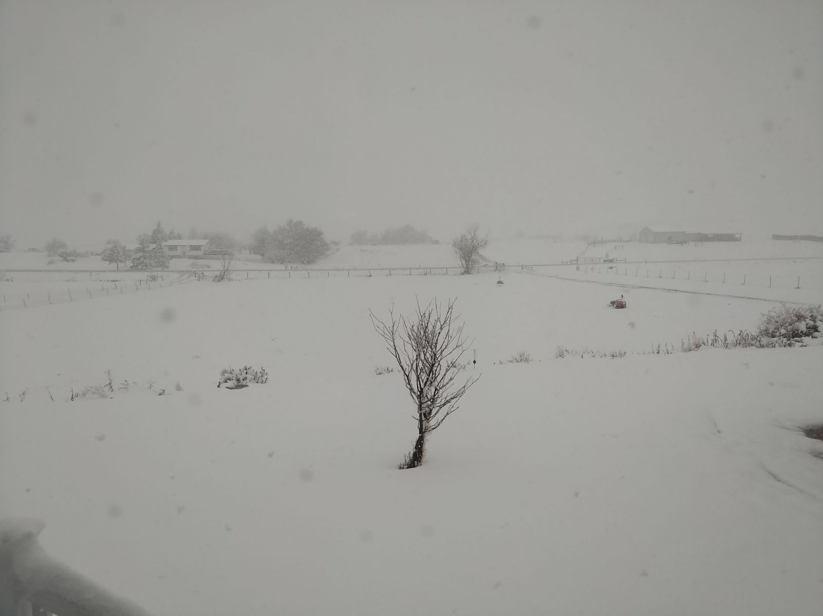
| Gillette WY Debbie S |
Wright WY Denene W |
8 miles west of Belle Fourche Heidi N |
4 miles south of Devils Tower Heike B |
 |
 |
 |
 |
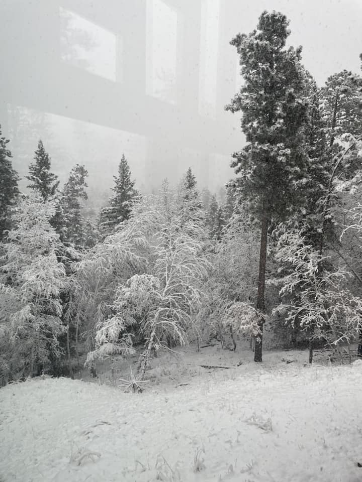
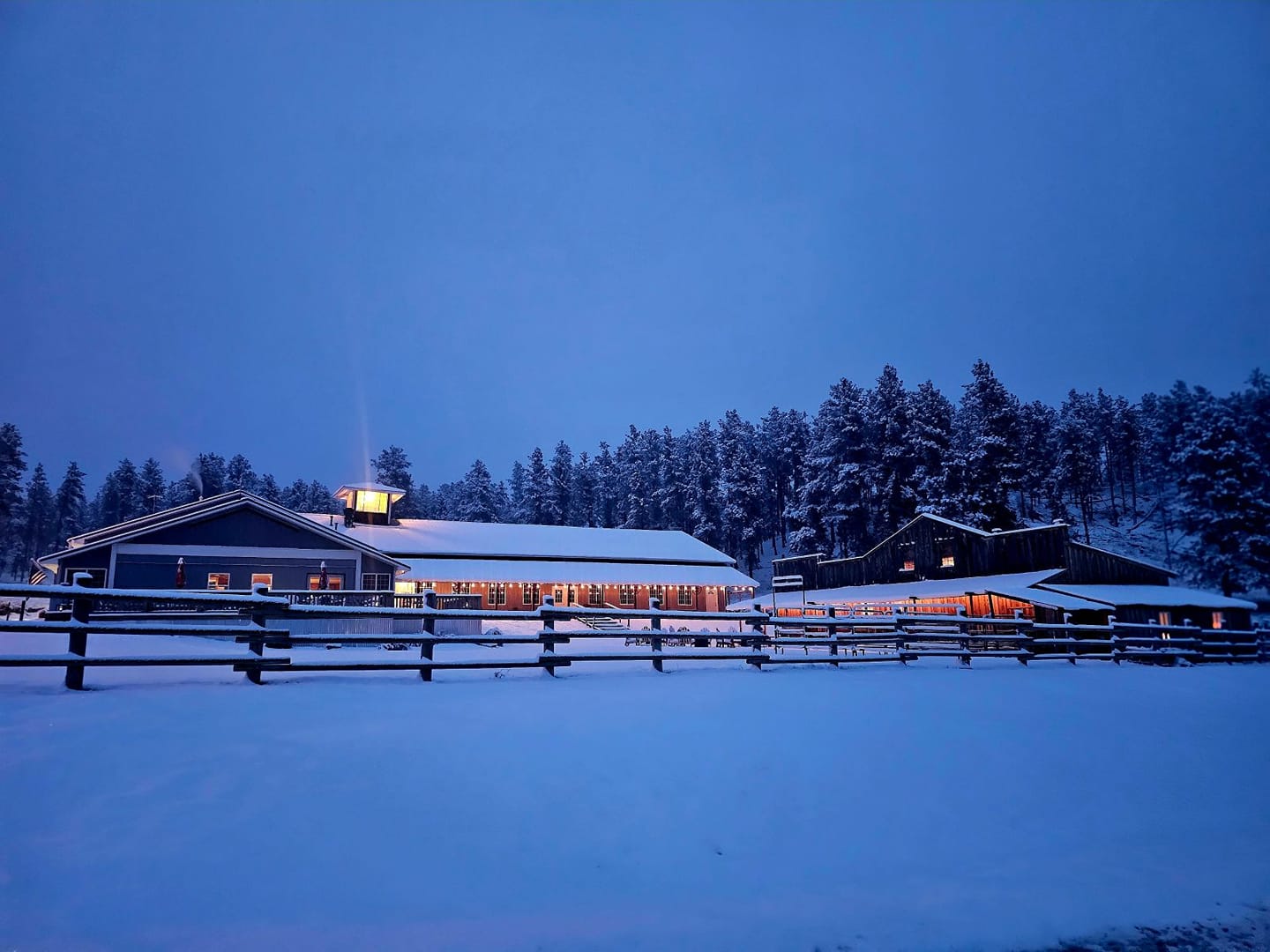
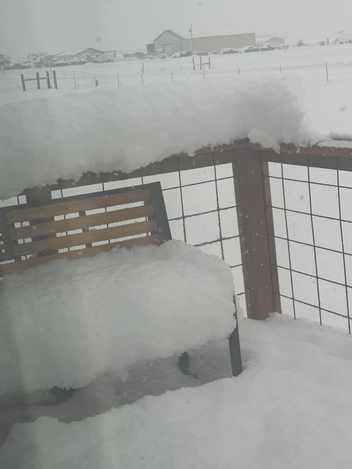
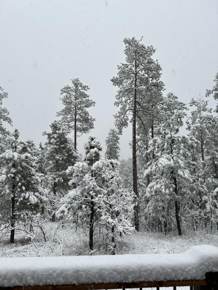
| 4 miles northwest of Hill City High Country Guest Ranch |
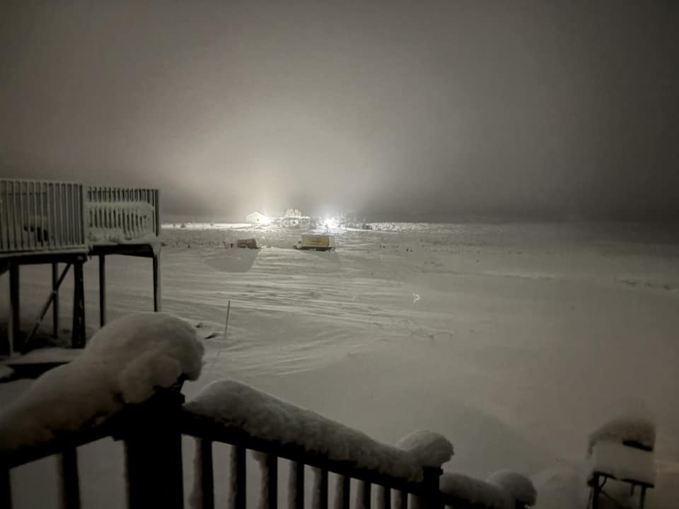
11 miles west of Gillette Izzy C |
Spearfish Jeff D |
2 miles south of Pactola Jennifer F |
 |
 |
 |
 |
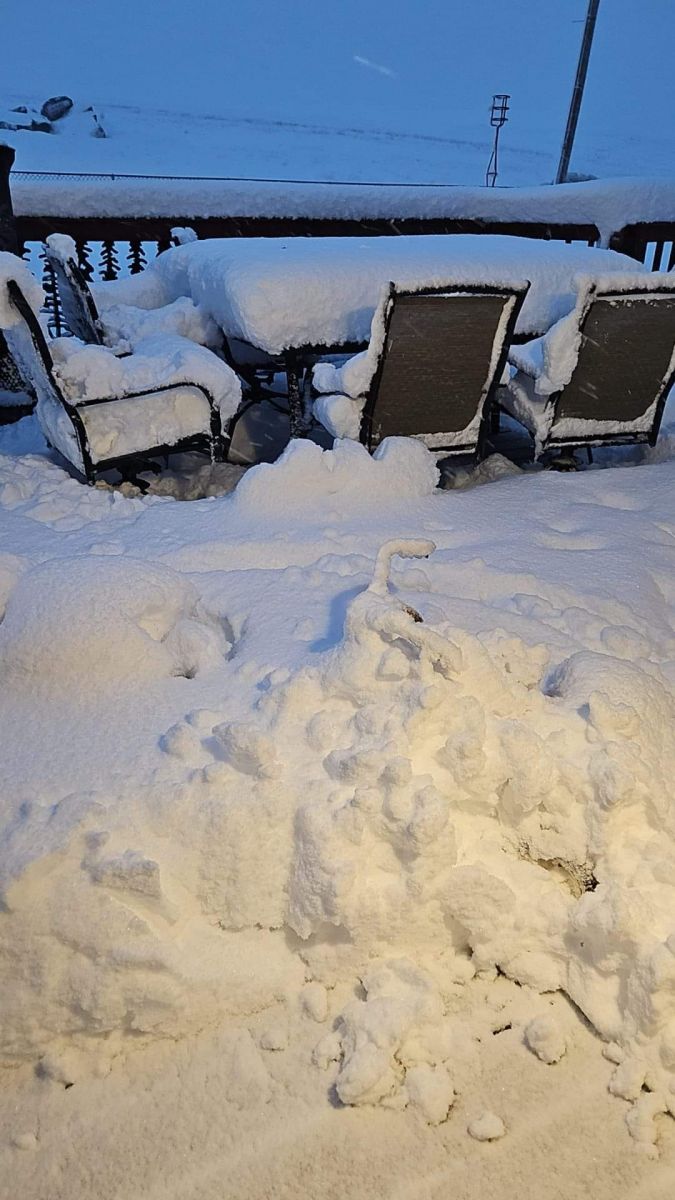
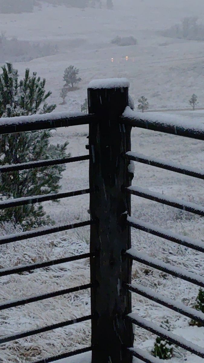
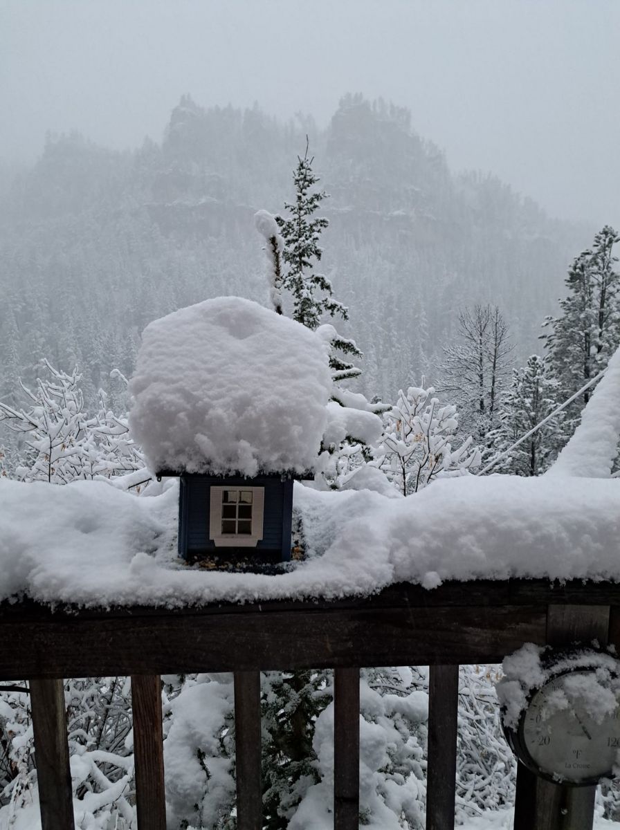
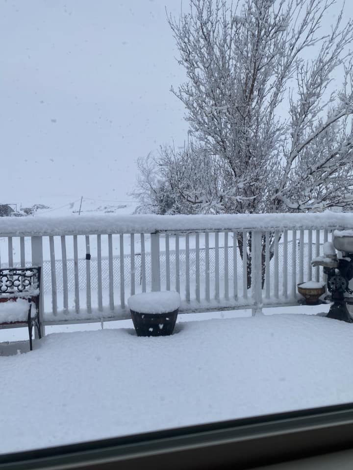
| South Rochford Road Kevin K |
Lead Luci S |
Lead Matt F |
Sundance Meghan and Dave P |
 |
 |
 |
 |
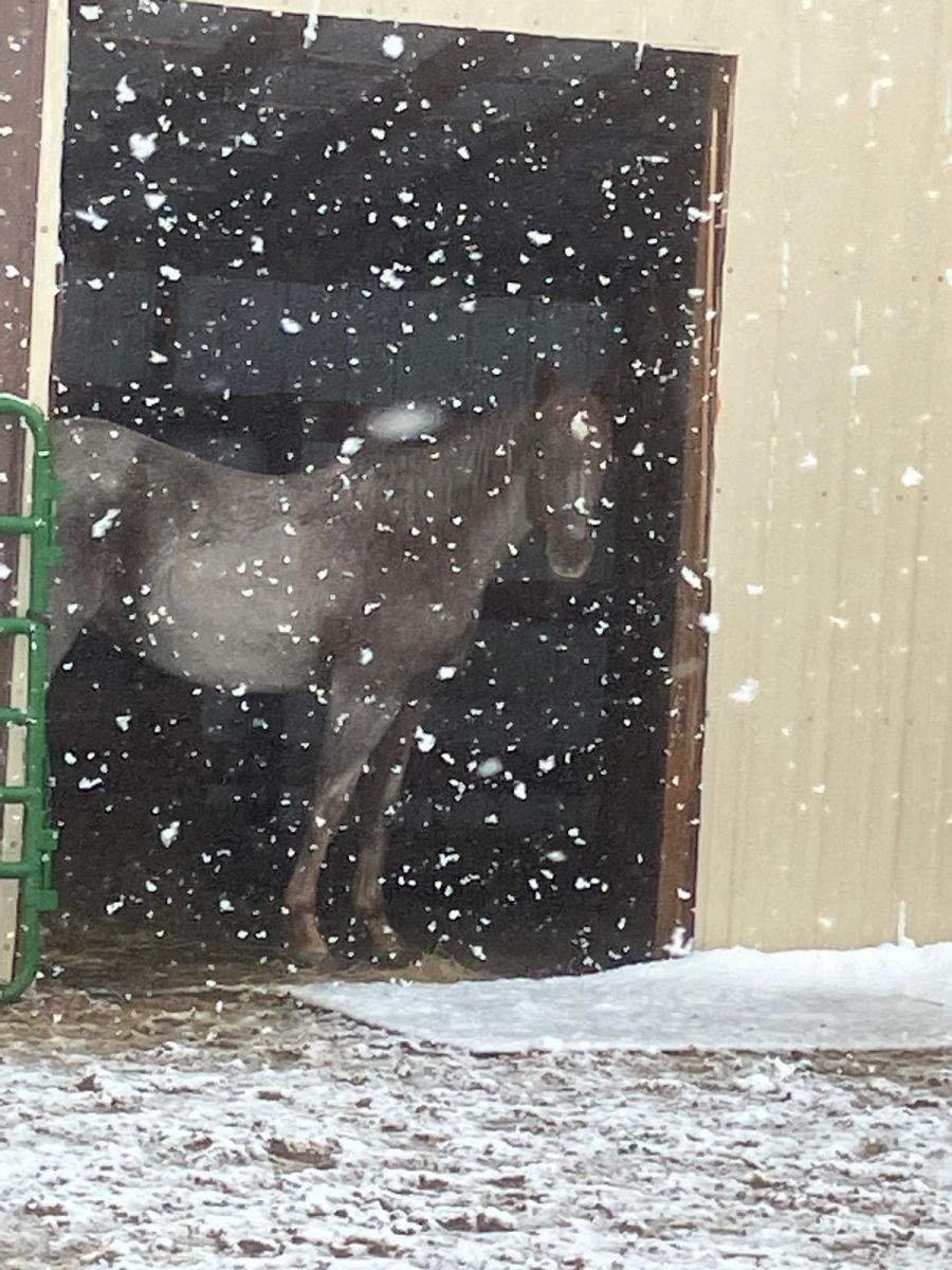
| Merritt Rob R |
2 miles south of Lead Ronnie H |
Wright Rosalie E |
Savoy in Spearfish Canyon Shari B |
 |
 |
 |
 |
| Lead Tana H |
Gillette Todd M |
3 miles southwest of Spearfish Tom D |
13 miles southwest of Upton Twyla B |
Radar
 |
Media use of NWS Web News Stories is encouraged! Please acknowledge the NWS as the source of any news information accessed from this site. |
|

