Widespread life-threatening flash and urban flooding continues in south-central Texas, with considerable flooding impacts possible across central Texas. Wildfire smoke is impacting air quality across much of the Great Lakes region into southern New England and the Mid-Atlantic. Monsoonal thunderstorms may produce isolated to scattered flash flooding across the Southwest into the Great Basin. Read More >
Overview
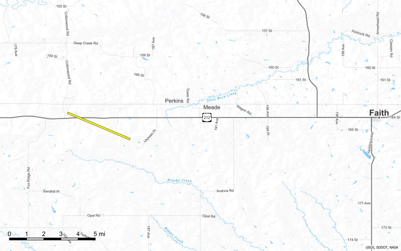
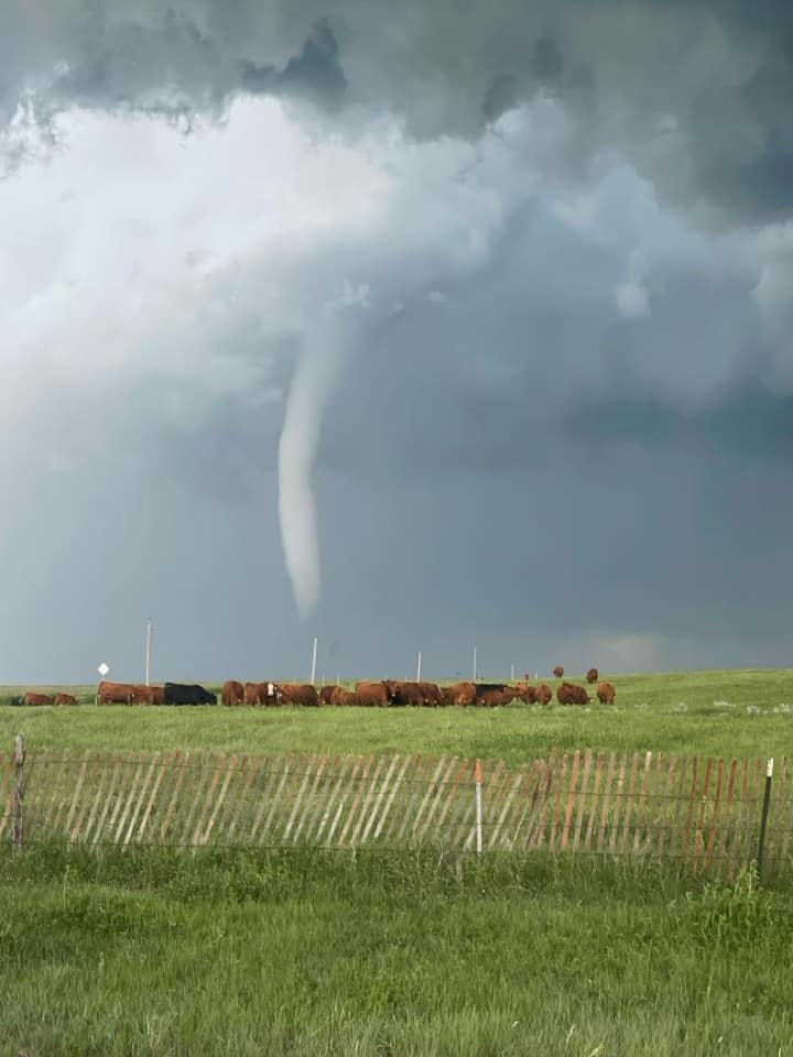
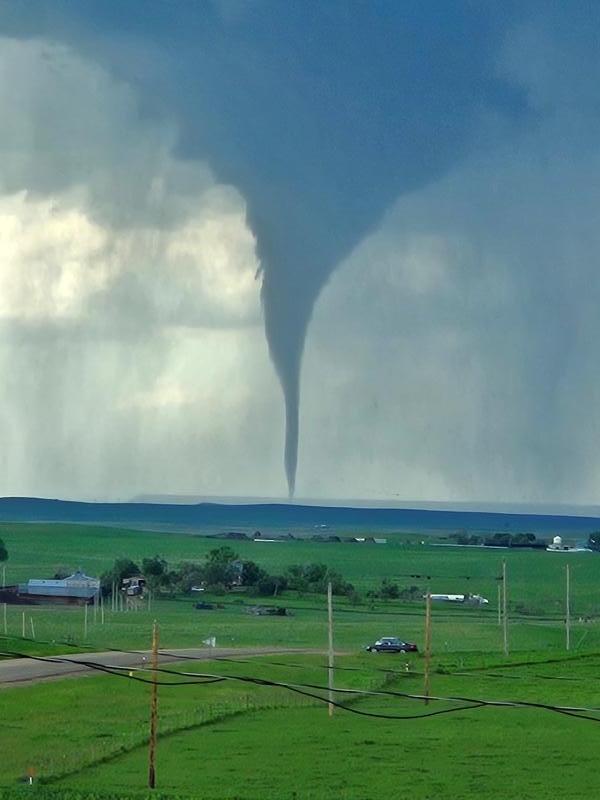
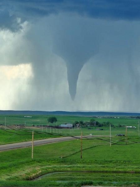
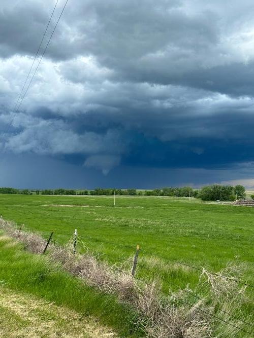
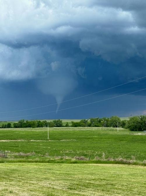
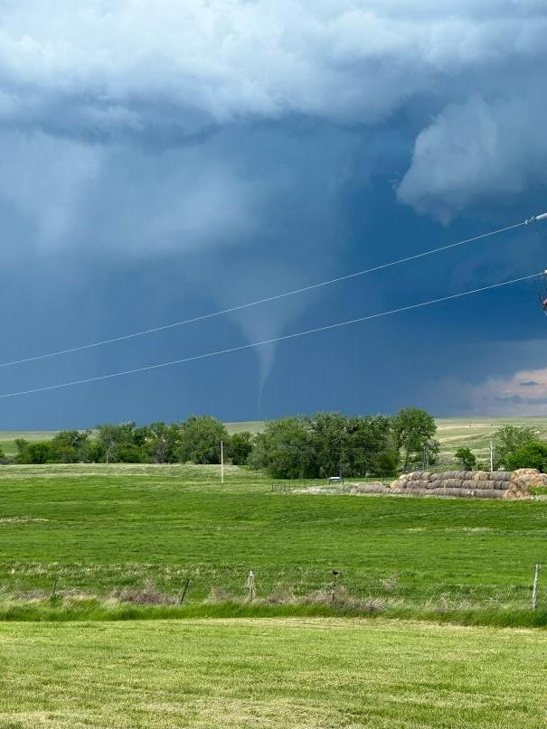
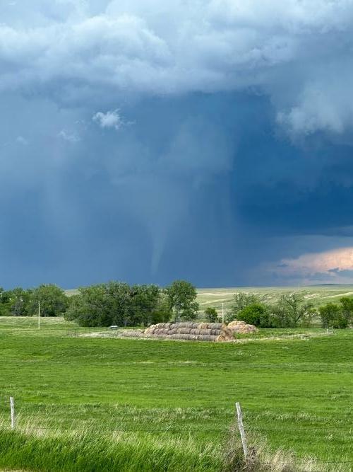
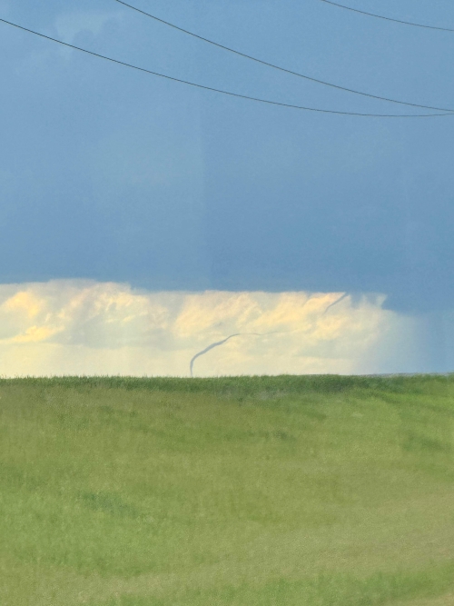
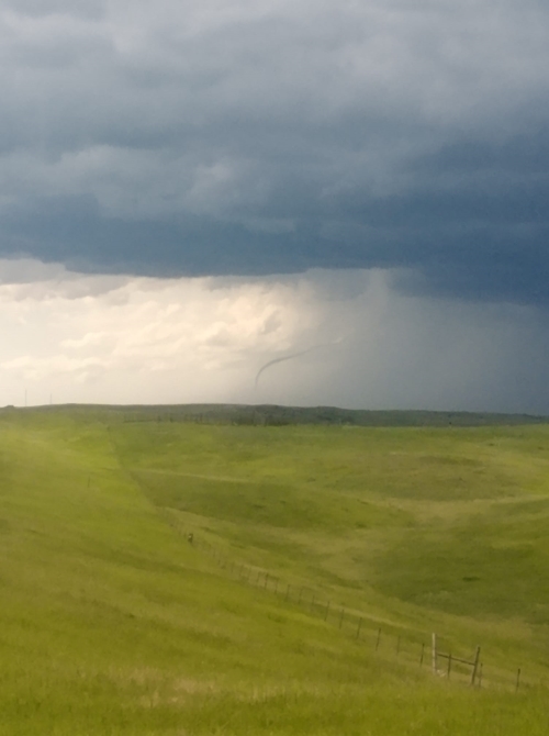
During the afternoon and evening hours of June 2, a cold front moving through the Northern Plains resulted in isolated severe thunderstorms. A severe thunderstorm developed in northwestern South Dakota and produced hail up to tennis ball size and a tornado as it tracked into northern Meade County. Other severe storms produced wind gusts in excess of 60 mph and large hail.
Tornadoes
|
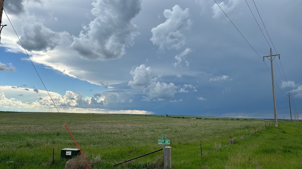
Tornado - 17 Miles W Faith
|
||||||||||||||||
The Enhanced Fujita (EF) Scale classifies tornadoes into the following categories:
| EF0 Weak 65-85 mph |
EF1 Moderate 86-110 mph |
EF2 Significant 111-135 mph |
EF3 Severe 136-165 mph |
EF4 Extreme 166-200 mph |
EF5 Catastrophic 200+ mph |
 |
|||||
Photos & Video
Header
 |
 |
 |
 |
| West of Faith, SD (Courtesy Jerry Senn) |
Near Faith, SD (Courtesy JT Vig) |
Near Faith, SD (Courtesy JT Vig) |
Near Faith, SD (Courtesy Lisa Surber) |
 |
 |
 |
 |
| Near Faith, SD (Courtesy Lisa Surber) |
Near Faith, SD (Courtesy Lisa Surber) |
Near Faith, SD (Courtesy Lisa Surber) |
Near Faith, SD (Courtesy Steve Dekle) |
 |
 |
||
| Near Faith, SD (Courtesy Steve Dekle) |
Near Faith, SD (Courtesy Xavier Bear Stops) |
Radar
Header
| < |
| NWS Rapid City Doppler Radar Loop June 2, 2024 2 PM MDT through 8 PM MDT |
Storm Reports
The following are unofficial observations taken during the event

***********************PEAK WIND GUST***********************

LOCATION             MAX WIND      TIME/DATE  COMMENTS
                         GUST       MEASURED
                        (mph)

SOUTH DAKOTA

...Tripp County...
  4 SSE Witten             64   701 PM  6/02  Mesonet at SD State


*********************MAXIMUM HAIL SIZE**********************

LOCATION                 HAIL      TIME/DATE  COMMENTS
                         SIZE       MEASURED
                     (inches)

SOUTH DAKOTA

...Meade County...
  12 NE Opal             1.75   320 PM  6/02  Law Enforcement

...Pennington County...
  2 W Rapid City Arpt    1.00   230 PM  6/02  Public
  1 E Dwtn Rapid City    0.75   245 PM  6/02  Public

...Perkins County...
  17 SW Usta             2.50   312 PM  6/02  Trained Spotter
  Shadehill              0.88   333 PM  6/02  Trained Spotter

...Ziebach County...
  1 WNW Red Scaffold     1.00   416 PM  6/02  Trained Spotter
  11 NW Red Scaffold     0.50   358 PM  6/02  Trained Spotter


...MAXIMUM OBSERVED WINDS SORTED BY MAGNITUDE...

LOCATION                      MAX WIND    COMMENTS
                               MPH

4 SSE Witten SD                  64        701 PM 6/02/2024


...MAXIMUM HAIL SIZE SORTED BY MAGNITUDE...

LOCATION                      MAX SIZE    COMMENTS
                               IN/S/

17 SW Usta SD                  2.50        312 PM 6/02/2024
12 NE Opal SD                  1.75        320 PM 6/02/2024
2 W Rapid City Arpt SD         1.00        230 PM 6/02/2024
1 WNW Red Scaffold SD          1.00        416 PM 6/02/2024
Shadehill SD                   0.88        333 PM 6/02/2024
1 E Dwtn Rapid City SD         0.75        245 PM 6/02/2024
11 NW Red Scaffold SD          0.50        358 PM 6/02/2024
 |
Media use of NWS Web News Stories is encouraged! Please acknowledge the NWS as the source of any news information accessed from this site. |
|