Dangerous and extreme heat will remain across portions of the southern U.S. this week. A heat wave over the Southwest U.S. will intensify this week, peaking and expanding into the Intermountain West and northern High Plains this weekend. Multiple rounds of thunderstorms will produce heavy to excessive rainfall with significant flash flooding across portions of southern New England today. Read More >
Overview
|
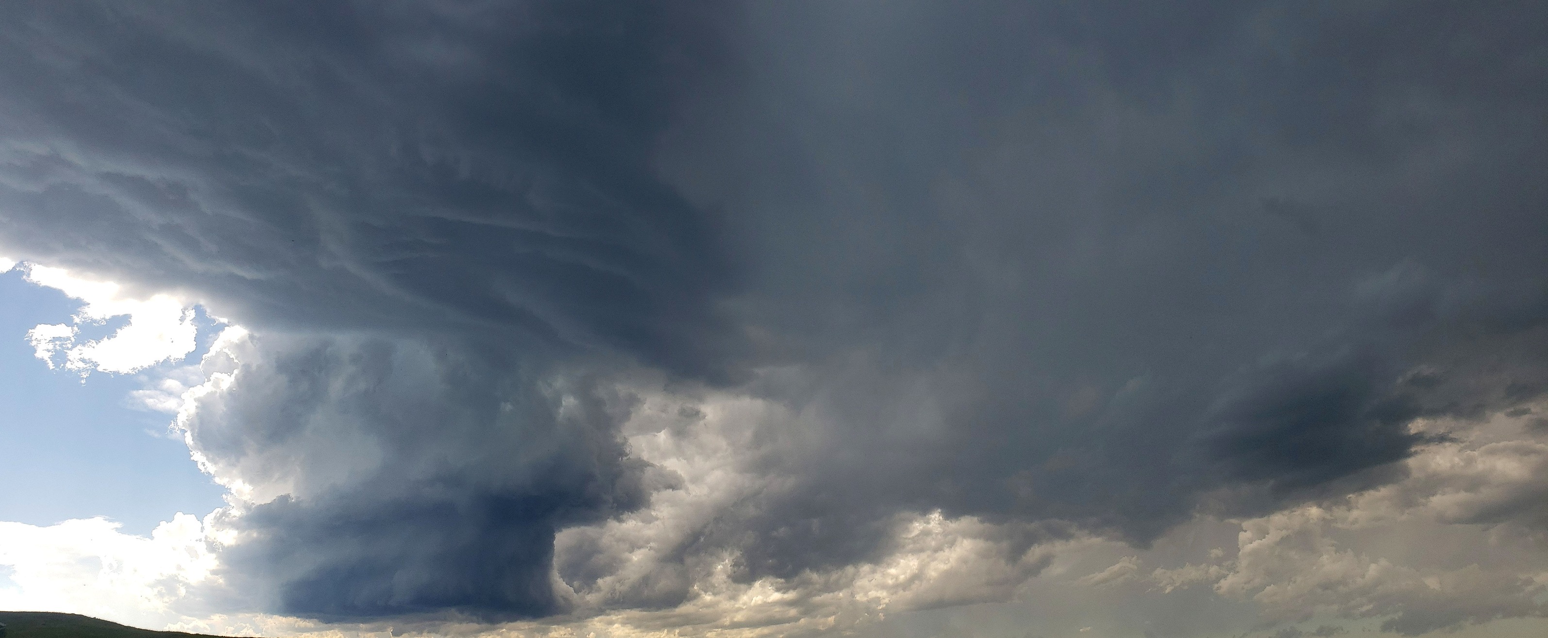
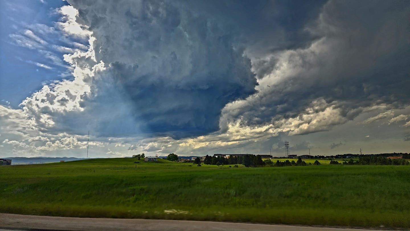
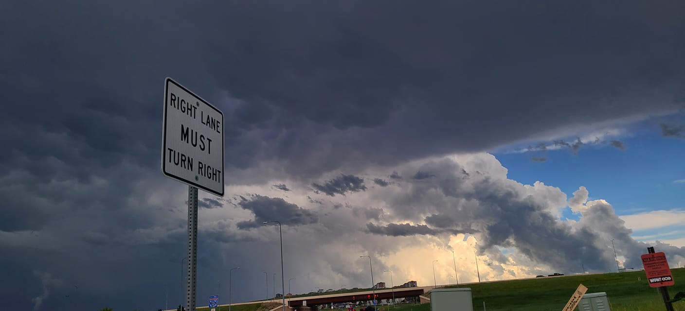
Two rounds of severe storms brought large hail, strong winds and brief heavy rainfall to portions of northeastern Wyoming and southwestern South Dakota. Storms began over the Black Hills in the afternoon hours, with large hail reported in Piedmont, Nemo, Black Hawk, Hart Ranch, and Hermosa. A second round of severe storms moved through in the evening hours as an upper level system combined with a cold front. These features allowed storms to develop in a line and move east through most of northeastern Wyoming and western South Dakota. Strong winds were associated with this line of storms with wind gusts exceeding 60 mph at Rochelle, near Dewey, in the Badlands, Cactus Flats, Cottonwood, Phillip, and Belvidere. |
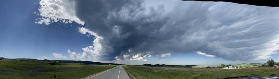
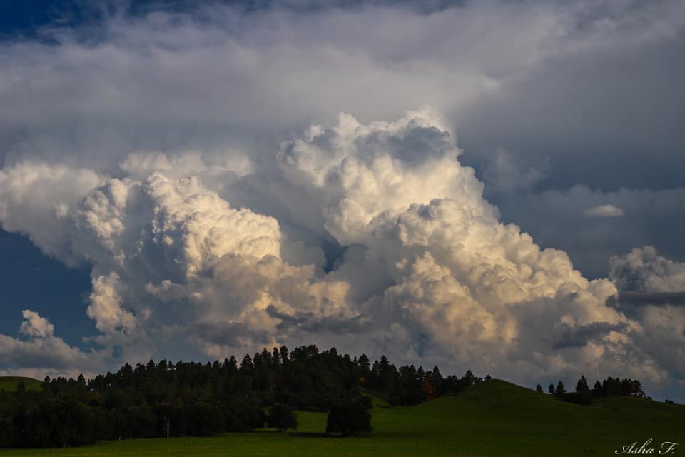
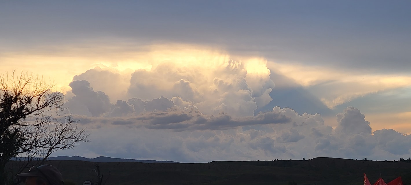
 Clouds over Rapid City Photo by Marcella Fish |
Photos & Video
Monday, July 3
 |
 |
 |
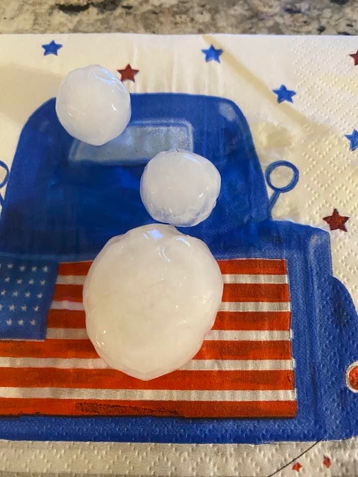
| Hail Rapid City Photo by Lonna Reiner |
Hail Rapid City Photo by Lonna Reiner |
Hail Nemo Rd Photo by Jill Peterson |
 |
 |
 |
| Hail Rapid City Photo by Cicely DeMars Schock |
Hail Rapid City Photo by Cicely DeMars Schock |
Hail Black Hills RV Park Photo by Beth Ann Gallagher Warkentin |
 |
 |
 |
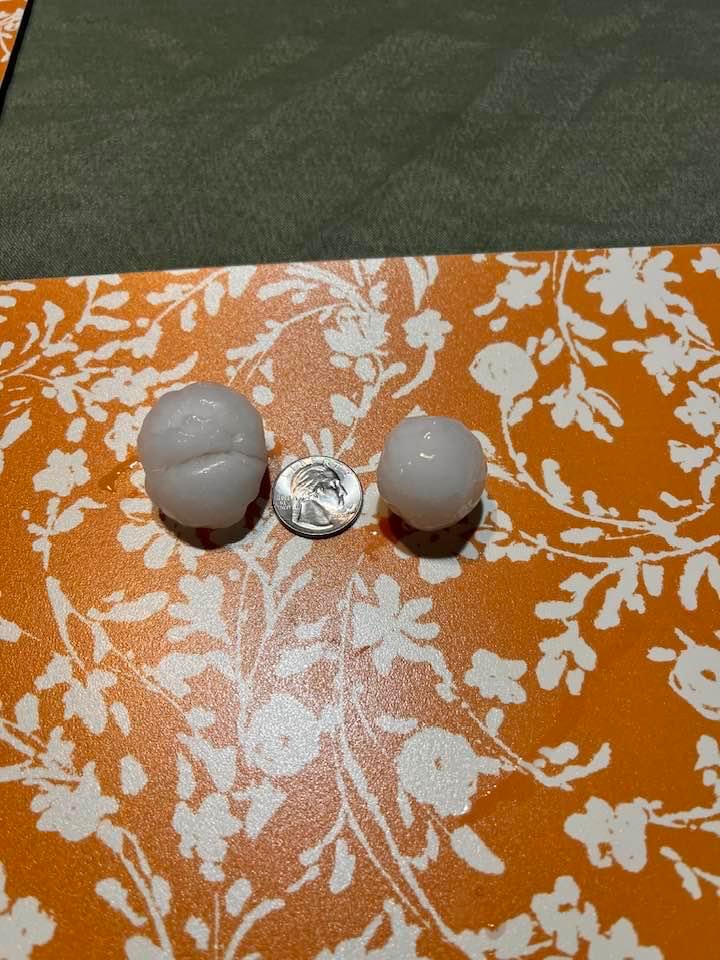
| Hail Wright Photo by Robby Gallob |
Hail Wright Photo by Robby Gallob |
Hail Pine Haven Photo by Tom Lubas |
 |
 |
 |
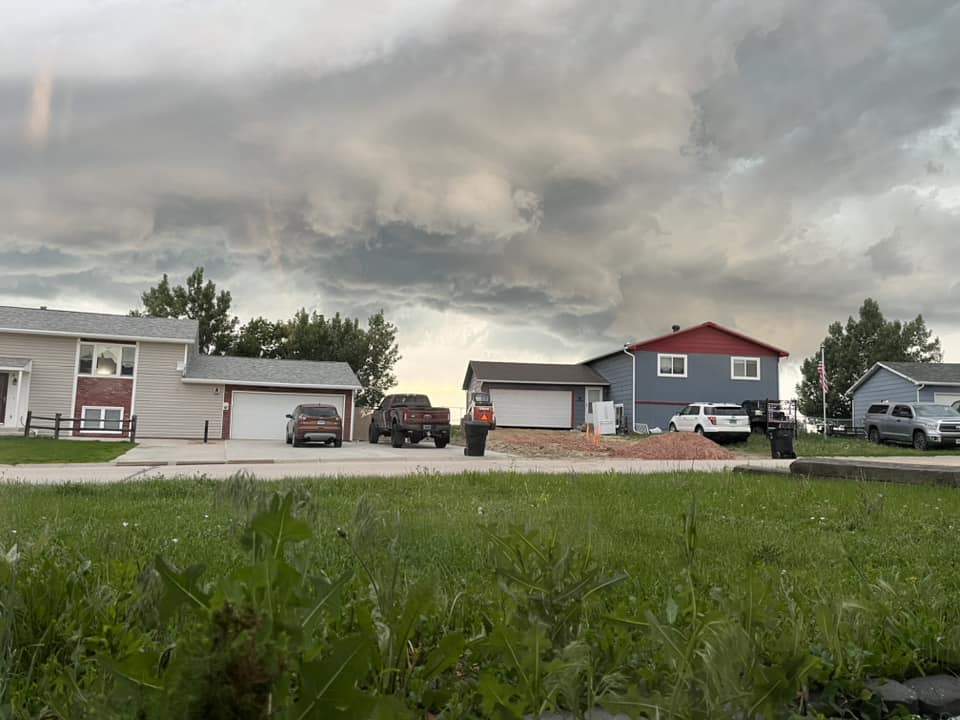
| Sturgis Photo by Asha Franzen |
Wright Photo by Dylan Kelly |
South of Rapid City Photo by Gavin O'Brien |
 |
|
 |
| Rapid City Photo by Zoey Senri White |
Black Hawk Photo by Lisa Howard |
Newcastle Photo by Amber Perkins |
MON-5:49 PM: Crystal Lee reporting Baseball sized hail near Hart Ranch around 5:45 PM #sdwx @NWSRapidCity pic.twitter.com/veOgHo2Pub
— Brant Beckman ☀ï¸ðŸ’§âš¡ï¸ (@BrantBeckmanwx) July 3, 2023
MON-10:28 PM: Kaitlyn Oster caught some impressive lightning next to the fireworks show in Belle Fourche, SD.
— Brant Beckman ï¸ (@BrantBeckmanwx) July 4, 2023
(Would not recommend mixing fireworks with lightning, but cool photo) #sdwx @NWSRapidCity pic.twitter.com/xpl7u8USP0
#Thunderstorms over the #Badlands. #SDwx pic.twitter.com/l8Ss7vfmrn
— Derek Thompson (@derek130wx) July 4, 2023
Looking south at storm near Hermosa, SD. pic.twitter.com/wFY8mkGQ4s
— Randy Halverson (@dakotalapse) July 4, 2023
Supercell over Hermosa, SD. And a tiny SLC on it. #sdwx pic.twitter.com/aiW3NnPc9H
— Jakob McMillin (@JakobWX) July 4, 2023
This structure is GORGEOUS!!! pic.twitter.com/ppVD6l4iTq
— Darsha Dodge (@darsha_news) July 3, 2023
â¦@NWSRapidCityâ© feel free to use this image for you event summary. Between red shirt and scenic #sdwx 7/3/23 pic.twitter.com/TGkFQmW1ih
— Shane Ornelas (@ShaneHpns) July 4, 2023
North of interior #sdwx 11:09 mdt @NWSRapidCity pic.twitter.com/HcROPtr37n
— Shane Ornelas (@ShaneHpns) July 4, 2023
One of the most beautiful supercells I have ever seen moved through the Black Hills and Badlands today #sdwx @NWSRapidCity @chaser_dave @BrantBeckmanwx pic.twitter.com/AQjV5KnFey
— Brad Walton (@wx_Brad) July 4, 2023
1.5” hail in Wright @NWSRapidCity pic.twitter.com/DTQpoHftqd
— Kevin Palmer (@krp234) July 4, 2023
BASEBALL SIZED HAIL FALLING SOUTH OF RAPID CITY #SDWX @NWSRapidCity pic.twitter.com/FiTL77oqiW
— Storm Chaser Ryan Scholl (@WxScholl) July 4, 2023
Lots of rotation @chaser_dave @ryanlarmeuwx @NWSRapidCity pic.twitter.com/SKD5TGNWPx
— Shelby Peplowski (@PeppyWx) July 3, 2023
Radar
1st Round of Storms (1:50 PM until 7:50 AM MT)
2nd Round of Storms (8:00 PM until 1:50 AM MT)
Storm Reports
*********STORM TOTAL RAINFALL (AT LEAST 0.50 INCH)**********

LOCATION                TOTAL      TIME/DATE  COMMENTS
                     RAINFALL       MEASURED
                     (inches)

SOUTH DAKOTA

...Butte County...
  9 SSW Castle Rock      0.62   600 AM  7/04  CoCoRaHS
  1 NNW Nisland          0.50   800 AM  7/04  SDSU Mesonet

...Custer County...
  7 WSW Folsom           1.28   515 AM  7/04  CoCoRaHS
  1 NW Hermosa           0.65   700 AM  7/04  CoCoRaHS
  1 WSW Custer           0.50   800 AM  7/04  CoCoRaHS

...Harding County...
  9 NW Ludlow            0.97   700 AM  7/04  CoCoRaHS
  9 WSW Ladner           0.72   800 AM  7/04  CoCoRaHS
  5 SSE Ralph            0.50   800 AM  7/04  CWOP

...Lawrence County...
  5 SW Brownsville       0.75   800 AM  7/04  CWOP
  6 NNW Dwtn Spearfish   0.57   700 AM  7/04  CoCoRaHS

...Meade County...
  8 SE Mud Butte         0.53   800 AM  7/04  CoCoRaHS
  1 NNW Piedmont         0.52   800 AM  7/04  NWS Employee

...Mellette County...
  7 N Wood               0.60   600 AM  7/04  CoCoRaHS

...Pennington County...
  3 W Scenic             1.04   700 AM  7/04  CoCoRaHS
  Mount Rushmore         0.90  1258 AM  7/04  Co-Op Observer
  8 S Wall               0.79   800 AM  7/04  RAWS
  12 S Quinn             0.53   800 AM  7/04  CoCoRaHS

...Perkins County...
  9 SE Meadow            0.98   700 AM  7/04  CoCoRaHS
  8 ESE Prairie City     0.95   700 AM  7/04  CoCoRaHS
  7 S Shadehill          0.91   800 AM  7/04  RAWS
  Bison                  0.68   800 AM  7/04  SDSU Mesonet

WYOMING

...Campbell County...
  1 NE Echeta            0.59   800 AM  7/04  RAWS
  14 NNW Dwtn Gillette   0.53   700 AM  7/04  CoCoRaHS

...Crook County...
  Sundance               1.30   600 AM  7/04  CoCoRaHS
  4 SSE Pine Haven       0.98  1015 PM  7/03  Trained Spotter
  4 SSE Devils Tower     0.93   730 AM  7/04  CoCoRaHS

...Weston County...
  1 WSW Newcastle        0.76   700 AM  7/04  CoCoRaHS
  3 E Newcastle          0.67   600 AM  7/04  CoCoRaHS


**************PEAK WIND GUST (AT LEAST 50 MPH)**************

LOCATION             MAX WIND      TIME/DATE  COMMENTS
                         GUST       MEASURED
                        (mph)

SOUTH DAKOTA

...Custer County...
  7 SSW Folsom             60   705 PM  7/03  Public
  8 W Jewel Cave           55   951 PM  7/03  SDDOT
  8 SSW Folsom             54   651 PM  7/03  SDDOT

...Fall River County...
  12 E Oelrichs            65  1001 PM  7/03  SDDOT
  14 NNW Edgemont          58   925 PM  7/03  SDSU Mesonet
  10 S Hot Springs         57  1016 PM  7/03  RAWS
  10 W Edgemont            52   930 PM  7/03  SDDOT
  7 W Ardmore              52   905 PM  7/03  SDSU Mesonet
  11 W Hot Springs         50   932 PM  7/03  SDDOT

...Haakon County...
  3 E Philip               61  1144 PM  7/03  ASOS
  10 NNW Ottumwa           54  1252 AM  7/04  SDDOT

...Harding County...
  1 N Buffalo              55  1023 PM  7/03  ASOS
  7 NNE Ralph              50  1102 PM  7/03  SDDOT

...Jackson County...
  4 E Cactus Flat          72  1127 PM  7/03  SDDOT
  2 E Cottonwood           67  1130 PM  7/03  SDSU Mesonet
  9 ENE Belvidere          61  1156 PM  7/03  SDDOT
  7 E Wanblee              50  1228 AM  7/04  SDDOT

...Oglala Lakota County...
  5 NE Porcupine           62  1141 PM  7/03  RAWS
  3 ESE Pine Ridge         56  1017 PM  7/03  ASOS
  9 SW Batesland           55  1048 PM  7/03  SDDOT

...Pennington County...
  8 S Wall                 75  1113 PM  7/03  Twitter
  16 ESE Scenic            63  1057 PM  7/03  Public
  3 NNW Scenic             61  1105 PM  7/03  SDDOT

...Perkins County...
  8 E Prairie City         55  1122 PM  7/03  SDDOT

...Todd County...
  7 ESE Rosebud            54  1115 PM  7/03  SDSU Mesonet

...Tripp County...
  1 NE Winner              52   133 AM  7/04  ASOS

WYOMING

...Campbell County...
  25 ESE Wright            61   905 PM  7/03  RAWS
  Wright                   50   745 PM  7/03  Trained Spotter

...Crook County...
  4 SSE Pine Haven         60  1015 PM  7/03  Trained Spotter
  10 ESE Pine Haven        51   912 PM  7/03  WYDOT


***********MAXIMUM HAIL SIZE (AT LEAST 0.50 MPH)************

LOCATION                 HAIL      TIME/DATE  COMMENTS
                         SIZE       MEASURED
                     (inches)

SOUTH DAKOTA

...Custer County...
  5 ENE Custer           1.75   745 PM  7/03  Trained Spotter
  1 SW Hermosa           1.50   604 PM  7/03  Mping report
  Hermosa                1.00   633 PM  7/03  Public
  5 WNW Hermosa          0.50   802 PM  7/03  Trained Spotter

...Lawrence County...
  Nemo                   1.75   534 PM  7/03  Facebook

...Meade County...
  1 NNW Piedmont         1.75   318 PM  7/03  NWS Employee
  Summerset              1.00   350 PM  7/03  Trained Spotter
  1 NW Black Hawk        0.70   358 PM  7/03  Trained Spotter

...Pennington County...
  7 E Rockerville        2.75   549 PM  7/03  Public
  2 NW Dwtn Rapid City   2.00   420 PM  7/03  Elongated hail stone
  5 ENE Rockerville      2.00   545 PM  7/03  Reptile Gardens
  4 NE Johnson Siding    1.75   416 PM  7/03  Facebook
  4 WNW Dwtn Rapid Cit   1.50   417 PM  7/03  Mping report
  4 ENE Rockerville      1.50   545 PM  7/03  Public
  4 S Dwtn Rapid City    1.50   535 PM  7/03  NWS Employee
  3 N Mystic             1.00   616 PM  7/03  Mostly pea size hail
  3 W Dwtn Rapid City    1.00   420 PM  7/03  Facebook
  4 N Johnson Siding     0.75   413 PM  7/03  Trained Spotter
  7 SW Rapid City Arpt   0.70   418 PM  7/03  NWS Employee

WYOMING

...Campbell County...
  Wright                 1.75   745 PM  7/03  Trained Spotter
  13 SE Weston           1.00   830 PM  7/03  Public

...Crook County...
  4 ESE Pine Haven       1.50   900 PM  7/03  Trained Spotter
  2 NE Sundance          1.00   930 PM  7/03  Trained Spotter

...Weston County...
  Newcastle              1.00   942 PM  7/03  Public


...PRELIMINARY RAINFALL TOTALS (AT LEAST 0.50 INCH) SORTED BY MAGNITUDE...

LOCATION                      TOTAL RAIN  COMMENTS
                               IN/S/

Sundance WY                    1.30        600 AM 7/04/2023
7 WSW Folsom SD                1.28        515 AM 7/04/2023
3 W Scenic SD                  1.04        700 AM 7/04/2023
4 SSE Pine Haven WY            0.98       1015 PM 7/03/2023
9 SE Meadow SD                 0.98        700 AM 7/04/2023
9 NW Ludlow SD                 0.97        700 AM 7/04/2023
8 ESE Prairie City SD          0.95        700 AM 7/04/2023
4 SSE Devils Tower WY          0.93        730 AM 7/04/2023
7 S Shadehill SD               0.91        800 AM 7/04/2023
Mount Rushmore SD              0.90       1258 AM 7/04/2023
8 S Wall SD                    0.79        800 AM 7/04/2023
1 WSW Newcastle WY             0.76        700 AM 7/04/2023
5 SW Brownsville SD            0.75        800 AM 7/04/2023
9 WSW Ladner SD                0.72        800 AM 7/04/2023
Bison SD                       0.68        800 AM 7/04/2023
3 E Newcastle WY               0.67        600 AM 7/04/2023
1 NW Hermosa SD                0.65        700 AM 7/04/2023
9 SSW Castle Rock SD           0.62        600 AM 7/04/2023
7 N Wood SD                    0.60        600 AM 7/04/2023
1 NE Echeta WY                 0.59        800 AM 7/04/2023
6 NNW Dwtn Spearfish SD        0.57        700 AM 7/04/2023
14 NNW Dwtn Gillette WY        0.53        700 AM 7/04/2023
12 S Quinn SD                  0.53        800 AM 7/04/2023
8 SE Mud Butte SD              0.53        800 AM 7/04/2023
1 NNW Piedmont SD              0.52        800 AM 7/04/2023
1 WSW Custer SD                0.50        800 AM 7/04/2023
5 SSE Ralph SD                 0.50        800 AM 7/04/2023
1 NNW Nisland SD               0.50        800 AM 7/04/2023


...MAXIMUM OBSERVED WINDS (AT LEAST 50 MPH) SORTED BY MAGNITUDE...

LOCATION                      MAX WIND    COMMENTS
                               MPH

8 S Wall SD                      75       1113 PM 7/03/2023
4 E Cactus Flat SD               72       1127 PM 7/03/2023
2 E Cottonwood SD                67       1130 PM 7/03/2023
12 E Oelrichs SD                 65       1001 PM 7/03/2023
16 ESE Scenic SD                 63       1057 PM 7/03/2023
5 NE Porcupine SD                62       1141 PM 7/03/2023
25 ESE Wright WY                 61        905 PM 7/03/2023
3 NNW Scenic SD                  61       1105 PM 7/03/2023
9 ENE Belvidere SD               61       1156 PM 7/03/2023
3 E Philip SD                    61       1144 PM 7/03/2023
7 SSW Folsom SD                  60        705 PM 7/03/2023
4 SSE Pine Haven WY              60       1015 PM 7/03/2023
14 NNW Edgemont SD               58        925 PM 7/03/2023
10 S Hot Springs SD              57       1016 PM 7/03/2023
3 ESE Pine Ridge SD              56       1017 PM 7/03/2023
8 W Jewel Cave SD                55        951 PM 7/03/2023
9 SW Batesland SD                55       1048 PM 7/03/2023
1 N Buffalo SD                   55       1023 PM 7/03/2023
8 E Prairie City SD              55       1122 PM 7/03/2023
8 SSW Folsom SD                  54        651 PM 7/03/2023
10 NNW Ottumwa SD                54       1252 AM 7/04/2023
7 ESE Rosebud SD                 54       1115 PM 7/03/2023
10 W Edgemont SD                 52        930 PM 7/03/2023
1 NE Winner SD                   52        133 AM 7/04/2023
7 W Ardmore SD                   52        905 PM 7/03/2023
10 ESE Pine Haven WY             51        912 PM 7/03/2023
11 W Hot Springs SD              50        932 PM 7/03/2023
Wright WY                        50        745 PM 7/03/2023
7 E Wanblee SD                   50       1228 AM 7/04/2023
7 NNE Ralph SD                   50       1102 PM 7/03/2023


...MAXIMUM HAIL SIZE (AT LEAST 0.50 INCH) SORTED BY MAGNITUDE...

LOCATION                      MAX SIZE    COMMENTS
                               IN/S/

7 E Rockerville SD             2.75        549 PM 7/03/2023
2 NW Dwtn Rapid City SD        2.00        420 PM 7/03/2023
5 ENE Rockerville SD           2.00        545 PM 7/03/2023
Wright WY                      1.75        745 PM 7/03/2023
5 ENE Custer SD                1.75        745 PM 7/03/2023
4 NE Johnson Siding SD         1.75        416 PM 7/03/2023
Nemo SD                        1.75        534 PM 7/03/2023
1 NNW Piedmont SD              1.75        318 PM 7/03/2023
4 WNW Dwtn Rapid City SD       1.50        417 PM 7/03/2023
4 ESE Pine Haven WY            1.50        900 PM 7/03/2023
4 ENE Rockerville SD           1.50        545 PM 7/03/2023
1 SW Hermosa SD                1.50        604 PM 7/03/2023
4 S Dwtn Rapid City SD         1.50        535 PM 7/03/2023
Summerset SD                   1.00        350 PM 7/03/2023
2 NE Sundance WY               1.00        930 PM 7/03/2023
3 N Mystic SD                  1.00        616 PM 7/03/2023
Hermosa SD                     1.00        633 PM 7/03/2023
13 SE Weston WY                1.00        830 PM 7/03/2023
Newcastle WY                   1.00        942 PM 7/03/2023
3 W Dwtn Rapid City SD         1.00        420 PM 7/03/2023
4 N Johnson Siding SD          0.75        413 PM 7/03/2023
7 SW Rapid City Arpt SD        0.70        418 PM 7/03/2023
1 NW Black Hawk SD             0.70        358 PM 7/03/2023
5 WNW Hermosa SD               0.50        802 PM 7/03/202
 |
Media use of NWS Web News Stories is encouraged! Please acknowledge the NWS as the source of any news information accessed from this site. |
|