
Dangerous heat will remain across portions of the southern U.S. through the weekend. A heat wave over the Southwest will intensify this week, peaking and expanding into the Intermountain West and northern High Plains this weekend. Severe thunderstorms will produce damaging winds and heavy rainfall over portions of the northern/central Plains into the mid/upper-Mississippi Valleys today. Read More >
Overview
|
Thunderstorms developed over southeast Montana and northeast Wyoming in the mid-afternoon, then quickly become severe as they tracked southeast through the northern Black Hills, Rapid City, the Badlands, and areas within and east of the Pine Ridge Reservation. Very large hail bigger than baseballs and severe wind gusts in excess of 80 mph occurred, along with a couple tornadoes. |
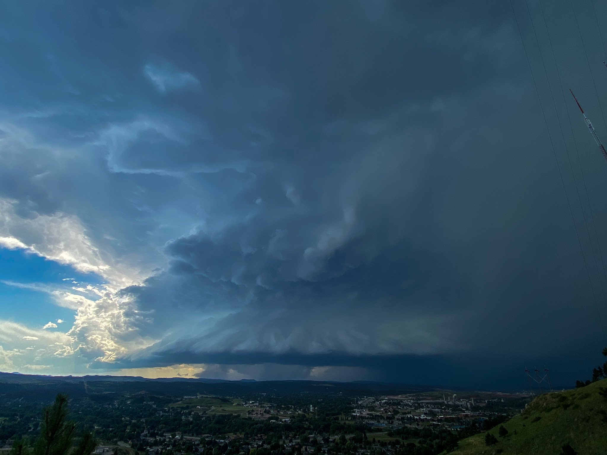 View of storm looking west from Skyline Drive in Rapid City, courtesy of David Stradling |
Tornadoes:
|
Tornado - Between Batesland and Allen
Track Map 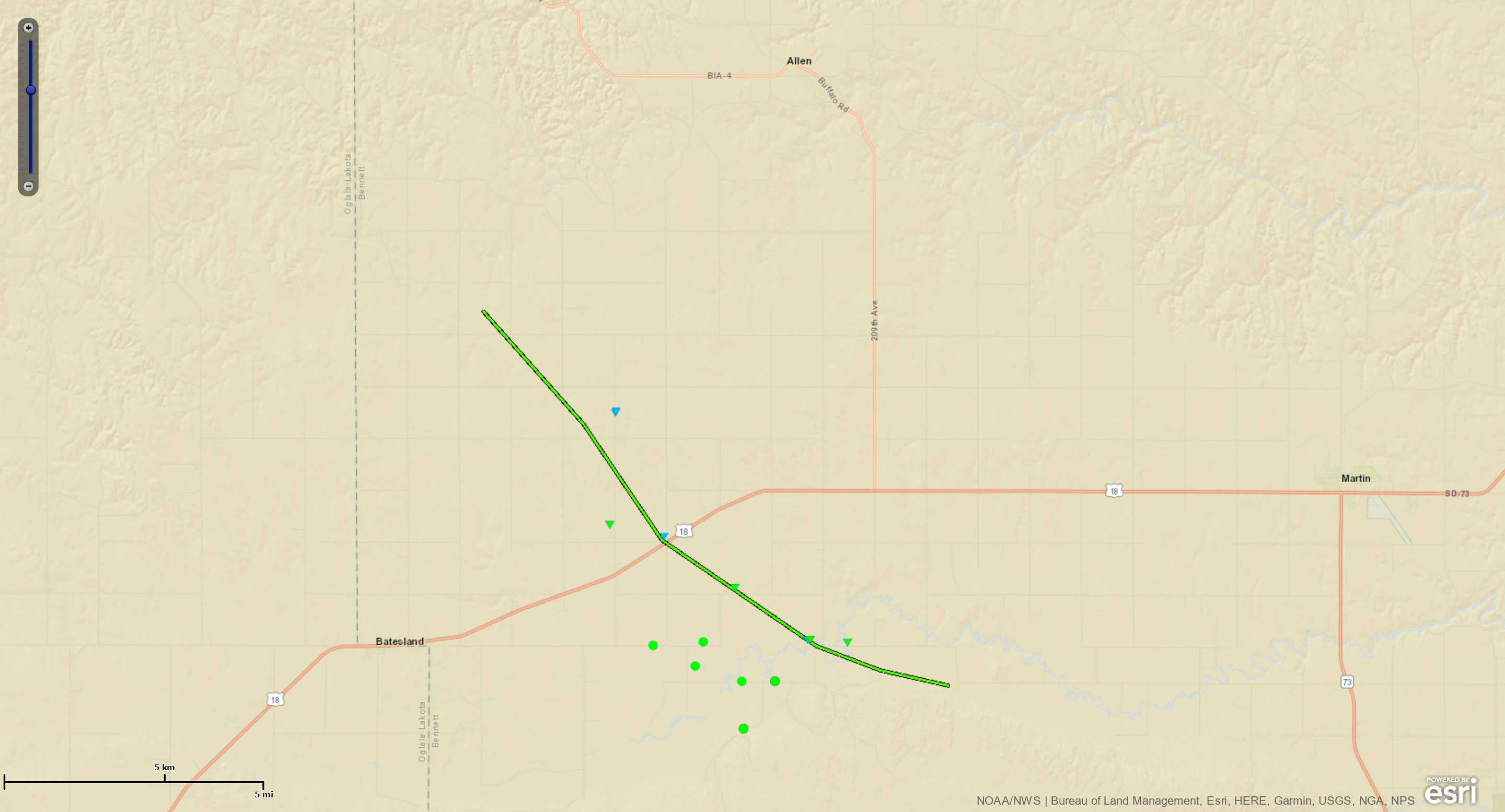  |
||||||||||||||||
|
Tornado - Spearfish Canyon
Track Map 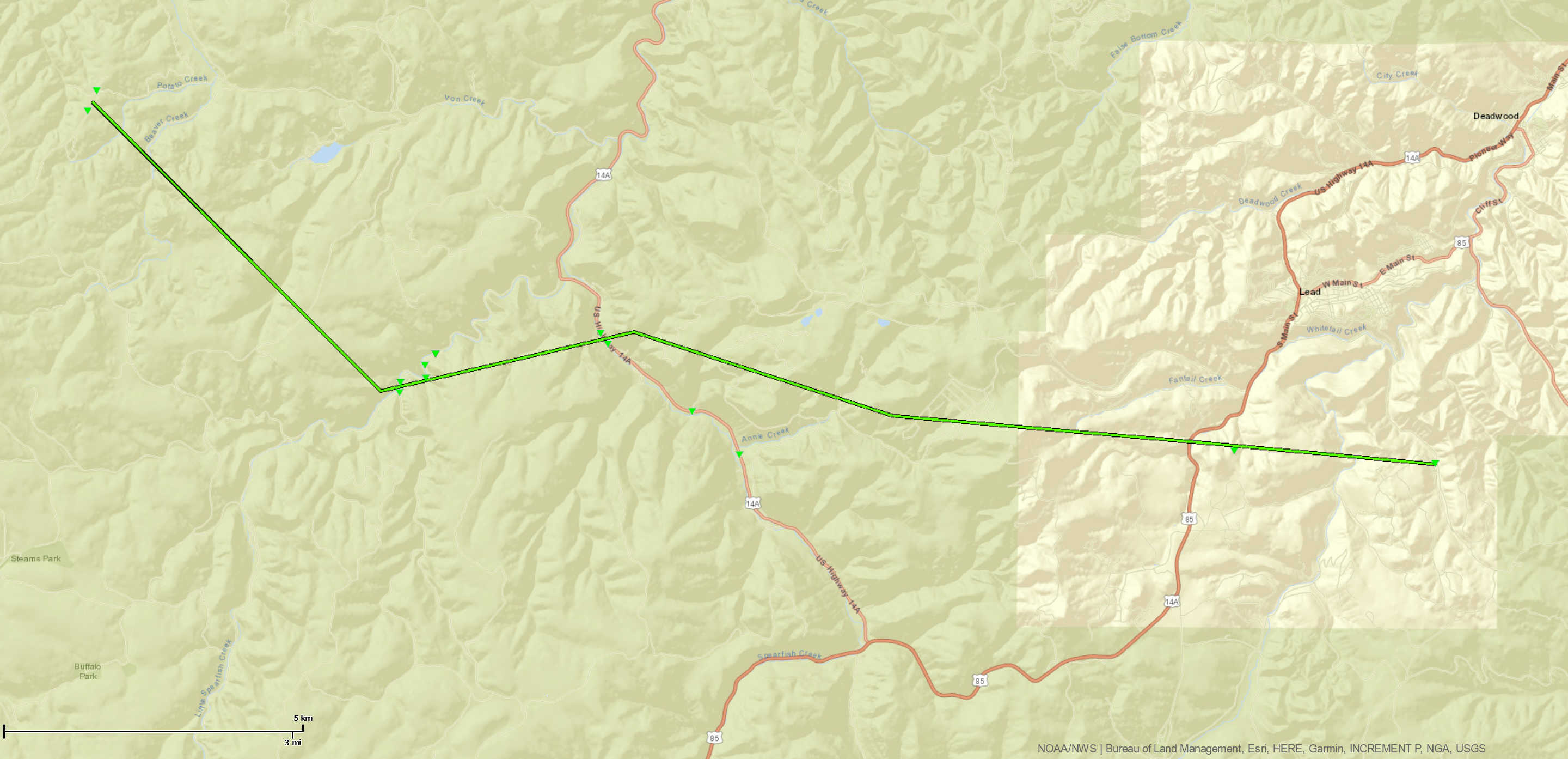 |
||||||||||||||||
The Enhanced Fujita (EF) Scale classifies tornadoes into the following categories:
| EF0 Weak 65-85 mph |
EF1 Moderate 86-110 mph |
EF2 Significant 111-135 mph |
EF3 Severe 136-165 mph |
EF4 Extreme 166-200 mph |
EF5 Catastrophic 200+ mph |
 |
|||||
Photos & Video
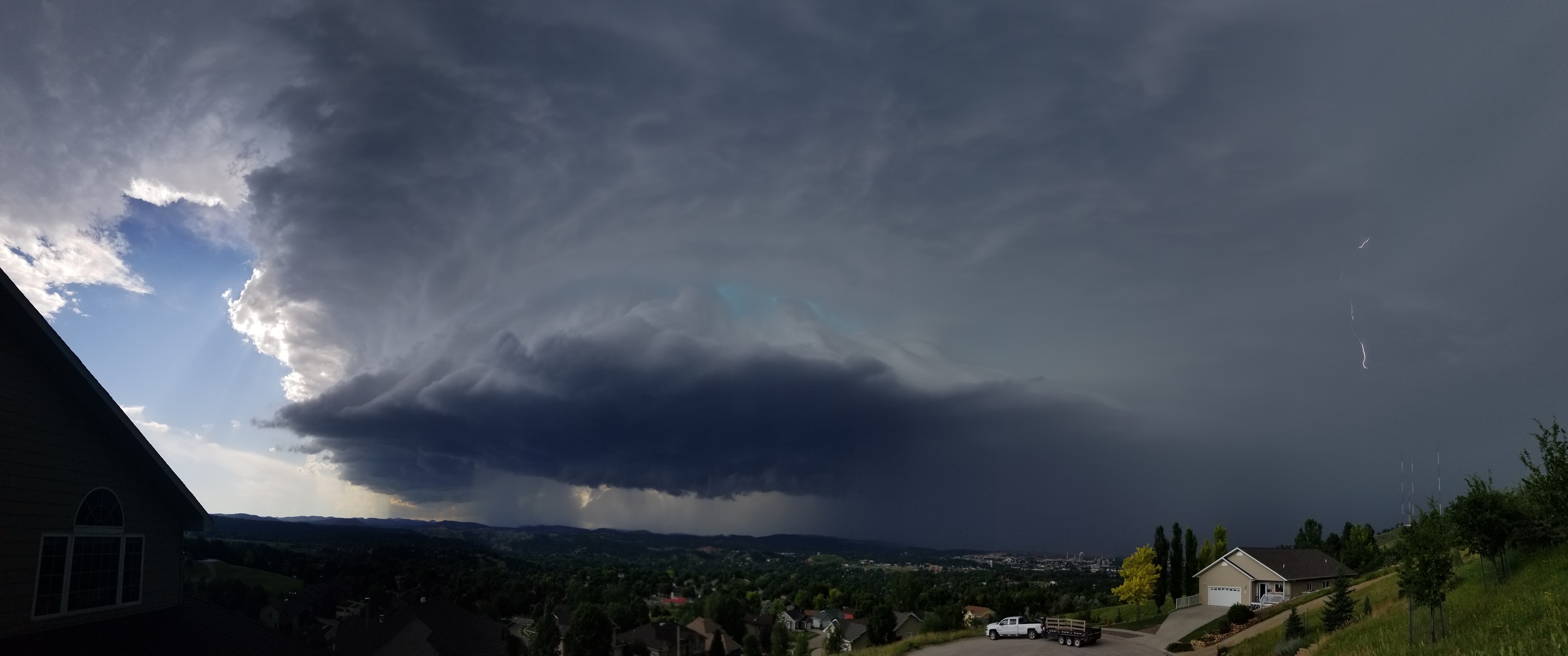
Below is a picture of the storm as it approached Rapid City, courtesy Matthew Morse.
 |
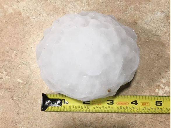
Below is a photo of the largest documented hail stone, which fell in Swett, SD. Photo courtesy of Kaitlyn Rayhill.
 |
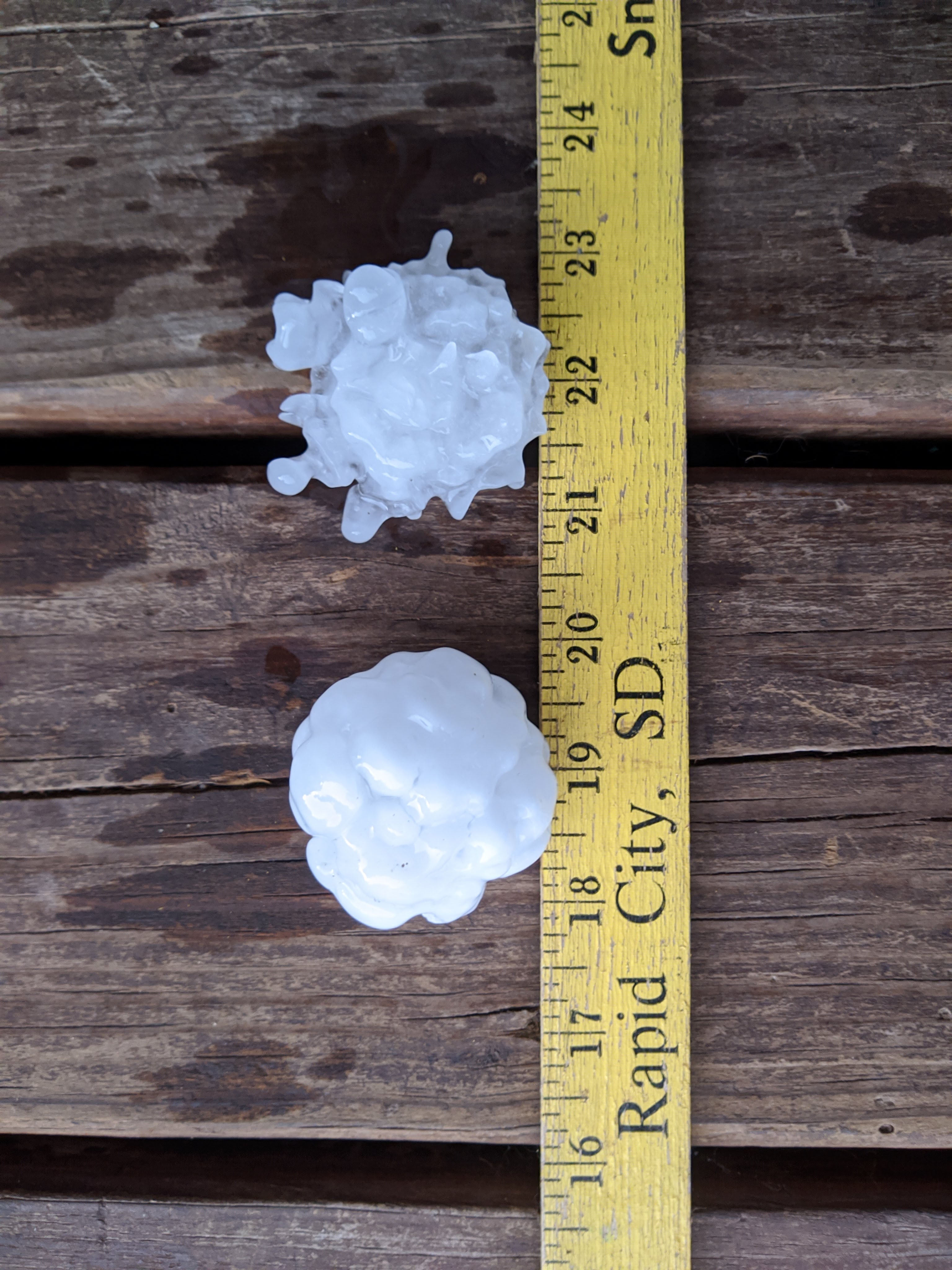
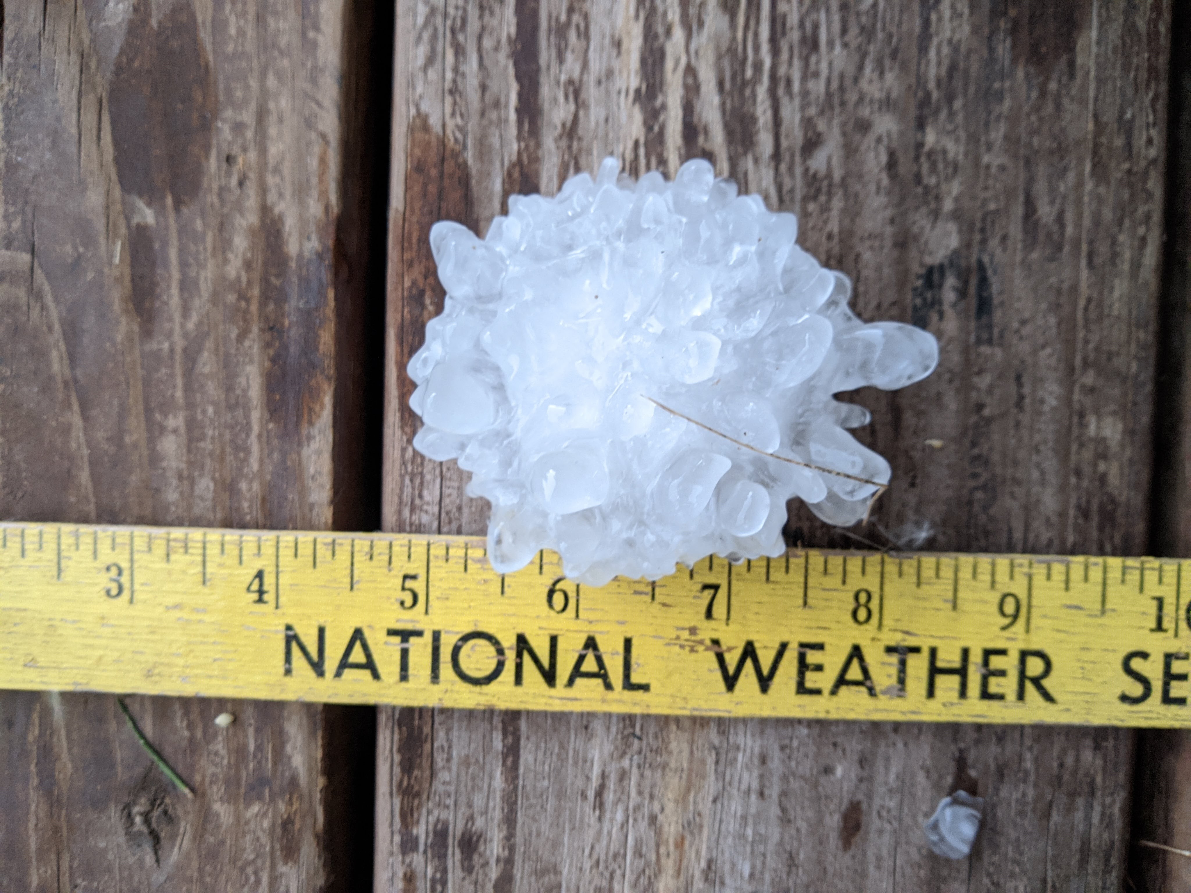
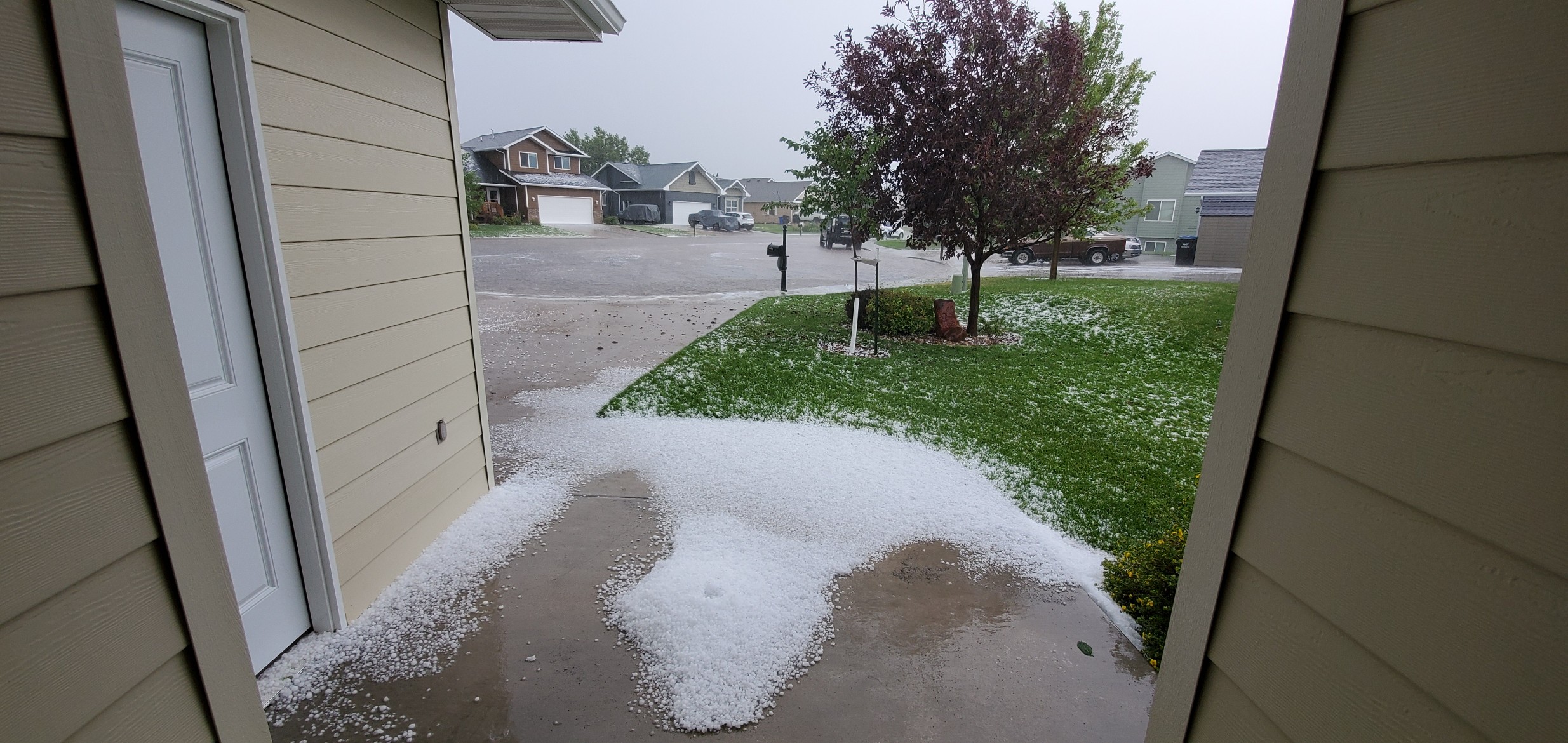
Below are photos of the hail around Rapid City.
 |
 |
 |
| Courtesy LeAnna Dugue' | Courtesy Tatiana Spain | Courtesy Shane Eagan |
 |
 |
 |
 |
| Courtesy Jim Bussell | Courtesy Shane Eagan | Courtesy Jon Chamberlain | Courtesy Jon Chamberlain |
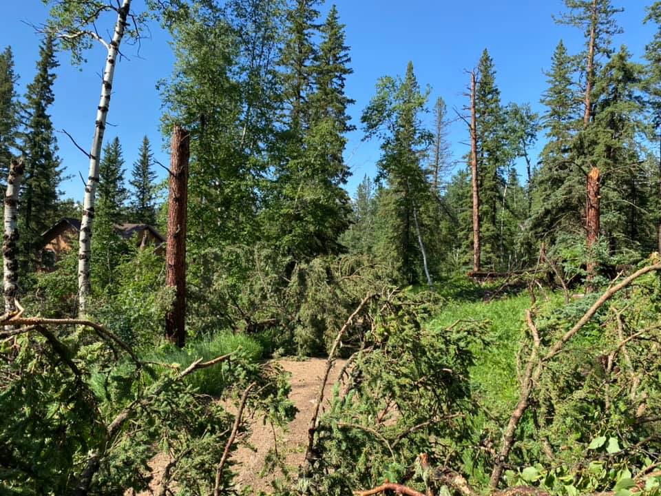
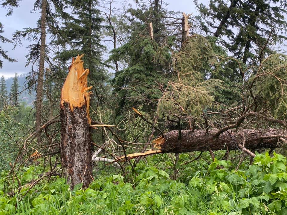
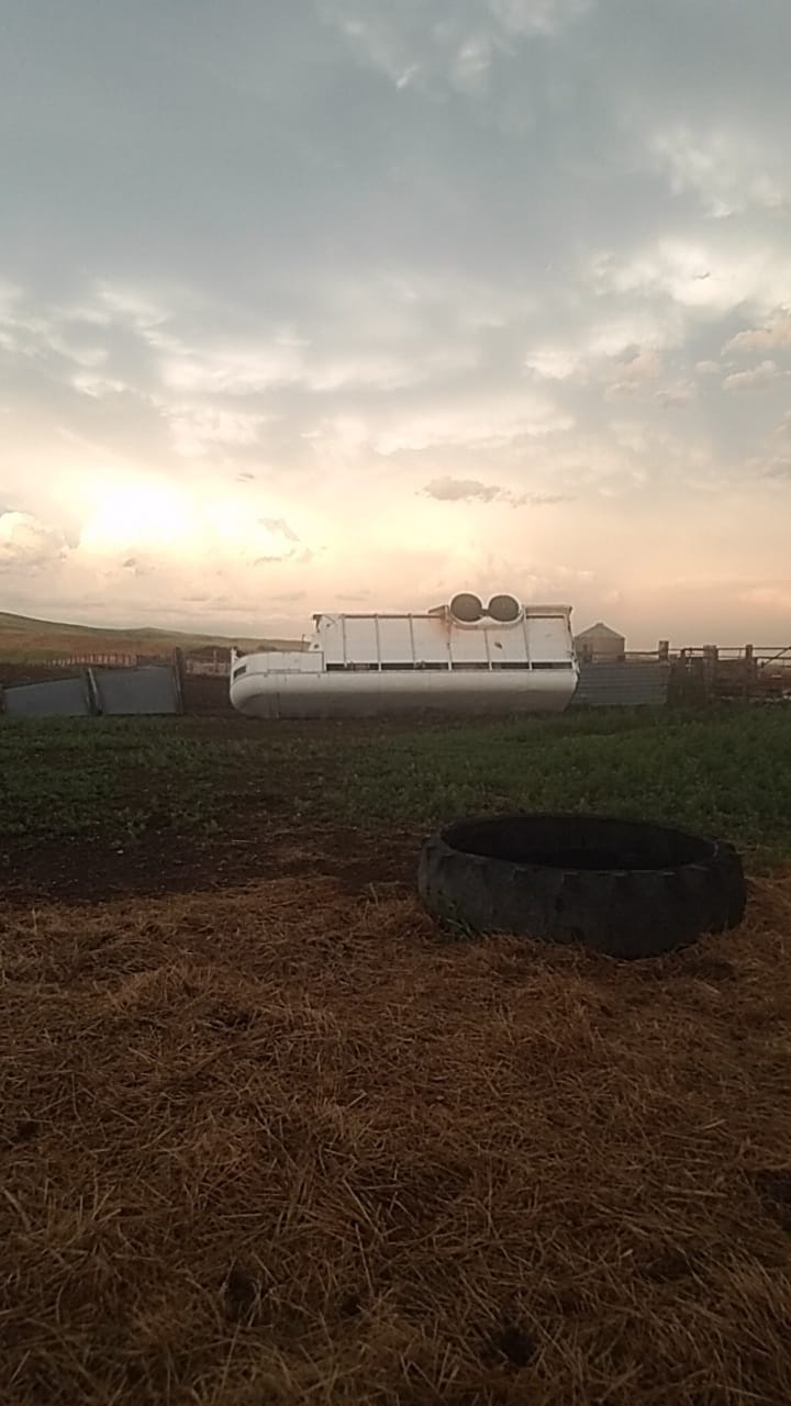
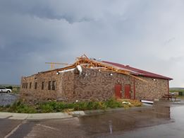
Below are storm damage photos in/around the northern Black Hills.
 |
 |
 |
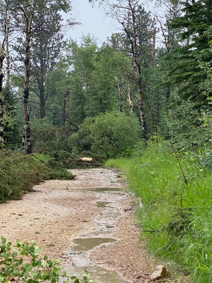 |
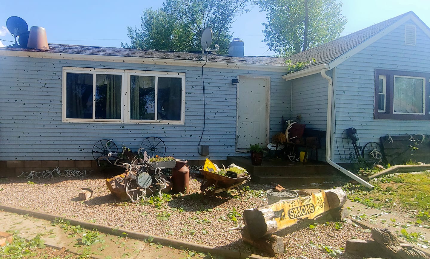
| Near Beulah, WY, courtesy Nadia Simons | Near Terry Peak, courtesy Haley Bachler | Near Terry Peak, courtesy Haley Bachler | Near Terry Peak, courtesy Haley Bachler |
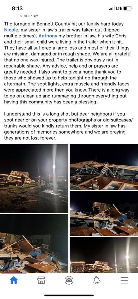
Below are storm damage photos in eastern Oglala Lakota and western Bennett counties.
 |
 |
 |
 |
| Batesland, courtesy Dawn Marie Shelbourn | Swett, courtesy Kaitlyn Rayhillr | Sharps Corner, courtesy Jon Siedschlaw | Batesland, courtesy Jon Siedschlaw |
Tornado SW/SD https://t.co/13E61DshHA
— Jeff Piotrowski (@Jeff_Piotrowski) July 11, 2020
Aerial view of some of the hail fog on the SW side of Rapid City, SD. @weatherchannel @NWSRapidCity #sdwx #hail #dronephotography pic.twitter.com/i55CfcqTHZ
— Charles Peek (@CharlesPeekWX) July 11, 2020
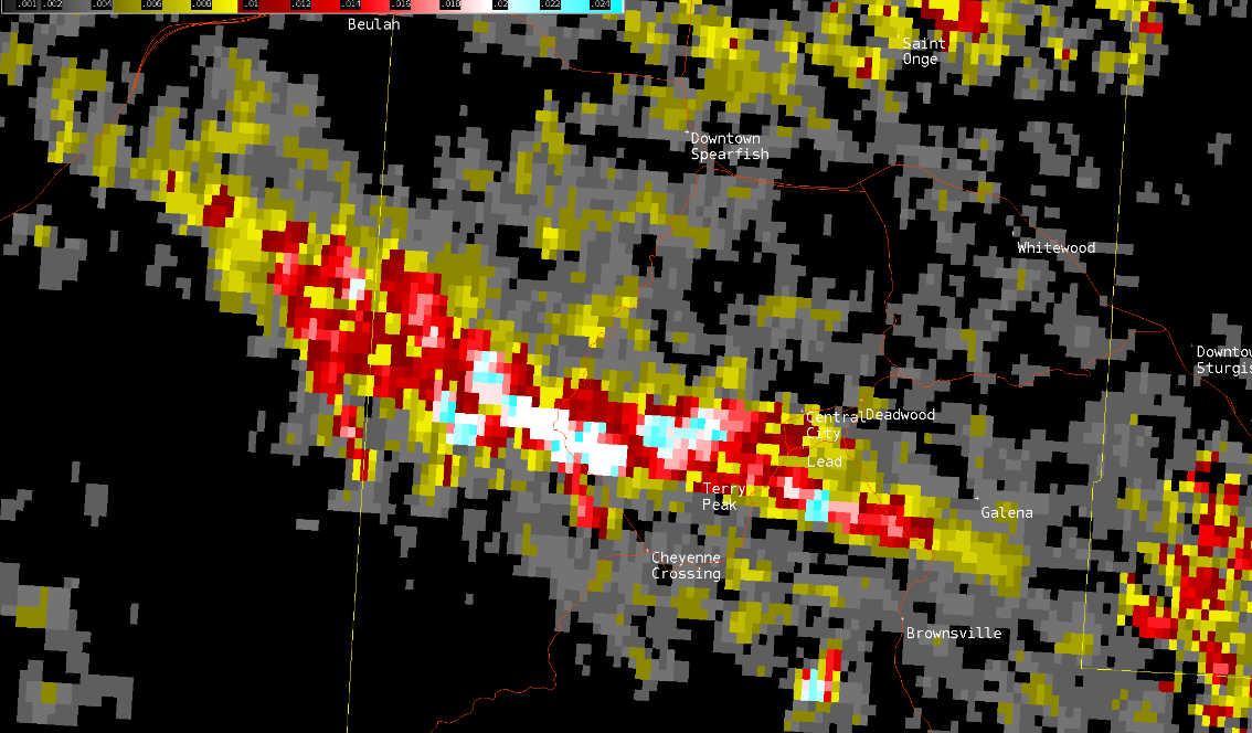
Radar
 |
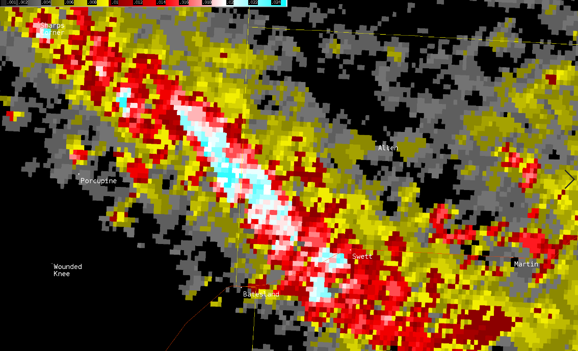 |
| Radar-accumluated rotation in the northern Black Hills, which shows where the supercell's strongest low-level circulation was and can be indicative of a potential tornado | Radar-accumluated rotation in Oglala and Bennett counties, which shows where the supercell's strongest low-level circulation was and can be indicative of a potential tornado |
Storm Reports
Here are the preliminary severe thunderstorm storm reports for July 10, 2020.
HAIL REPORTS LISTED BY SIZE (INCHES)

 SIZE    LOCATION                 ST  COUNTY           TIME
 ------  -----------------------  --  --------------   -------
  4.00   SWETT                    SD  BENNETT          0655 PM
  3.25   4 W DWTN RAPID CITY      SD  PENNINGTON       0450 PM
                 SEVERAL WINDSHIELDS BROKEN IN THE
                 NEIGHBORHOOD
  3.25   4 SW DWTN RAPID CITY     SD  PENNINGTON       0440 PM
                 LASTED 13 MINUTES
  3.25   5 SW BEULAH              WY  CROOK            0332 PM
  3.00   1 SSE DWTN RAPID CITY    SD  PENNINGTON       0454 PM
  3.00   2 SW DWTN RAPID CITY     SD  PENNINGTON       0443 PM
  3.00   4 SW DWTN RAPID CITY     SD  PENNINGTON       0440 PM
  3.00   4 W DWTN RAPID CITY      SD  PENNINGTON       0435 PM
  2.75   9 S MARTIN               SD  BENNETT          0715 PM
  2.75   1 SE SHARPS CORNER       SD  OGLALA LAKOTA    0625 PM
  2.75   2 SW DWTN RAPID CITY     SD  PENNINGTON       0444 PM
  2.50   5 W ROCKYFORD            SD  OGLALA LAKOTA    0550 PM
  2.50   3 W DWTN RAPID CITY      SD  PENNINGTON       0440 PM
  2.25   4 S DWTN RAPID CITY      SD  PENNINGTON       0448 PM
  2.25   1 E DWTN RAPID CITY      SD  PENNINGTON       0443 PM
  2.00   3 W DWTN RAPID CITY      SD  PENNINGTON       0446 PM
  2.00   3 S DWTN RAPID CITY      SD  PENNINGTON       0444 PM
  1.75   5 E PORCUPINE            SD  OGLALA LAKOTA    0637 PM
  1.75   9 SW FARMINGDALE         SD  PENNINGTON       0530 PM
  1.75   2 WSW DWTN RAPID CITY    SD  PENNINGTON       0436 PM
                 REPORTED AT JACKSON BLVD AND 32ND ST
  1.75   4 WNW DWTN RAPID CITY    SD  PENNINGTON       0430 PM
  1.75   2 NNE JOHNSON SIDING     SD  PENNINGTON       0420 PM
  1.75   DWTN SPEARFISH           SD  LAWRENCE         0345 PM
  1.75   6 W BEULAH               WY  CROOK            0323 PM
                 HAIL AND WIND LASTED 10 MINUTES
  1.50   1 NNW PIEDMONT           SD  MEADE            0424 PM
  1.50   16 SSE MISSION           SD  TODD             1035 AM
                 HEAVY RAIN IS CAUSING FLOODING.
  1.25   1 SSW RAPID VALLEY       SD  PENNINGTON       0453 PM
  1.25   5 NE ROCKERVILLE         SD  PENNINGTON       0450 PM
  1.25   1 E DWTN RAPID CITY      SD  PENNINGTON       0435 PM
  1.25   1 NNW SUMMERSET          SD  MEADE            0422 PM
                 QUARTER SIZED HAIL STARTED AT 420 PM,
                 INCREASED TO PING-PONG BALL SIZE AT 428 PM.
  1.25   19 SSE MISSION           SD  TODD             1045 AM
  1.00   5 ENE CUSTER             SD  CUSTER           0540 PM
  1.00   7 SW RAPID CITY ARPT     SD  PENNINGTON       0500 PM
  1.00   4 NE ROCKERVILLE         SD  PENNINGTON       0451 PM
                 HAIL LASTED ABOUT 8 MINUTES
  1.00   1 NNW SUMMERSET          SD  MEADE            0434 PM
                 AT I-90 EXIT 52
  1.00   SUMMERSET                SD  MEADE            0430 PM
  1.00   1 S DWTN SPEARFISH       SD  LAWRENCE         0351 PM
  1.00   9 W DWTN SPEARFISH       SD  LAWRENCE         0340 PM
  1.00   8 NNE SUNDANCE           WY  CROOK            0325 PM
  1.00   ALADDIN                  WY  CROOK            0320 PM
  1.00   4 SE ALVA                WY  CROOK            0310 PM
  1.00   12 WNW COLONY            WY  CROOK            0245 PM
  0.88   9 WSW HILL CITY          SD  PENNINGTON       0525 PM
  0.88   1 N HEREFORD             SD  MEADE            0458 PM
  0.88   ROCKERVILLE              SD  PENNINGTON       0456 PM
  0.88   1 NNE ROSEBUD            SD  TODD             1015 AM
  0.75   3 NW NEW HAVEN           WY  CROOK            0230 PM
  0.50   3 NNW HULETT             WY  CROOK            0300 PM

TSTM WIND REPORTS LISTED BY SPEED (MPH)

 SPEED   LOCATION                 ST  COUNTY           TIME
 ------  -----------------------  --  --------------   -------
 97.00   15 SSE MISSION           SD  TODD             1034 AM
 85.00   15 SSE MISSION           SD  TODD             0807 PM
 85.00   8 ESE SAINT FRANCIS      SD  TODD             1040 AM
                 8 INCH TREE BRANCHES DOWN AND TOPS OF CEDAR
                 TREES SNAPPED
 85.00   16 SSE MISSION           SD  TODD             1035 AM
                 LARGE COTTONWOOD AND ELM TREES BLOWN DOWN AND
                 BROKEN.
 80.00   9 SW FARMINGDALE         SD  PENNINGTON       0530 PM
 80.00   19 SSE MISSION           SD  TODD             1045 AM
                 SEVERAL TREE BRANCHES 6 TO 8 INCH IN DIAMETER
                 BROKEN AND SNAPPED FROM TREES.
 79.00   15 SSE MISSION           SD  TODD             0802 PM
 70.00   1 N HEREFORD             SD  MEADE            0458 PM
 70.00   6 W BEULAH               WY  CROOK            0323 PM
                 HAIL AND WIND LASTED 10 MINUTES
 68.00   7 ESE ROSEBUD            SD  TODD             1025 AM
 64.00   15 SSE MISSION           SD  TODD             0757 PM
 64.00   15 SSE MISSION           SD  TODD             1029 AM
 63.00   BEULAH                   WY  CROOK            0336 PM
 60.00   SUMMERSET                SD  MEADE            0430 PM
 60.00   2 NNE JOHNSON SIDING     SD  PENNINGTON       0420 PM
 60.00   10 E DEVILS TOWER        WY  CROOK            0315 PM
                 POSSIBLY MORE THAN 60 MPH
 60.00   3 NNW HULETT             WY  CROOK            0300 PM
 60.00   3 NW NEW HAVEN           WY  CROOK            0230 PM
 60.00   1 NNE ROSEBUD            SD  TODD             1015 AM
 59.00   7 ESE ROSEBUD            SD  TODD             1020 AM
 58.00   11 SW PARMELEE           SD  TODD             0737 PM
 57.00   11 SW PARMELEE           SD  TODD             0732 PM
 56.00   9 SW BATESLAND           SD  OGLALA LAKOTA    0657 PM
 56.00   BEULAH                   WY  CROOK            0346 PM
 55.00   3 ESE PINE RIDGE         SD  OGLALA LAKOTA    0644 PM
 55.00   3 NW WASTA               SD  PENNINGTON       0532 PM
 55.00   3 WSW FAIRBURN           SD  CUSTER           0530 PM
 54.00   15 SSE MISSION           SD  TODD             0817 PM
 54.00   3 NW WASTA               SD  PENNINGTON       0542 PM
 54.00   1 E DWTN RAPID CITY      SD  PENNINGTON       0440 PM
 54.00   12 WSW CASTLE ROCK       SD  BUTTE            0400 PM
 53.00   5 WNW NEW UNDERWOOD      SD  PENNINGTON       0507 PM
 53.00   2 SE HULETT              WY  CROOK            0255 PM
 52.00   11 SW PARMELEE           SD  TODD             0727 PM
 52.00   1 ESE MARTIN             SD  BENNETT          0715 PM
 52.00   3 ESE PINE RIDGE         SD  OGLALA LAKOTA    0654 PM
 52.00   5 WNW NEW UNDERWOOD      SD  PENNINGTON       0517 PM
 52.00   1 NE ECHETA              WY  CAMPBELL         0251 PM
 51.00   WEWELA                   SD  TRIPP            0817 PM
 51.00   1 ESE MARTIN             SD  BENNETT          0735 PM
 51.00   3 WSW FAIRBURN           SD  CUSTER           0545 PM
 51.00   3 WSW FAIRBURN           SD  CUSTER           0540 PM
 51.00   4 S DWTN RAPID CITY      SD  PENNINGTON       0500 PM
 50.00   WEWELA                   SD  TRIPP            0827 PM

RAIN AMOUNTS (INCHES)

 AMOUNT  LOCATION                 ST  COUNTY           TIME
 ------  -----------------------  --  --------------   -------
  2.20   4 NNE DWTN RAPID CITY    SD  PENNINGTON       0448 PM
                 WIND GUSTS 30-35 MPH
  1.02   1 NNW PIEDMONT           SD  MEADE            0450 PM
                 RAINFALL FELL IN 30 MINUTES.
  0.75   SUMMERSET                SD  MEADE            0430 PM
-------------------------------------------------------------- |
Media use of NWS Web News Stories is encouraged! Please acknowledge the NWS as the source of any news information accessed from this site. |
|

