
Wildfires and poor air quality continue for the Pacific Northwest, Rockies and extended into the Plains. Severe thunderstorms possible for the northern Plains and upper Midwest on Monday along a frontal boundary. Another boundary will focus showers and thunderstorms for the eastern seaboard with localized heavy rainfall possible. For Alaska, a strong Bering Sea storm will bring winds and rainfall. Read More >
Overview
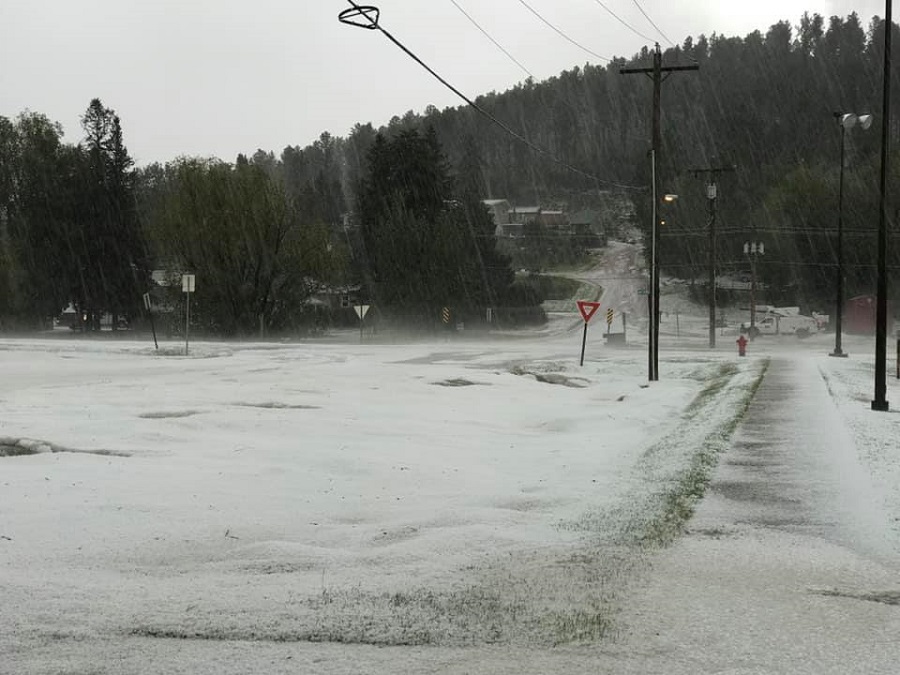
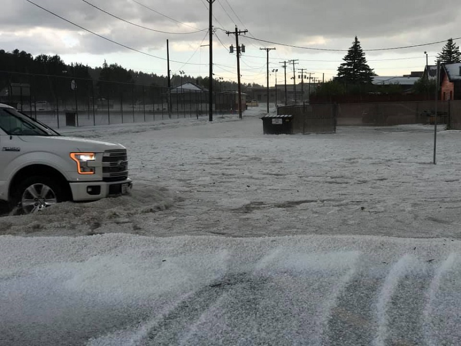
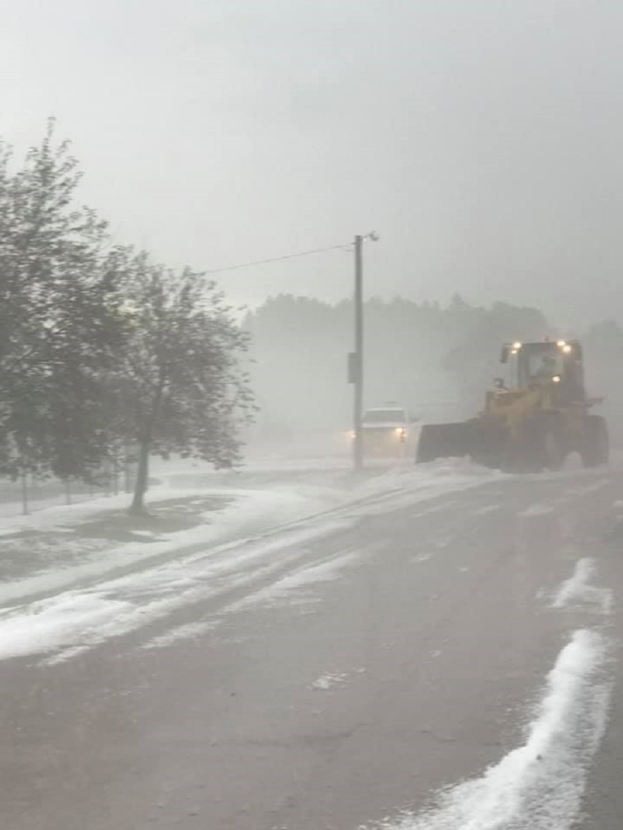
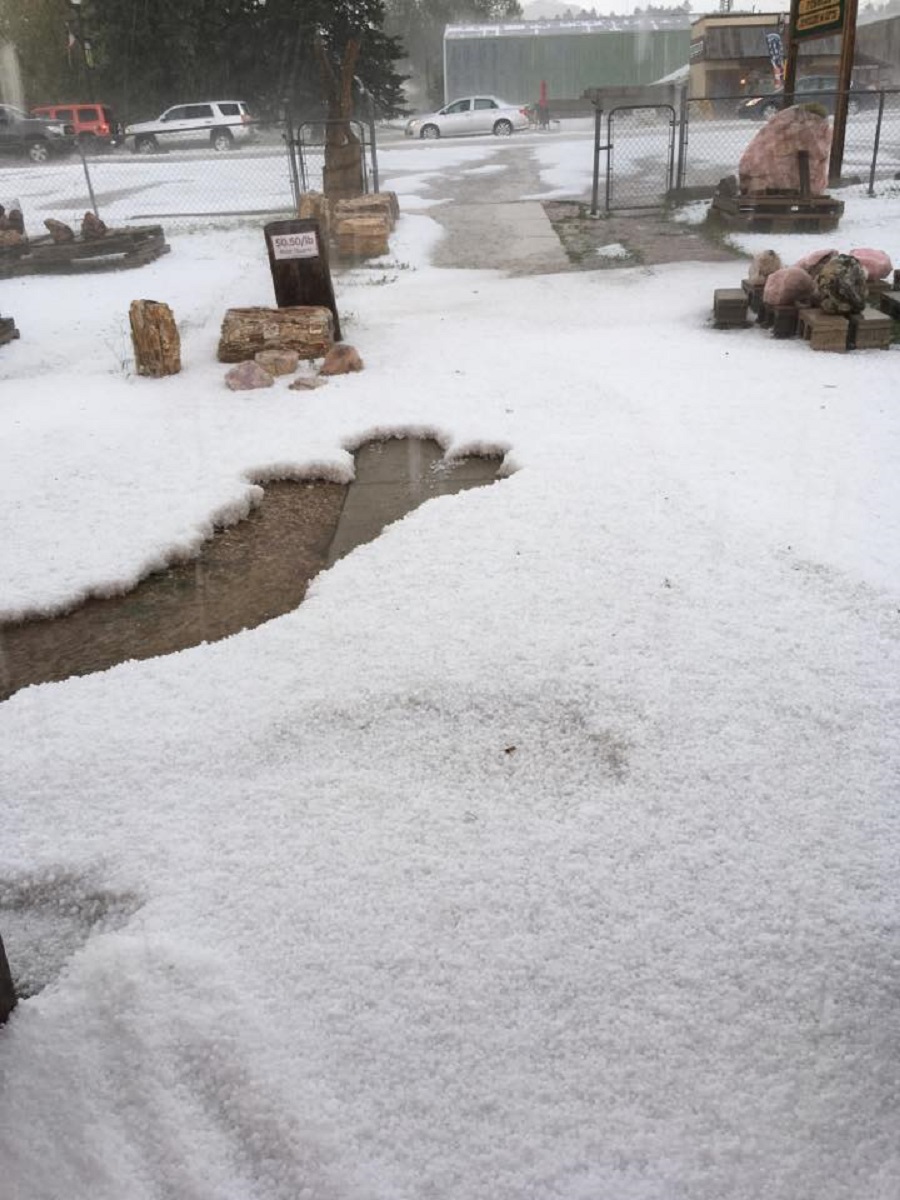
In the early afternoon of June 25, 2020, a severe thunderstorm developed over Custer. Hail reports ranged in size from peas to golf balls, and the massive amounts of hail that accumulated forced plows to clear roads. In addition, the combination of heavy rain and accumulating hail caused some flooding around Custer.
Photos & Video
Hail
 |
 |
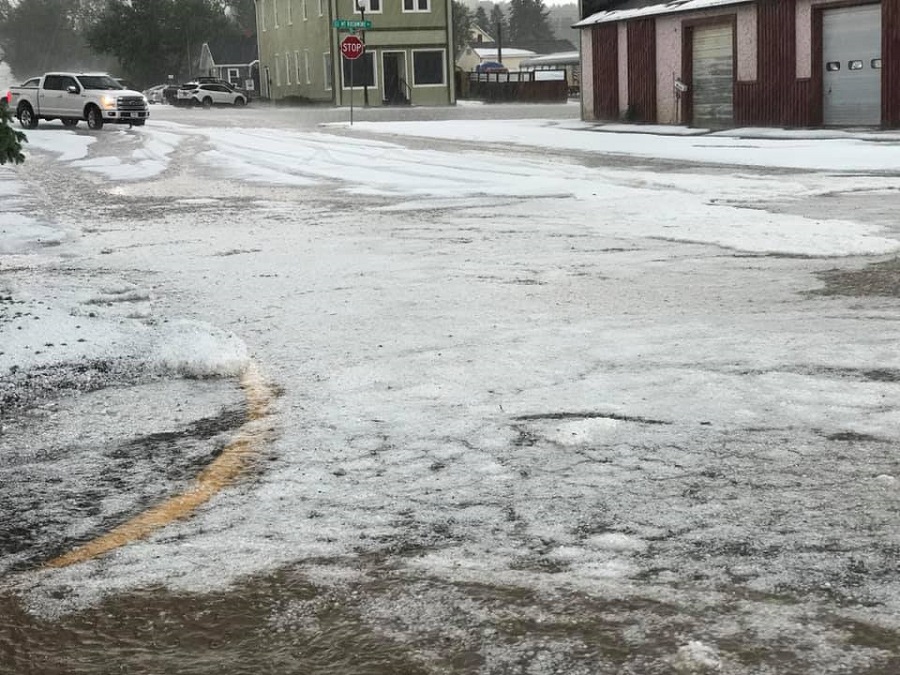 |
| courtesy Custer County Sheriff | courtesy Custer County Sheriff | courtesy Custer County Sheriff |
 |
 |
||
| courtesy Custer County Sheriff | courtesy Susan Parker |
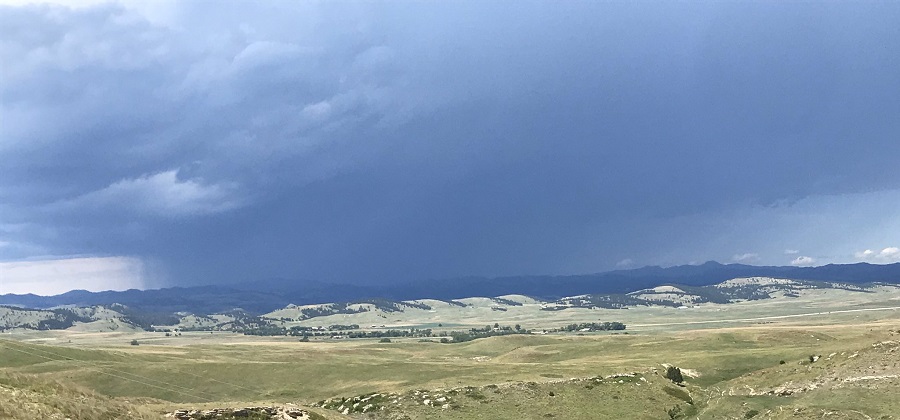
Storm Photo
 |
|||
| courtesy Jim Strain |
Videos
Hail no. ðŸ¤¦â™€ï¸ #wx #sdwx #weather #kotaweather @NWSRapidCity @KOTAWeather @NewsCenter1 @WeatherNation pic.twitter.com/LzTlvqOwFY
— Nature Tech Family (@naturetechfam) June 25, 2020
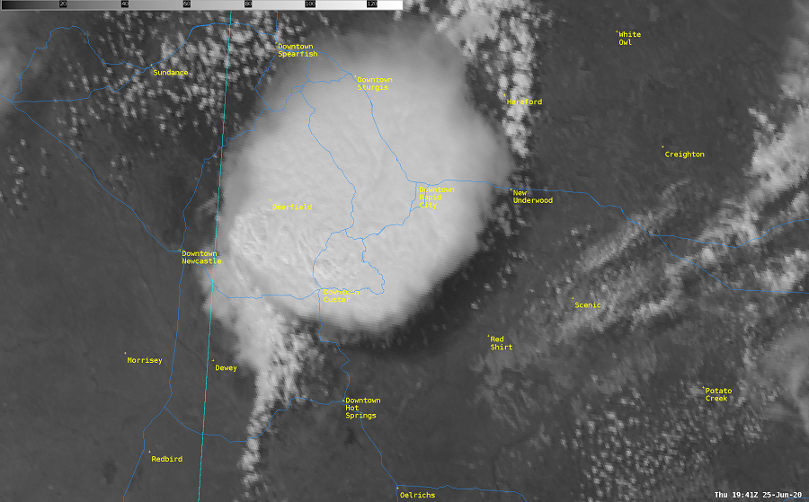
Radar and Satellite
Radar
Satellite
 |
 |
Media use of NWS Web News Stories is encouraged! Please acknowledge the NWS as the source of any news information accessed from this site. |
|

