
Dangerous heat will remain across portions of the southern U.S. through the weekend. A heat wave over the Southwest will intensify this week, peaking and expanding into the Intermountain West and northern High Plains this weekend. Severe thunderstorms will produce damaging winds and heavy rainfall over portions of the northern/central Plains into the mid/upper-Mississippi Valleys today. Read More >
Overview
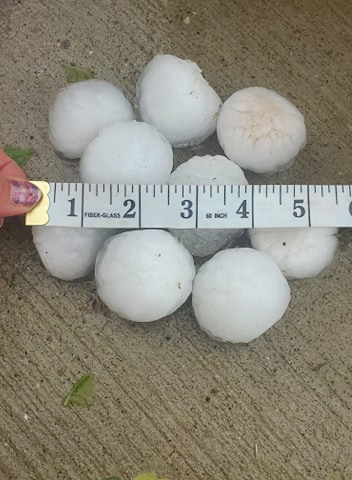
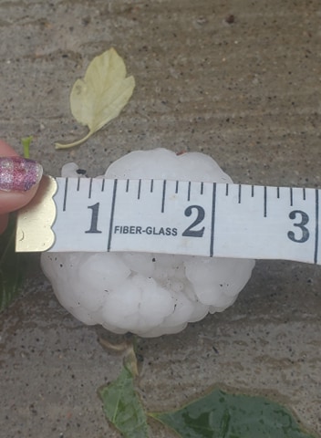
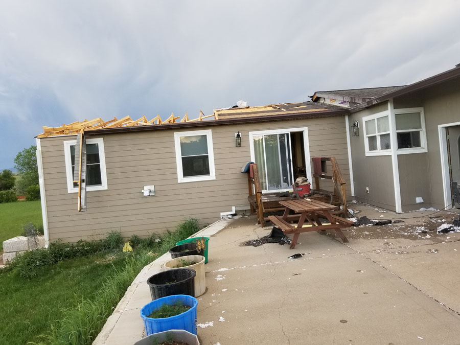
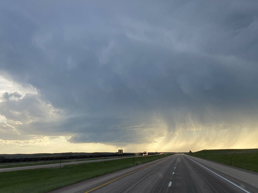
On June 4, 2020, severe thunderstorms brought very large hail and damaging winds to portions of northeastern Wyoming and western South Dakota. Hail of tennis ball to baseball sized was observed from near Spearfish to portions of Rapid City, with hail larger than baseballs observed south of Faith. Winds over 70 mph damaged structures northwest of Spearfish and north of Ellsworth AFB.
Photos & Video
Hail
 |
 |
 |
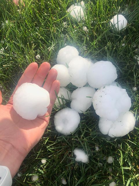
| Hail in Spearfish (courtesy Alex Miller) |
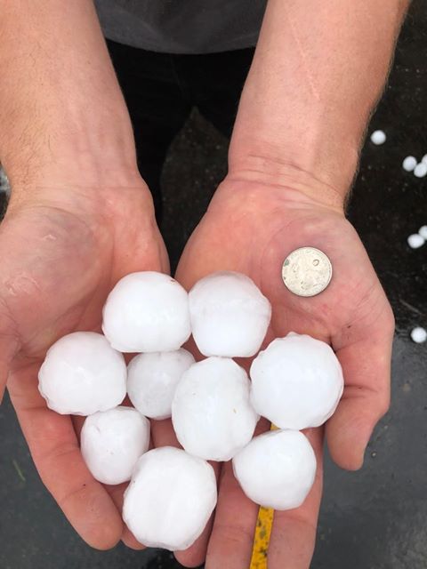
Hail northeast of Deadwood (courtesy William Collister) |
|
 |
 |
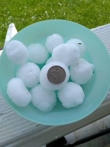
| Hail in Spearfish (courtesy Rebecca Kalbach) |
|
Wind Damage
 |
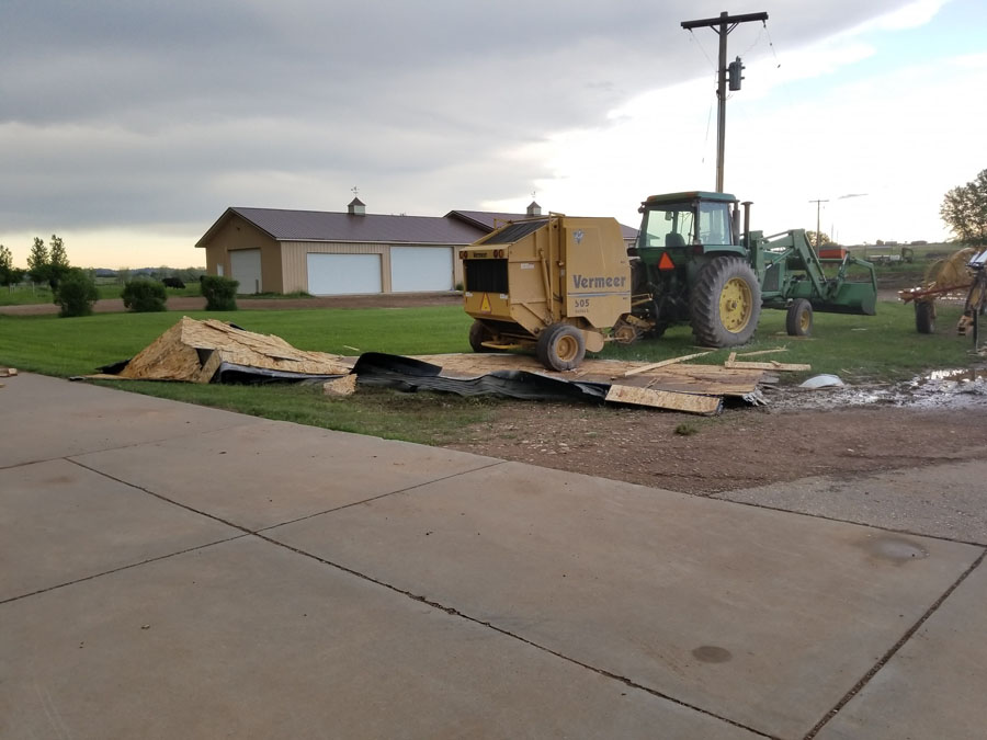 |
| Wind damage near I-90, exit 2 (courtesy Collette Fickbohm) |
|
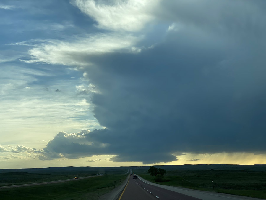
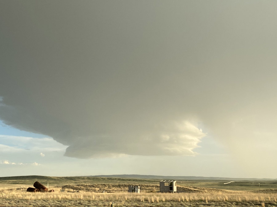
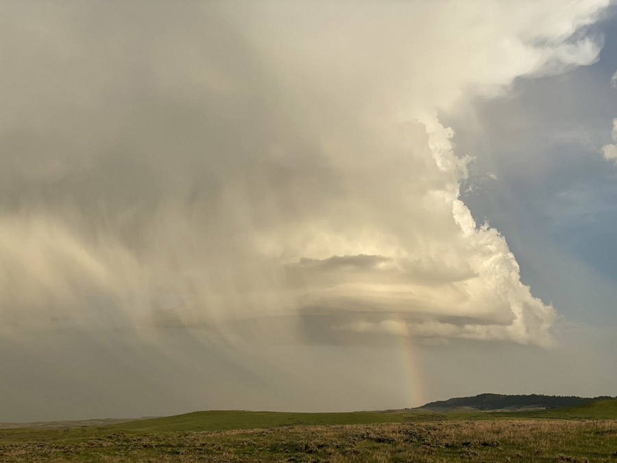
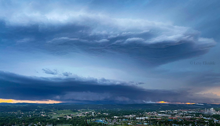
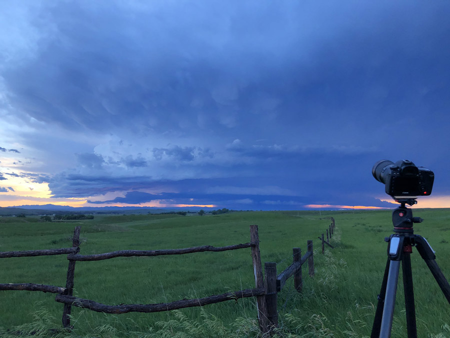
Storm Photos
 |
 |
 |
 |
| Supercell from Gillette to Newcastle (courtesy Jesse Frear) |
|
 |
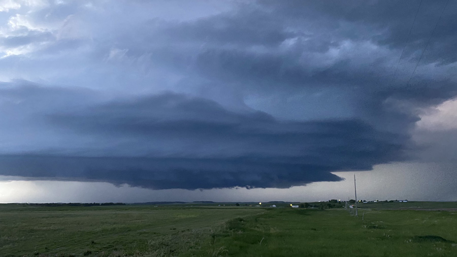 |
| Supercell near Rapid City (courtesy Lexy Elizalde) |
Supercell near Martin (courtesy Jeff Piotrowski) |
 |
 |
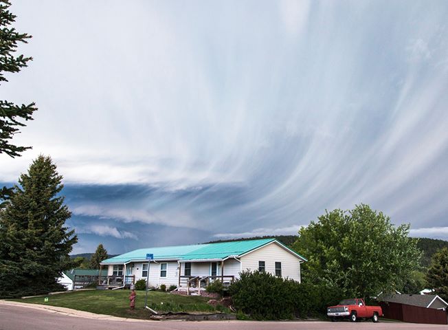 |
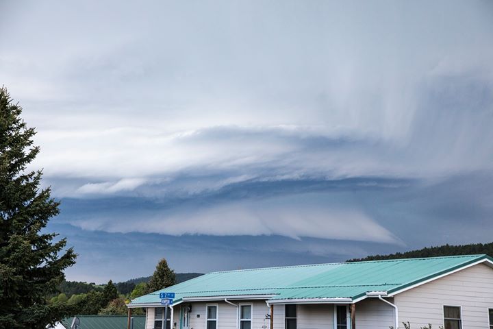
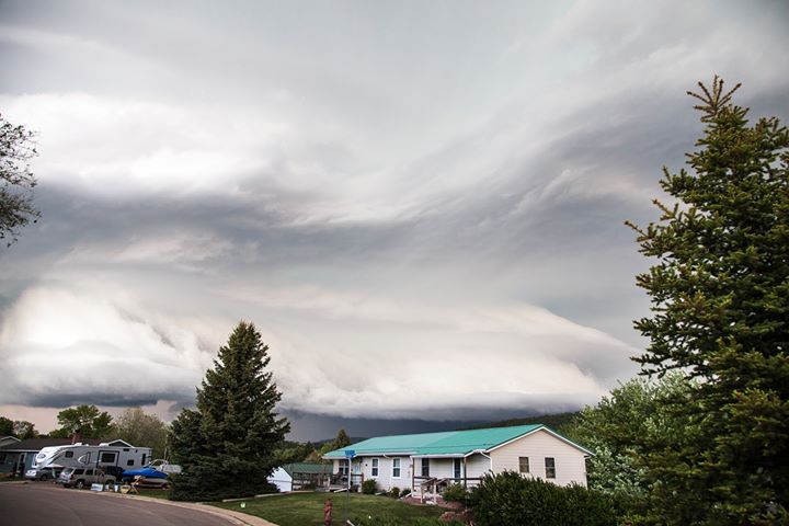
| Supercell near Sundance (courtesy Meghan and Dave Porter) |
||
 |
 |
| Supercell and rainbow over the Badlands (courtesy Spencer Dant) |
Looking toward the Black Hills (courtesy Michael Charnick) |
Videos and Time Lapses
I don’t know about y’all, but this is the view I needed today. #sdwx @BrantBeckmanwx pic.twitter.com/7VXCekEhy8
— Megan Murat (@MeganMuratTV) June 5, 2020
Quick supercell timelapse from the drone #sdwx pic.twitter.com/rfdb3F0PLr
— Michael Snyder (@SeattleWXGuy) June 5, 2020
6/4/2020: 16x timelapse of hailstorm moving over Rapid City, SD (looking WNW from Radar Hill Rd.) #SDwx pic.twitter.com/2EKSFw7iD2
— Matthew Bunkers (@wxbunkers) June 5, 2020
THU - 6:42 PM: Tennis Ball ?? sized hail and 80 mph winds knocks out my back windshield in Blackhawk, SD along I-90. Mud, hail and tree branches came shooting through the back window and hit my front windshield. few cuts, but otherwise uninjured. @NWSRapidCity #sdwx #blackhills pic.twitter.com/kTa6lB1Q5R
— Brant Beckman ? (@BrantBeckmanwx) June 5, 2020
Radar
Storm Reports
HAIL REPORTS LISTED BY SIZE (INCHES)

 SIZE    LOCATION                 ST  COUNTY           TIME
 ------  -----------------------  --  --------------   -------
  3.20   9 S FAITH                SD  MEADE            0444 PM
  2.75   1 NNW PIEDMONT           SD  MEADE            0617 PM
  2.75   8 W FAITH                SD  MEADE            0425 PM
  2.50   6 ENE MARTIN             SD  BENNETT          0905 PM
  2.50   3 N DWTN RAPID CITY      SD  PENNINGTON       0641 PM
  2.50   1 N DWTN RAPID CITY      SD  PENNINGTON       0637 PM
  2.50   BLACK HAWK               SD  MEADE            0628 PM
                 HAIL IS DIME TO TENNIS BALL SIZE.
  2.50   1 SE SUMMERSET           SD  MEADE            0627 PM
  2.50   3 WNW DWTN SPEARFISH     SD  LAWRENCE         0539 PM
  2.00   6 ENE MARTIN             SD  BENNETT          0905 PM
  2.00   2 N DWTN RAPID CITY      SD  PENNINGTON       0638 PM
                 SEVERAL BROKEN WINDSHIELDS IN LOWES PARKING
                 LOT.
  2.00   1 WNW DWTN SPEARFISH     SD  LAWRENCE         0547 PM
  2.00   2 WNW DWTN SPEARFISH     SD  LAWRENCE         0538 PM
                 HAIL LASTED 5 MINUTES
  2.00   3 W FAITH                SD  MEADE            0510 PM
  2.00   7 W FAITH                SD  MEADE            0430 PM
  1.75   SUMMERSET                SD  MEADE            0625 PM
                 STILL ONGOING
  1.75   TILFORD                  SD  MEADE            0609 PM
                 STILL ONGOING
  1.75   9 NE MILESVILLE          SD  HAAKON           0533 PM
                 WIND GUSTS TO 50 MPH.
  1.75   1 W RED SCAFFOLD         SD  ZIEBACH          0503 PM
  1.50   3 SSE DWTN RAPID CITY    SD  PENNINGTON       0652 PM
  1.50   4 N DWTN RAPID CITY      SD  PENNINGTON       0642 PM
  1.50   3 SSE SORUM              SD  PERKINS          0324 PM
                 GROUND COVERED WITH HAIL.
  1.25   SUNDANCE                 WY  CROOK            0715 PM
  1.25   6 SSE DWTN GILLETTE      WY  CAMPBELL         0712 PM
                 WIND GUSTS TO 45 MPH.
  1.25   3 NNE DWTN RAPID CITY    SD  PENNINGTON       0647 PM
                 MULTIPLE BROKEN WINDOWS ON HOUSE
  1.25   DEADWOOD                 SD  LAWRENCE         0554 PM
  1.25   8 S USTA                 SD  PERKINS          0415 PM
  1.00   7 SE SAINT FRANCIS       SD  TODD             0950 PM
  1.00   5 S POTATO CREEK         SD  JACKSON          0945 PM
                 40 MPH WINDS
  1.00   9 W JEWEL CAVE           SD  CUSTER           0850 PM
                 40 MPH WINDS
  1.00   2 SE FARMINGDALE         SD  PENNINGTON       0845 PM
                 50 MPH WINDS
  1.00   7 SW RAPID CITY ARPT     SD  PENNINGTON       0830 PM
  1.00   5 S POTATO CREEK         SD  JACKSON          0825 PM
  1.00   POTATO CREEK             SD  JACKSON          0818 PM
  1.00   HISEGA                   SD  PENNINGTON       0818 PM
  1.00   13 ESE SCENIC            SD  PENNINGTON       0750 PM
  1.00   9 SSE DWTN GILLETTE      WY  CAMPBELL         0715 PM
  1.00   3 ESE DWTN RAPID CITY    SD  PENNINGTON       0648 PM
  1.00   1 NE OSHOTO              WY  CROOK            0638 PM
  1.00   3 N JOHNSON SIDING       SD  PENNINGTON       0627 PM
  1.00   5 S SAINT ONGE           SD  LAWRENCE         0559 PM
  1.00   6 NNE ALADDIN            WY  CROOK            0510 PM
  1.00   15 NNW ALVA              WY  CROOK            0444 PM
                 LOTS OF MARBLE TO QUARTER SIZE HAIL. GROUND
                 COVERED WITH HAIL
  0.88   6 NNW KYLE               SD  OGLALA LAKOTA    0935 PM
                 30-40 MPH WINDS
  0.88   15 ENE MILESVILLE        SD  HAAKON           0526 PM
                 WIND GUSTS TO 40 MPH.
  0.88   HISEGA                   SD  PENNINGTON       0525 PM
  0.88   4 SSW REVA               SD  HARDING          0306 PM
                 GROUND COVERED WITH HAIL
  0.75   13 S UPTON               WY  WESTON           0810 PM
  0.75   11 ENE RECLUSE           WY  CAMPBELL         0600 PM
                 WIND GUSTS TO 50 MPH.
  0.70   2 NE SILVER CITY         SD  PENNINGTON       0810 PM
  0.70   3 NNE DWTN RAPID CITY    SD  PENNINGTON       0553 PM
                 WIND GUSTS ESTIMATED AT OVER 50 MPH.


TSTM WIND REPORTS LISTED BY SPEED (MPH)

 SPEED   LOCATION                 ST  COUNTY           TIME
 ------  -----------------------  --  --------------   -------
 76.00   3 NNW SCENIC             SD  PENNINGTON       0734 PM
 72.00   3 NNW SCENIC             SD  PENNINGTON       0729 PM
 64.00   3 NNW SCENIC             SD  PENNINGTON       0724 PM
 62.00   RAPID CITY ARPT          SD  PENNINGTON       0651 PM
 62.00   1 E LEAD                 SD  LAWRENCE         0555 PM
 61.00   7 NNE ELLSWORTH AFB      SD  MEADE            0615 PM
                 WIND GUSTS OF 60 TO 70 MPH BLEW OVER AT LEAST
                 3 POLE BARNS IN THE NEIGHBORHOOD. WIND LASTED
                 ABOUT 10 MINUTES.
 60.00   3 SSE SORUM              SD  PERKINS          0324 PM
 59.00   ELLSWORTH AFB            SD  MEADE            0602 PM
 56.00   1 SSE BOX ELDER          SD  PENNINGTON       0600 PM
 53.00   4 E DWTN SPEARFISH       SD  LAWRENCE         0555 PM
 52.00   BEULAH                   WY  CROOK            0532 PM
 50.00   16 WSW DWTN GILLETTE     WY  CAMPBELL         0652 PM
 50.00   4 S DWTN RAPID CITY      SD  PENNINGTON       0650 PM
 |
Media use of NWS Web News Stories is encouraged! Please acknowledge the NWS as the source of any news information accessed from this site. |
|

