Overview
|
Severe storms with tornadoes, large hail, damaging straight-line winds, heavy rain, and flash flooding moved across northeastern Wyoming and western South Dakota during the afternoon and evening of July 3, 2019. Tornadoes were reported near both Allen, South Dakota, and southwest of Dewey, South Dakota (located across the border in Wyoming). The lightning map to the right shows that there were concentrated areas of cloud-to-ground lightning flashes in both of those areas. |
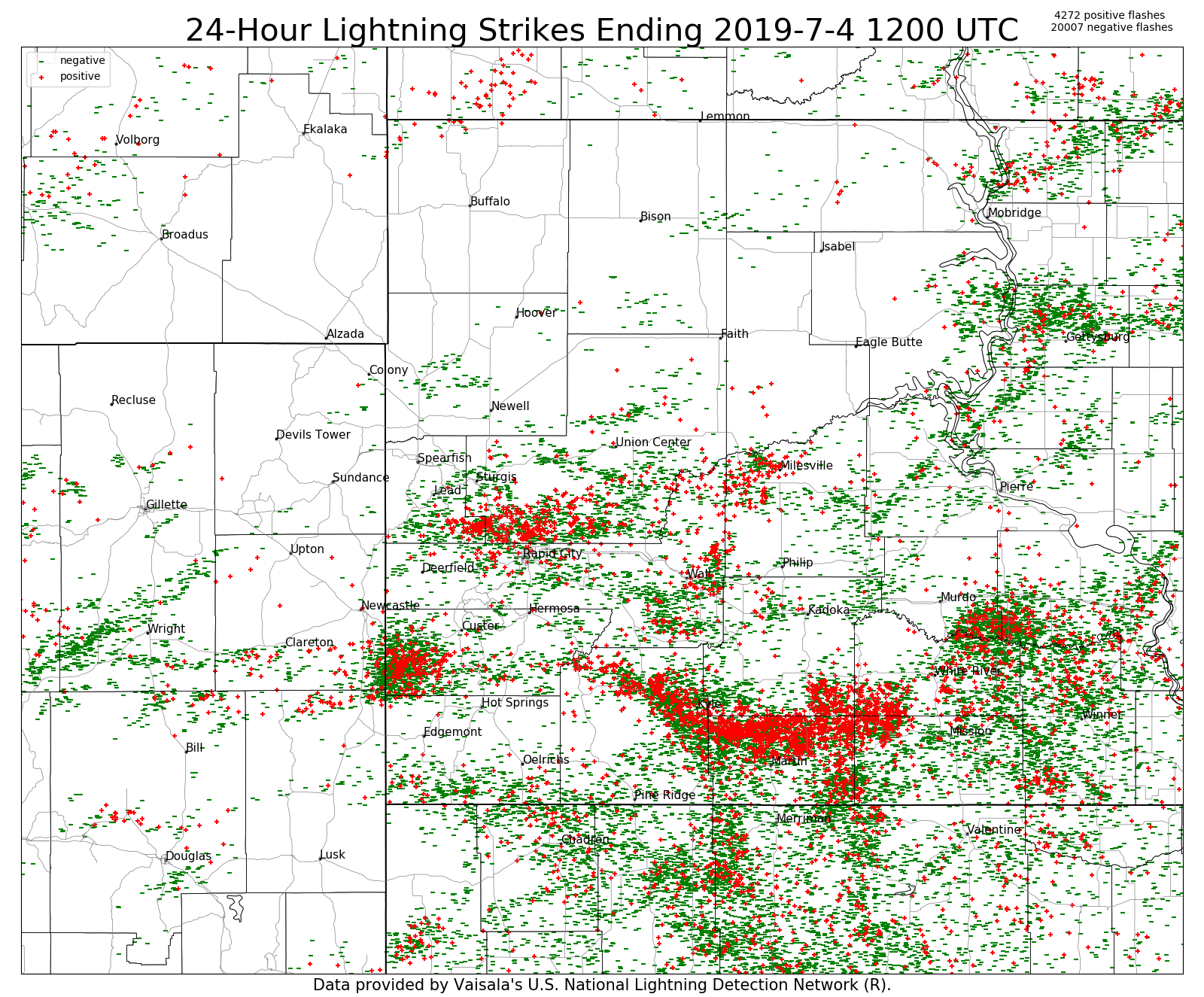 24-hour cloud-to-ground lightning from 6 am July 4 to 6 am July 5, 2019 |
Tornadoes:
|
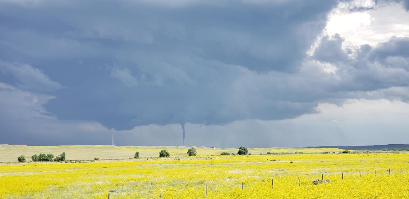
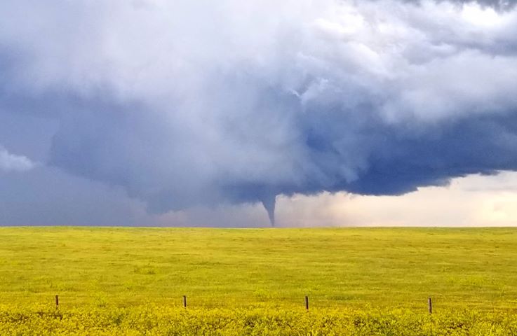
Tornadoes - 8 west-northwest of Swett, 9 west of Allen, 5 west-southwest of Allen, and 3 southwest of Allen
Track Map 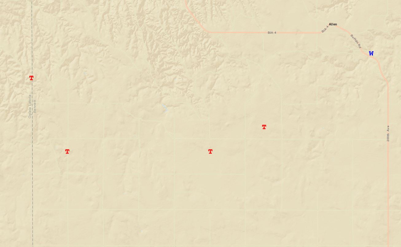  |
||||||||||||||||
|
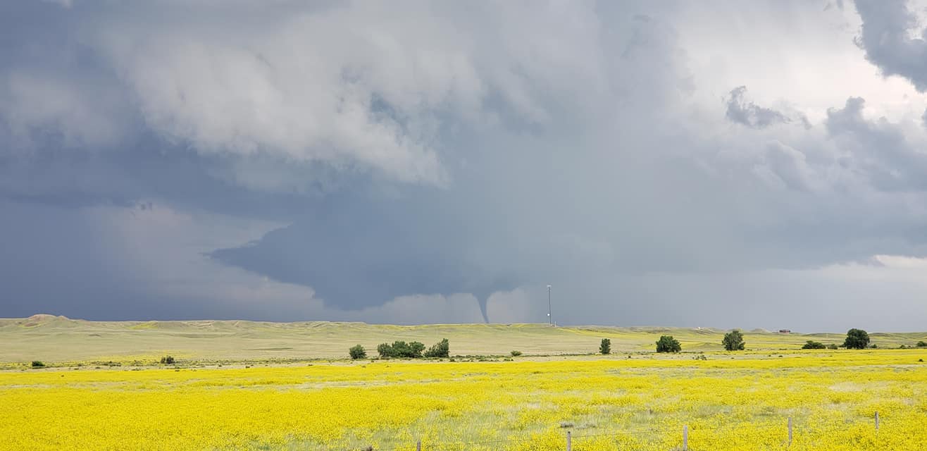
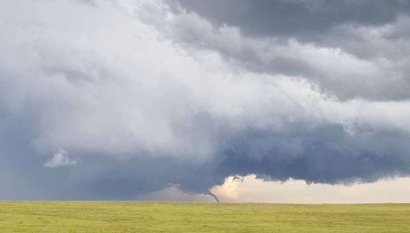
Tornado - 2 southwest of Dewey
Track Map 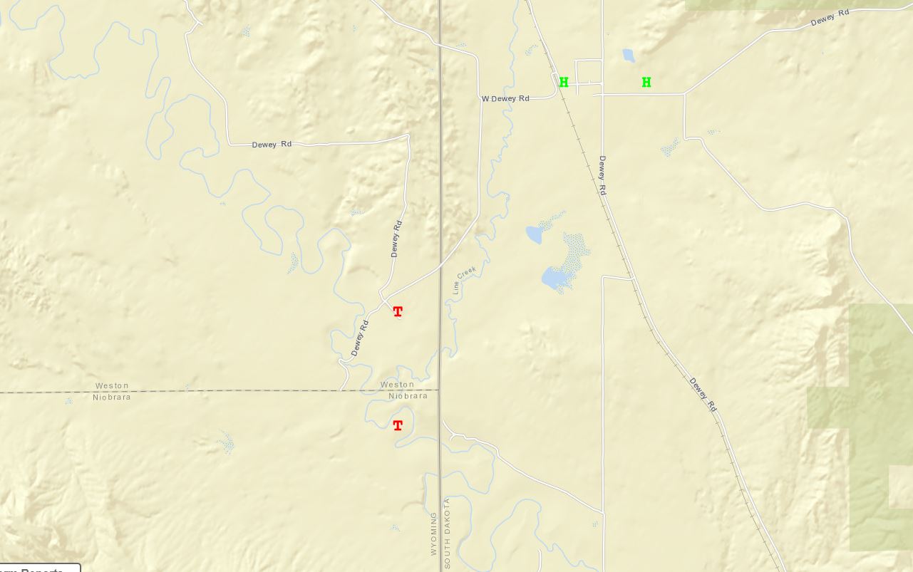 |
||||||||||||||||
The Enhanced Fujita (EF) Scale classifies tornadoes into the following categories:
| EF0 Weak 65-85 mph |
EF1 Moderate 86-110 mph |
EF2 Significant 111-135 mph |
EF3 Severe 136-165 mph |
EF4 Extreme 166-200 mph |
EF5 Catastrophic 200+ mph |
 |
|||||
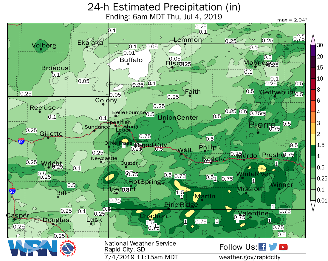
Rainfall & Flooding
Heavy rain and flooding was reported over parts of the area. Here are some 24-hour rainfall reports from CoCoRaHS (Community Collaborative Rain, Hail & Snow Network) ending at 7 am on July 4, 2019.
SDBN02 : BATESLAND 7.4 NNE * : 2.70 SDBN17 : MARTIN 14.1 ENE * : 2.25 SDTP28 : WINNER 10.2 NNW * : 1.78 SDBN07 : MARTIN 11.7 E * : 1.75 SDFR24 : EDGEMONT 14.2 NW * : 1.62 SDTP27 : COLOME 9.3 SSW * : 1.50 SDMD32 : PIEDMONT 4.6 E * : 1.47 SDTP07 : HAMILL 1.7 SW * : 1.42 SDFR30 : HOT SPRINGS 4.2 W * : 1.42 SDML10 : NORRIS 2.5 NE * : 1.42 SDMD36 : RAPID CITY 6.2 NNE * : 1.39 SDTP20 : WINNER 0.5 WSW * : 1.31 SDML03 : NORRIS 2.0 SSW * : 1.30 SDHK19 : PHILIP 18.0 N * : 1.05 SDMD31 : TILFORD 0.1 N * : 0.95 SDFR34 : HOT SPRINGS 0.4 NW * : 0.95 SDHK05 : PHILIP 20.7 NW * : 0.94 SDML14 : WHITE RIVER 12.7 ENE * : 0.90 SDLW06 : LEAD 5.5 SSW * : 0.88 SDJK06 : KADOKA 0.3 N * : 0.82 SDLY16 : VIVIAN 5.1 SSW * : 0.81 SDTP13 : DALLAS 13.2 SSW * : 0.80 SDPN56 : RAPID CITY 9.6 WNW * : 0.75 SDPN09 : WALL 13.0 SSE * : 0.64 SDCS27 : HERMOSA 10.3 ESE * : 0.57 |
24-hour estimated rainfall ending at 6 am MDT on July 4, 2019 |
 |
| Flooding near 3-Mile Creek southwest of Kyle (photo courtesy of Oglala Sioux Tribe EM) |
|
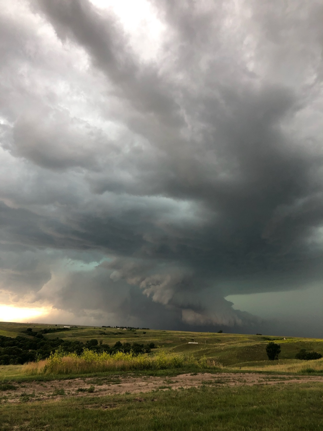
Photos & Video
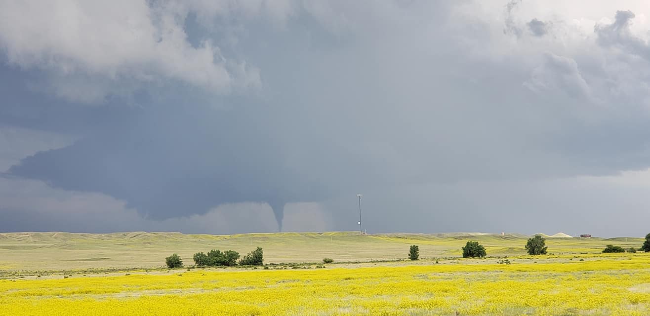
Below are photos of the storm that produced tornadoes to the west through southwest of Allen, SD. The photos are courtesy of Jennifer Nelson.
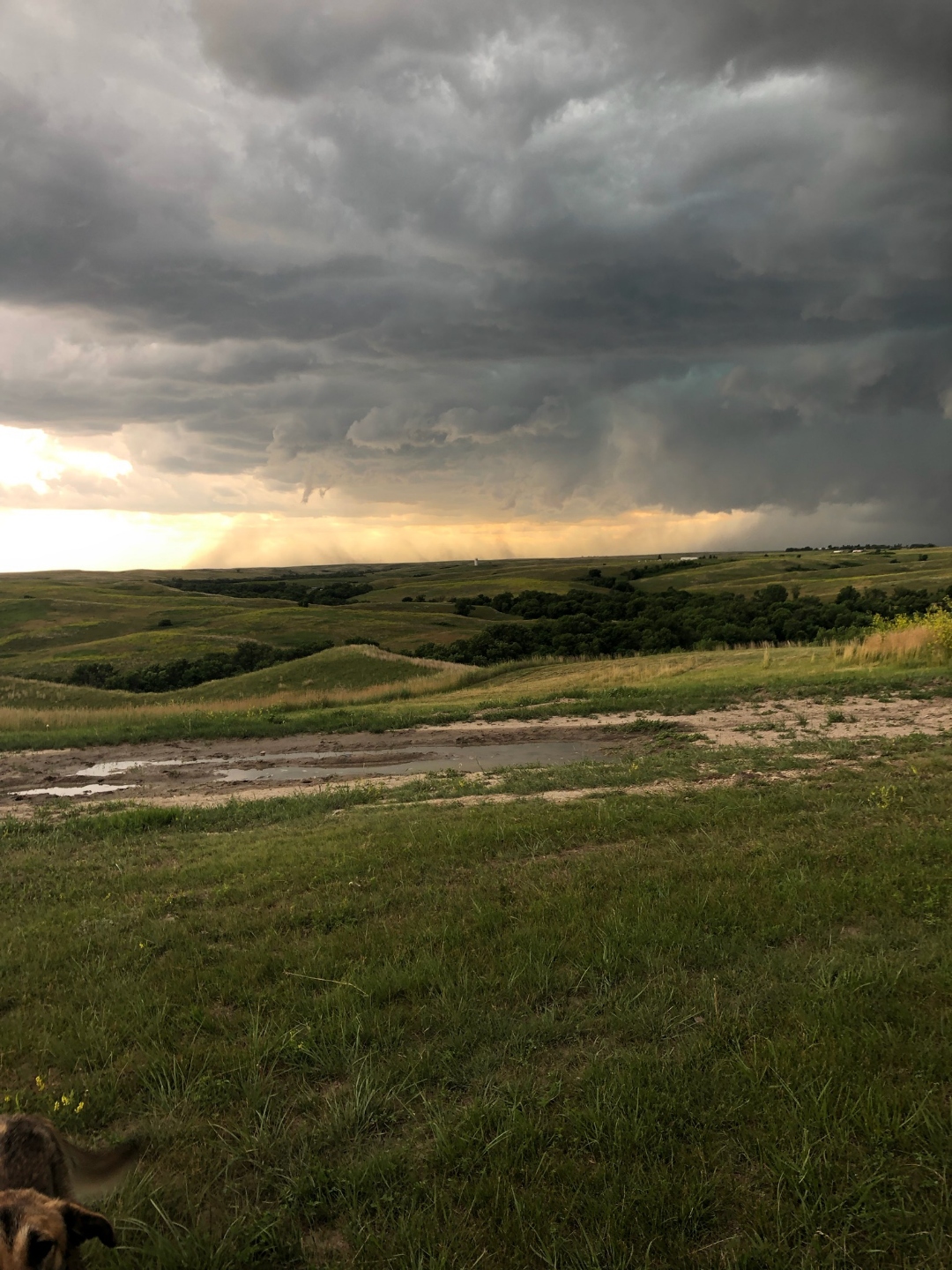 |
|
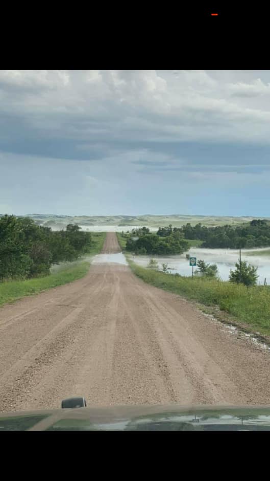
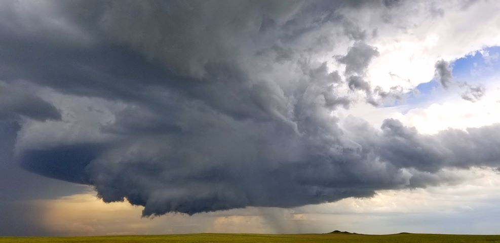
Below are photos of the storm and tornado that occurred southwest of Dewey, SD (across the state line in far southeastern Weston County, Wyoming). The photos are courtesy of Vince Miller.
 |
 |
 |
 |
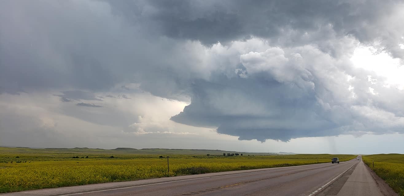
Below are photos of the storm and tornado that occurred southwest of Dewey, SD (across the state line in far southeastern Weston County, Wyoming). The photos are courtesy of Brandon Bailey.
 |
 |
 |
 |
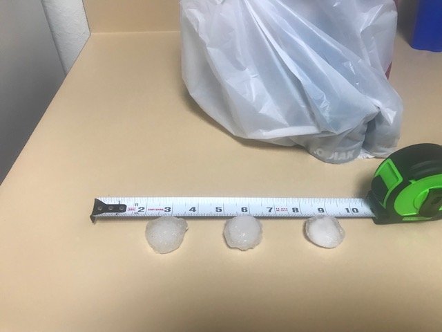
Below are photos of hail as the storm moved over Antelope Ridge in the Box Elder, SD, area. The photos are courtesy of Kyle Richardson.
 |
 |
 |
 |
|
|
|
Radar
 |
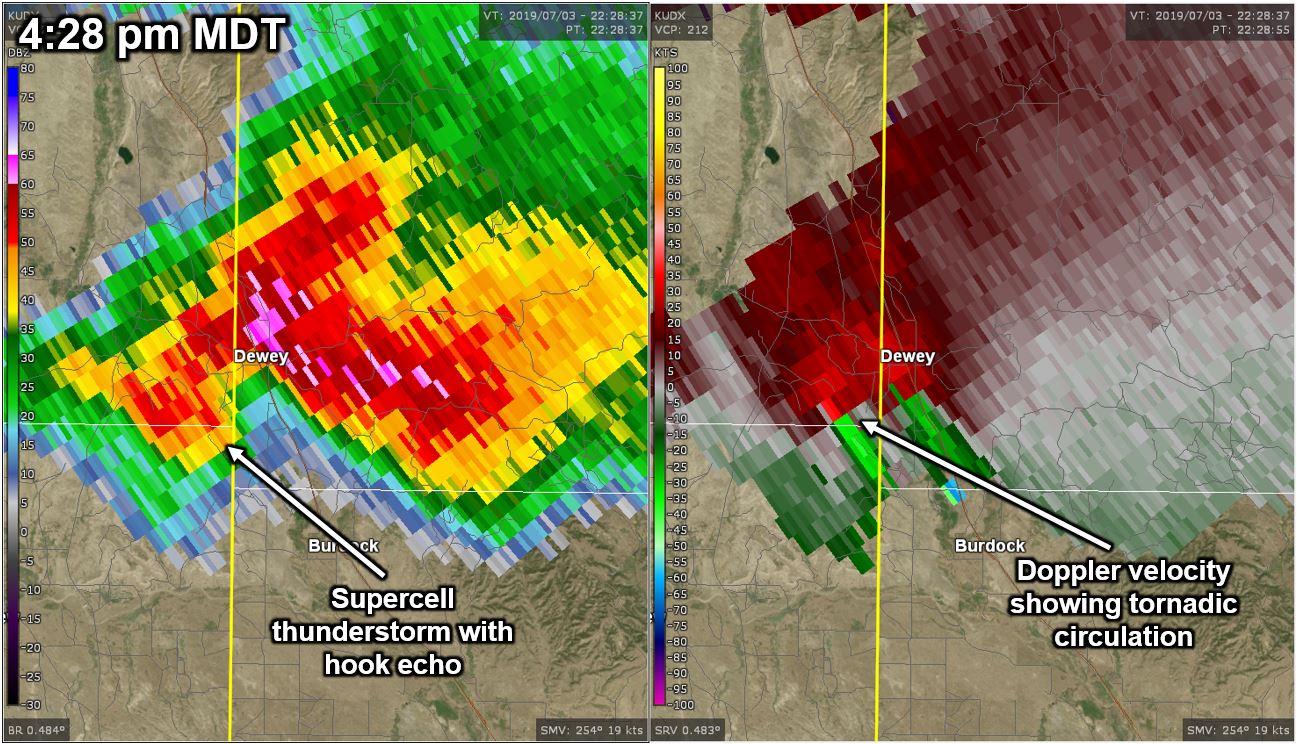 |
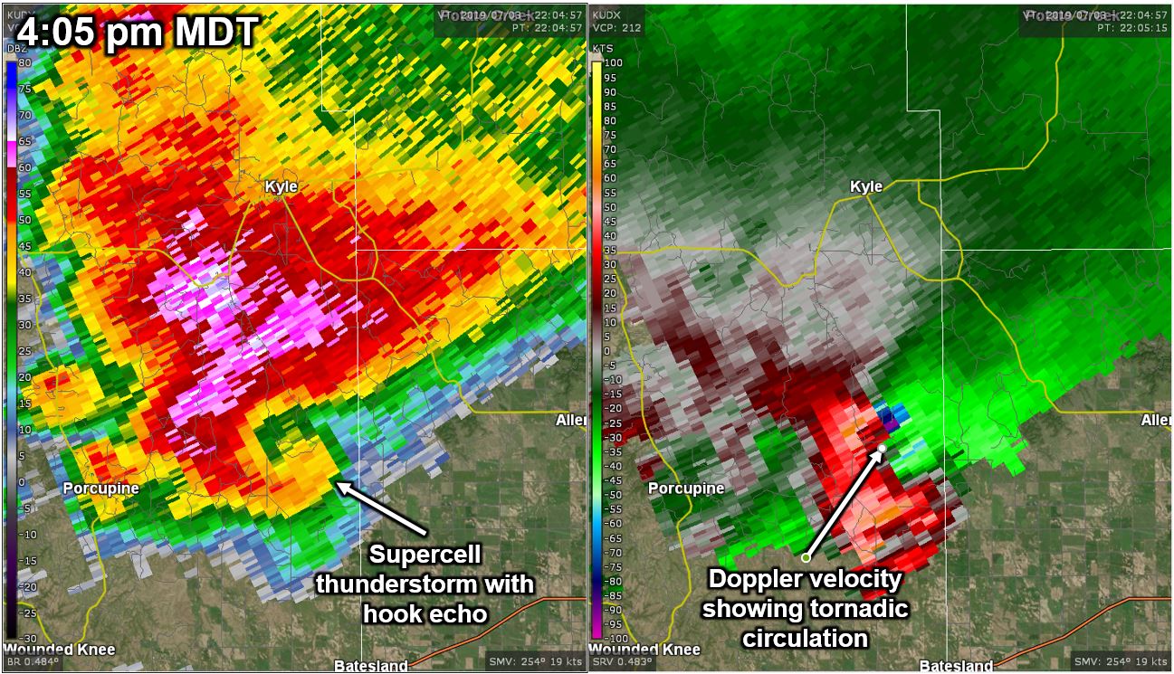
| Radar reflectivity (left) and velocity (right) near the time of the first tornado west of Allen, SD (valid 4:05 pm MDT, July 3, 2019) | Radar reflectivity (left) and velocity (right) when the tornado had started southwest of Dewey, SD (valid 4:28 pm MDT, July 3, 2019) |
Storm Reports
Here are the preliminary severe thunderstorm storm reports for July 3, 2019.
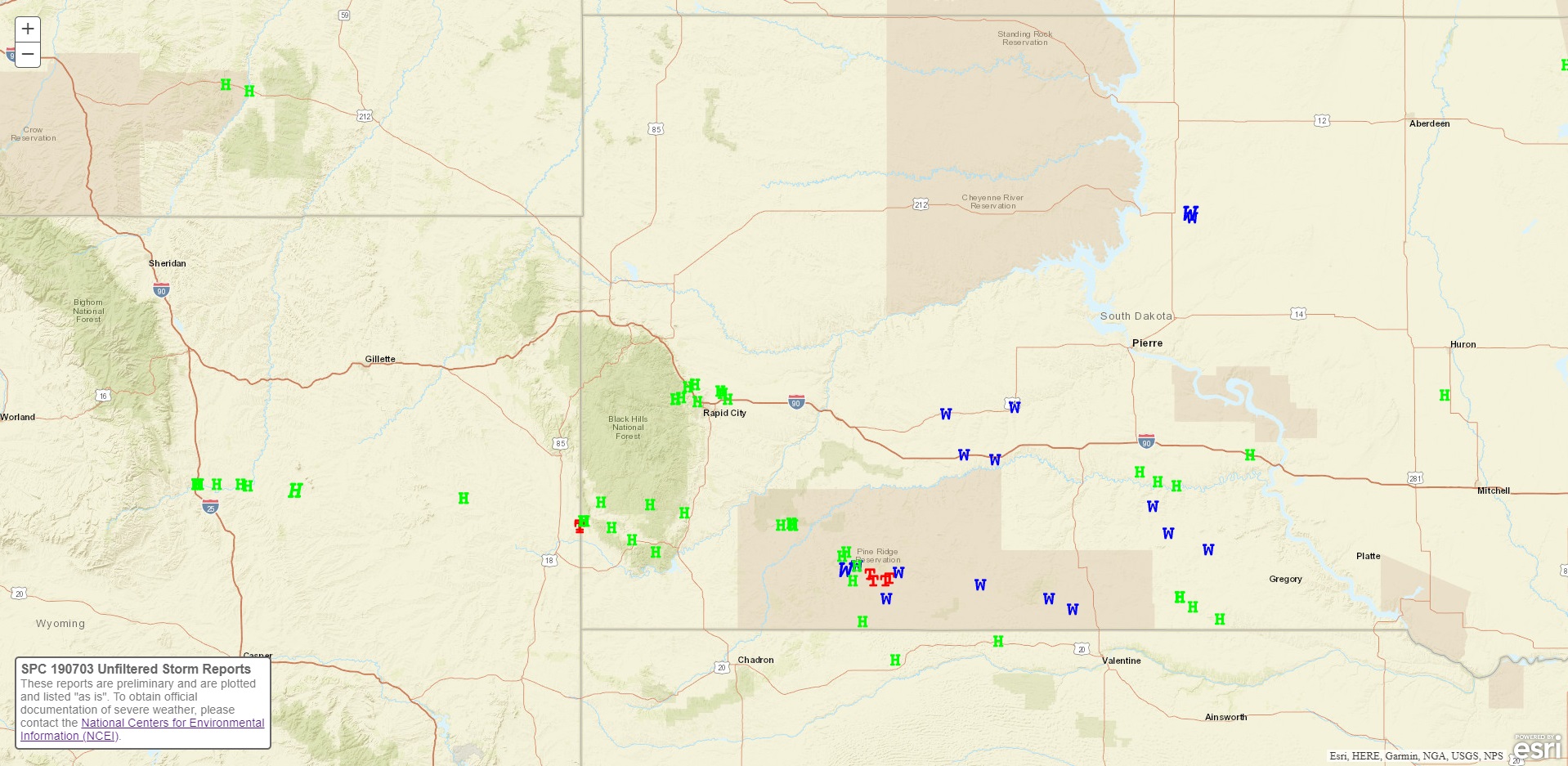 |
| Preliminary storm reports for July 3, 2019 (green H's represent hail; blue W's represent wind gusts; the red T's represent tornado reports) |
The storm reports listed below are in descending order and may not necessarily be the final storm reports. Hail reports listed by size (inches) SIZE LOCATION ST COUNTY TIME ------ ----------------------- -- -------------- ------- 2.00 10 WNW PINE TREE JUNCTI WY CAMPBELL 0820 PM 1.75 10 W ROCKYFORD SD OGLALA LAKOTA 0738 PM 1.75 11 NNE EDGEMONT SD FALL RIVER 0706 PM 1.75 9 SSW JEWEL CAVE SD CUSTER 0531 PM 1.75 BOX ELDER SD PENNINGTON 0530 PM 1.75 7 SSW BATESLAND SD OGLALA LAKOTA 0514 PM 1.75 5 E PORCUPINE SD OGLALA LAKOTA 0424 PM 1.75 8 S KYLE SD OGLALA LAKOTA 0415 PM SHEET METAL TORN OFF ROOF, 10-15 LARGE LIMBS BROKEN OFF COTTONWOOD TREES. 1.75 7 W ROCKYFORD SD OGLALA LAKOTA 0300 PM 1.50 PRINGLE SD CUSTER 0600 PM 1.25 2 E SUMMERSET SD MEADE 0530 PM HAIL FELL 10 MINUTES FROM 530-540 PM. LARGEST SIZE WAS HALF DOLLARS, BUT MOST WERE MARBLE SIZED. 1.25 7 W ROCKYFORD SD OGLALA LAKOTA 0320 PM 1.00 7 ENE ROCHELLE WY WESTON 1015 PM 1.00 5 SW HOT SPRINGS SD FALL RIVER 0715 PM 1.00 9 ESE DEWEY SD CUSTER 0648 PM 1.00 DEWEY SD CUSTER 0624 PM 1.00 DEWEY SD CUSTER 0620 PM 1.00 6 NNW BUFFALO GAP SD CUSTER 0615 PM 1.00 4 NNE MILLBORO SD TRIPP 0550 PM 1.00 2 E SUMMERSET SD MEADE 0534 PM 1.00 SUMMERSET SD MEADE 0525 PM 1.00 ELLSWORTH AFB SD MEADE 0518 PM 1.00 1 WNW ELLSWORTH AFB SD MEADE 0515 PM 1.00 3 NW DWTN RAPID CITY SD PENNINGTON 0455 PM 1.00 4 NE JOHNSON SIDING SD PENNINGTON 0440 PM 1.00 2 NNE JOHNSON SIDING SD PENNINGTON 0420 PM 1.00 3 NNE WEWELA SD TRIPP 0405 PM 1.00 5 ESE SHARPS CORNER SD OGLALA LAKOTA 0346 PM 1.00 CLEARFIELD SD TRIPP 0345 PM 1.00 5 WSW KYLE SD OGLALA LAKOTA 0339 PM Tstm wind reports listed by speed (mph) SPEED LOCATION ST COUNTY TIME ------ ----------------------- -- -------------- ------- 78.00 5 NE PORCUPINE SD OGLALA LAKOTA 0441 PM 70.00 3 WSW SWETT SD BENNETT 0438 PM 65.00 1 NW SAINT FRANCIS SD TODD 0712 PM ESTIMATED BETWEEN 60 AND 70 MPH WINDS 64.00 1 NE MIDLAND SD HAAKON 0825 PM 64.00 3 E PHILIP SD HAAKON 0726 PM 62.00 1 NE WINNER SD TRIPP 0859 PM 60.00 3 NNW WITTEN SD TRIPP 0915 PM 60.00 BELVIDERE SD JACKSON 0836 PM 60.00 2 NE KADOKA SD JACKSON 0757 PM 60.00 8 ESE SAINT FRANCIS SD TODD 0715 PM 1 INCH DIAMETER BRANCHES DOWN 60.00 13 NNW WITTEN SD TRIPP 0630 PM 60.00 VETAL SD BENNETT 0628 PM 53.00 1 NE WINNER SD TRIPP 0853 PM 50.00 7 ENE ROCHELLE WY WESTON 0915 PM 50.00 MIDLAND SD HAAKON 0830 PM 50.00 6 W PARMELEE SD TODD 0728 PM 50.00 6 W PARMELEE SD TODD 0648 PM 50.00 5 E PORCUPINE SD OGLALA LAKOTA 0425 PM -------------------------------------------------------------- |
 |
| Straight-line wind damage near Allen, SD (image obtained from KOTA TV) |
Environment
Click here for a satellite animation of the event.
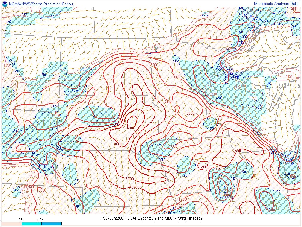
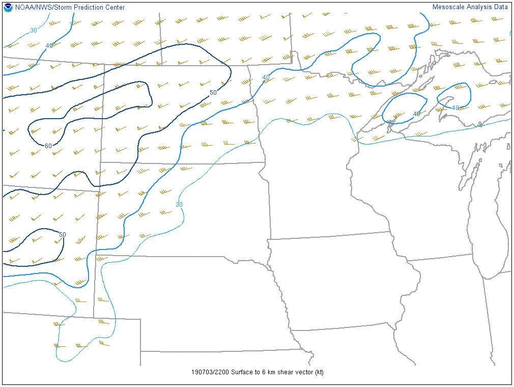
The environment was unstable with a lot of energy available for severe thunderstorms (left image). The vertical wind shear (middle image) was strong enough for organized severe storms over most of the area. Finally, the significant tornado parameter (used to assess the potential for EF2 or greater tornadoes) was supportive of tornadoes in the area where they occurred.
 |
 |
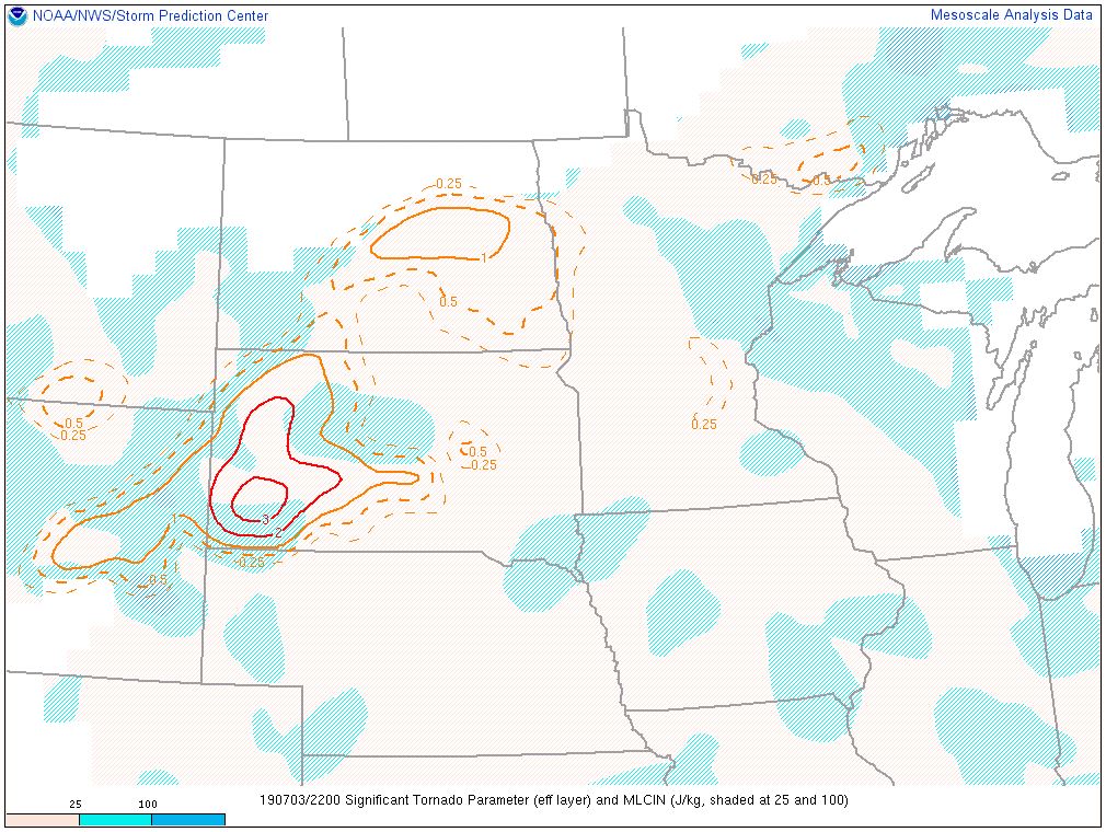 |
| MLCAPE (a measure of buoyancy) valid at 4 pm MDT, July 3, 2019 | 0-6km wind shear (indicative of storm severity) valid at 4 pm MDT, July 3, 2019 | Significant tornado parameter (suggestive of EF2 or greater tornadoes) valid at 4 pm MDT, July 3, 2019 |
 |
Media use of NWS Web News Stories is encouraged! Please acknowledge the NWS as the source of any news information accessed from this site. |
|