Isolated to scattered severe thunderstorms may produce large hail, severe wind gusts, and heavy rain and isolated flash flooding across portions of the southern and central Plains. Showers and thunderstorms are expected to linger cross the South the next couple of days. Heavy showers are creating a flash flooding threat around Kauai and Niihau, Hawaii. Read More >
Overview
|
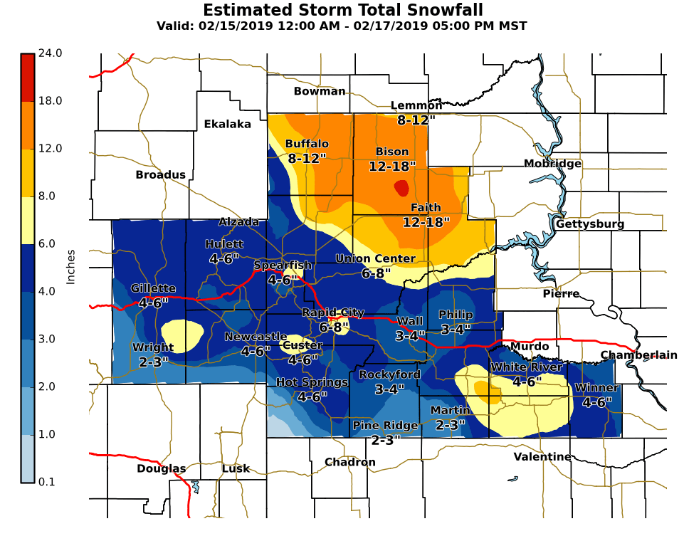
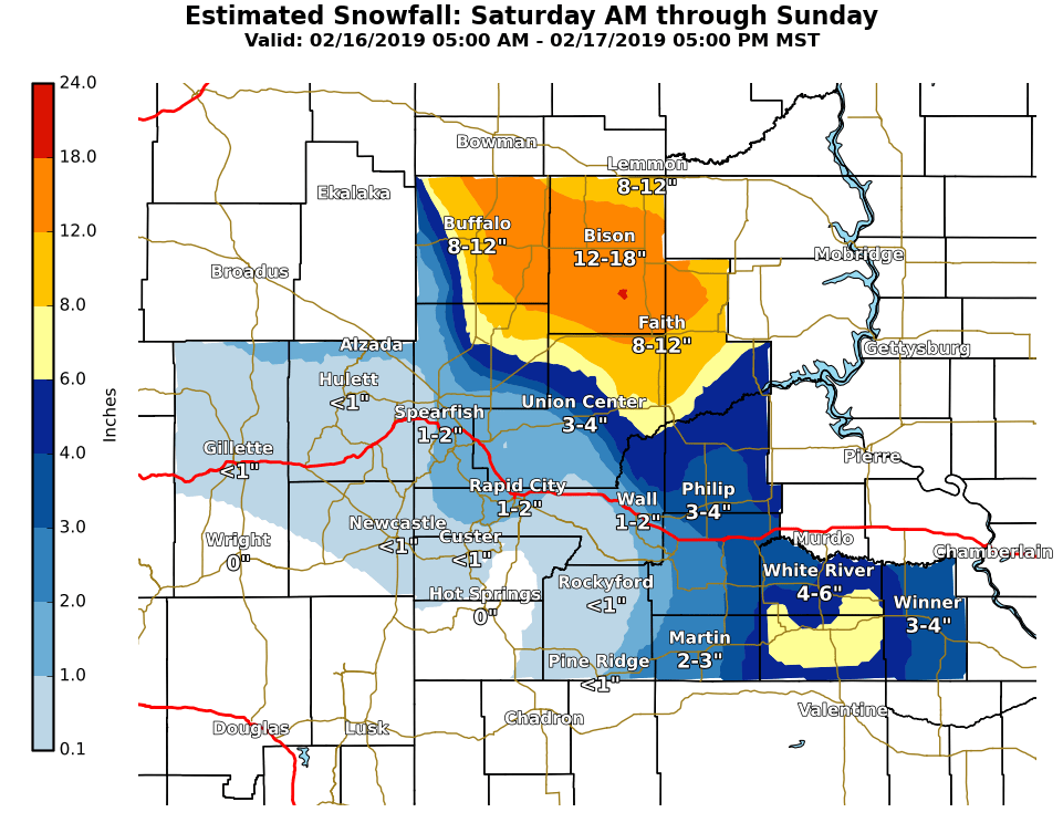
A complex, slow-moving upper-level disturbance brought several rounds of snowfall to eastern Wyoming and western South Dakota from early on February 15th through the day on February 17th. The most significant accumulations during the event occurred within a band of heavy snow over the northwest South Dakota plains on the 16th, which brought localized snowfall rates of over two inches per hour at times. Snowfall totals over the three days exceeded a foot in many locations over northwestern South Dakota, with a general decrease in amounts towards the southwest. Highest amounts were measured in Perkins County, where over 20" of snowfall occurred.
|
|
Snowfall Totals
 |
 |
|||
| Storm Total (click to enlarge) | February 16th-17th (click to enlarge) | |||
   SNOWFALL TOTALS FROM FEB 15 THROUGH FEB 17

INCHES  LOCATION                 ST  COUNTY           TIME
 ------  -----------------------  --  --------------   -------
 21.00   8 WNW USTA               SD  PERKINS          0600 AM
 16.00   10 S REVA                SD  HARDING          0605 PM
 16.00   7 SSE BISON              SD  PERKINS          0722 AM
 15.00   1 S MEADOW               SD  PERKINS          0607 PM
 14.00   1 WNW HOOVER             SD  BUTTE            1235 PM
 14.00   9 SSE SORUM              SD  PERKINS          1155 AM
 14.00   9 SSW LODGEPOLE          SD  PERKINS          0618 PM
 13.00   OPAL                     SD  MEADE            1248 PM
 12.00   DUPREE                   SD  ZIEBACH          0440 PM
 12.00   1 NNE RALPH              SD  HARDING          1232 PM
 12.00   9 WSW RED ELM            SD  ZIEBACH          0736 AM
 10.50   2 W OPAL                 SD  MEADE            0700 AM
 10.00   RED OWL                  SD  MEADE            0700 AM
  9.20   6 WNW SHADEHILL          SD  PERKINS          0700 AM
  9.10   LEMMON                   SD  PERKINS          0500 PM
  9.00   2 SW NORRIS              SD  MELLETTE         0700 AM
  8.00   8 SE HOOVER              SD  BUTTE            1230 PM
  7.90   5 ESE DOWNTOWN RAPID CI  SD  PENNINGTON       0700 AM
  7.30   3 SE SAINT ONGE          SD  LAWRENCE         0530 AM
  7.10   1 NNE SUNDANCE           WY  CROOK            1200 AM
  7.00   5 NE MILESVILLE          SD  HAAKON           1240 PM
  7.00   8 WSW LODGEPOLE          SD  PERKINS          1000 AM
  6.80   8 SE MUD BUTTE           SD  MEADE            0800 AM
  6.70   1 SSE DOWNTOWN SPEARFIS  SD  LAWRENCE         0800 AM
  6.50   MISSION                  SD  TODD             0102 PM
  6.50   19 SW UPTON              WY  WESTON           0700 AM
  6.40   2 S DOWNTOWN RAPID CITY  SD  PENNINGTON       0700 AM
  6.20   1 N HISEGA               SD  PENNINGTON       0700 AM
  6.00   4 W DOWNTOWN RAPID CITY  SD  PENNINGTON       0700 AM
  5.40   7 NNE ELLSWORTH AFB      SD  MEADE            0700 AM
  5.30   HILL CITY                SD  PENNINGTON       0700 AM
  5.30   HULETT                   WY  CROOK            0645 AM
  5.10   1 ESE PACTOLA RESERVOIR  SD  PENNINGTON       0800 AM
  5.10   MOUNT RUSHMORE           SD  PENNINGTON       1200 AM
  5.00   7 NW CEDAR BUTTE         SD  MELLETTE         0700 AM
  5.00   11 NNE WESTON            WY  CAMPBELL         0700 AM
  5.00   DOWNTOWN HOT SPRINGS     SD  FALL RIVER       0700 AM
  5.00   7 N WOOD                 SD  MELLETTE         0600 AM
  5.00   3 SSE HARDING            SD  HARDING          0800 AM
  4.80   6 W NEW UNDERWOOD        SD  PENNINGTON       0700 AM
  4.60   3 NE HISEGA              SD  PENNINGTON       0700 AM
  4.50   ORAL                     SD  FALL RIVER       0700 AM
  4.50   1 ESE WINNER             SD  TRIPP            0700 AM
  4.50   4 NNE SUMMERSET          SD  MEADE            0700 AM
  4.50   1 S DOWNTOWN BELLE FOUR  SD  BUTTE            0700 AM
  4.50   4 NNE SUMMERSET          SD  MEADE            0700 AM
  4.30   6 NNW DOWNTOWN SPEARFIS  SD  LAWRENCE         0700 AM
  4.30   SUNDANCE                 WY  CROOK            0600 AM
  4.10   14 NNE MARTIN            SD  BENNETT          0700 AM
  4.10   3 ESE CHEYENNE CROSSING  SD  LAWRENCE         0700 AM
  4.00   6 SW BEULAH              WY  CROOK            0800 AM
  4.00   3 E DOWNTOWN NEWCASTLE   WY  WESTON           0700 AM
  4.00   1 WSW DOWNTOWN NEWCASTL  WY  WESTON           0700 AM
  4.00   7 E LAKEVIEW             SD  TODD             0700 AM
  3.70   9 ENE WEWELA             SD  TRIPP            0600 AM
  3.50   1 ENE MIDLAND            SD  HAAKON           0700 AM
  3.50   LEAD                     SD  LAWRENCE         0100 PM
  3.50   6 ENE NEWELL             SD  BUTTE            0700 AM
  3.00   3 ENE KYLE               SD  OGLALA LAKOTA    0700 AM
  3.00   9 N CEDAR BUTTE          SD  MELLETTE         0600 AM
  3.00   2 WSW HAMILL             SD  TRIPP            0700 AM
  2.50   16 NW PHILIP             SD  HAAKON           1250 PM
  1.50   1 NNE EDGEMONT           SD  FALL RIVER       0600 AM
Radar
| Radar imagery through Saturday, February 16th, showing the development and evolution of a heavy band of snow across northwestern South Dakota into southeastern Montana and southwestern North Dakota |
Snow Photos
 |
 |
 |
 |
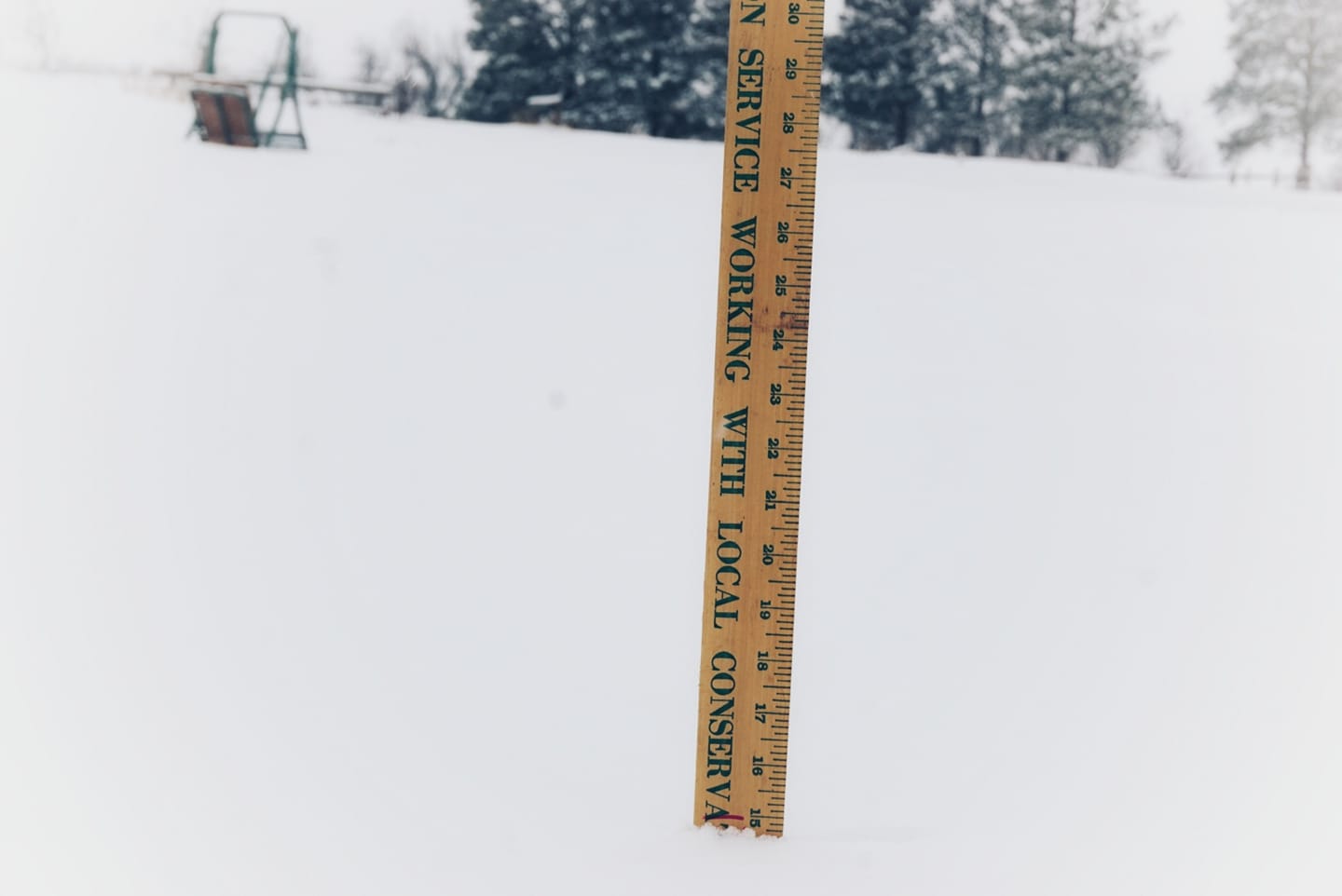
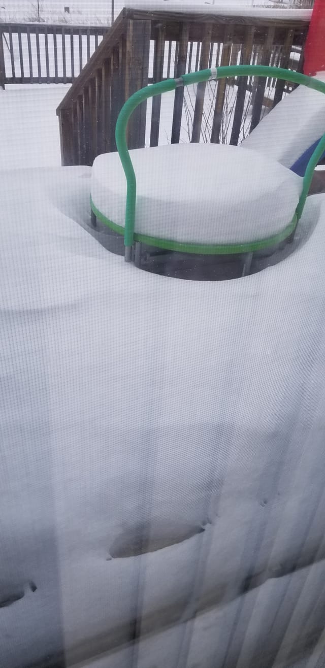
| Mission, SD (courtesy Barbara S.) |
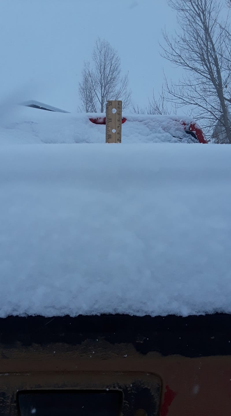
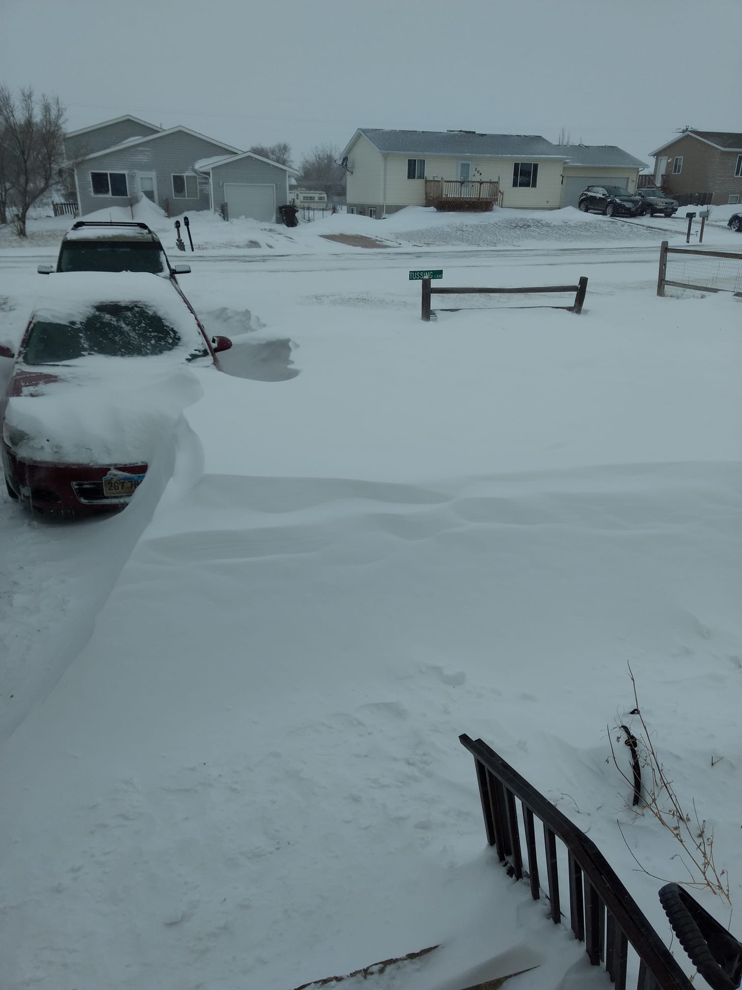
NW Perkins County, SD (courtesy Tressie E.) |
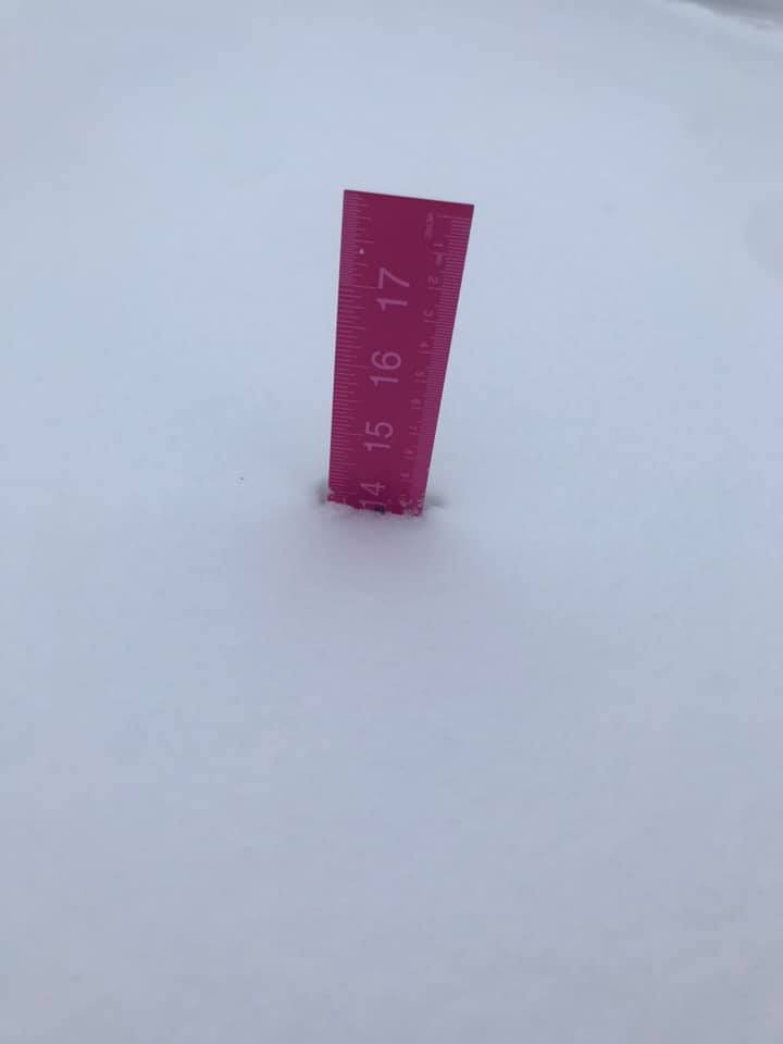
N Perkins County, SD (courtesy Jenny B.) |
|
 |
 |
|||
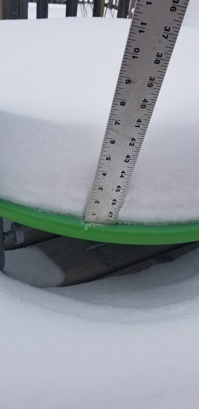
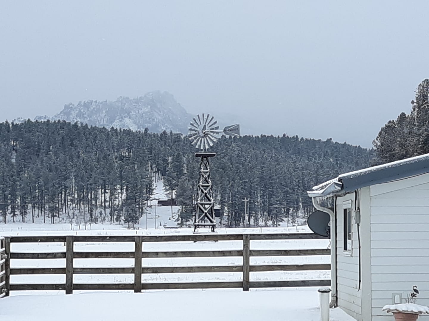
| Hill City, SD (courtesy Kim G.) |
New Underwood, SD (courtesy Chad T.) |
|||
 |
Media use of NWS Web News Stories is encouraged! Please acknowledge the NWS as the source of any news information accessed from this site. |
|