
A heat wave over the Southwest will intensify this week, peaking and expanding into the Intermountain West and northern High Plains this weekend. Critical to extremely critical fire weather conditions are forecast from the Northwest and the northern Great Basin this weekend. Particularly Dangerous Situation Red Flag Warnings have been issued. Read More >
Overview
 During the evening of June 28, 2018, a storm produced several tornadoes across Carter County, MT and Harding County, SD. Information is still being compiled, and the report will be completed in several days. Updated information as of July 2nd indicates that four tornadoes occurred across Harding County. Four additional tornadoes occurred in Carter County, Montana.
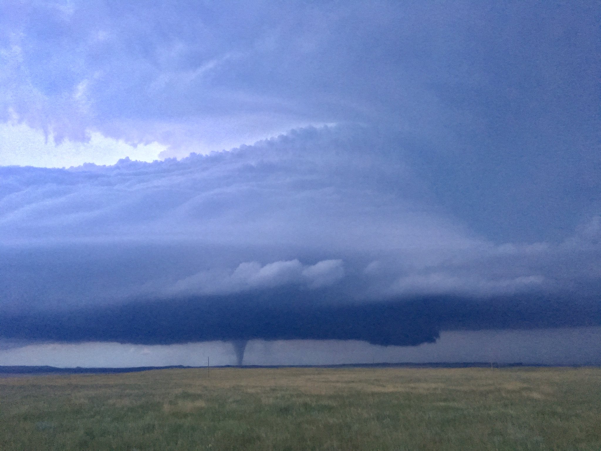
The first tornado crossed the Montana-South Dakota state line near Forty-eight Mile Creek, approximately 10 miles south-southwest of Camp Crook around 8:20 PM MDT based upon video evidence and eyewitness reports. It traveled northeastward, crossing South Camp Crook Rd before dissipating near Sagebrush Draw at 8:30 PM.
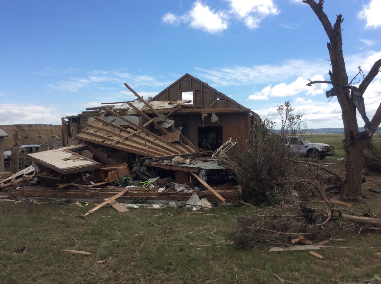
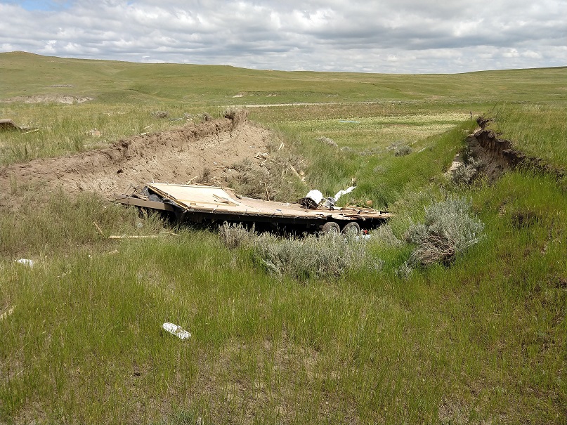
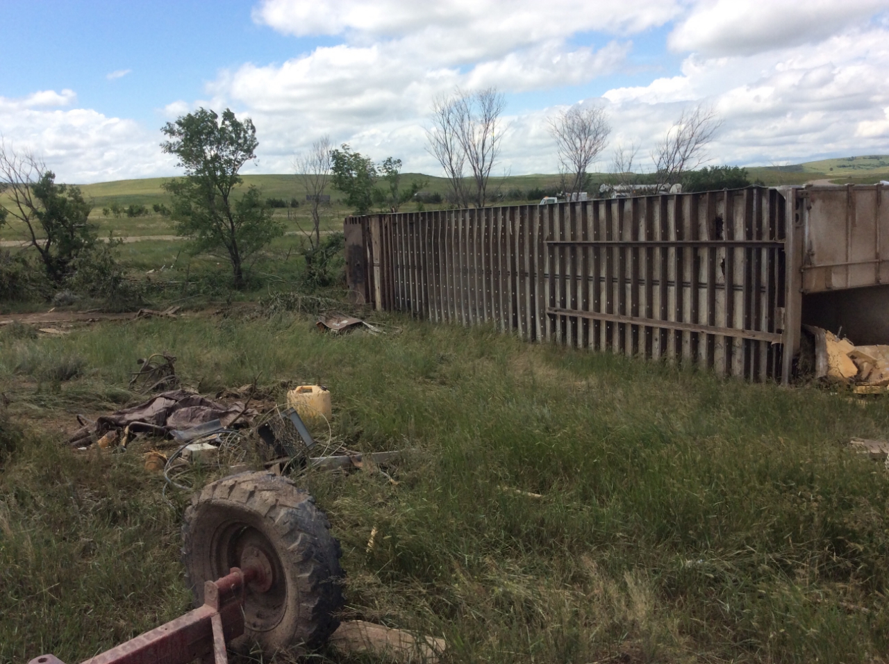
West of South Camp Crook Rd, the first tornado produced considerable tree and structural damage, including debarking of some trees, collapse of exterior walls of a home, and complete destruction of some outbuildings. Based on this damage, winds were estimated at 136 mph. The tornado also lofted and destroyed some farm machinery, including a 5-ton tractor that has yet to be found. As the tornado crossed Camp Crook Rd, several hundred yards of fence were either flattened or littered with debris, and widespread sagebrush destruction was observed. East of Camp Crook Rd near Hawk Creek, a large farm outbuilding was destroyed, and its foundation was extracted from the ground and broken apart. A tractor tire found on this property may have been part of the tractor lost approximately two miles to the southwest. While much of the damage was consistent with an EF-1 or EF-2 tornado, the most significant damage was consistent with an EF-3 tornado.
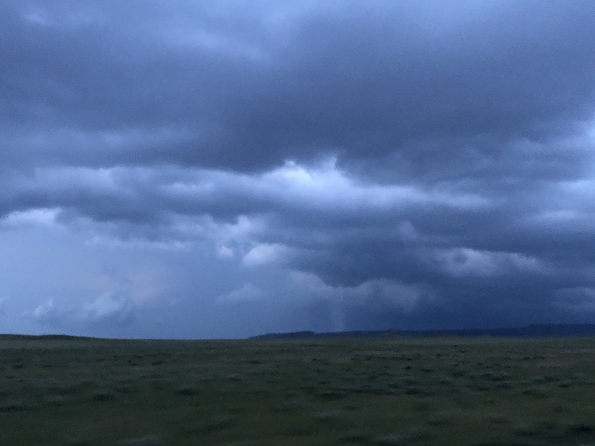
The next two tornadoes occurred over mainly rural areas of Harding County southeast of Camp Crook and southwest of Buffalo. Their times of occurrence, along with approximate start and end points, were determined via eyewitness accounts, video/photographic evidence, and radar data. Though delayed reports of structural damage associated with tornado #2 were received a few days after the event, the strengths of these tornadoes are unknown.
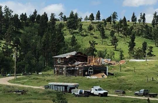
The final tornado developed just south of Highway 20 near mile marker 17 around 9:10 PM, where it subsequently snapped power poles and trees near a residence. A farm outbuilding was also severely damaged, with collapse of most exterior walls. Based on video evidence, the tornado then continued northward across rural areas northwest of Buffalo and crossed Clanton Rd before dissipating at 9:26 PM.
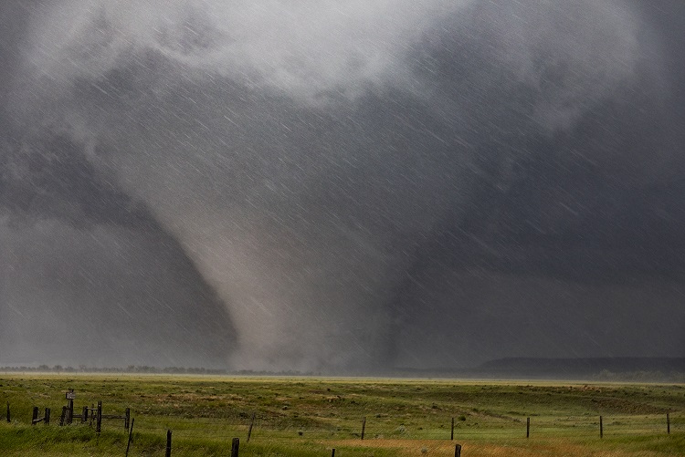
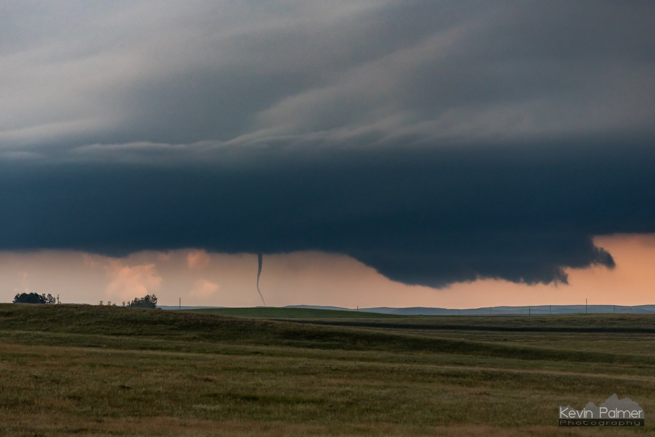
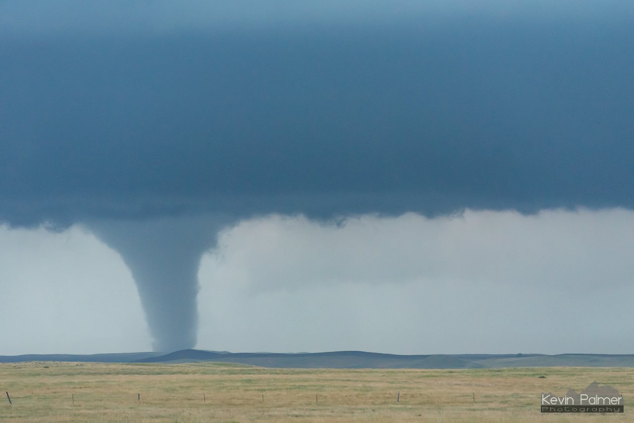
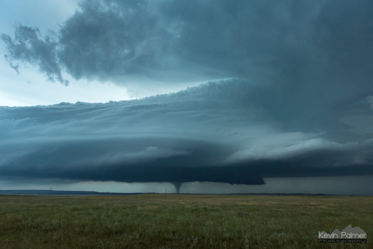
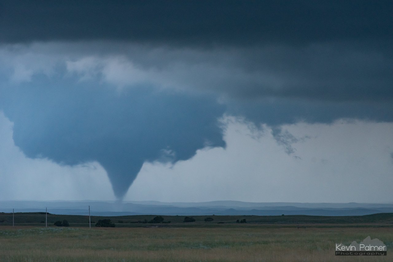
Above: Photo of tornado by Camp Crook by Roger Hill.
Tornadoes:
|
Tornado #1 - South of Camp Crook, SD
Track Map 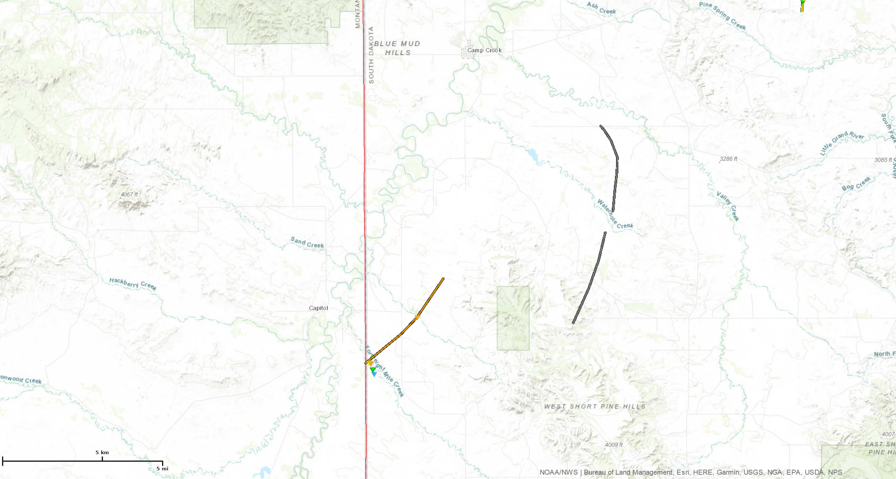 
|
||||||||||||||||
|
Tornado #2 - Southeast of Camp Crook
Track Map 
|
||||||||||||||||
|
Tornado #3 - Southeast of Camp Crook
Track Map 
|
||||||||||||||||
|
Tornado #4 - West of Buffalo
Track Map 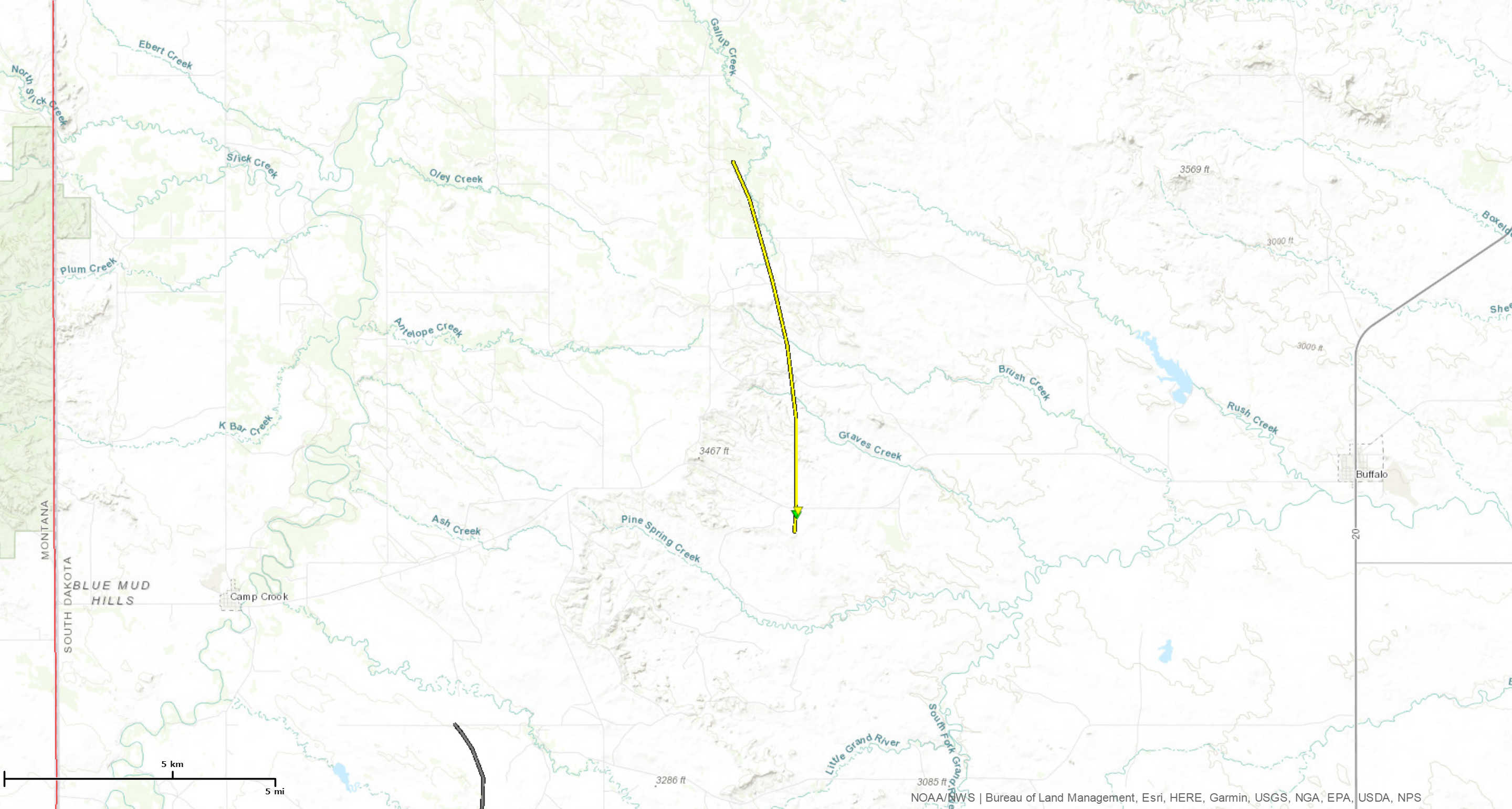
|
||||||||||||||||
The Enhanced Fujita (EF) Scale classifies tornadoes into the following categories:
| EF0 Weak 65-85 mph |
EF1 Moderate 86-110 mph |
EF2 Significant 111-135 mph |
EF3 Severe 136-165 mph |
EF4 Extreme 166-200 mph |
EF5 Catastrophic 200+ mph |
 |
|||||
Photos & Video:
Tornado #1 Damage, West of South Camp Crook Rd
 |
 |
 |
 |
Tornado #1 Damage, East of South Camp Crook Rd
 |
 |
 |
 |
Tornado #1 Photos
 |
 |
| Courtesy Jesse Risley | |
 |
|
| Courtesy Roger Hill |
Tornado #2 Damage
 |
 |
 |
|
| Courtesy Allison Patterson via Lori Buck | |||
Tornado #2 Photos
 |
 |
|
| Courtesy Tom Warner | Courtesy Kevin Palmer | |
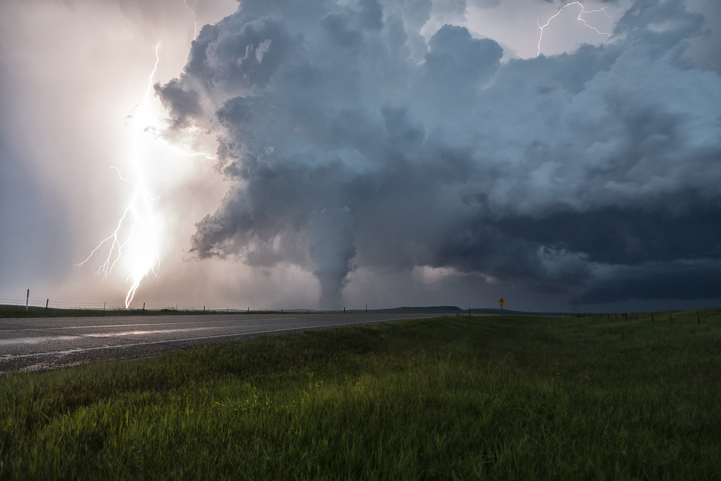
Tornado #3 Photos
 |
 |
|
| Courtesy Kevin Palmer | ||
 |
 |
| Courtesy Daniel Kalbach | Courtesy Kevin Palmer |
Tornado #4 Damage
 |
 |
 |
 |
Tornado #4 Photos
 |
 |
| Courtesy Kevin Palmer | Courtesy Roger Hill |
Radar:
 |
 |
| Tornado #1 | Tornado #2 |
 |
 |
| Tornado #3 | Tornado #4 |
Environment:
The University of Wisconsin-Madison CIMSS Satellite Blog has a very interesting post about the various GOES-16 imagery from the event: http://cimss.ssec.wisc.edu/goes/blog/archives/28739
 |
 |
|
|
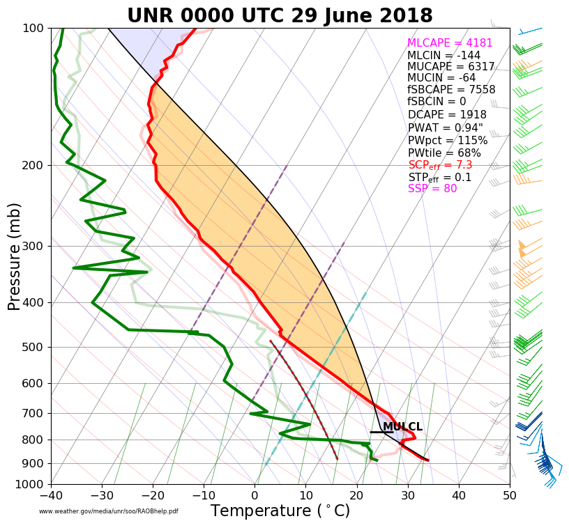
Temperature, dew point, and wind data from the sounding launched from the Rapid City, SD forecast office at 5 PM on June 28, 2018. |
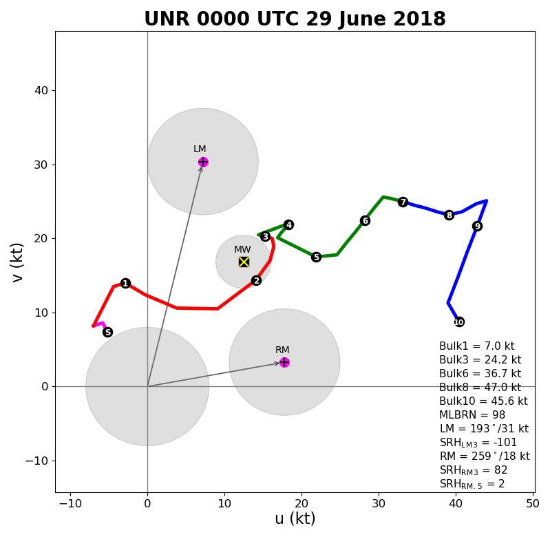
Wind data from the same sounding, depicted as a hodograph. | |
Storm Reports:
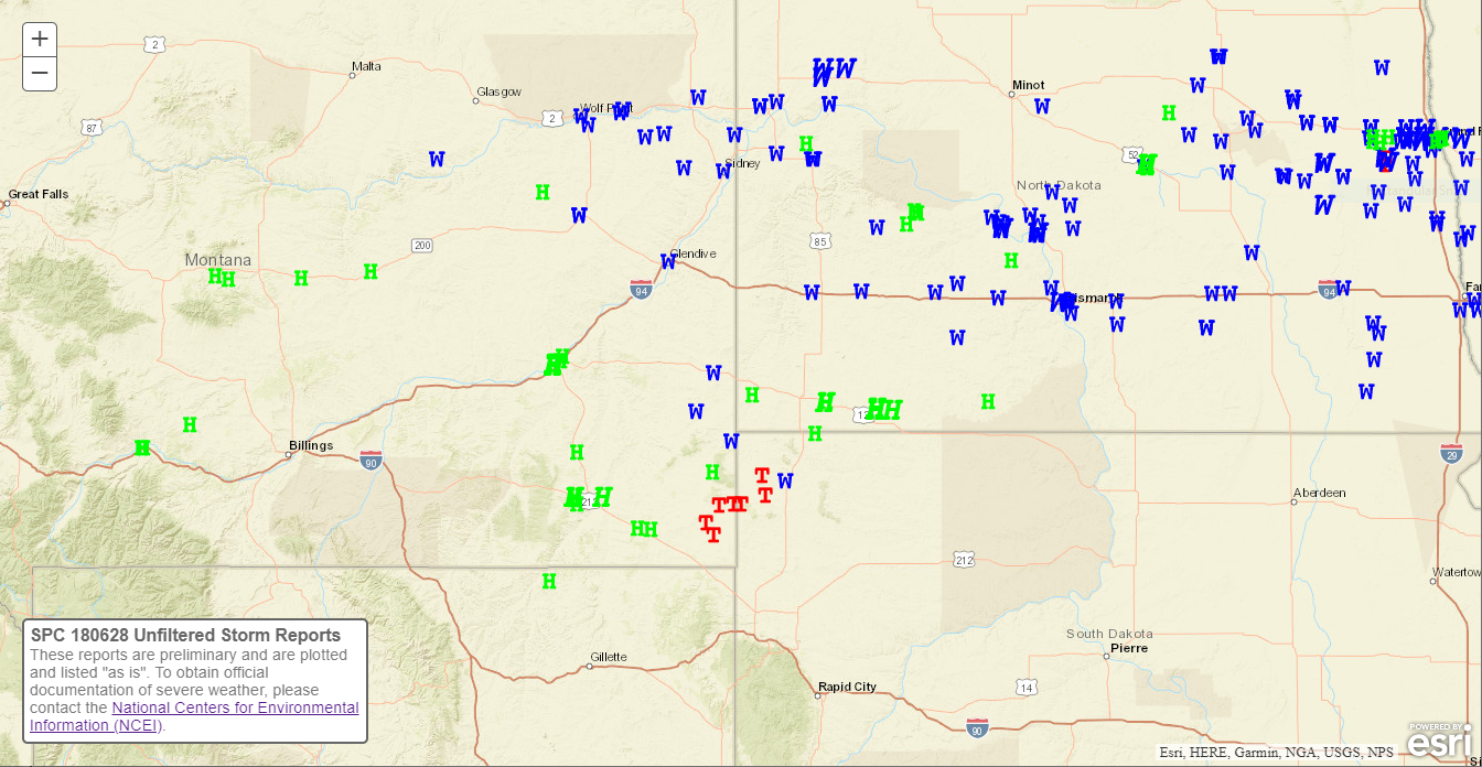 |
|
|
Regional preliminary storm reports for June 28, 2018 through the morning of June 29, 2018. Note the localized tornado event across southeastern Montana and northwestern South Dakota (red "T"s), with widespread straight-line wind (blue "W"s) and hail (green "H"s) to our north, west, and east. Image courtesy of the Storm Prediction Center. |
 |
Media use of NWS Web News Stories is encouraged! Please acknowledge the NWS as the source of any news information accessed from this site. |
|


