
Dangerous and extreme heat will remain across portions of the southern U.S. this week. Heavy rainfall may bring significant flash flooding across portions of the Mid-Atlantic and Northeast through the night, and additional flash flooding concerns across New England on Wednesday. Monsoonal thunderstorms will bring a flash flood risk to the Four Corners region, especially in burn scar areas Read More >
Overview
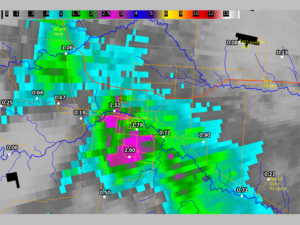
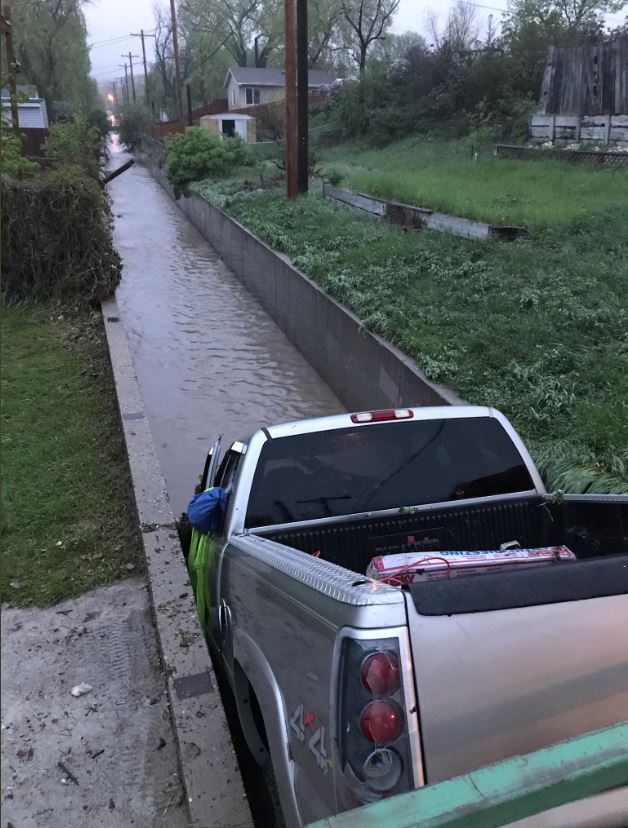
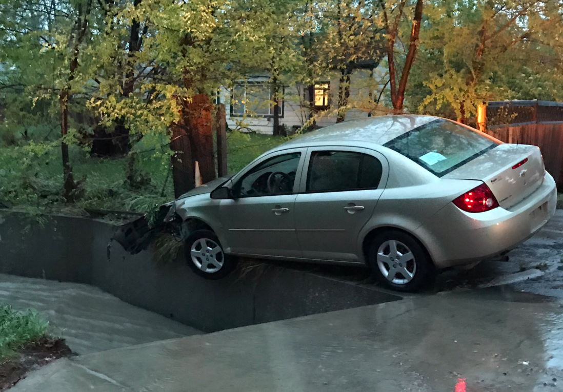
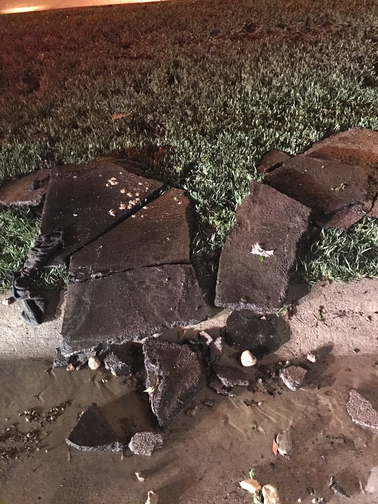
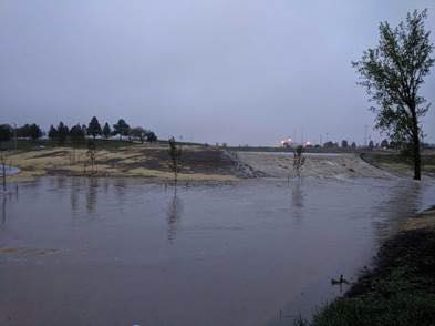
Late in the afternoon on May 18, 2018, a localized thunderstorm moved over Rapid City and dumped two to three inches of rain in about an hour. Runoff from the heavy rainfall flooded streets and low-lying areas. Rapid Creek quickly rose and overflowed its banks near the Fairgrounds. In Rapid City, several water rescues were performed by the fire department. The heaviest rainfall fell over the Robbinsdale area, where the runoff filled a detention pond near the park and tore up sections of asphalt on Fairlane Drive. Several vehicles were pushed by the rushing water and one vehicle ended up in the Robbinsdale Park detention pond.
Flooding
Radar/Photos
 |
|
| Radar Storm Total Accumulation with Rainfall Reports | Animation of Radar Reflectivity |
 |
 |
 |
 |
| Water-swept Truck (Rapid City Fire Dept.) |
Water-swept Car (Rapid City Fire Dept.) |
Water-damaged Asphalt (Rapid City Fire Dept.) |
Flooding of Robbinsdale Pond (Pennington Co. Sheriff's Dept.) |
— Rapid City Fire Dept (@RapidCityFire) May 19, 2018
Rain Reports
| Location | Amount | Source |
| Rapid City 2SSE | 2.60 | CoCoRaHS |
| Rapid City NWS | 1.79 | Rapid City NWS Employees |
| Rapid Creek at Founders Park | 1.32 | USGS Automated River Gage |
| Box Elder Creek near Rapid City | 1.06 | USGS Automated River Gage |
| Rapid City 4.7E | 0.90 | CoCoRaHS |
| Rapid Creek below Hawthrone Ditch | 0.71 | USGS Automated River Gage |
| Rapid Creek at Water Reclamation Facility | 0.71 | USGS Automated River Gage |
| Rapid City 3.4 WNW | 0.67 | CoCoRaHS |
| South Canyon near Rapid City | 0.64 | USGS Automated River Gage |
| South Rapid Foothills | 0.50 | Private Weather Station |
| Wild Irishman Gulch near Rapid City | 0.25 | USGS Automated River Gage |
| Rapid City Airport | 0.21 | ASOS |
| Rapid City RAWS | 0.19 | RAWS |
| Box Elder 1.6NE | 0.13 | CoCoRaHS |
| Ellsworth Airforce Base | 0.08 | ASOS |
 |
Media use of NWS Web News Stories is encouraged! Please acknowledge the NWS as the source of any news information accessed from this site. |
|

