Overview
February 23-24, 2017 - A snowstorm developed early in the morning of February 23 and persisted until the early morning of February 24. Heavy snow fell over parts of northeast Wyoming and southern South Dakota.Snow/Ice
SNOW REPORTS LISTED BY AMOUNT

 INCHES  LOCATION                 ST  COUNTY           TIME
 ------  -----------------------  --  --------------   -------
 15.00   4 E KEYAPAHA             SD  TRIPP            0112 PM
 12.00   14 SSW PROVO             SD  FALL RIVER       1043 AM
 11.00   5 ENE DOWNTOWN CUSTER    SD  CUSTER           0751 AM
 10.00   WRIGHT                   WY  CAMPBELL         1049 AM
  8.50   5 S HILL CITY            SD  PENNINGTON       0744 AM
  8.00   1 E CLARETON             WY  WESTON           1141 AM
  8.00   7 E LAKEVIEW             SD  TODD             1043 AM
  8.00   1 S LAKEVIEW             SD  TODD             0843 AM
  8.00   1 ENE MILLBORO           SD  TRIPP            0400 AM
  7.00   6 NW CLEARFIELD          SD  TRIPP            0112 PM
  7.00   7 W HERMOSA              SD  CUSTER           0712 AM
  6.00   2 E DOWNTOWN STURGIS     SD  MEADE            0118 PM
  6.00   7 W DOWNTOWN RAPID CITY  SD  PENNINGTON       0700 AM
  5.90   HILL CITY                SD  PENNINGTON       0800 AM
  5.50   5 SSW DOWNTOWN RAPID CI  SD  PENNINGTON       1248 PM
  5.50   HILL CITY                SD  PENNINGTON       0759 AM
  5.40   4 NE ROCKERVILLE         SD  PENNINGTON       0710 AM
  5.00   4 WNW NEMO               SD  LAWRENCE         1149 AM
  5.00   10 WNW DOWNTOWN RAPID C  SD  PENNINGTON       0700 AM
  4.80   1 SSW DOWNTOWN HOT SPRI  SD  FALL RIVER       0700 AM
  4.50   2 SSE DOWNTOWN RAPID CI  SD  PENNINGTON       1034 AM
  4.50   3 ENE KYLE               SD  OGLALA LAKOTA    0743 AM
  4.50   20 ENE MARTIN            SD  BENNETT          0700 AM
  4.40   1 E DOWNTOWN RAPID CITY  SD  PENNINGTON       0450 AM
  4.20   4 NNW WHITEWOOD          SD  LAWRENCE         1035 AM
  4.20   4 NNW WHITEWOOD          SD  LAWRENCE         0530 AM
  4.00   3 NE WHITEWOOD           SD  LAWRENCE         1256 PM
  4.00   8 E SMITHWICK            SD  FALL RIVER       1042 AM
  4.00   5 E PORCUPINE            SD  OGLALA LAKOTA    0300 AM
  4.00   4 NE ROCKERVILLE         SD  PENNINGTON       0507 PM
  3.50   3 SSE WHITE RIVER        SD  MELLETTE         1054 AM
  3.50   6 SSW LEAD               SD  LAWRENCE         1040 AM
  3.50   5 E PIEDMONT             SD  MEADE            1036 AM
  3.00   6 W WANBLEE              SD  JACKSON          1201 PM
  3.00   2 NW BUFFALO GAP         SD  CUSTER           1115 AM
  3.00   4 SE FOLSOM              SD  CUSTER           1111 AM
  3.00   4 W MOSHER               SD  MELLETTE         1051 AM
  3.00   8 W DOWNTOWN HOT SPRING  SD  FALL RIVER       1047 AM
  3.00   16 W MARTIN              SD  BENNETT          1037 AM
  3.00   4 NW DOWNTOWN RAPID CIT  SD  PENNINGTON       0803 AM
  3.00   RAPID CITY AIRPORT       SD  PENNINGTON       0510 AM
  2.50   LEAD                     SD  LAWRENCE         1153 AM
  2.50   7 W CEDAR BUTTE          SD  MELLETTE         1057 AM
  2.00   8 NNE BOX ELDER          SD  MEADE            1039 AM
  2.00   DOWNTOWN SPEARFISH       SD  LAWRENCE         1038 AM
  2.00   7 SW BROWNSVILLE         SD  LAWRENCE         0504 AM
  1.20   19 SW UPTON              WY  WESTON           1042 AM
  1.10   2 SW HAMILL              SD  TRIPP            1042 AM
  1.00   EDGEMONT                 SD  FALL RIVER       1041 AM
  1.00   6 SW LADNER              SD  HARDING          0935 AM
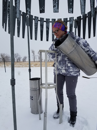
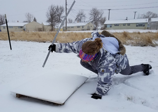
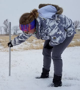
Measuring Snow
One of our meteorologists measures the snow around lunch time February 23, 2017.


Radar Loop
| Radar animation of the event starting in the evening on February 23, 2017, and ending in the early morning hours of February 24, 2017 |
 |
Media use of NWS Web News Stories is encouraged! Please acknowledge the NWS as the source of any news information accessed from this site. |
 |