
A storm system developing across the Plains may cause locally severe weather in western Kansas and southwestern Nebraska today, with isolated flash flooding possible in portions of eastern Montana and western North Dakota. Frost and Freeze Warnings are in effect for portions of the central Rockies and central Appalachians tonight into Friday morning. Read More >
Overview
|
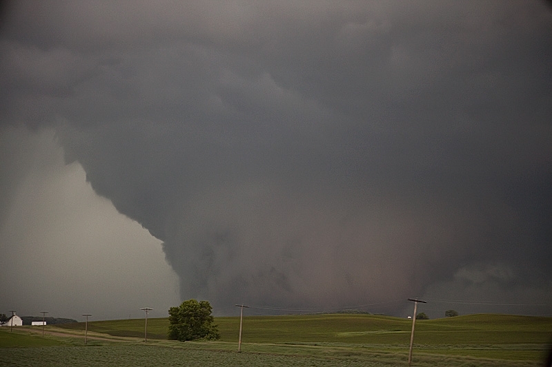
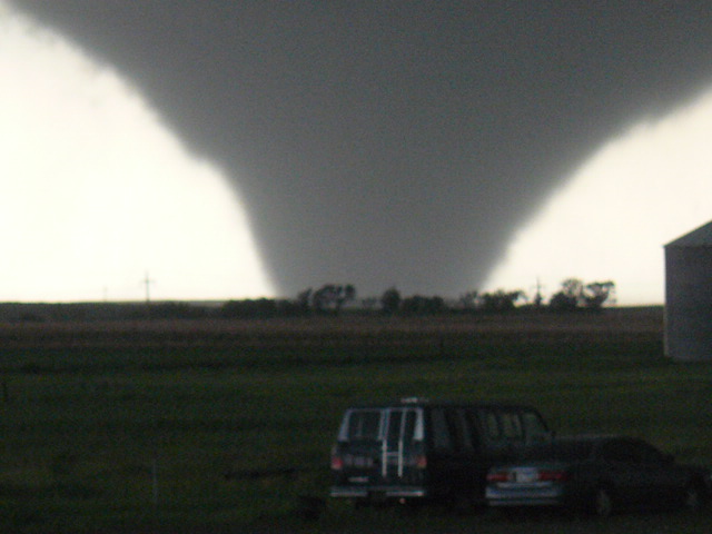
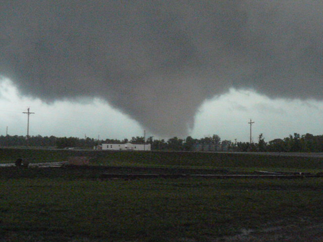
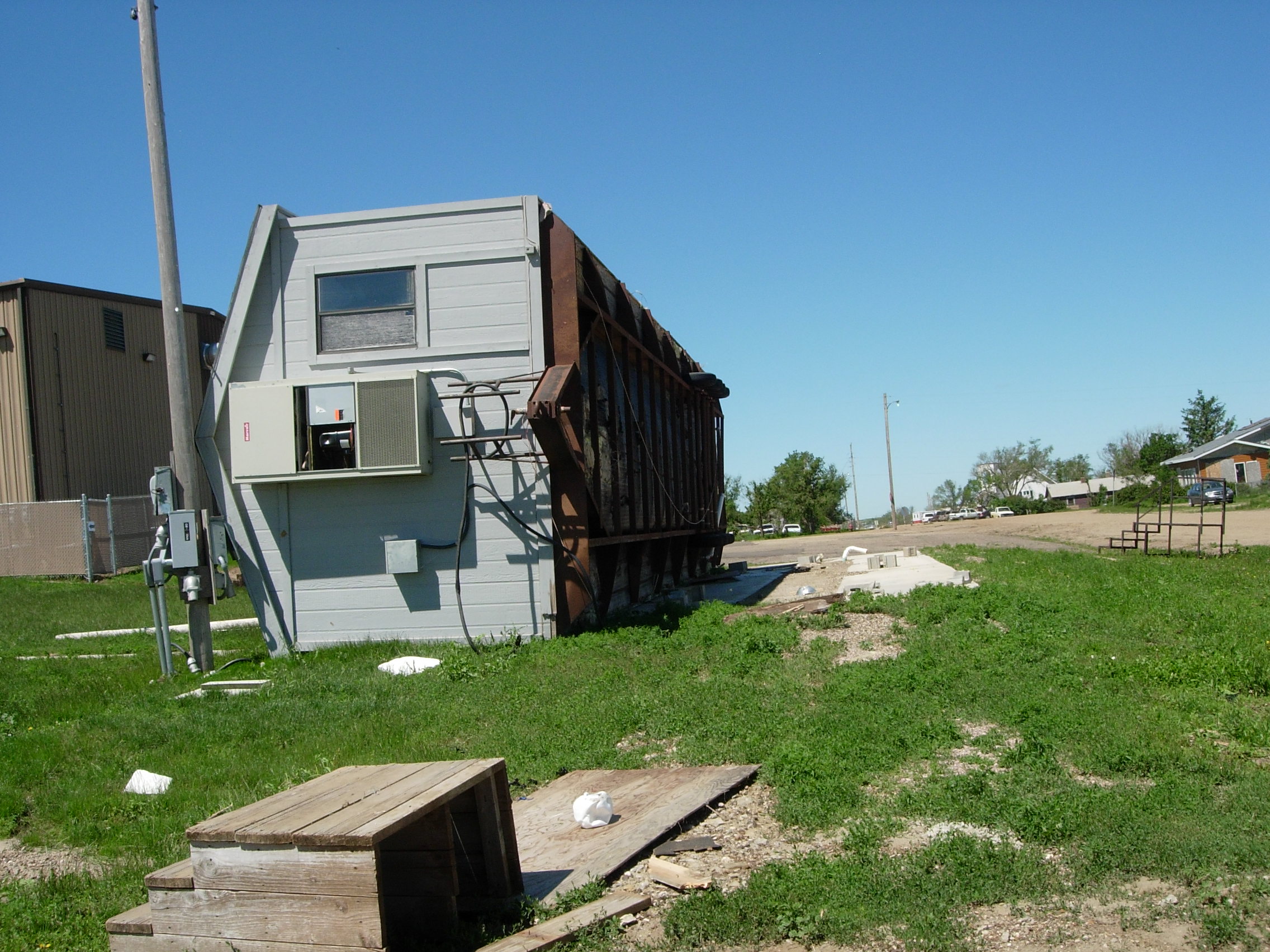
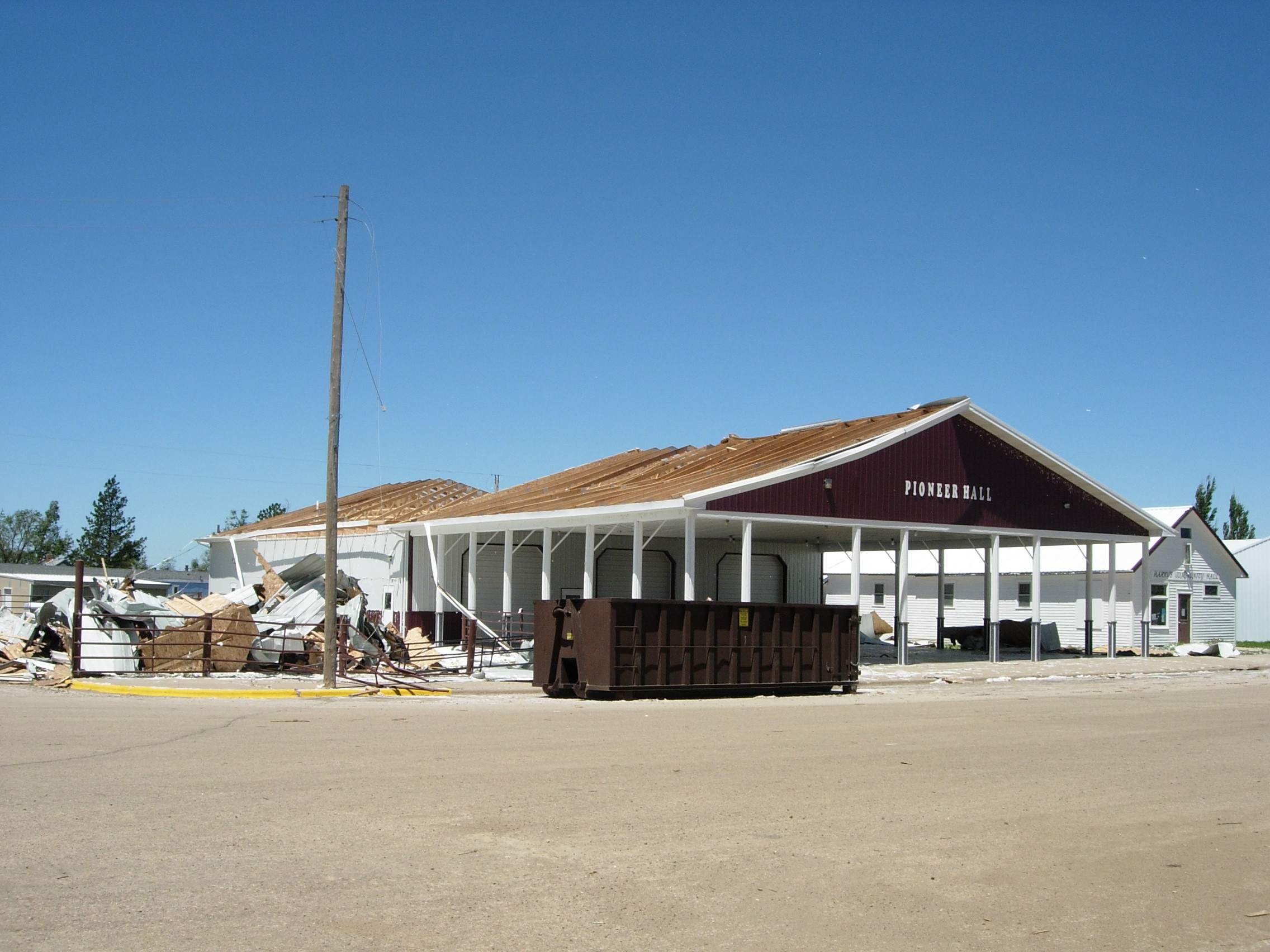
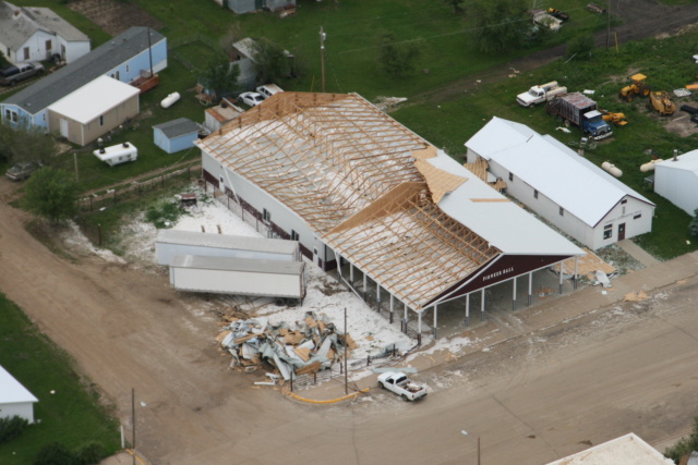
During the late afternoon and evening of Wednesday, June 16, a slow-moving thunderstorm lingered over the Dupree, South Dakota, area for more than three hours and produced tornadoes, damaging straight-line winds, and torrential rainfall that caused widespread flooding. Law enforcement, local spotters, and storm chasers observed 16 tornadoes from southwest of Dupree to north of town. Multiple tornadoes were ongoing at the same time. Significant damage occurred in Dupree, where several mobile homes were smashed, grain bins were blown over, roofs were damaged, and trees were downed. Two people were injured in Dupree. A storm survey conducted by the NWS determined the damage in Dupree was caused by a combination of straight-line winds and tornadoes. The tornadoes in the town of Dupree were likely rain-wrapped and not visible. Due to the widespread damage from straight-line winds, the exact tracks of the tornadoes could not be determined, although the damage pattern did reveal tornadic rotation. The extent of the damage indicated wind speeds of 120 to 130 mph, which is rated an EF-2 on the Enhanced Fujita (EF) Scale. |
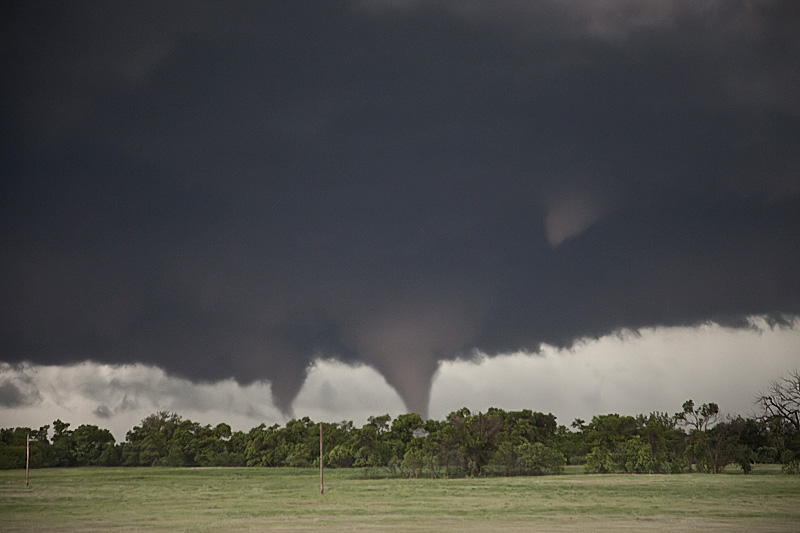 Two tornadoes near Dupree, SD (Photo courtesy of Roger Hill) |
 |
 |
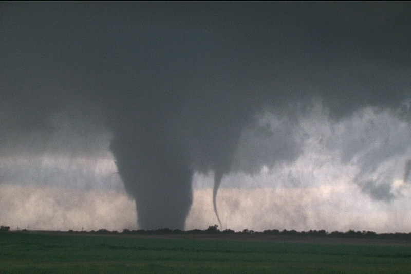 |
| Several tornadoes near Dupree, SD; the right photo shows a "satellite" tornado around the main tornado (Photos courtesy of Roger Hill) | ||
 |
 |
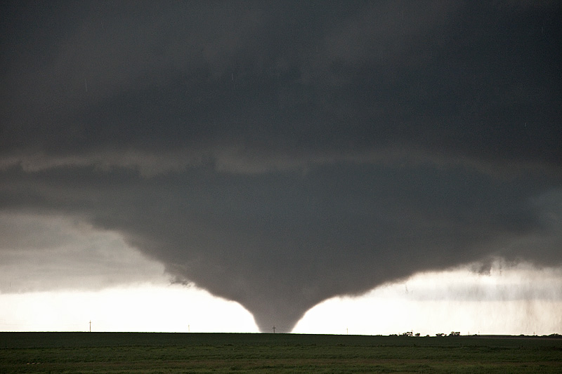 |
| Several tornadoes near Dupree, SD (Photos courtesy of Roger Hill) | ||
Tornadoes:
|
Tornadoes - Dupree, SD
Track Map 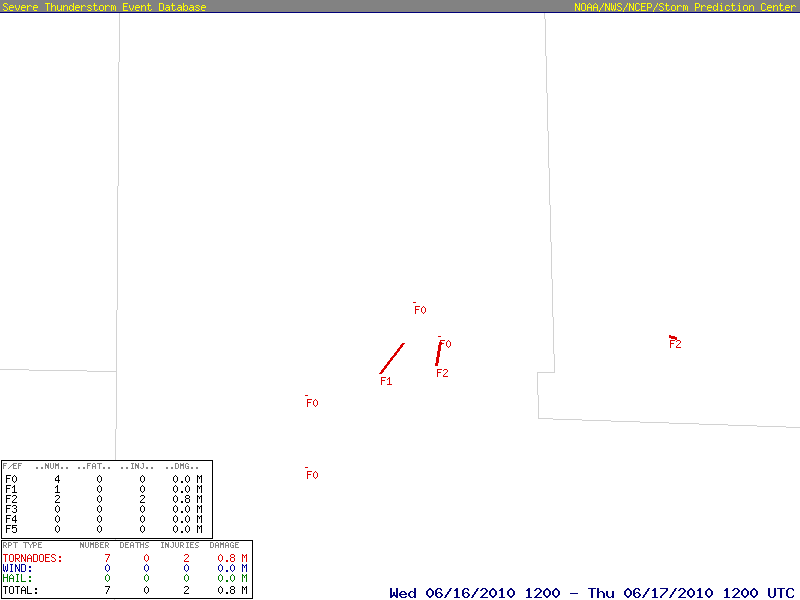 
Downloadable KMZ File |
||||||||||||||||
The Enhanced Fujita (EF) Scale classifies tornadoes into the following categories:
| EF0 Weak 65-85 mph |
EF1 Moderate 86-110 mph |
EF2 Significant 111-135 mph |
EF3 Severe 136-165 mph |
EF4 Extreme 166-200 mph |
EF5 Catastrophic 200+ mph |
 |
|||||
Flooding
During the evening of 16 June 2010, four to seven inches of rain fell in the area around Dupree, SD, producing widespread flash flooding, and causing many roads to become impassable. Flash flooding occurred in Dupree and along Bear Creek, Ash Creek, and along the Moreau River. Several homes flooded from the heavy rain and several sections of Highway 212 were covered with water of at least a foot deep, and in some places of Highway 212 water was estimated to be over a half mile wide.
Radar-Estimated Rainfall
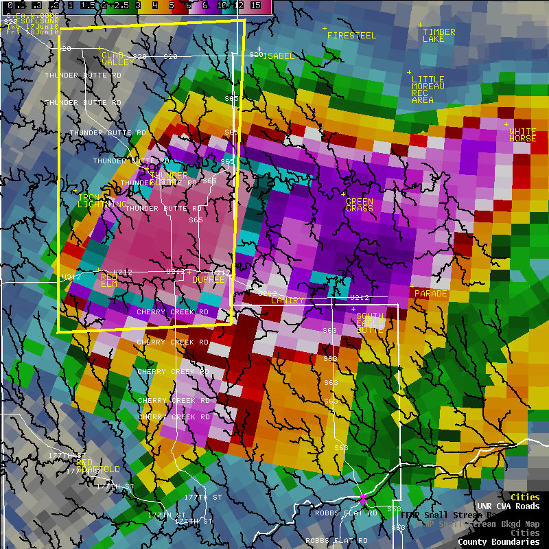 |
| Radar-estimated rainfall over and around Ziebach County, SD, with a maximum estimate of near 15 inches. |
Photos & Video
Additional Tornado Pictures
 |
 |
 |
 |
| Tornadoes near Dupree, SD (Photos courtesy of Robert Shannon & Gary Cudmore) | |||
 |
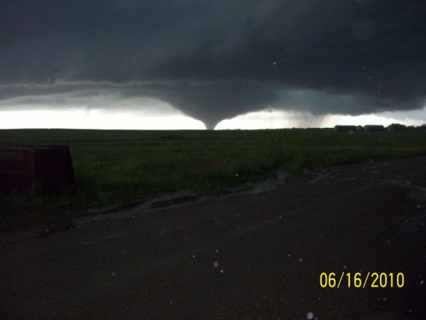 |
| Tornado near Dupree, SD (Photo courtesy of Robert Shannon) | Tornado near Dupree, SD (Photo courtesy of Bob Menzel) |
NWS Damage Survey Photos
 |
 |
 |
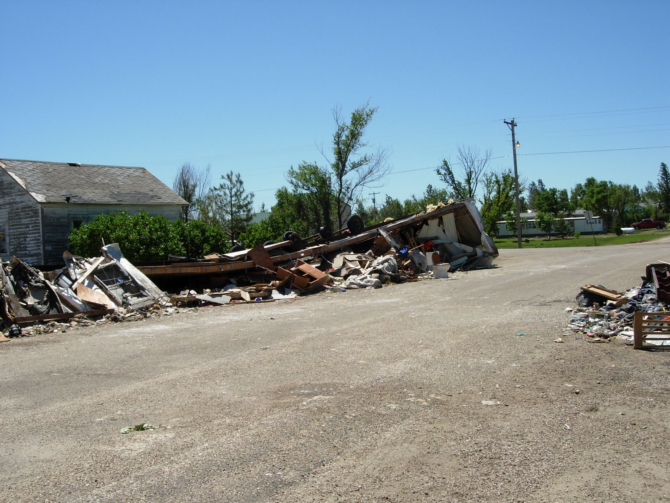 |
| Storm Damage in Dupree, SD (NWS photos) | |||
 |
 |
 |
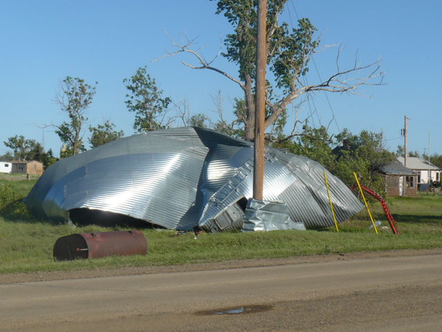 |
| Storm Damage in Dupree, SD (NWS photos) | Storm Damage in Dupree, SD (Photos courtesy of Robert Shannon) | ||
 |
 |
 |
 |
| Storm Damage in Dupree, SD (Photo courtesy of Robert Shannon) |
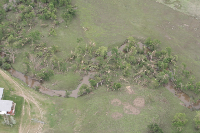
Storm Damage around Dupree, SD (Photos courtesy of the Civil Air Patrol) | ||
Radar Animation
This is a radar animation centered around Dupree, SD, from 3:04 pm MDT to 9:56 pm MDT on 16 June 2010. The time between radar images is 4 to 5 minutes. Red polygons show tornado warnings; yellow polygons show severe thunderstorm warnings; and green polygons show flash flood warnings.
Storm Reports
..TIME...   ...EVENT...      ...CITY LOCATION...     ...LAT.LON...
..DATE...   ....MAG....      ..COUNTY LOCATION..ST.. ...SOURCE....
            ..REMARKS..

0504 PM     TORNADO          7 S RED ELM             44.95N 101.79W
06/16/2010                   ZIEBACH            SD   LAW ENFORCEMENT

            SHERIFF SAW BRIEF TORNADO SOUTH OF RED ELM. TORNADO WAS
            ON THE GROUND FOR LESS THAN ONE MINUTE.

0515 PM     HAIL             3 NE RED ELM            45.09N 101.75W
06/16/2010  E0.88 INCH       ZIEBACH            SD   TRAINED SPOTTER

            HAIL LASTED FROM 515 PM TO 525 PM MDT.

0532 PM     HAIL             RED ELM                 45.06N 101.79W
06/16/2010  E1.00 INCH       ZIEBACH            SD   PUBLIC

0625 PM     TORNADO          4 W DUPREE              45.05N 101.67W
06/16/2010                   ZIEBACH            SD   LAW ENFORCEMENT

0640 PM     TSTM WND DMG     2 W DUPREE              45.05N 101.63W
06/16/2010                   ZIEBACH            SD   LAW ENFORCEMENT

            POWER POLES DOWNED 1 TO 2 MILES WEST OF DUPREE ALONG HIGHWAY 212.

0745 PM     HEAVY RAIN       18 NNW DUPREE           45.29N 101.73W
06/16/2010  M2.25 INCH       ZIEBACH            SD   PUBLIC

            RAINFALL TOTAL OVER LAST 90 MINUTES.

0745 PM     HAIL             DUPREE                  45.05N 101.59W
06/16/2010  E1.50 INCH       ZIEBACH            SD   PUBLIC

0745 PM     TSTM WND GST     18 NNW DUPREE           45.29N 101.73W
06/16/2010  E60.00 MPH       ZIEBACH            SD   PUBLIC

0815 PM     FLASH FLOOD      5 E RED ELM             45.06N 101.69W
06/16/2010                   ZIEBACH            SD   LAW ENFORCEMENT

            UP TO 3 FEET OF WATER OVER HIGHWAY 212 BETWEEN RED ELM AND DUPREE.

0915 PM     FLASH FLOOD      DUPREE                  45.05N 101.59W
06/16/2010                   ZIEBACH            SD   FIRE DEPT/RESCUE

            NUMEROUS HOMES FLOODED AND A CAR FLIPPED OVER IN DUPREE.

0915 PM     FLASH FLOOD      3 E DUPREE              45.05N 101.53W
06/16/2010                   ZIEBACH            SD   FIRE DEPT/RESCUE

            ONE FOOT OF WATER OVER 2 MILES OF HIGHWAY 212 EAST OF DUPREE.
Rainfall Reports
Here are the rainfall reports (inches) from near Dupree, SD, for the 16–17 June 2010 flash flood event.
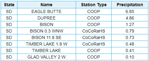 |
| Rainfall reports (inches) from NWS COOP and volunteer CoCoRaHS observers for 16–17 June 2010. |
Environmental Summary
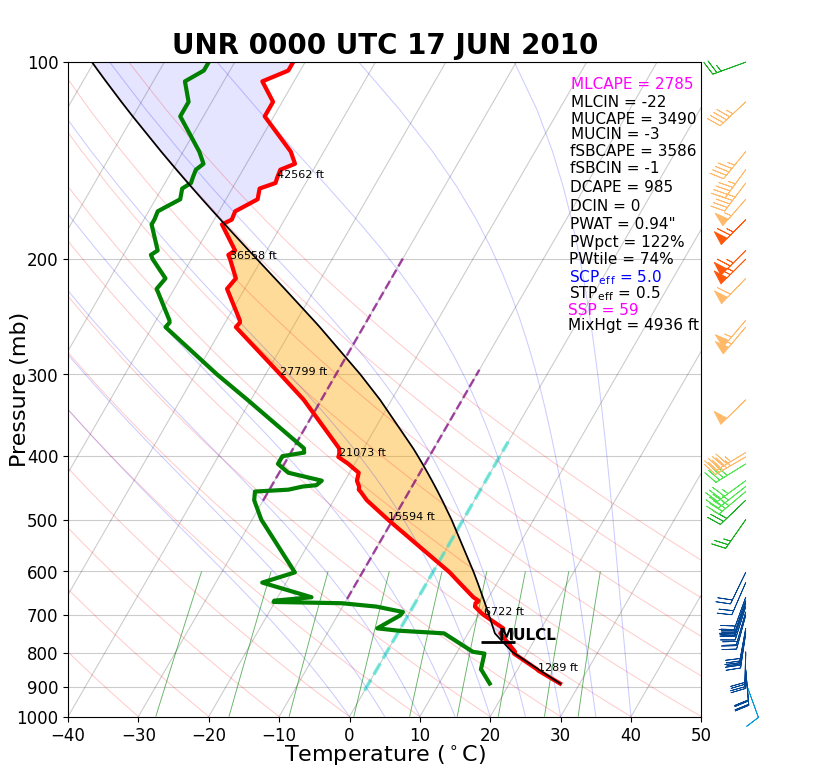
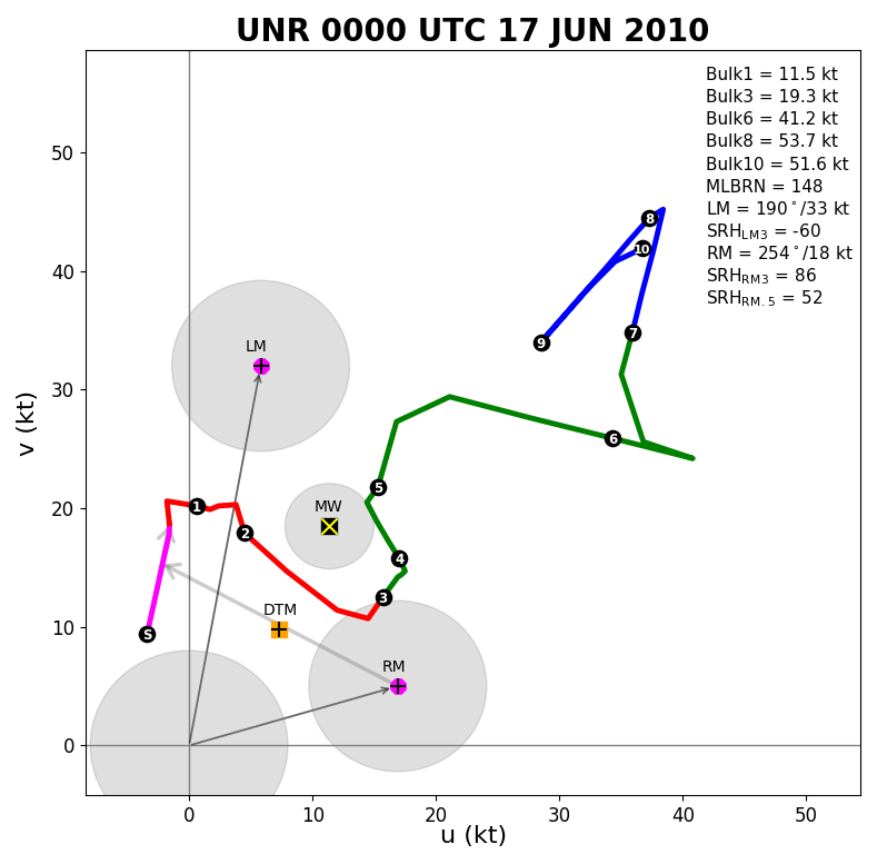
The atmosphere was very unstable on 16 June 2010 across western South Dakota. First, the surface map (first image below) showed a warm front just southwest of Faith, SD (dashed orange line). Tornadoes commonly occur along and just north of warm fronts. In addition, the Rapid City balloon information (first two images of the second row below) showed a lot of buoyancy and instability, along with moderate vertical wind shear -- all of which are critical to tornado formation. Finally, the significant tornado parameter (STP) showed increasing values from 3 pm to 6 pm MDT (bottom four images). STP values of 1 are considered the lower threshold for getting strong tornadoes. In this case, STP values were well above 1, increasing from a max of 4 at 3 pm to max values of 6 to 9 from 5 to 6 pm MDT.
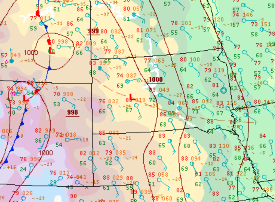 |
| Surface Weather Map (6 pm MDT on 16 June 2010) |
 |
 |
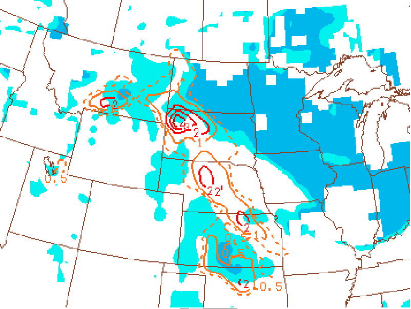 |
| Rapid City sounding (6 pm MDT on 16 June 2010) | Rapid City hodograph (6 pm MDT on 16 June 2010) | Significant Tornado Parameter (3 pm MDT on 16 June 2010) |
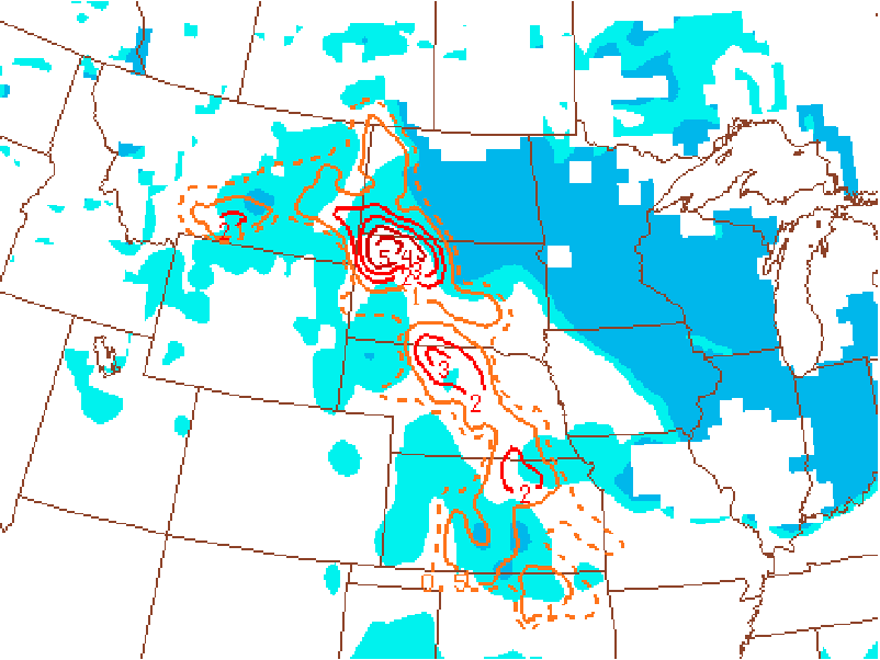 |
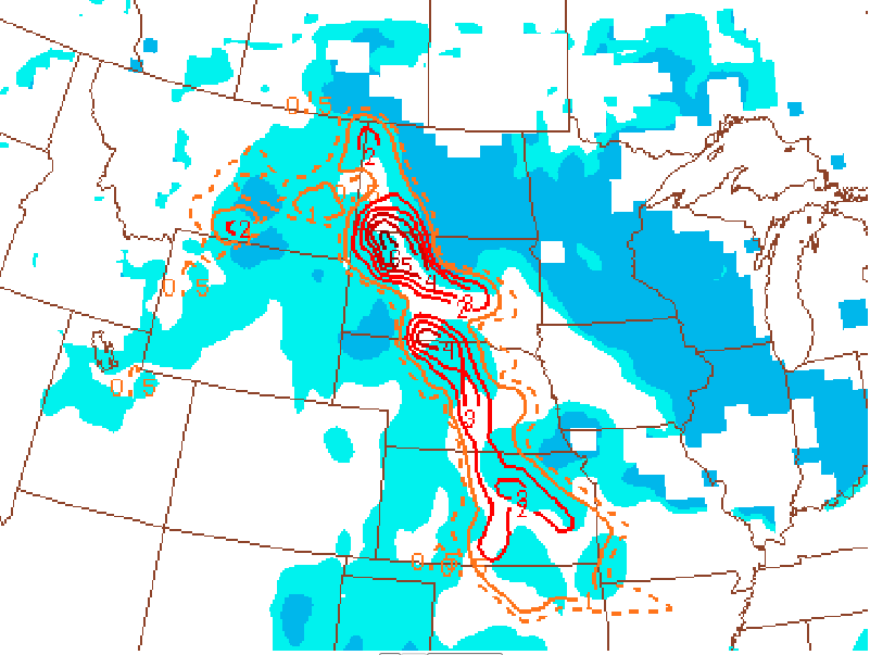 |
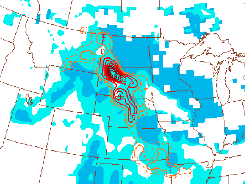 |
| Significant Tornado Parameter (4 pm MDT on 16 June 2010) | Significant Tornado Parameter (5 pm MDT on 16 June 2010) | Significant Tornado Parameter (6 pm MDT on 16 June 2010) |
 |
Media use of NWS Web News Stories is encouraged! Please acknowledge the NWS as the source of any news information accessed from this site. |
 |