
A heat wave over the Southwest will intensify this week, peaking and expanding into the Intermountain West and northern High Plains this weekend. Critical to extremely critical fire weather conditions are forecast from the Northwest and the northern Great Basin this weekend. Particularly Dangerous Situation Red Flag Warnings have been issued. Read More >
Overview
On March 5–14, 2010, ice jams occurred on the White River and caused flooding from Interior to south of Reliance.
Near Interior
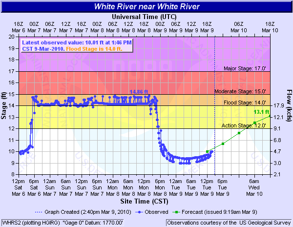
On Friday morning, March 5, 2010, ice jams developed on the White River along Highway 44 southeast of Interior. The river rose above flood stage (14 ft) on Friday, March 5 at 12:30 am MST and continued to rise until Friday, March 5 at 5:15 pm MST, when it crested at 15.4 ft. When the river crested, a resident near the site indicated flood waters had reached the shoulder of Highway 44 south of Interior. The river stage remained relatively steady at 14.5 to 15 feet through Monday morning until the ice jam eventually released Monday afternoon at 2:30 pm MST.
 |
Photos
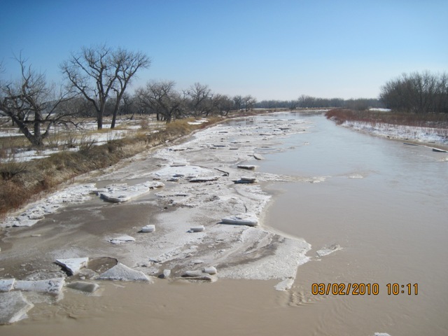
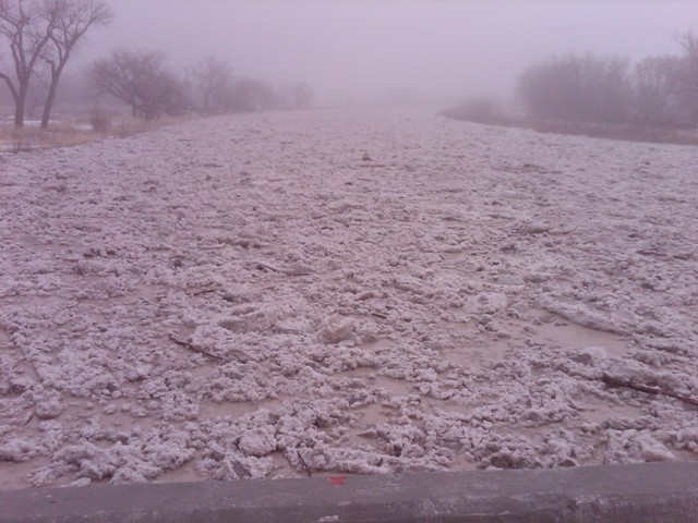
Just two days before the ice jam developed, the USGS took a photo (below, left) looking downstream on the White River near Interior on March 2, 2010 at 10:11 am MST. A second photo was taken by the USGS (below, middle) during the ice jam on March 4, 2010 around 11:00 am MST. On March 8, 2010, just hours after the ice jam released, a third photo (below, right) was taken at 3:26 pm MST by Kyle Carstens, NWS Rapid City meteorologist. Ice left over from the ice jam can be seen on the both sides of the bank.
 |
 |
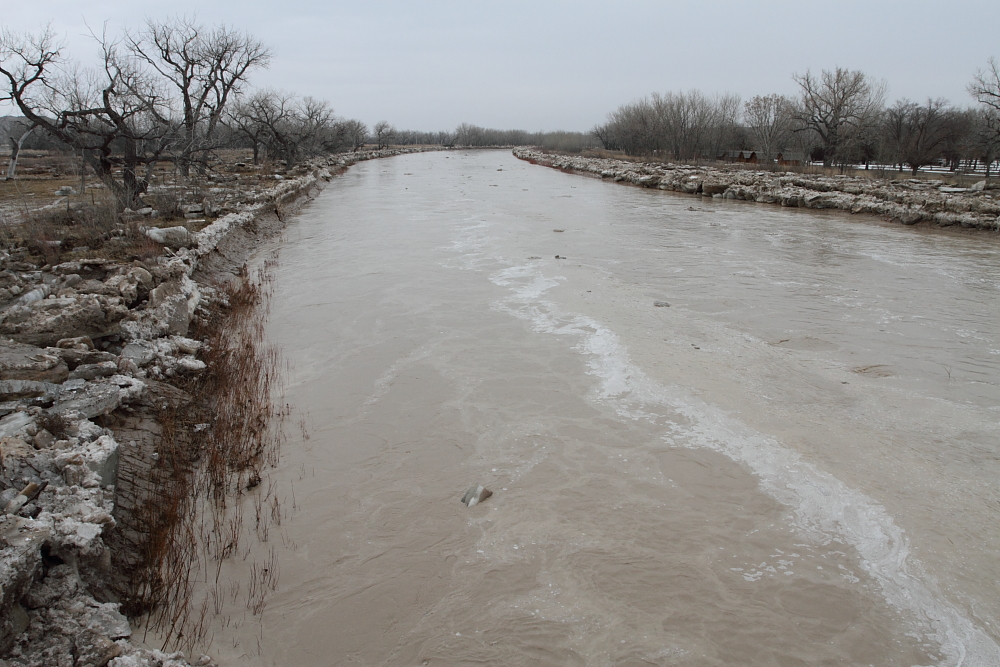 |
| White River near Interior, March 2, 2010 (photo by USGS) | White River near Interior, March 4, 2010 (photo by USGS) | White River near Interior, March 8, 2010 (photo by Kyle Carstens) |
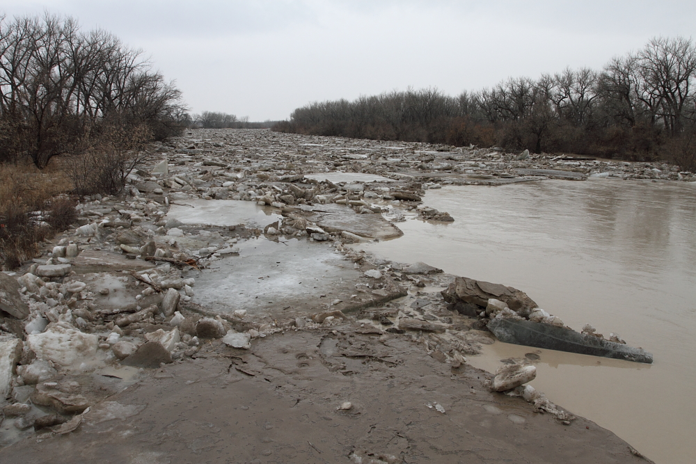
South of Murdo
Another ice jam developed farther downstream on the White River south of Murdo along Highway 83. The river rose above flood stage (14 ft) at 5:15 pm CST on Saturday, March 6 and remained steady between 14 and 15 ft on Sunday into Monday. The river crested on Monday, March 8, reaching 14.9 ft at 1:00 pm CST. Just four hours later the ice jam released, and as a result, the river level quickly dropped below flood stage.
|
Photos
Below are photos of the ice jam at White River south of Murdo near Highway 83. Photos were taken by Kyle Carstens, NWS Rapid City meteorologist, on Monday morning, March 8, 2010, between 10:30 and 11:15 am CST.
 |
 |
 |
| White River near Highway 83 | White River near Highway 83 | White River near Highway 83 |
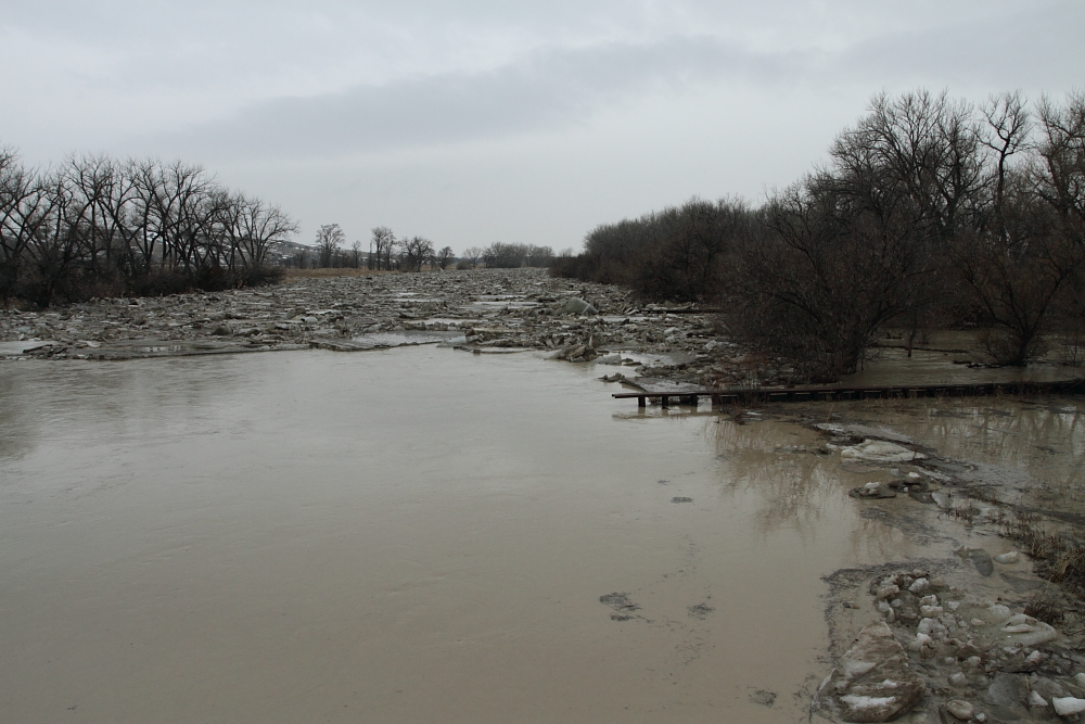
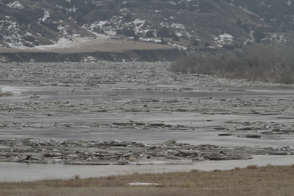
South of Reliance
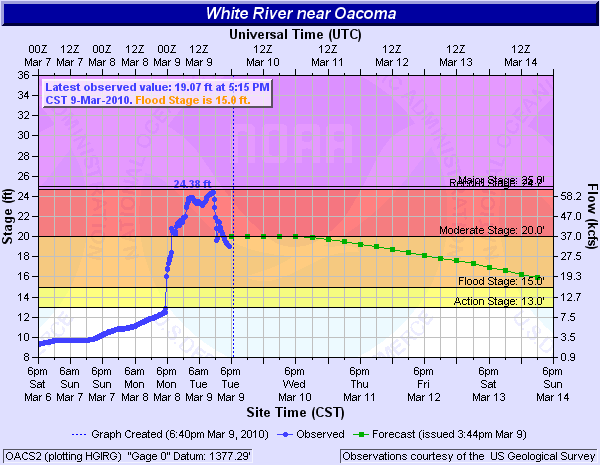
The ice from Interior and south of Murdo flowed downstream toward Highway 47 south of Reliance and southwest of Oacoma. An ice jam developed late Monday afternoon, March 8, 2010 causing river levels to rise above flood stage (15 ft) at 5:45 pm CST Monday. The river stage continued rising overnight into Tuesday morning. The stage finally crested at 24.4 ft just before the ice jam released at 11:15 am CST Tuesday. This was just half a foot shy from the record flood stage set in March 1994 (with records extending back to 1929). Two storm systems brought up to an inch and a half of precipitation through the week to the south-central South Dakota. The resulting runoff kept river levels on the White River in minor to moderate flood stages with a secondary crest of 20.8 ft on Thursday, March 11 around 6:00 pm CST. The stage then steadily decreased to below flood stage early Sunday morning, March 14.
 |
 |
Media use of NWS Web News Stories is encouraged! Please acknowledge the NWS as the source of any news information accessed from this site. |
|

