
Unseasonably warm temperatures continue through the weekend across the Southwest and southern U.S., with more than 100 record or near record maximum temperatures forecast through the rest of the week and over the weekend. Elevated to critical fire weather conditions will persist across the Plains and Southeast U.S. this weekend. Read More >
Overview
|
The most recent tornado inside the city limits of Rapid City occurred on Father's Day, June 18, 1967. The tornado developed west of Mount Rushmore and north of Fairmont Boulevard, causing damage to a motel (see figure at right) and breaking power poles, which laid electric lines across the street. The tornado continued to move across the Robbinsdale area of south Rapid City—peeling shingles off roofs, breaking windows, and destroying campers and trailers. A report written by a Rapid City Weather Bureau (now National Weather Service) employee described the event as follows (some minor grammatical changes were made): June 18, 1967 – A tornado developed at about 1245 MST at the Town and Country Motel on Mt. Rushmore Road at the end of Cleveland. It moved generally eastward, at times skipping or just skimming the ground with the funnel cloud lifting and gradually disappearing after about one mile of travel in five minutes. Property damage was estimated at $2,000,000; it caused no deaths and only three injuries. The motel was deroofed; otherwise, damage was superficial with no dwellings destroyed. The storm cloud appeared quite innocuous with little thunder and no rain. A rather extended funnel cloud was observed, part of it nearly horizontal and then sloping to the ground. A tornado watch was in effect for the area, having been issued about one hour before the tornado occurred and radio and TV stations had repeated the watch (seven times by KOTA-AM and 4 times by KOTA-TV). The roof removed from the Town and Country Motel was deposited on another motel across the street, causing heavy damage. Along its track, many homes had shingles peeled back (some removed), windows broken, and fences downed. The home of a Weather Bureau employee was damaged by quartz rock from a neighboring rooftop, blasting the siding severely, and breaking windows in the house and car. Several camping trailers were severely damaged down the street. Beyond its initial contact at the motel the damage was little more than could be expected with a large whirlwind of a hot day. Excerpts from the “Rapid City Journal” article on Monday, June 19, 1967 include: Twisting winds dropped out of bright, practically clear skies Sunday afternoon and skipped through the southeast part of Rapid City causing property damage estimated at nearly $2 million. Miraculously, only three minor injuries from the tornado were reported, but Robbinsdale residents were busy Monday with clean-up work that will go on for weeks. The injured persons apparently were all passengers in a small foreign compact car that had just driven up to the motel. All three received cuts on the legs from flying glass as the front windshield blew in. Witnesses and meteorologists agree there was no distinct funnel visible when the tornado hit the Town ‘N Country Motel at Rushmore Road and Cleveland and skipped eastward across Robbinsdale. The funnel became clearly visible as the storm left the city and lifted into the clouds over the airport. Black Hills Power and Light Co. reported Monday that power difficulties because of the tornado were not too severe, mostly troublesome. A couple of poles were broken off east of the Beach Motel and a couple of spans of wire were downed. In an area further east around Nevada Street, some 20 to 24 services pulled loose from houses because of high winds. Longest service outage was about two hours. One feeder in the area was knocked out for a short period. Hardest hit was the Town ‘N Country Motel where the new owner reported serious damage to 45 out of 100 units. Nine persons dashed into one unit and hid under a bed. The roof blew off, but none of the nine were injured. A car was dropped into another unit. The roof torn off the topmost units of Town ‘N Country was whisked down the hill across the street and slammed up against a Beach Motel wall and roof. Several campers, pickups and cars were thrown about, overturned and hit by debris. Three units of the Beach Motel suffered mostly roof damage. Damage was extensive throughout Robbinsdale, ranging from campers and trailers demolished and roofs torn off to minor shingle loss. Numerous patio covers were destroyed and many trees were damaged. The previous tornado to hit Rapid City damaged a bottling plant along Mount Rushmore Road on June 14, 1962. The 1960s were an active period for tornadoes around the Black Hills—with several large tornadoes occurring near Rockerville, Lead, and Rochford. While tornadoes do not occur frequently in the Black Hills and Rapid City area, they are not rare events, either. June and July have the highest number of tornadoes, and they typically occur in the afternoon and early evening. |
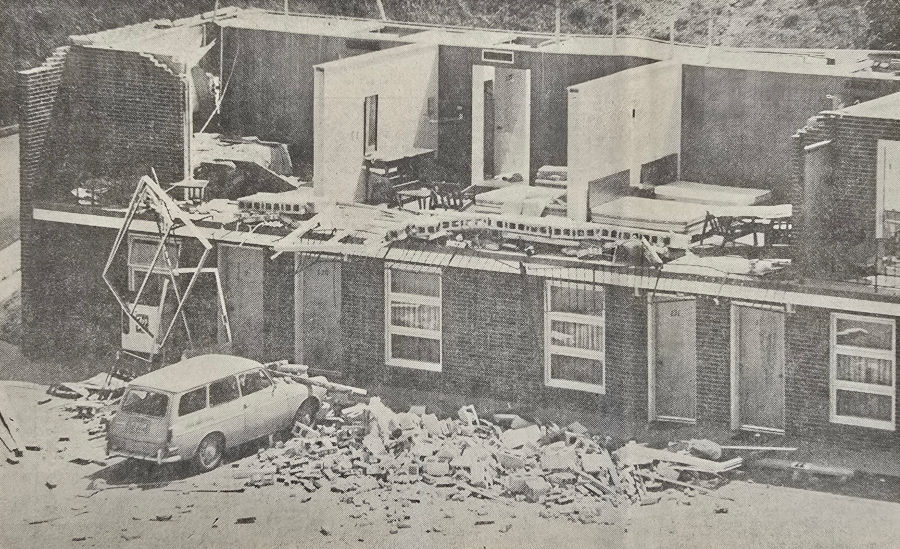 Tornado damage along Mount Rushmore Road on the south side of Rapid City. Photo courtesy of the Rapid City Journal. |
Tornadoes:
|
Tornado - Rapid City, SD
Track Map 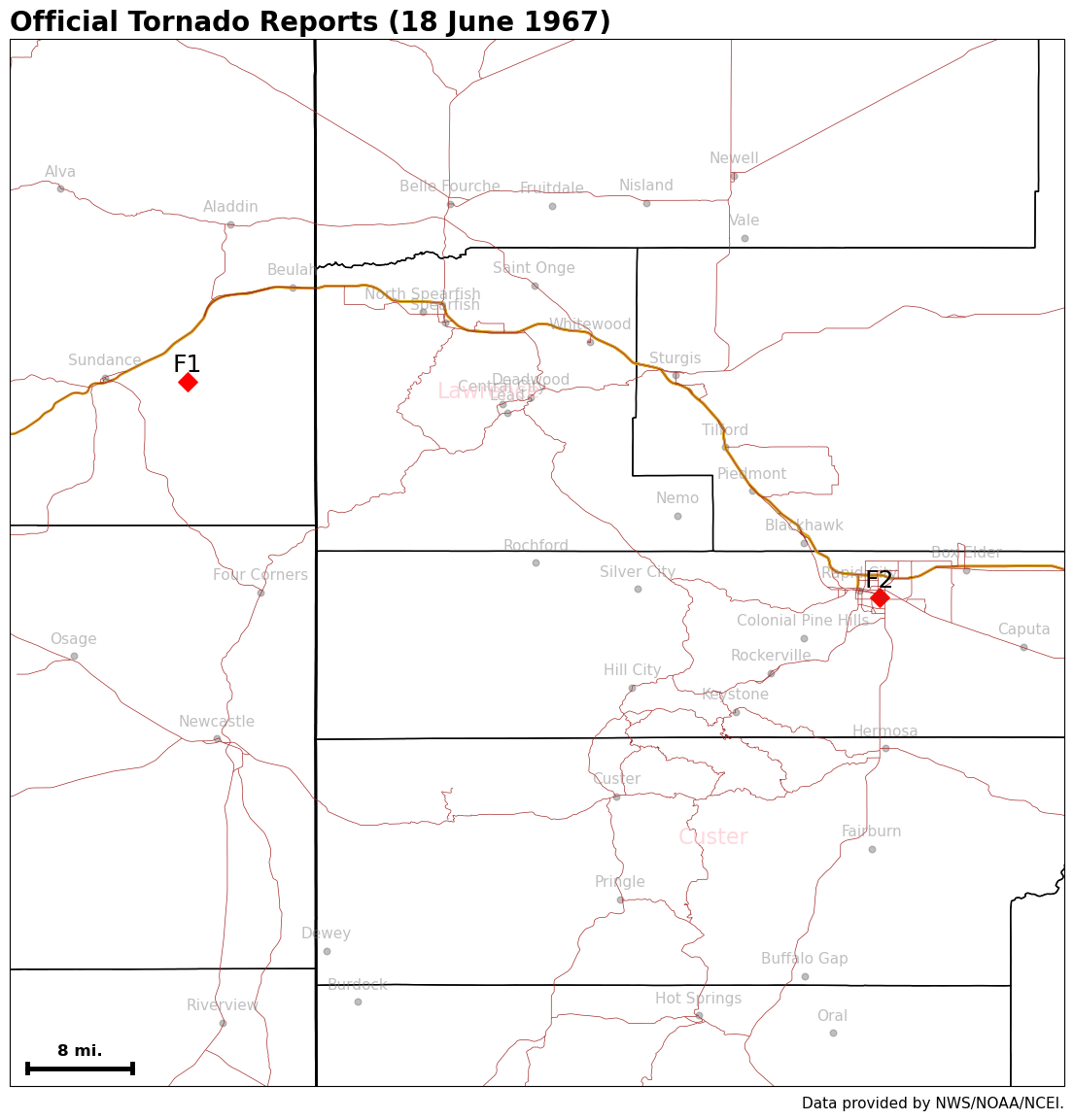 |
||||||||||||||||
Environment
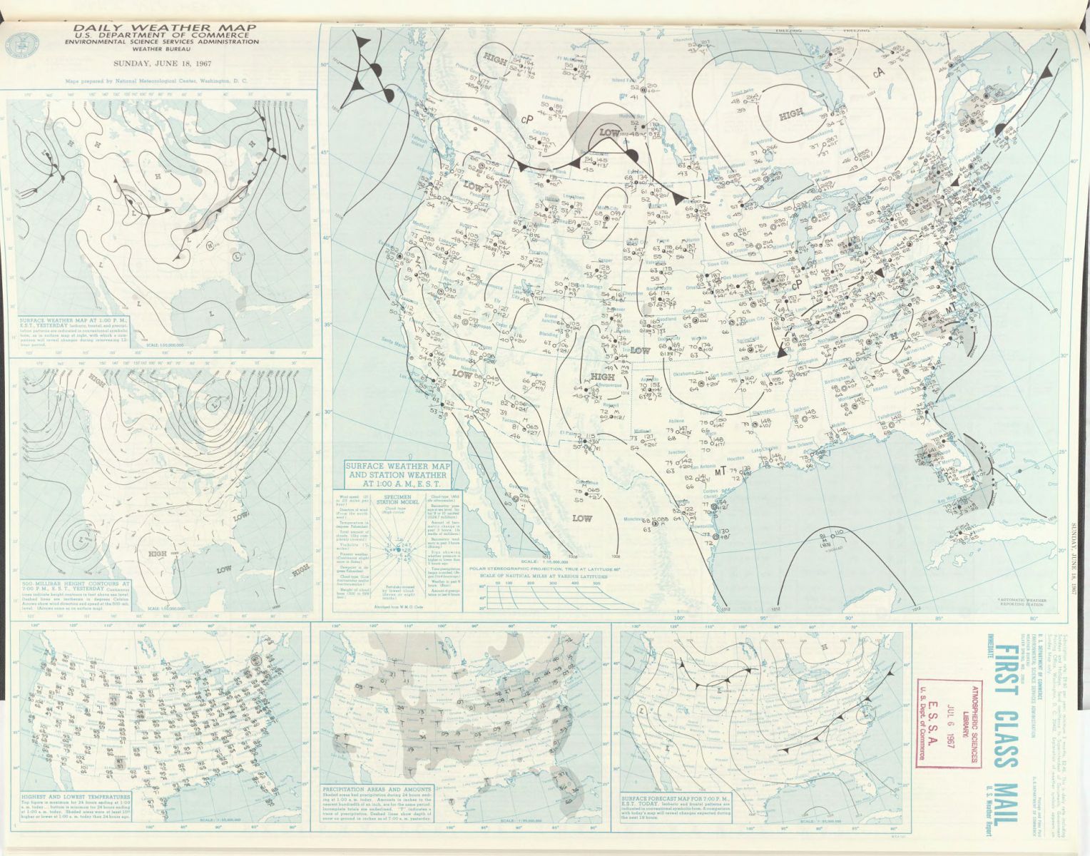
A cold front moved through the region between June 18 and June 19, 1967. Warm, moist, and unstable air pooled along the eastern Black Hills ahead of the cold front, setting the stage for severe thunderstorms. The vertical wind shear became favorable for tornadoes.
 |
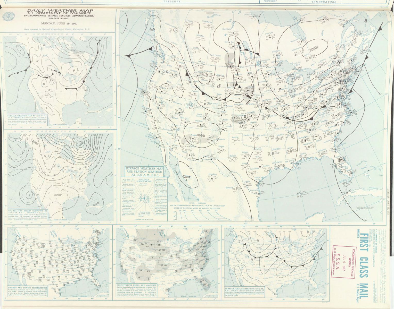 |
| June 18, 1967 Daily Weather Map | June 19, 1967 Daily Weather Map |
Soundings
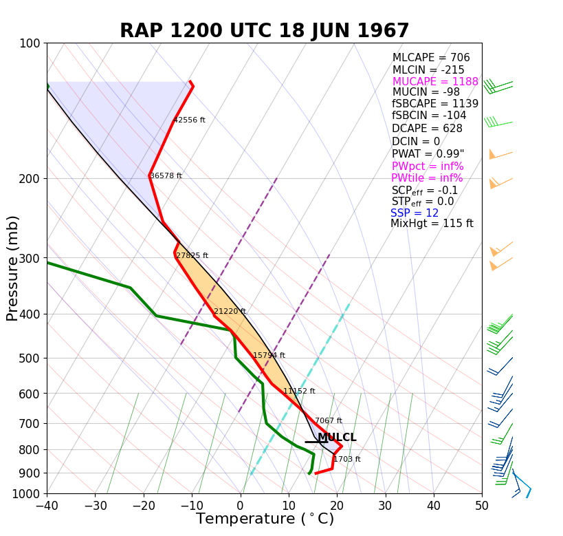 |
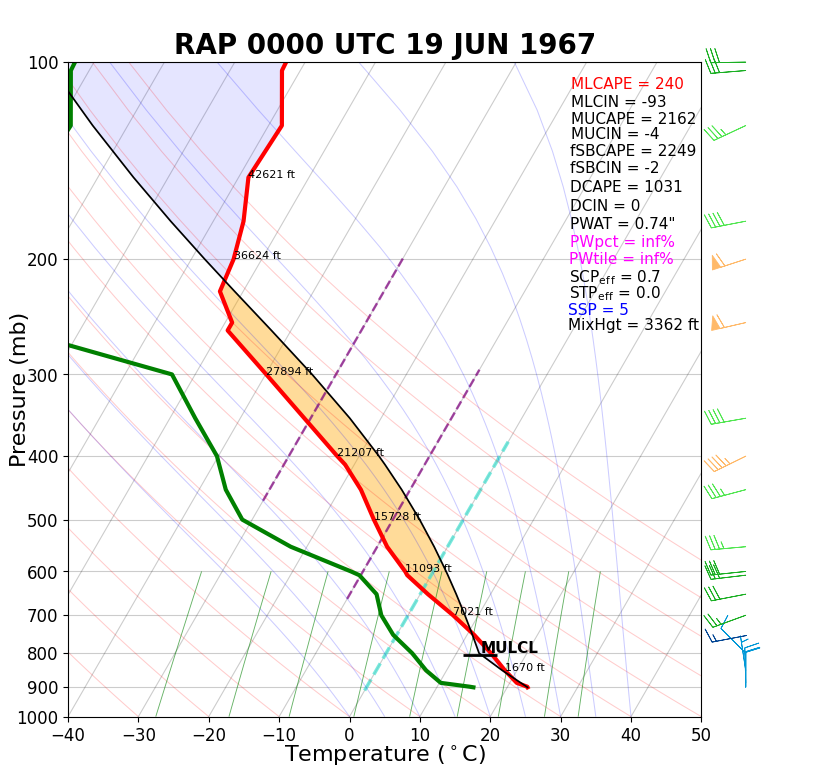 |
| June 18, 1967 12z RAP Sounding | June 19, 1967 00z RAP Sounding |
Hodographs
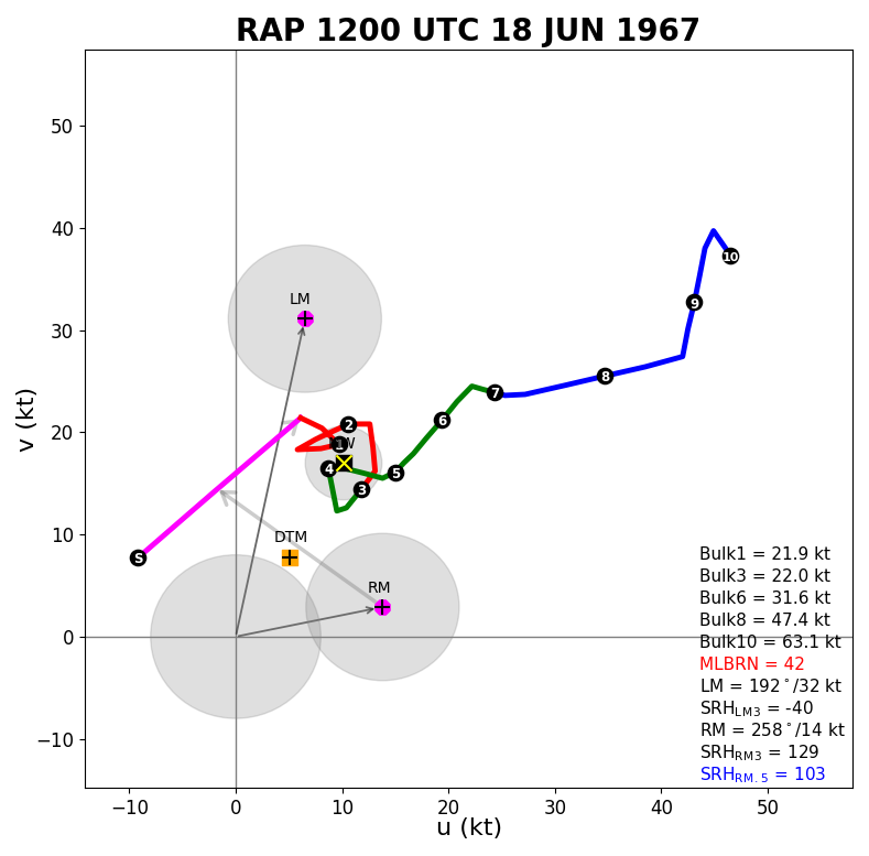 |
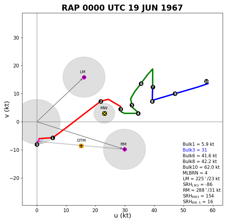 |
| June 18, 1967 12z RAP Hodograph | June 19, 1967 00z RAP Hodograph |
 |
Media use of NWS Web News Stories is encouraged! Please acknowledge the NWS as the source of any news information accessed from this site. |
 |