
Severe thunderstorms may produce damaging winds, large hail, and numerous instances of flash/urban flooding over parts of the central Plains and lower Missouri Valley. Hazardous heat will continue in the South, Desert Southwest and the California Central Valley this weekend. Isolated dry thunderstorms may increase the risk of fire starts and spread across the Four Corners region and vicinity. Read More >
|
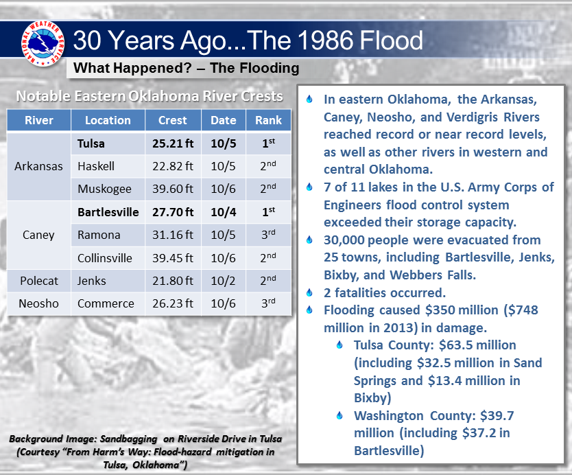
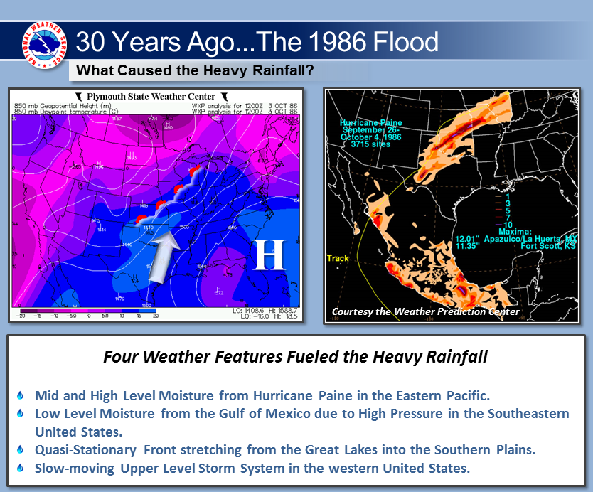
The 1986 Flood Heavy rains during the last two weeks of September 1986 left the ground across Oklahoma saturated. Then, moisture from Hurricane Paine flowed into Oklahoma, combined with a stationary frontal system, and produced 10-20 inches of rain over north central and northeast part of Oklahoma. This heavy rainfall over previously saturated land caused tremendous runoff, which in turn caused major rivers and all streams and creeks to flood. The Arkansas, Caney, Canadian, South Canadian, Cimarron, Washita, Salt Fork, Neosho, and Verdigris Rivers, and the North Fork of the Red River set or nearly set record high crests. This event set new record high flood levels at 7 stream gaging sites. Approximately 30,000 people had to be evacuated from about 25 towns. Half of these evacuations were in Bartlesville. All residents of Webbers Falls, Jenks, and Bixby were ordered to evacuate. Two lives were lost during this flood. A total of 509 residences were destroyed, and 3,957 were damaged. Many roads and bridges were washed out, including two bridges on Interstate 35. A total of 52 of the 77 counties in Oklahoma suffered some type of flood damage. There were 33 counties, the cities of Norman and Shawnee, and 10 counties in Kansas declared flood disaster areas. Damages were estimated at $350 million ($748 million in 2013), half of which was from agriculture (all damage figures are in 1986 dollars). Find more information about this event here.
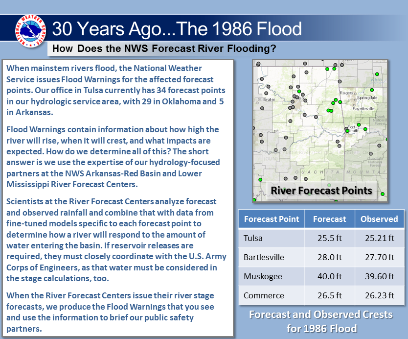
The 30th Anniversary of the 1986 Flood In October 2016, the National Weather Service in Tulsa, together with the City of Tulsa, U.S. Army Corps of Engineers Tulsa District, and the U.S. Geological Survey, commemorated the 30th Anniversary of this record flood along the Arkansas River at Tulsa. A High Water Mark sign provided by NWS Tulsa was installed at Cousins Park near 121st St. South and Yale Ave., where water was approximately 3.5 feet over the road. The Arkansas River at Tulsa crested at 25.21 feet during the early morning of October 5, 1986, causing flooding in Sand Springs, Tulsa, Jenks, and Bixby. Thousands of properties were flooded, causing $63.5 million in damages in Tulsa County ($137.4 million in 2016 dollars). The City of Tulsa produced an informative video about this event, featuring NWS Tulsa. The Tulsa County Floodplain Map, as well other information about City of Tulsa flood control program, can be found online. |
 |
 |
|
 |
|
|
Tulsa High Water Mark Sign (Photo: NWS Tulsa) |
 |
 |
|
 |
Click on images below for a larger view:
 |
 |
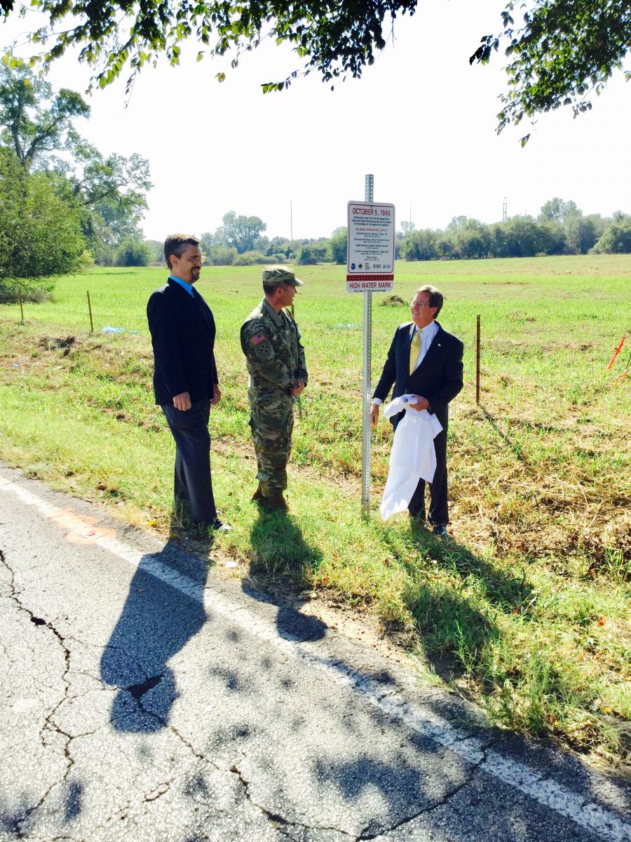 |
| Tulsa High Water Mark Sign (Photo: NWS Tulsa) | Preparing to unveil the High Water Mark Sign. Col. Christopher Hussin, Commander USACE Tulsa District; Steve Piltz, Meteorologist In Charge NWS Tulsa; City of Tulsa Mayor Dewey Bartlett (Photo: NWS Tulsa) | Unveiling the High Water Mark Sign. Steve Piltz, Meteorologist In Charge NWS Tulsa; Col. Christopher Hussin, Commander USACE Tulsa District; City of Tulsa Mayor Dewey Bartlett (Photo: NWS Tulsa) |
 |
 |
 |
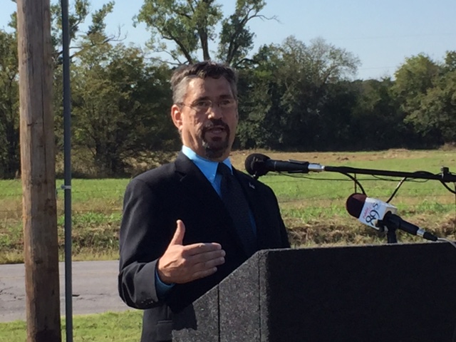
| Steve Piltz, Meteorologist In Charge of the NWS Tulsa provided remarks at the sign unveiling ceremony. (Photo: NWS Tulsa) | Steve Piltz, Meteorologist In Charge of the NWS Tulsa provided remarks at the sign unveiling ceremony. (Photo: NWS Tulsa) | NWS Tulsa and Arkansas-Red Basin River Forecast Center employees at the Tulsa High Water Mark Sign. (Photo: NWS Tulsa) |
 |
 |
 |
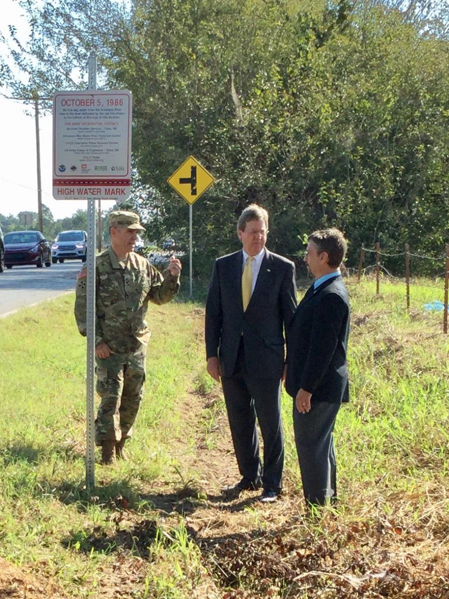
| Tulsa High Water Mark Sign. Col. Christopher Hussin, Commander USACE Tulsa District; City of Tulsa Mayor Dewey Bartlett; Steve Piltz, Meteorologist In Charge NWS Tulsa (Photo: NWS Tulsa) | Tulsa High Water Mark Sign. Col. Christopher Hussin, Commander USACE Tulsa District; City of Tulsa Mayor Dewey Bartlett; Steve Piltz, Meteorologist In Charge NWS Tulsa (Photo: NWS Tulsa) | Tulsa High Water Mark Sign. Col. Christopher Hussin, Commander USACE Tulsa District; City of Tulsa Mayor Dewey Bartlett; Steve Piltz, Meteorologist In Charge NWS Tulsa (Photo: NWS Tulsa) |

