|
November 27, 2005 Wind and Fire Event
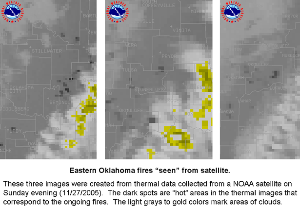
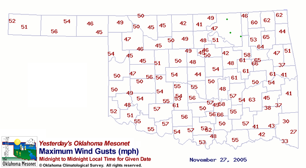
Strong gusty winds wreaked havoc across Eastern Oklahoma and portions of Northwest Arkansas during the late afternoon and evening hours of November 27, 2005. The winds were the result of a powerful low pressure system moving across Kansas and into the Mississippi Valley. The winds combined forces with the dry air in the wake of a dry line that moved through the area earlier in the day and the dry vegetation in place across the region to create the perfect conditions for rapid fire growth. Wild fires occurred in 9 counties in Eastern Oklahoma including: Cherokee, Mayes, McIntosh, Muskogee, Okfuskee, Osage, Pittsburg, Tulsa and Wagoner. 35 homes were destroyed with numerous outbuildings and barns lost. Many homes were also evacuated in these areas. 50,000 acres were reported to have burned across Oklahoma between the 27th and 28th of November. 5,000 acres burned in Okfuskee County alone. The wind gusts which were as high as 74 mph also created other problems across Eastern Oklahoma and portions of Northwest Arkansas. Numerous power lines were knocked down as a result of the high winds. During the height of the wind event more than 50,000 were without power with 27,000 of those in the Tulsa metro area. The wind also damaged many roofs and trees across the Tulsa metro area. *Some information provided by the Oklahoma Department of Emergency Management
|