For ongoing information on the threat for heavy rain, flash flooding, and other severe weather, visit the NWS Tulsa Decision Support Page.
Additional information on ongoing and forecast River Flooding, please visit the NWS Tulsa Rivers & AHPS page.
Flood Safety Information from the NWS
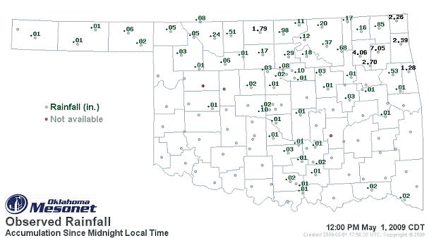
A very moist low-level atmosphere developed over eastern Oklahoma and northwest Arkansas during the last part of April and into the first part of May. Periods of heavy rain affected the region off and on from April 26 through May 1 as a series of fronts moved through the area. Widespread rainfall totals of 2 inches or more occurred in the 7 days prior to May 1 (from 7am on April 24th through 7am on May 1st) across northeast and southeast Oklahoma.
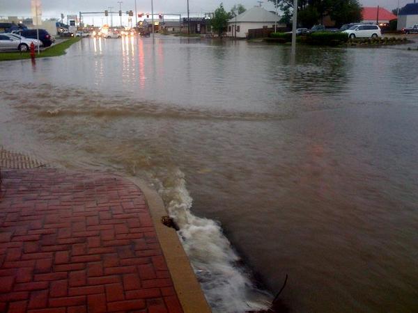
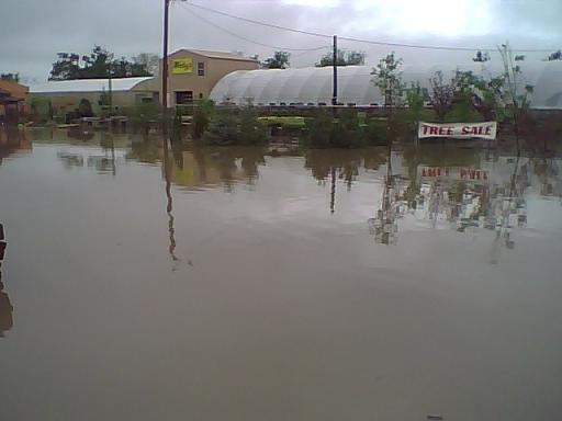
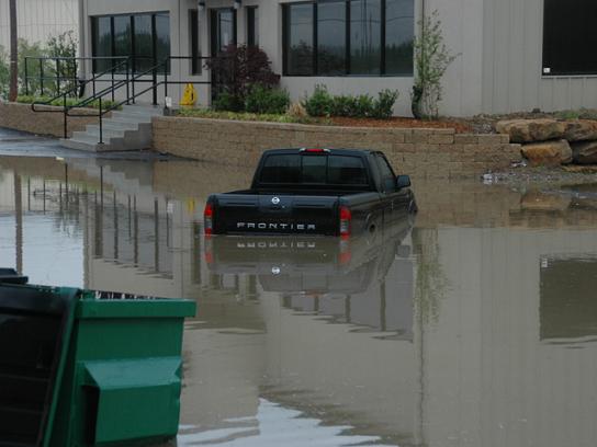
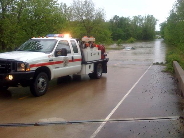
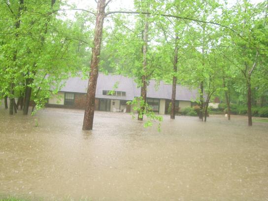
By the morning of May 1st, showers and thunderstorms developed along a cold front and an outflow boundary left over from the day before. A combination of slow storm movement, training of storms, and effecient rainfall production lead to very heavy rainfall in a short period of time across northeast Oklahoma. Rainfall rates of 2 to 3 inches per hour affected portions of Tulsa, Rogers, Mayes, Adair and Cherokee Counties. This led to severe flash flooding, with numerous water rescues and reports of water entering buildings and homes. Additionally, the recent rains have led to mainstem river flooding across northest Oklahoma, with the potential for additional flooding across all of eastern Oklahoma and northwest Arkansas for the next several days.
By noon, 2 to 5 inches of rain had fallen across northern Tulsa, Rogers, Mayes, Delaware, northern Cherokee, and northern Adair Counties. The highest totals, however, occurred over Pryor, OK in Mayes County, where 7 inches of rain fell between 5 am and 11 am. Over 5 inches of this total fell within 1 hour between approximately 7:30 and 8:30 am. Local news media was reporting over 25 water rescues had been performed in Pryor.
Click for a compiled list of Flood reports from the NWS office in Tulsa
|
|
|
|
|
|
|
|
|
|
|
|
|
|
|
|
|
|