
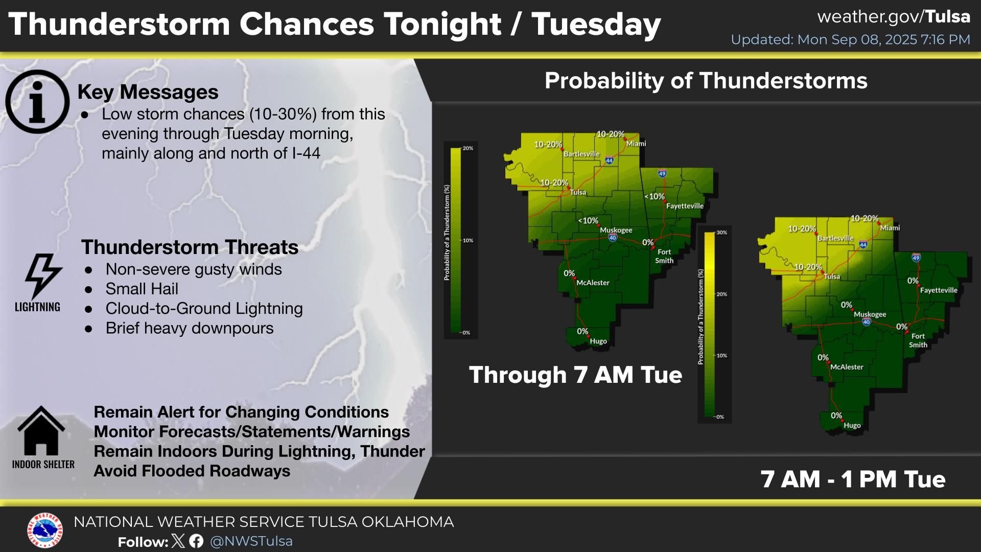
Severe thunderstorms will be possible over parts of the northern Plains today through Thursday which could bring large hail, damaging winds, and possible tornadoes. Thunderstorms with heavy to excessive rainfall may continue to produce flooding over parts of the southern and northern Plains today. Read More >
Last Map Update: Wed, Jun 3, 2026 at 3:44:28 pm CDT

| Latest Text Product Selector (Selected product opens in a new window) | |
 |
 |
 |
 |
 |
 |
| Decision Support | Winter | Hazards | Observations | Climate | Hydrology |
 |
 |
 |
 |
 |
 |
| Social Media | Satellite | Fire Weather | Weather Radio | Spotter Training | Text Products |
 |
|||||
| Models | |||||


 Weather Map
 Fort Smith Radar