
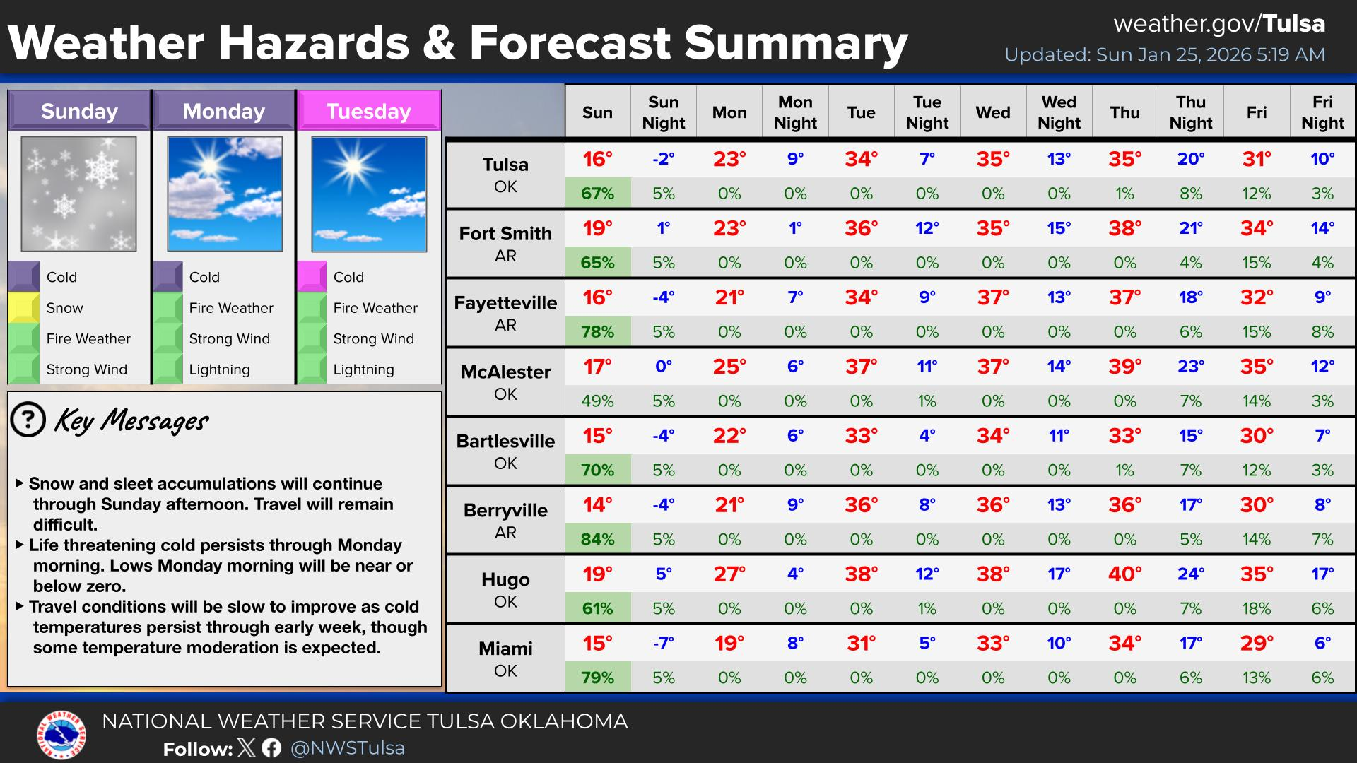
A heat wave over the Southwest will intensify this week, peaking and expanding into the Intermountain West and northern High Plains this weekend. Critical to extremely critical fire weather conditions are forecast from the Northwest and the northern Great Basin this weekend. Particularly Dangerous Situation Red Flag Warnings have been issued. Read More >
Last Map Update: Sun, Aug 2, 2026 at 1:24:29 pm CDT
| Latest Text Product Selector (Selected product opens in a new window) | |
 |
 |
 |
 |
 |
 |
| Decision Support | Winter | Hazards | Observations | Climate | Hydrology |
 |
 |
 |
 |
 |
 |
| Social Media | Satellite | Fire Weather | Weather Radio | Spotter Training | Text Products |
 |
|||||
| Models | |||||


 Tulsa Radar
  Weather Map
 Fort Smith Radar