National Weather Service United States Department of Commerce

Snow in the Great Lakes; Critical Fire Weather in the Southwest and Southern Plains

Lake effect snow will continue downwind of the Lower Great Lakes through Wednesday, with accumulations of 4 to 8 inches possible for portions of Upstate New York and the Adirondacks. Gusty winds and dry conditions will result in critical fire weather conditions in the Southwest and Southern Plains Wednesday through Friday. Red Flag Warnings have been issued. Read More >

Click a location below for detailed forecast.

Last Map Update: Wed, Apr 16, 2025 at 2:36:20 am CDT
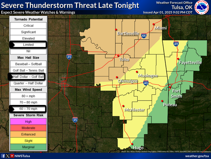
After a quiet and cool day today, a warmer and windier weather pattern will set up over the next couple of days. By Thursday, winds will gust between 40 and 50 mph across a good portion of E OK and NW AR from mid-morning thru the afternoon.
A more active weather pattern remains on track to develop across the Plains late next week, bringing multiple opportunities for strong to severe thunderstorms. Friday currently looks to be the start of the severe weather activity, with at least a 15 percent chance of severe weather across most of eastern Oklahoma and northwest and west central Arkansas. Monitor forecasts and start to think about your severe weather communications and sheltering plans.
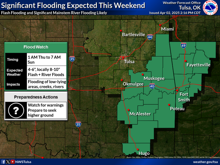
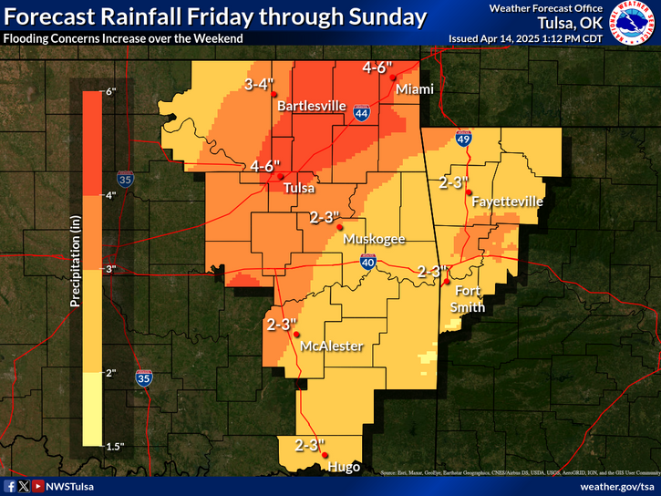
Widespread and repeated rounds of rainfall will lead to increasing flooding concerns Friday through Sunday. Monitor forecasts and don't drive through flooded roadways.
Latest Text Product Selector (Selected product opens in a new window)

Decision Support Winter Hazards Observations Climate Hydrology
 
 
Social Media Satellite Fire Weather Weather Radio Spotter Training Text Products
 
 
Models