Isolated severe thunderstorms with strong wind gusts and hail will be possible Tuesday from parts of central Plains northeastward into the Midwest. Additional storms capable of damaging winds will be possible across the eastern Florida peninsula. Elevated to critical fire weather including gusty winds and low relative humidity is forecast again Tuesday over much of the northern Great Plains. Read More >
July 6th Severe Storms Bring Heavy Flooding Rains, Damaging Winds and a Tornado
The information below can also be accessed at https://apps.dat.noaa.gov/StormDamage/DamageViewer/
 |
070615_EudoraClick here to download the KML file
|
|
|
|
The tornado initially touched down near the Wakarusa River a half mile north of Kansas Highway 10 and east of 2000 Rd where it produced minor tree damage, snapping large limbs. The tornado moved toward the east, intensifying to produce EF-1 damage in the neighborhood along N 1380 Rd where large trees were uprooted or snapped, and houses sustained damage to roofing materials. The tornado continued east into Eudora, producing consistent EF-0 damage through Main Street with small pockets of EF-1 damage primarily to large trees. As the tornado passed east of Main Street, it appeared to produce more persistent EF-1 damage primarily to trees, including substantial tree damage in the Eudora Cemetery along N 1420 Rd. The tornado continued to track east along N 1420 Rd where it had its greatest width of approximately 250 yards. The tornado appeared to reach maximum intensity near the intersection of N 1420 Rd and E 2300 Rd where a residence sustained roof damage, a utility pole was snapped, and there was significant tree damage. The path then continued to the east along Kansas Highway 10, with intermittent tree and highway sign damage before ending near the intersection of Evening Star Road and 103rd in Johnson County. |
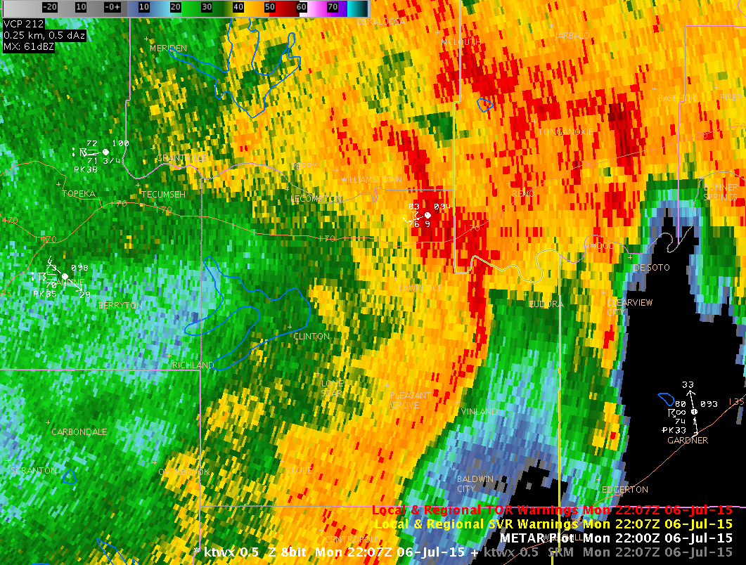
The image below shows what is called radar reflectivity. The shapes of the signatures tell us something about the processes that are occurring in these storms. In the case below we see a bow shape to the reflectivity that is indicative of strong and sometimes damaging winds. The bow was occurring just south of where a tornado occurred over Eudora.
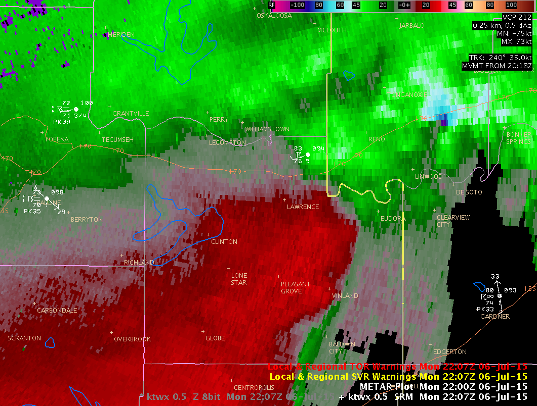
The animation below shows what is called storm relative velocity and it shows us the wind speed and direction within the thunderstorms. In many cases, tornadoes that form within lines of storms develop rapidly are small in size and don't last long. That was the case in Eudora where the tornado formed quickly on the west side of town and moved E into parts of Johnson County before dissipating. Look closely and you might catch the very small signature of the circulation the surrounds the tornado...but it is small and doesn't last long!
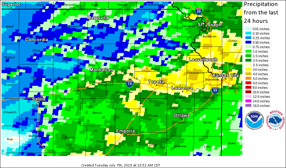
Finally the image below shows radar estimated storm totals for rainfall from the storms that occurred over the past 24 hours. The yellow areas indicate where the radar estimates at least 2.5 inches of rain. In some cases, the radar underestimated the rainfall totals from this event. Some areas including NWS Topeka at Billard airport received over 4 inches of rain in the past 24 hours.