
Severe thunderstorms are forecast through this weekend along a slow moving cold front and secondary storm system that will impact areas from the southern Plains to the Great Lakes. Large hail and isolated damaging wind gusts are the main threats with these storms along with a risk for heavy to excessive rainfall which could bring flooding. Read More >
Topeka, KS
Weather Forecast Office
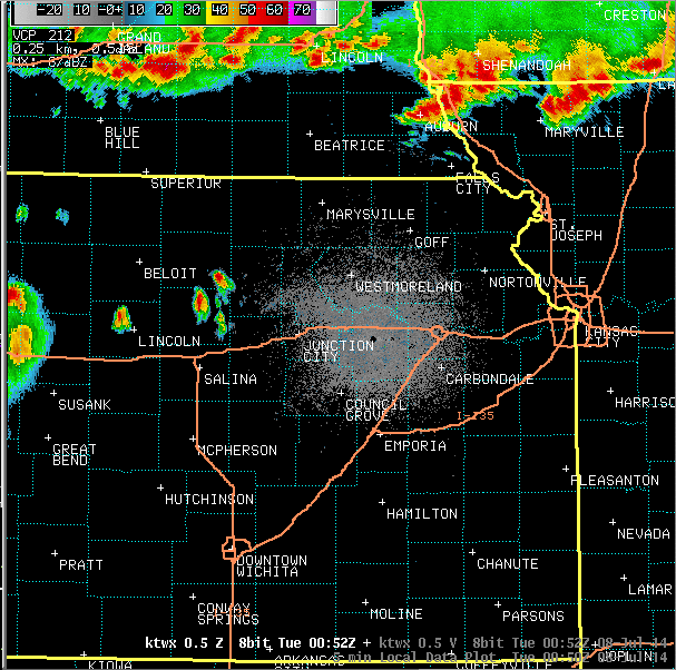
Radar imagery during the severe weather:
Map of severe weather reports - click for interactive view:

Images of wind damage:
In Fostoria, via Chris Trudo:

In Lyndon, via Douglas Watson:

Wakarusa Drive in Lawrence, via Arin Peters:

US Dept of Commerce
National Oceanic and Atmospheric Administration
National Weather Service
Topeka, KS
1116 NE Strait Avenue
Topeka, KS 66616-1667
785-234-2592
Comments? Questions? Please Contact Us.

