Heavy rainfall, thunderstorms, and gusty winds are expected across the Central Plains into the Mid Missouri Valley. Widespread precipitation and heavy mountain snow will continue across the Northwest. Severe thunderstorms are expected this afternoon and evening from parts of east Texas into Louisiana. Heavy rainfall is likely tonight across eastern Louisiana and southern Mississippi. Read More >

|
Overview
|
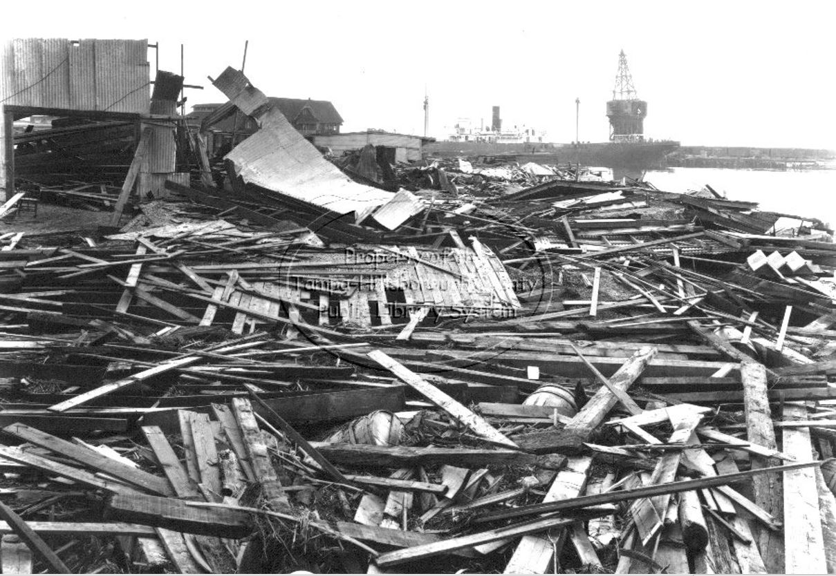
On October 25, 1921, the Tampa Bay Area suffered the most destructive hurricane to hit the area since 1848. A storm surge of up to 11 feet damaged and destroyed a significant amount of the structures along coastal locations from Pasco county south through southwest Florida. The highest storm surge inundated areas in downtown Tampa and Tarpon Springs. Many vessels, like the steamer “Favorite”, and the “Thomas B. Garland” were smashed against the docks by the waves. Other ships became unmoored and smashed into the docks and seawalls, causing additional destruction, or sank. Still other vessels moved inland with the surge and became beached as the water receded. Waves from the Bay were almost breaking in the streets of Ybor City. Numerous structures near the coast sustained heavy damage from being washed out by the storm surge. Structures further inland had to endure the powerful winds that also accompanied the storm. Winds were estimated at 120 mph near the landfall point in Tarpon Springs. The Tampa Weather Office at the time reported a peak wind of 75 mph with the storm. Numerous power poles and trees were downed from the winds, roofs were badly damaged, and windows were blown out of structures. |
1921 Tampa/Tarpon Springs Hurricane: Videos
1921 Tampa/Tarpon Springs Hurricane: Damage Photos
| Click on images to magnify and then click again to resize back to original | ||
Palmetto Waterfront 
|
St. Pete Yacht Club 
|
Parker St. Tampa 
|
Ybor Channel 
|
Yacht Basin 
|
Docks Destroyed 
|
Cortez Public School 
|
Albion Inn in Cortez 
|
Cortez Docks 
|
Cortez Docks 
|
Cortez Docks 
|
Cortez Boathouse 
|
St. Petersburg 
|
St. Petersburg 
|
St. Petersburg 
|
St. Petersburg Pier 
|
Pass-a-Grille 
|
Pass-a-Grille 
|
Palmetto Beach 
|
Palmetto Beach 
|
Palmetto Beach 
|
Tampa's Bayshore Blvd 
|
Tampa's Bayshore Blvd 
|
Tampa's Bayshore Blvd 
|
Tampa 
|
Tampa 
|
Tampa 
|
Tampa 
|
Tampa 
|
Tampa 
|
Ybor City 
|
Ybor City 
|
Stranded Vessel 
|
1921 Tampa/Tarpon Springs Hurricane: Surface Charts
1921 Tampa/Tarpon Springs Hurricane: Storm Statistics
| Category | Value |
|---|---|
| Storm Dates | October 20-30, 1921 |
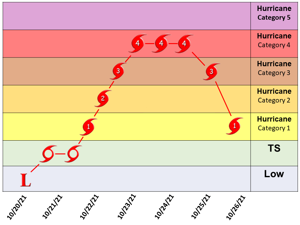
| Peak Winds | 140 mph (Category 4) |
| Death Toll / Fatalities | ~ 8 |
| Minimum Central Pressure | 941 mb (27.79 inches) |
| Landfall Winds (Florida) | 120 mph (Category 3) |
| Maximum Winds in Tampa | 75 mph |
| Landfall Pressure (Tarpon Springs, FL) | 952.25 mb (28.12 inches) |
| Maximum Storm Surge (Tampa Bay) | ~ 10.5 feet |
| Maximum Rainfall (St. Leo) / Tampa Weather Bureau | 11.73 inches / 8.53 inches |
1921 Tampa/Tarpon Springs Hurricane: Interactive Track (Mouseover icons on map for more info)
 |
1921 Tampa/Tarpon Springs Hurricane: Then & Now
Click and slide the blue slider button to compare Then and Now photos


1921 Tampa/Tarpon Springs Hurricane: Model Simulations
|
In anticipation of the 100th anniversary of the 1921 Tarpon Springs/Tampa Bay Hurricane, the National Weather Service in Ruskin, FL embarked on a project, in which an attempt was made to simulate this long ago hurricane utilizing the state-of-the-art Weather Research and Forecasting (WRF) Model. Until recently, the earliest reanalyses datasets in which to initialize these research models began with the year 1948, leaving out many important 20th century events, such as the 1921 Hurricane and the 1930’s Dust Bowl. The NOAA-CIRES-DOE Twentieth Century Reanalysis (20CR) project was designed to generate four-dimensional global atmospheric datasets of weather spanning 1836 to 2015, in order to place current atmospheric circulation patterns into a historical perspective. More information on these datasets can be found at https://psl.noaa.gov/data/20thC_Rean/. In this simulation, the Advanced Research WRF (ARW) was initialized from the 20CR datasets at a 12km horizontal resolution and 60 vertical levels beginning at 1200UTC on October 21, 1921. The model was allowed to run forward in time over a domain covering much of the Caribbean, Gulf of Mexico, Continental United States, and Western Atlantic Ocean for a total forecast period of 120 hours. Boundary conditions to the model domain were obtained from 6-hourly 20CR reanalysis datasets corresponding to the hour of the simulation. |
IR Satellite - Color Enhanced
|
|
The results of select variables/graphics from this simulation are presented below. The simulation of a weather pattern from 100 years ago using today's technology produced a hurricane, that moved along a generally similar path out of the northwest Caribbean Sea, and made landfall on the correct date at the correct location, near Tarpon Springs Florida. Other features of the 1921 hurricane that were reported to be fact also appear to have been well forecast by the model, including the large areal size of the cyclone, and a large swath of preceding rainfall to the northeast of the hurricane, that soaked much of the Florida peninsula as much as 24 hours ahead of the main cyclone impacts. |
|
Scroll slider bars to animate images
1921 Tampa/Tarpon Springs Hurricane: Other Links