Tampa Bay Area, FL
Weather Forecast Office
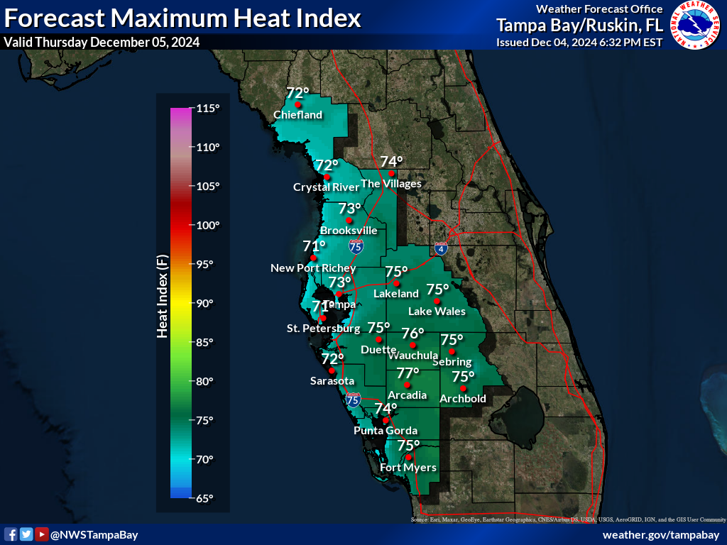
| Forecast Maximum Heat Index for Day 1 | ||
 |
||
| Heat Related Watch/Warning/Advisory Criteria |
The National Weather Service in Tampa Bay issues heat related Watch, Warning, and Advisory statements when the following criteria are forecast:
|
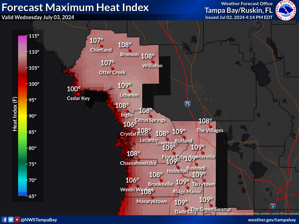
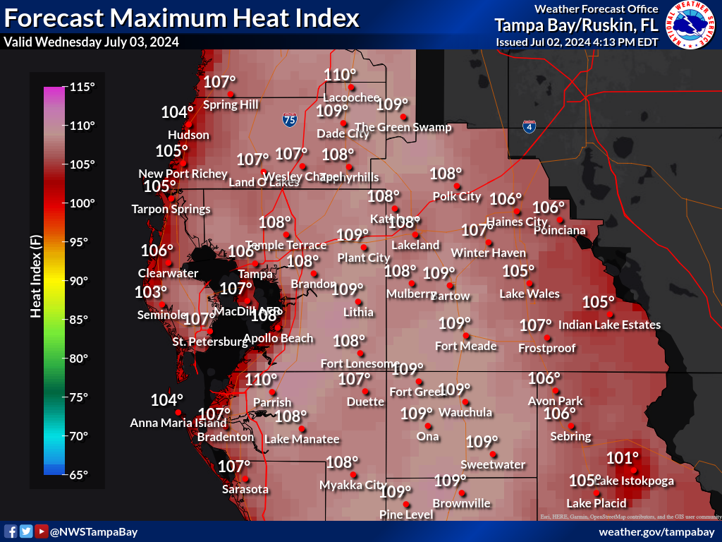
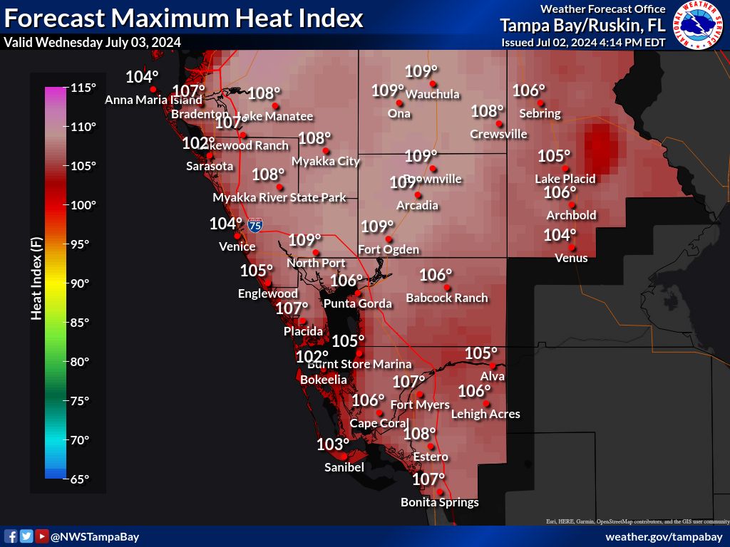
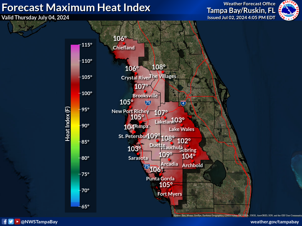
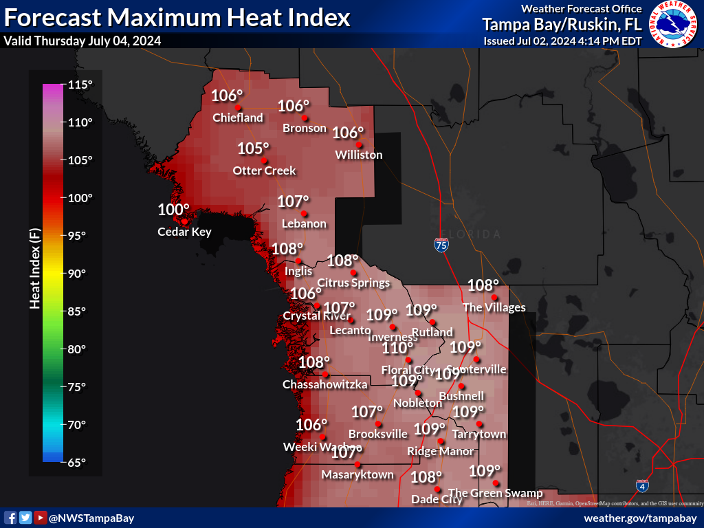
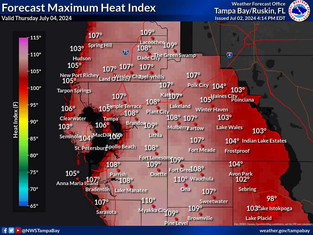
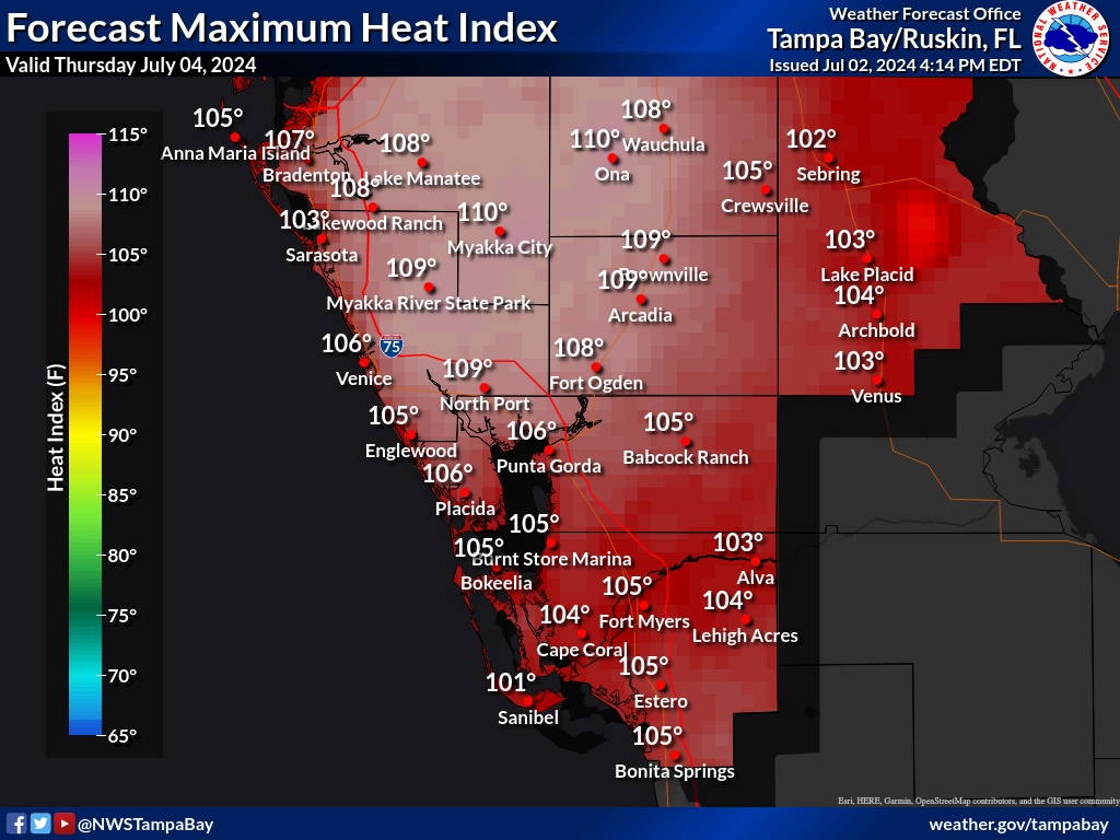
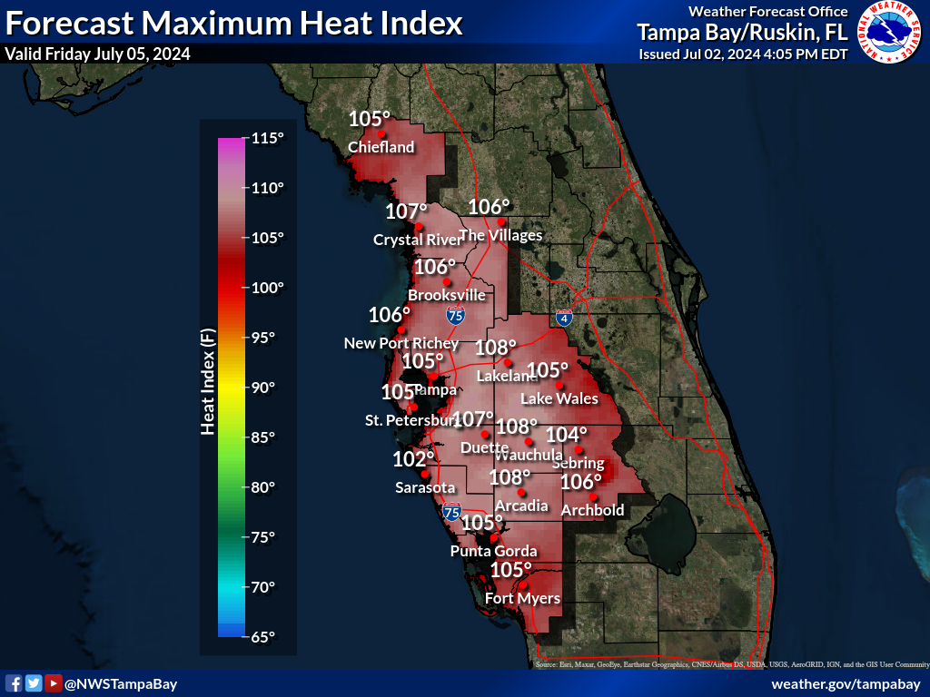
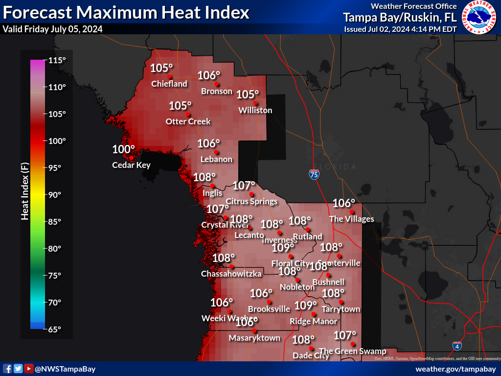
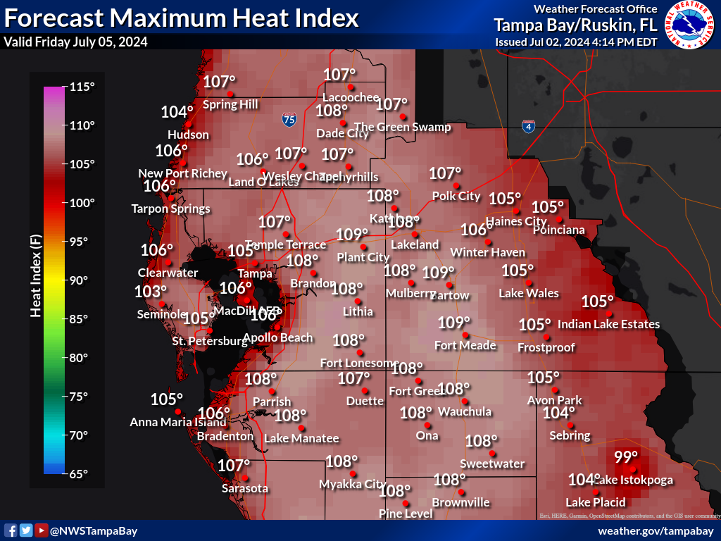
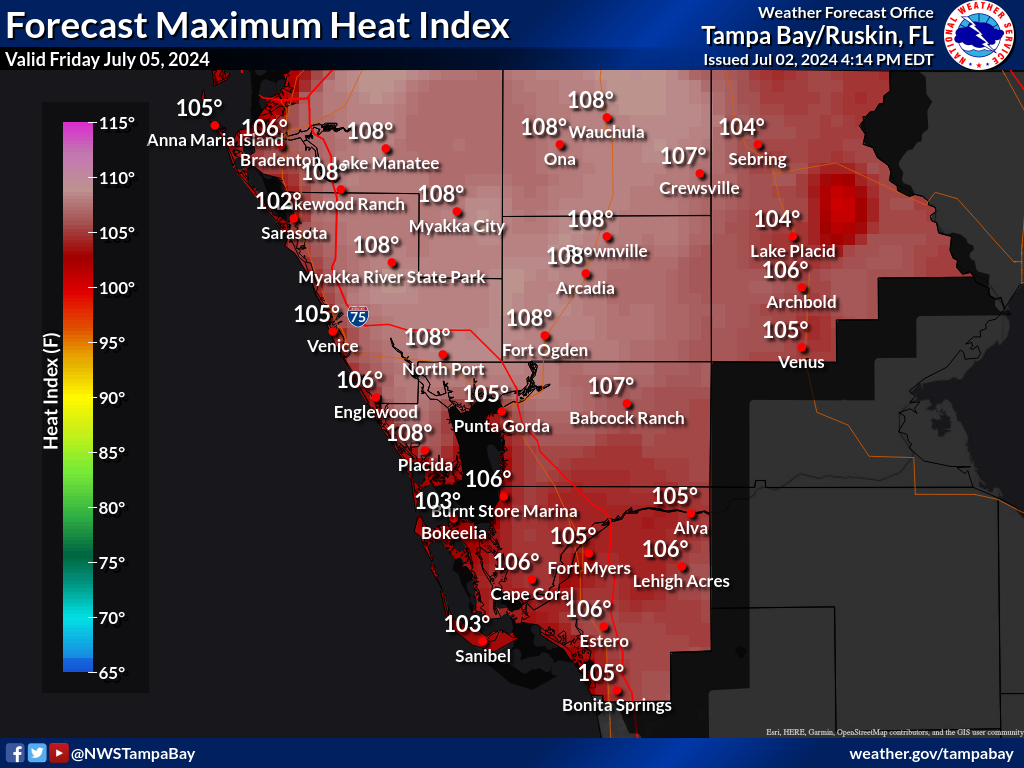
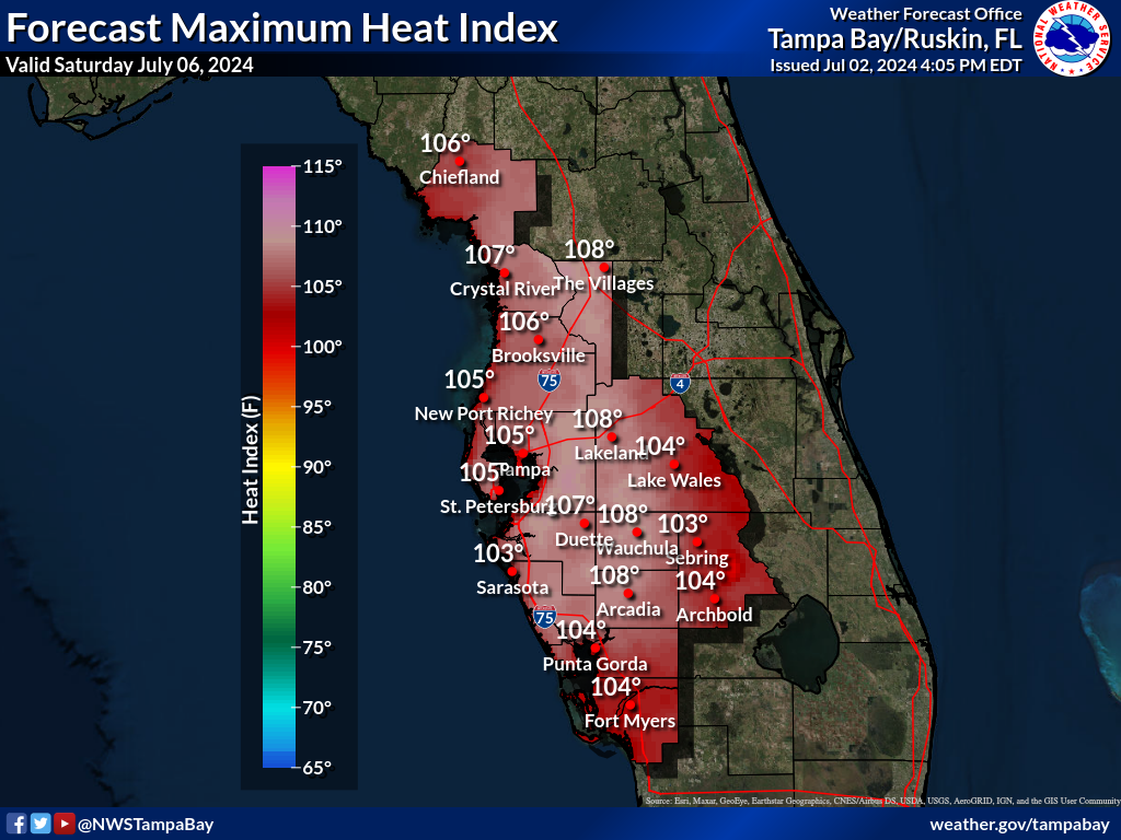
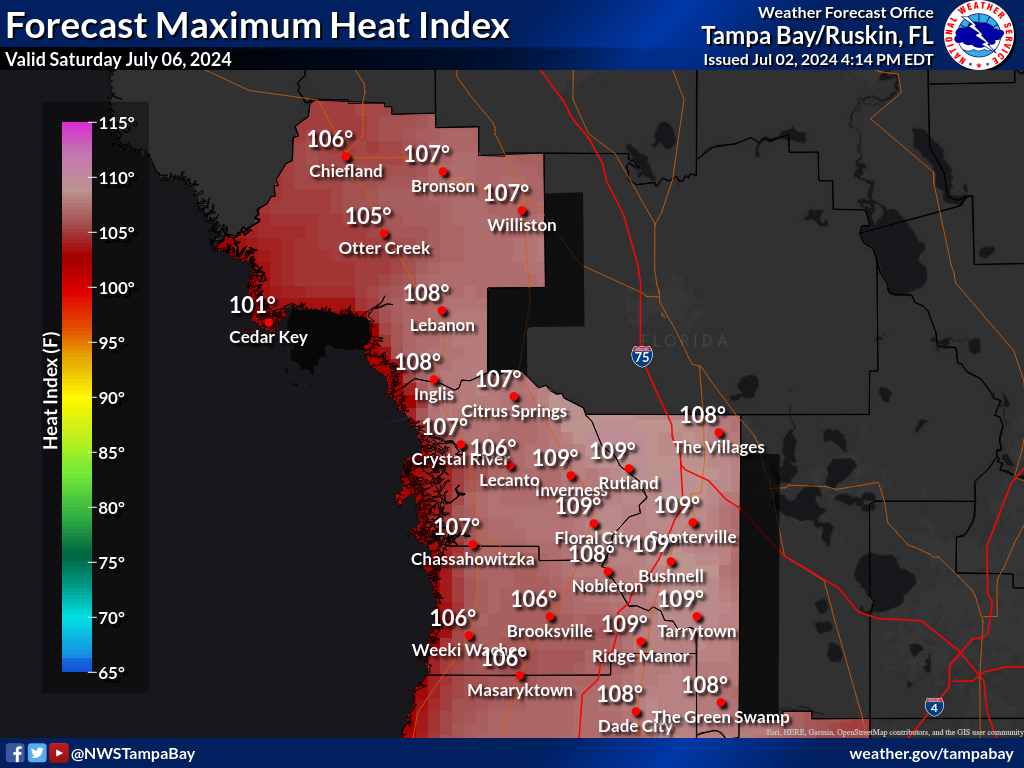
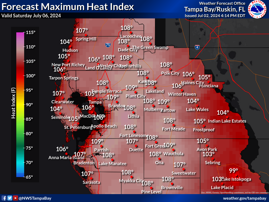
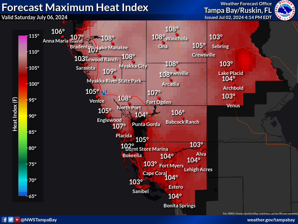
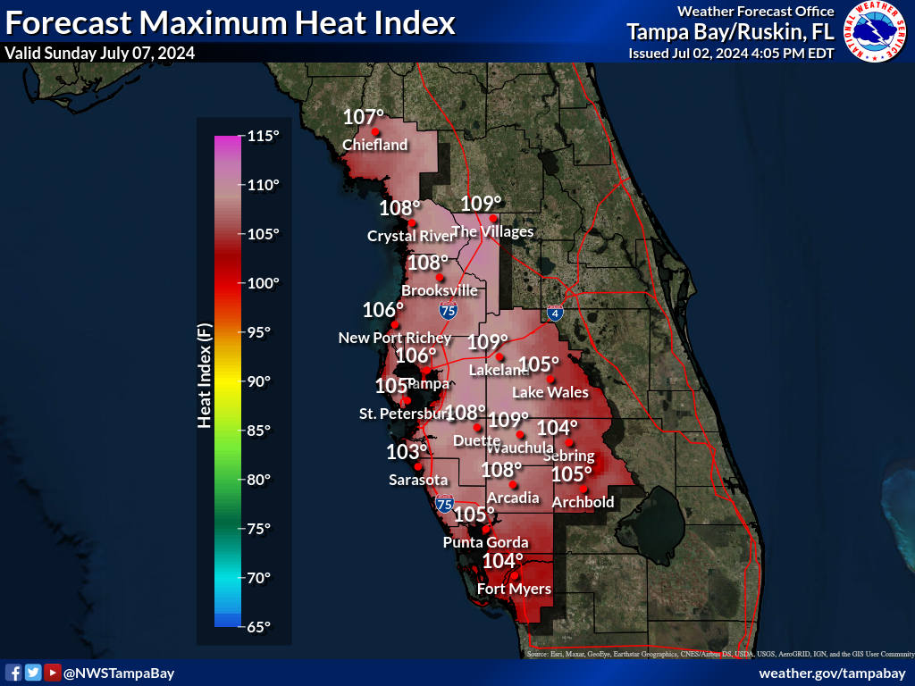
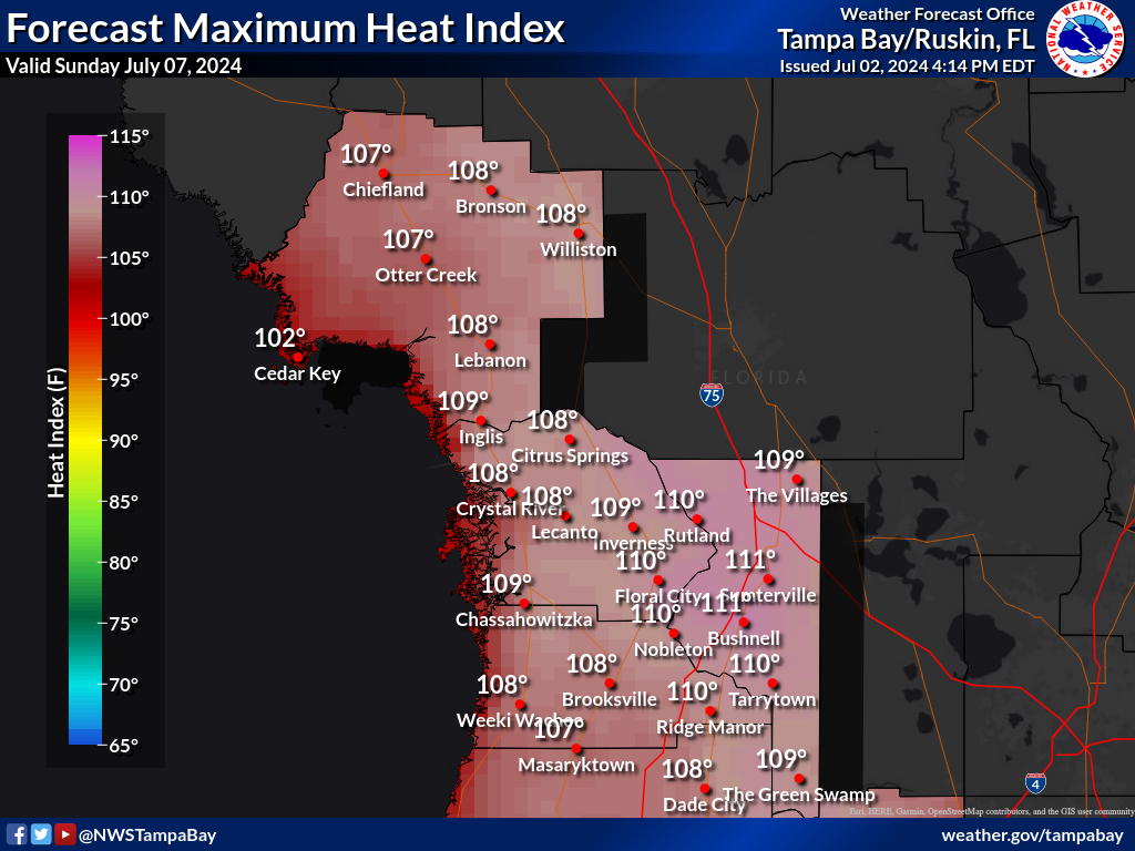
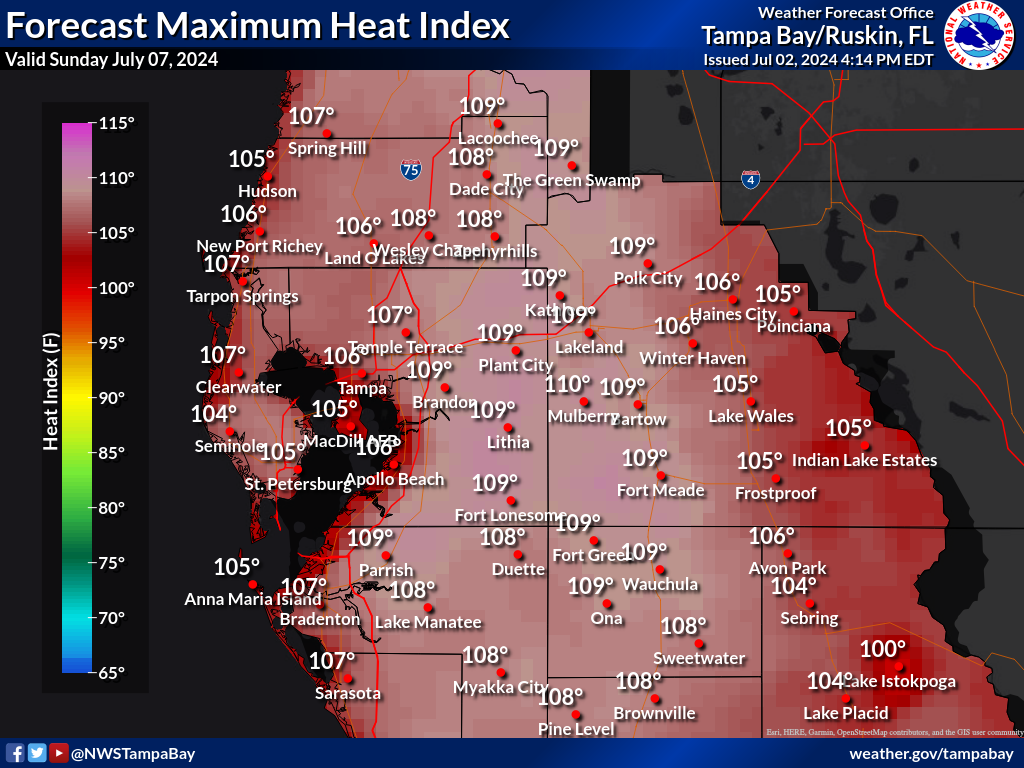
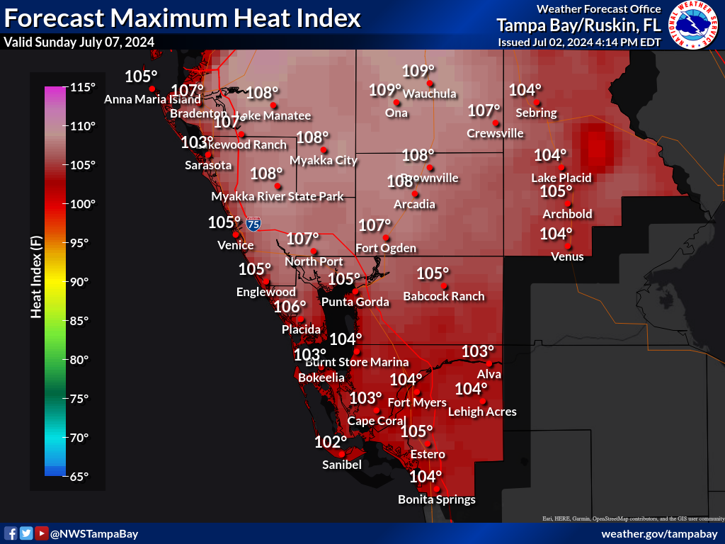
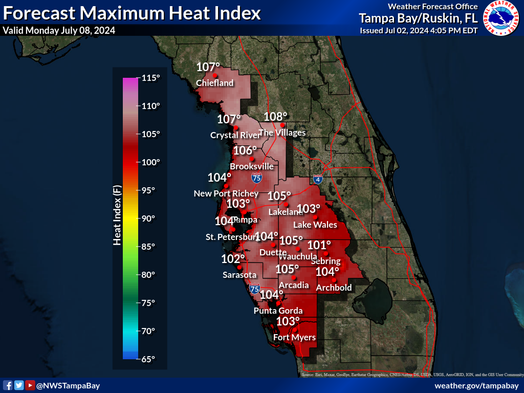
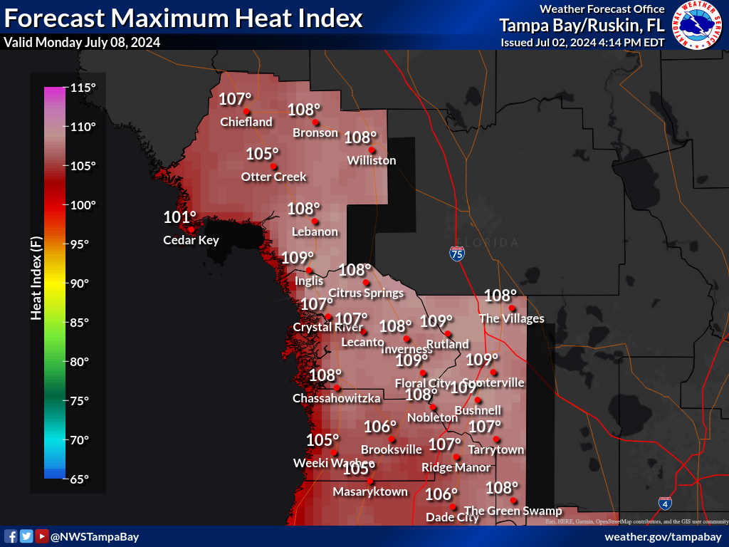
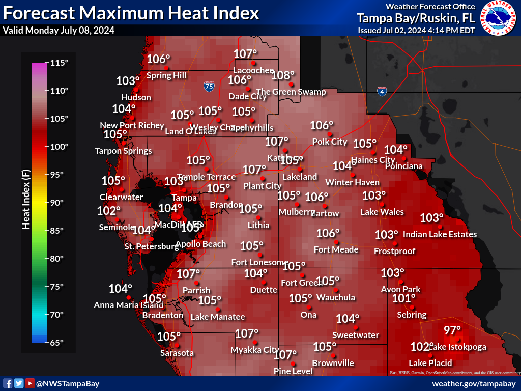
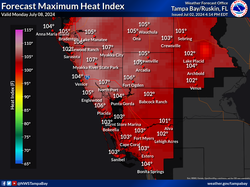
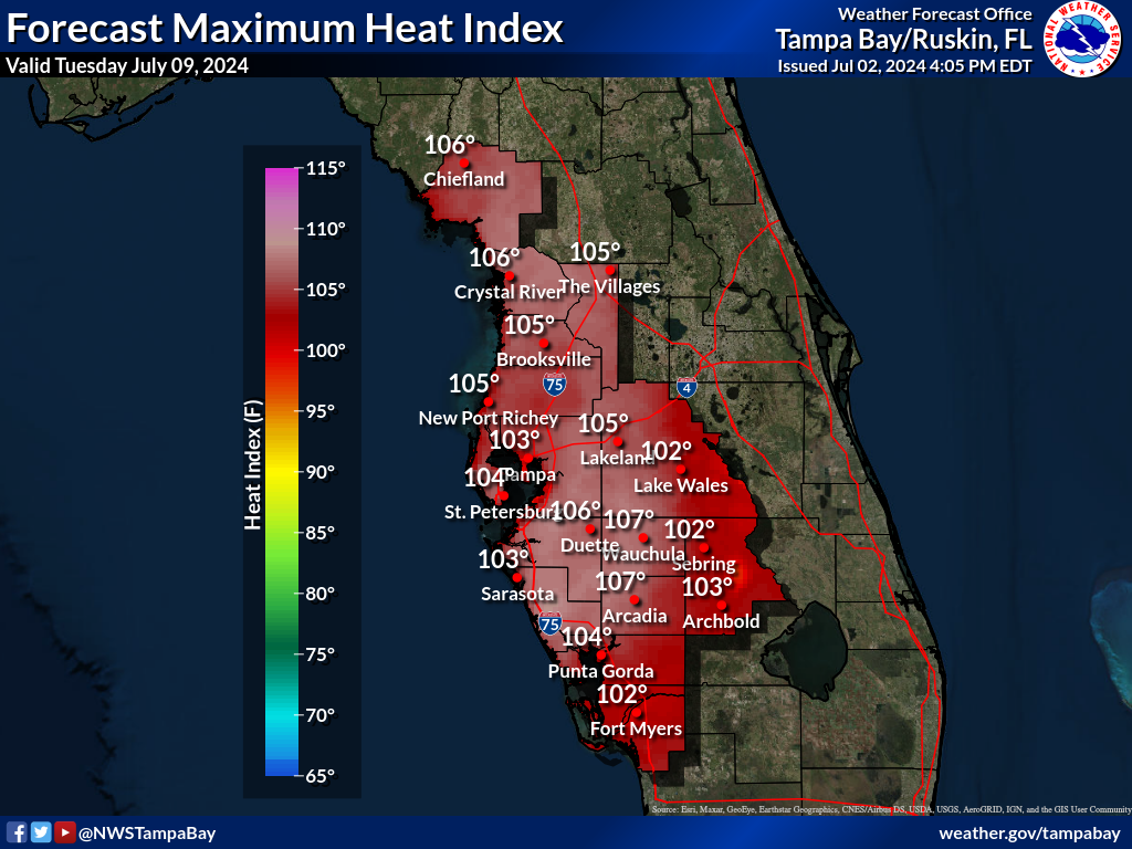
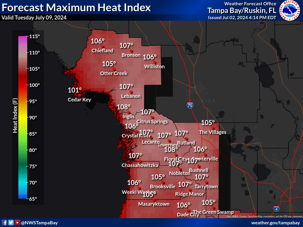
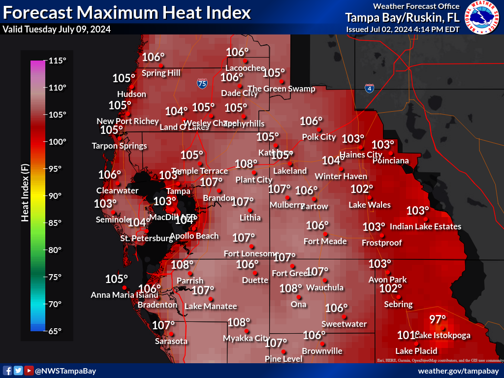
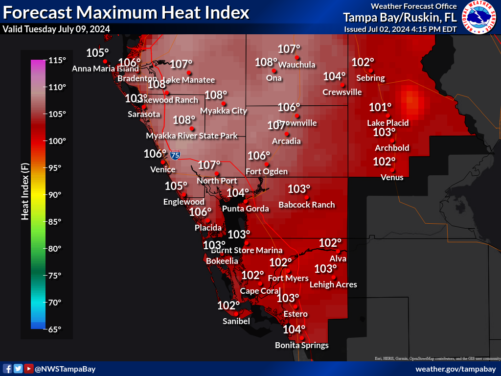
| The images below are the official NWS heat index forecast in degrees Fahrenheit for the next 7 days. These heat indices are determined by NWS forecasters to be the most likely outcome based on evaluation of data from computer models, satellite, radar, and other observations. |
| These graphics are updated at least twice per day, around 4:15 AM/4:15 PM. They can be magnified (enlarged) by left clicking on them, and resized back to original size with a second click. |
TBW CWA |
Nature Coast |
West Central |
Southwest |
|
Day 1 |
 |
 |
 |
 |
Day 2 |
 |
 |
 |
 |
Day 3 |
 |
 |
 |
 |
Day 4 |
 |
 |
 |
 |
Day 5 |
 |
 |
 |
 |
Day 6 |
 |
 |
 |
 |
Day 7 |
 |
 |
 |
 |
Other graphics like these, including forecast High Temperature, Low Temperature, and Rainfall are available within our Probabilistic DSS web page. |
||||
Current Hazards
Outlooks
Graphical Hazards
Submit a Storm Report
Local Storm Report Map
Radar Imagery
Local KTBW Radar
Regional Radar
KTBW Radar Status
Current Conditions
Surface Observation Map
Satellite
Observed Precipitation
Local Beaches
Local Observations
Past Weather
Tropical Cyclone Reports
Weather Events
Weather History
Forecasts
Activity Planner
Aviation
Beach
Fire
Forecaster's Discussion
Graphical
Hydrology
Marine
Tropical
Probabilistic DSS
Climate
National
Local
Records and Normals
1991-2020 Climate Normals
Local Drought/Rainfall
Thunderstorm Climatology
El Niño Southern Oscillation
Arctic Oscillation
Climate Summaries
US Dept of Commerce
National Oceanic and Atmospheric Administration
National Weather Service
Tampa Bay Area, FL
2525 14th Ave. SE
Ruskin, FL 33570
(813) 645-2323
Comments? Questions? Please Contact Us.

