National Weather Service United States Department of Commerce
Click a location below for detailed forecast.

Last Map Update: Fri, Feb 7, 2025 at 7:08:12 pm PST

Additional rainfall for southern California from 10 AM this morning through this evening of less than one-tenth inch for the lower elevations to one-quarter inch on the coastal slopes of the mountains.
Areas of southwest to west winds will continue for the mountains and deserts through this evening with the stronger gusts to 45 to 55 mph.
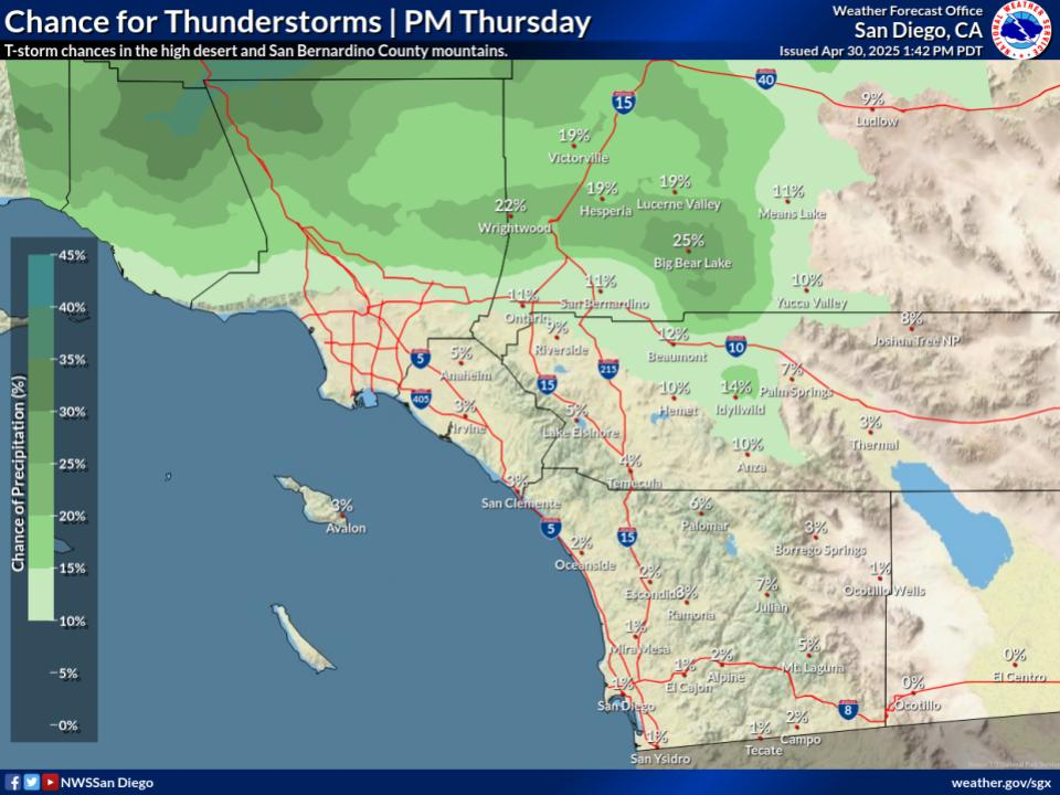
Slightly below average for the coasts/valleys and slightly above average for the deserts. For the coastal areas: 60 to 65, western valleys and inland Orange County: 63 to 67, inland valleys: 62 to 67, mountains between 4000 ft and 7000 ft: 50 to 62, high desert: 59 to 64, low desert: 74 to 78.
Near to slightly above average temperatures. For the coastal areas: 62 to 67, western valleys and inland Orange County: 65 to 70, inland valleys: 65 to 71, mountains between 4000 ft and 7000 ft: 51 to 61, high desert: 60 to 63, low desert: 73 to 77.
Another system will likely bring widespread rain and mountain snow to Southern California late next week. Stay tuned for more details as the storm gets closer.


Text Product Selector (Selected product opens in current window)