Overview
|
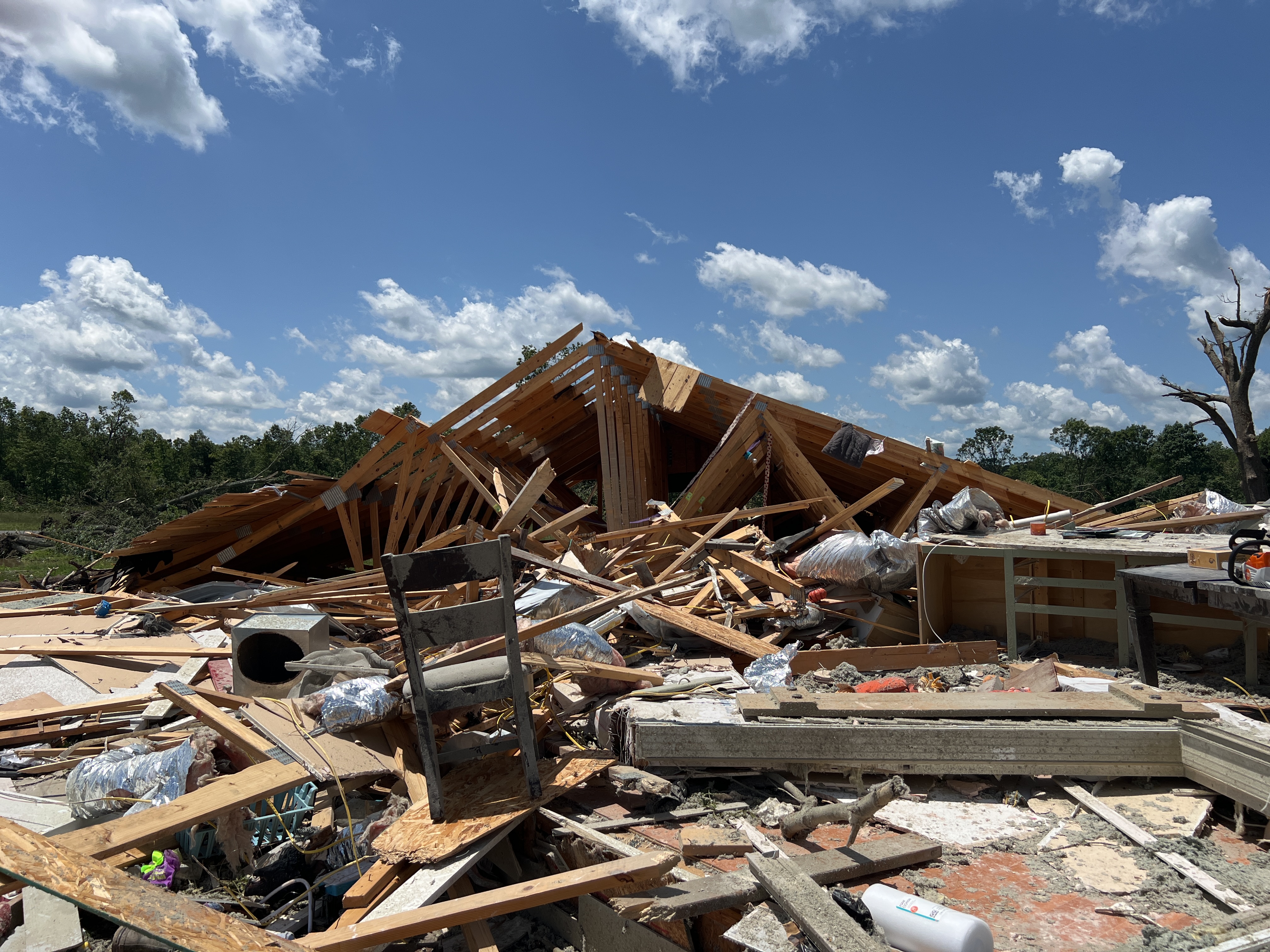
Two rounds of severe thunderstorms impacted southeast Kansas and the Missouri Ozarks on Sunday, May 26th, 2024. The first round occurred late Saturday night of May 25th into early Sunday morning May 26th. This cluster of thunderstorms produced wind gusts of 70 to 80 mph over far southwest Missouri in addition to four tornadoes (4 EF-0 and 1 EF-1). Additional severe thunderstorms moved through the area Sunday afternoon and evening. This round of severe thunderstorms produced tornadic supercells that resulted in multiple tornadoes and large hail swaths across the area. Five tornadoes have been surveyed from Sunday afternoon into the evening (2 EF-0, 1 EF-1, 1 EF-2, 1 EF-3). Large hail sizes included reports of baseball (2.75 inches) and softball (4.00 inches) sized hail. Lastly, localized flash flooding occurred on both Saturday night and Sunday. Rapid rises along numerous waterways resulted in some evacuations.
|
Tornadoes
|
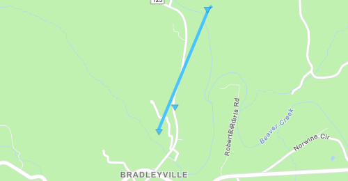
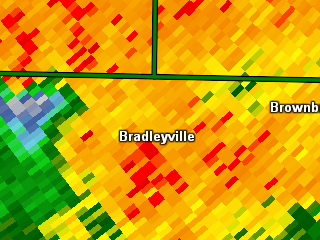
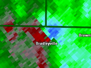
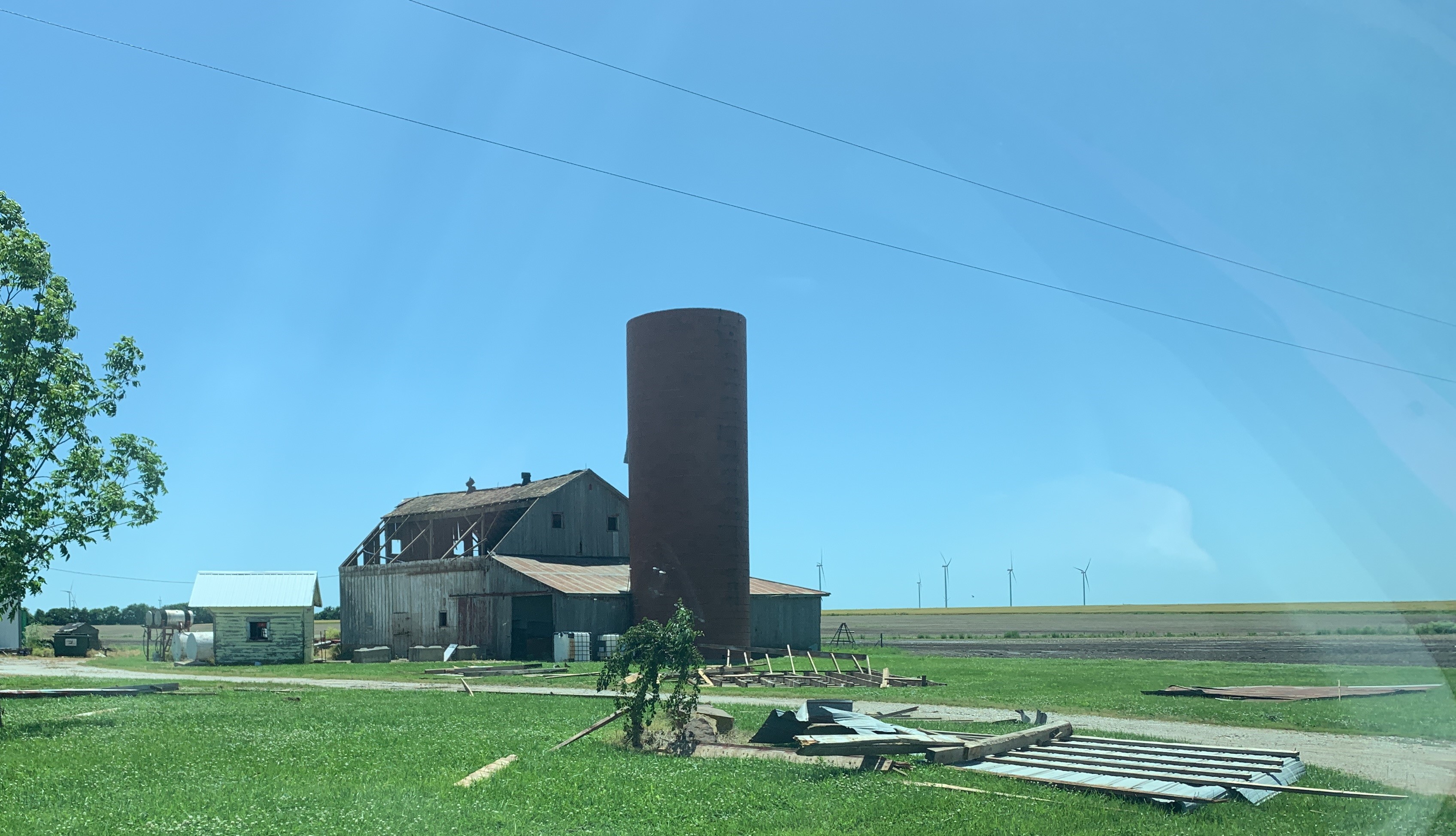
Tornado - Bradleyville, MO
|
||||||||||||||||
|
||||||||||||||||
|
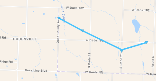
Tornado -1 NE Dudenville, MO
|
||||||||||||||||
|
||||||||||||||||
|
Tornado - 6 N Mansfield, MO
|
||||||||||||||||
|
||||||||||||||||
|
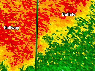
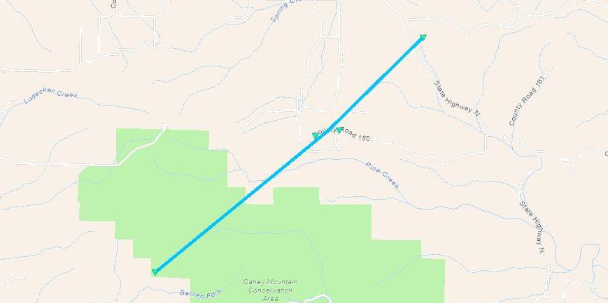
Tornado - 5 SW Buffalo, MO
|
||||||||||||||||
|
||||||||||||||||
|
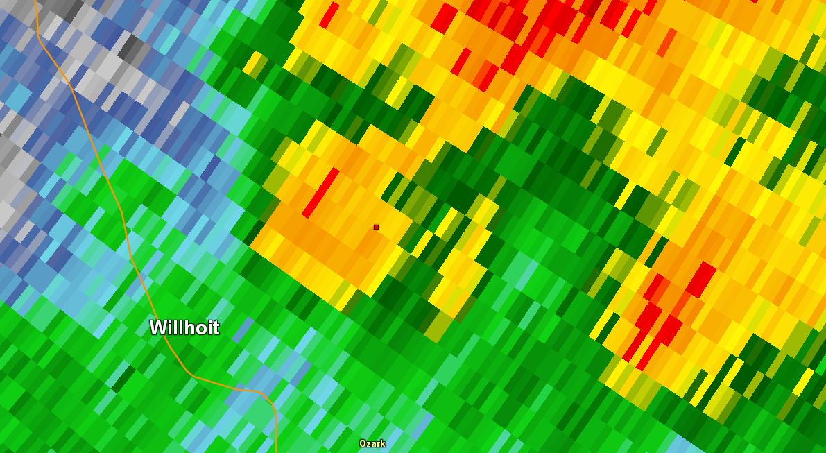
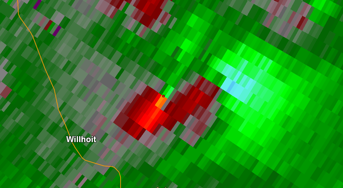
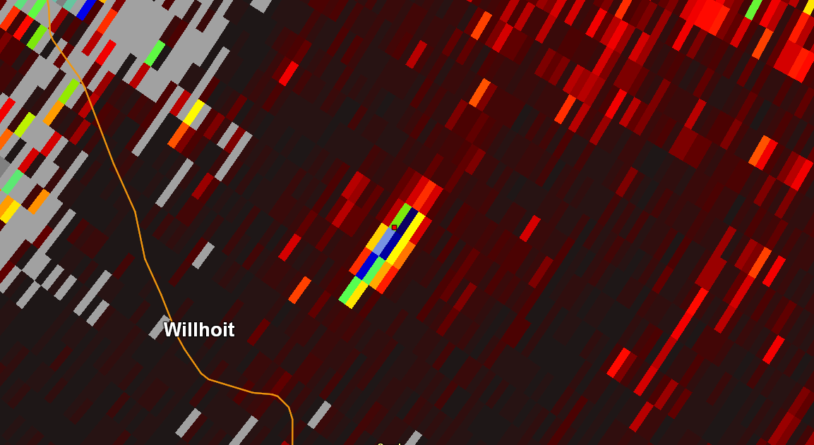
Tornado - 3 ENE Willhoit, MO
|
||||||||||||||||
|
||||||||||||||||
|
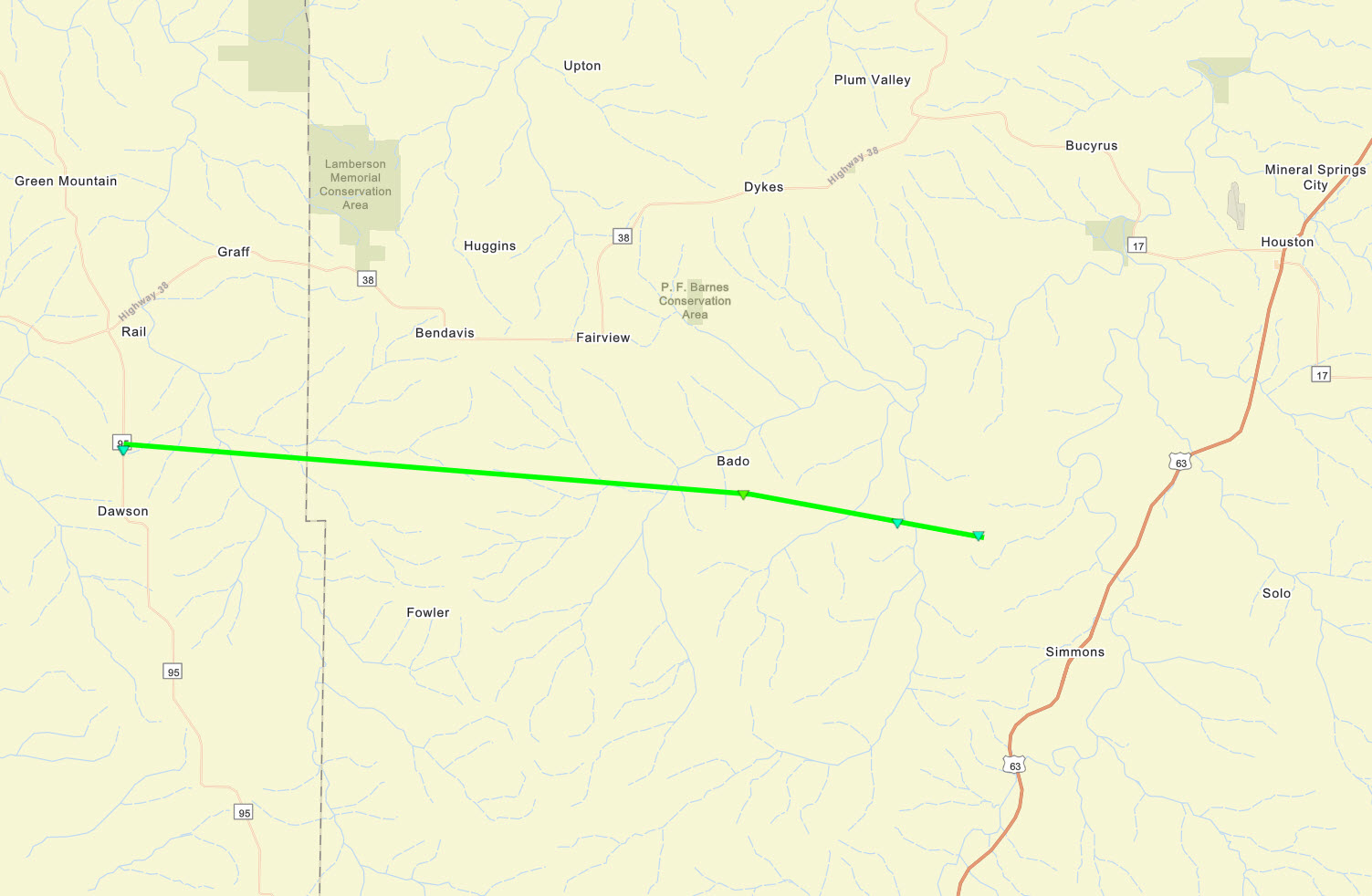
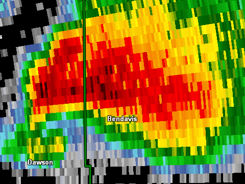
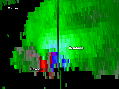
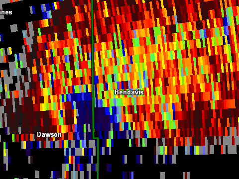
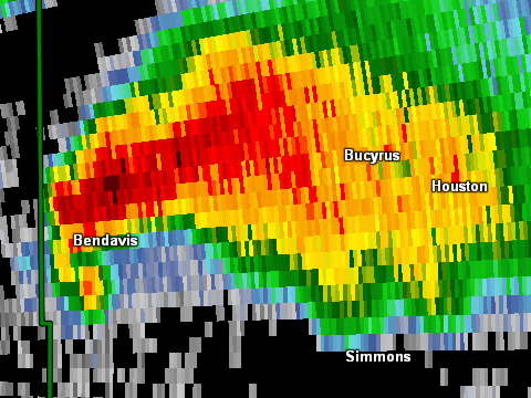
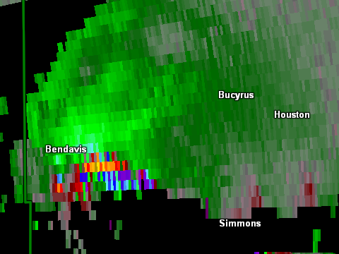
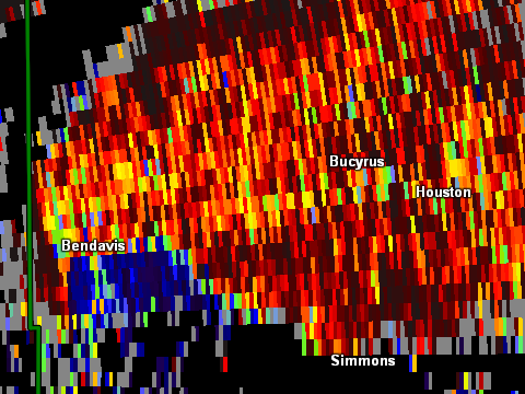
Tornado - 1 N Dawson - 7 SW Houston, MO
|
||||||||||||||||
|
||||||||||||||||
|
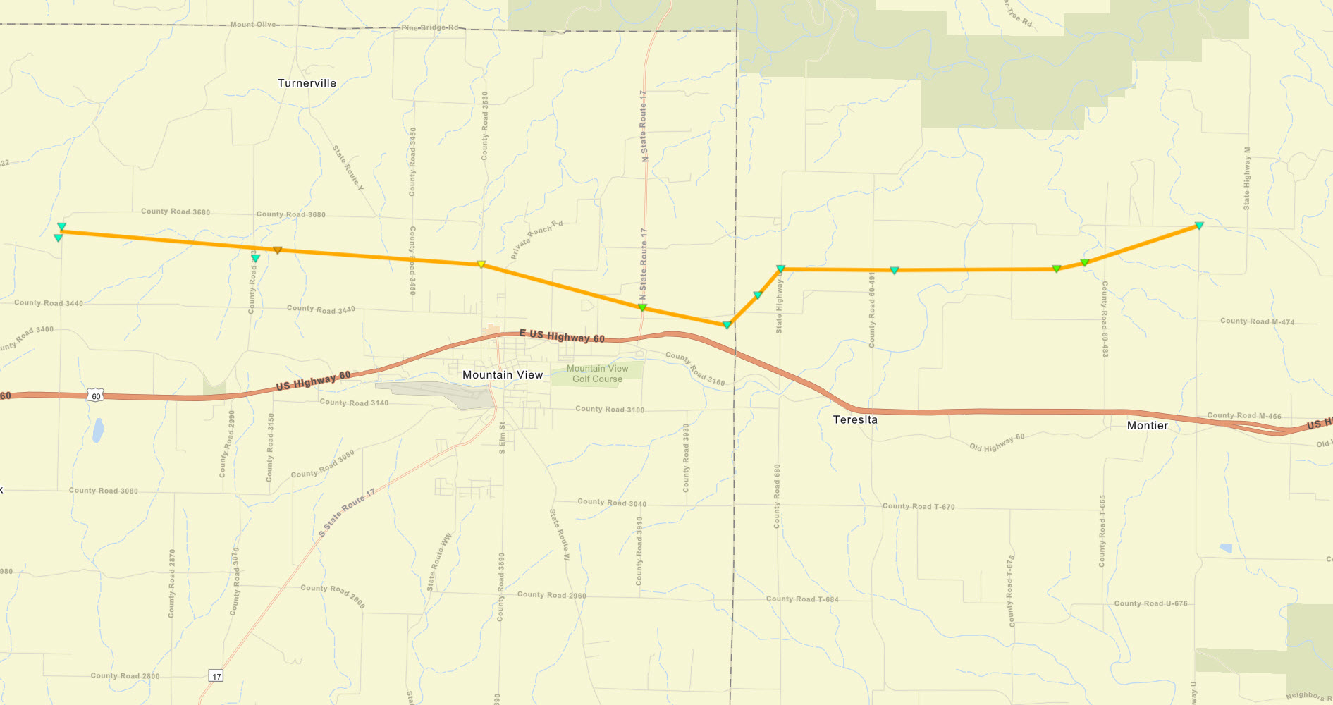
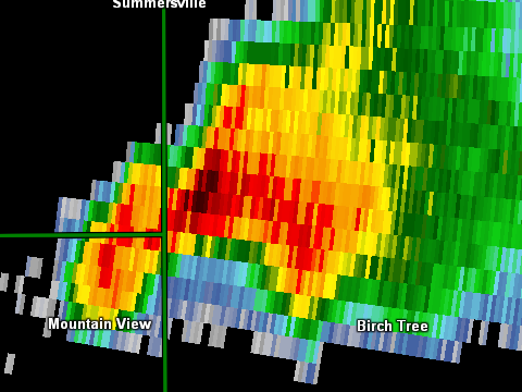
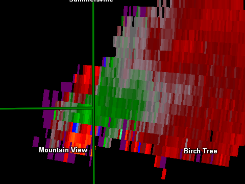
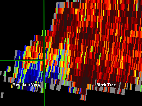
Tornado - 5 WNW Mountain View, MO
|
||||||||||||||||
|
||||||||||||||||
|
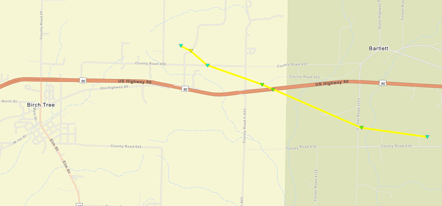
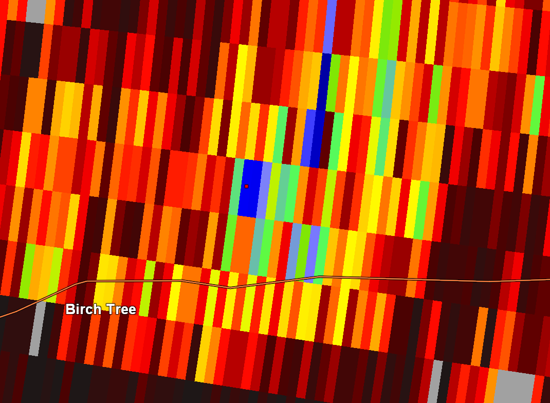
Tornado - 2 ENE Birch Tree, MO
|
||||||||||||||||
|
||||||||||||||||
|
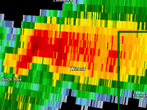
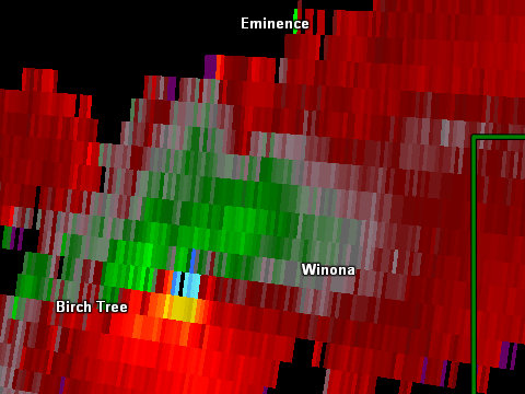
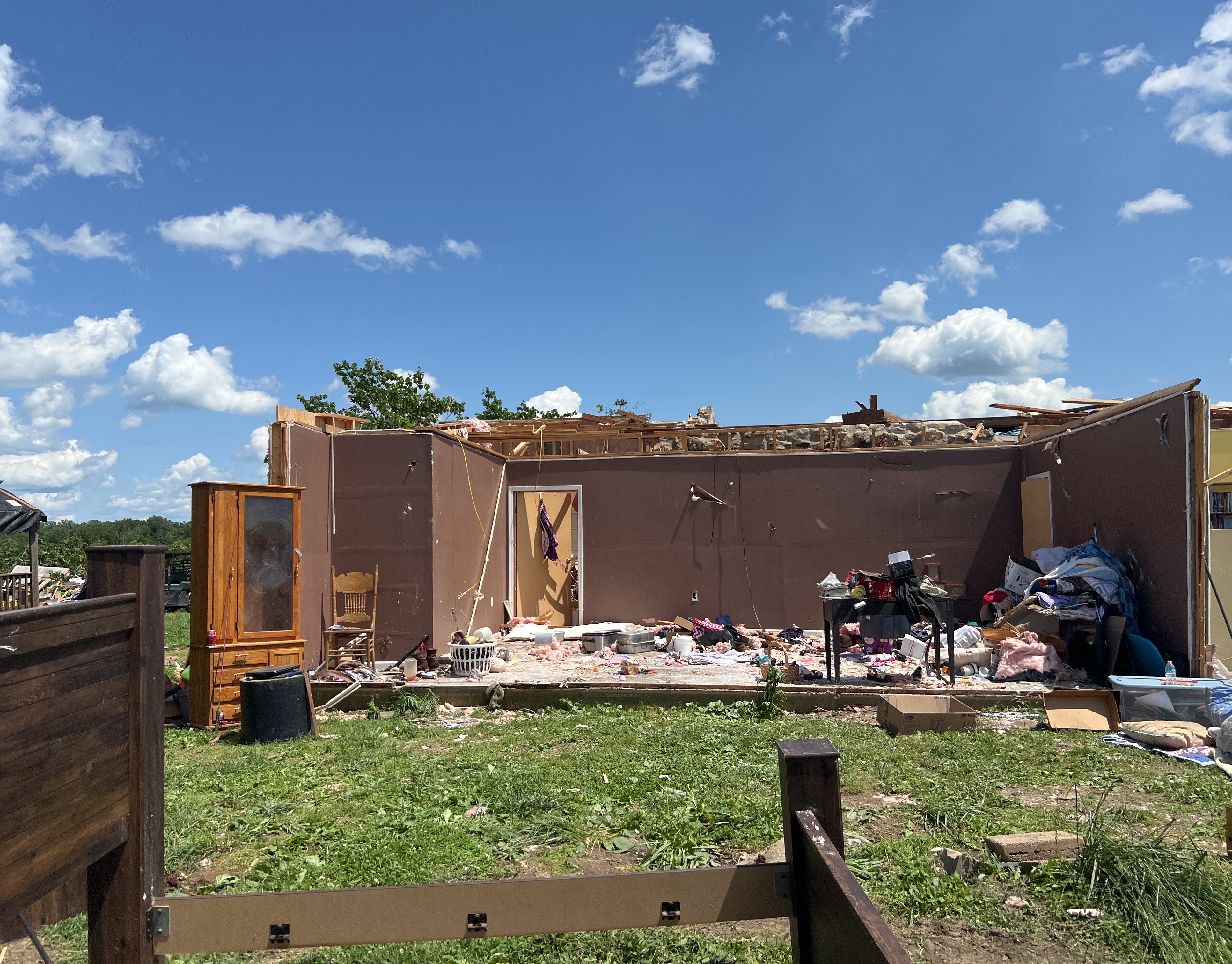
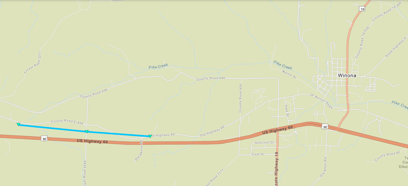
Tornado - 4 WSW Winona, MO
|
||||||||||||||||
|
||||||||||||||||
|
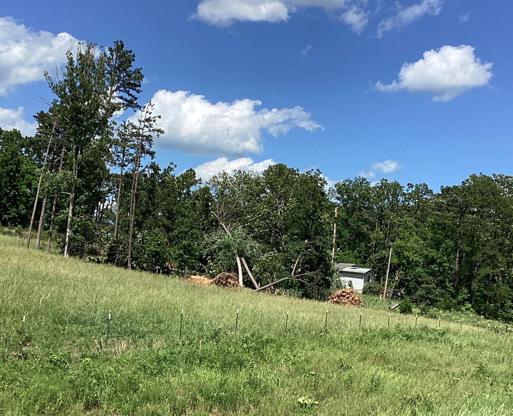
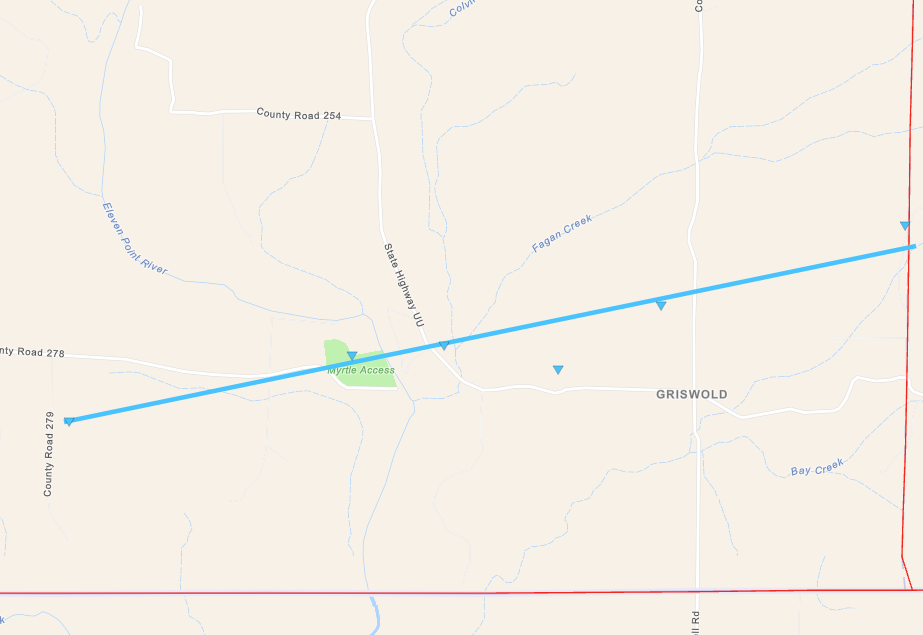
Tornado - 3 E Myrtle, MO
|
||||||||||||||||
|
||||||||||||||||
|
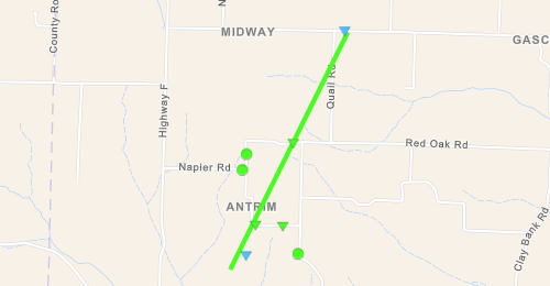
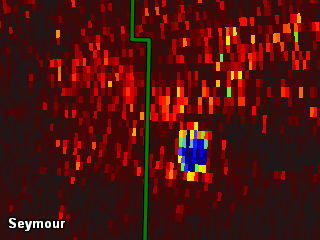
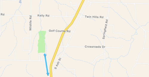
Tornado - LOCATION
Track Map 
Downloadable KMZ File |
||||||||||||||||
|
||||||||||||||||
The Enhanced Fujita (EF) Scale classifies tornadoes into the following categories:
| EF0 Weak 65-85 mph |
EF1 Moderate 86-110 mph |
EF2 Significant 111-135 mph |
EF3 Severe 136-165 mph |
EF4 Extreme 166-200 mph |
EF5 Catastrophic 200+ mph |
 |
|||||
Wind & Hail:
In addition to tornadoes, the severe thunderstorms produced wind gusts up to 60 to 80 mph and hail up to the size of baseballs (2.75 inches) and softballs (4.00 inches).
Wind
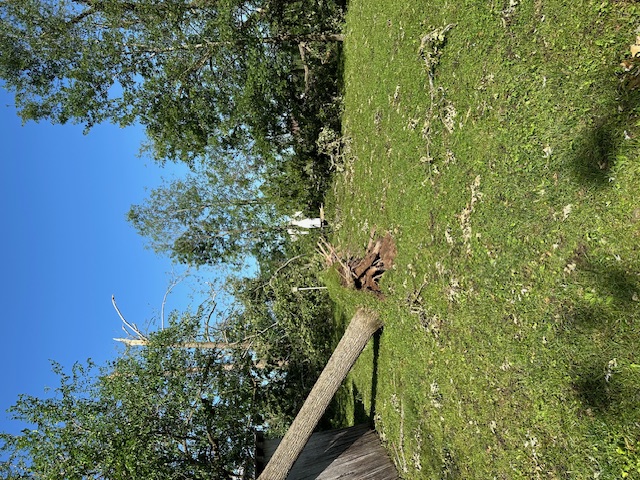
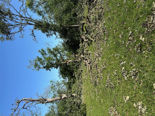
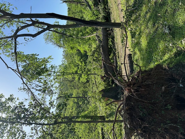
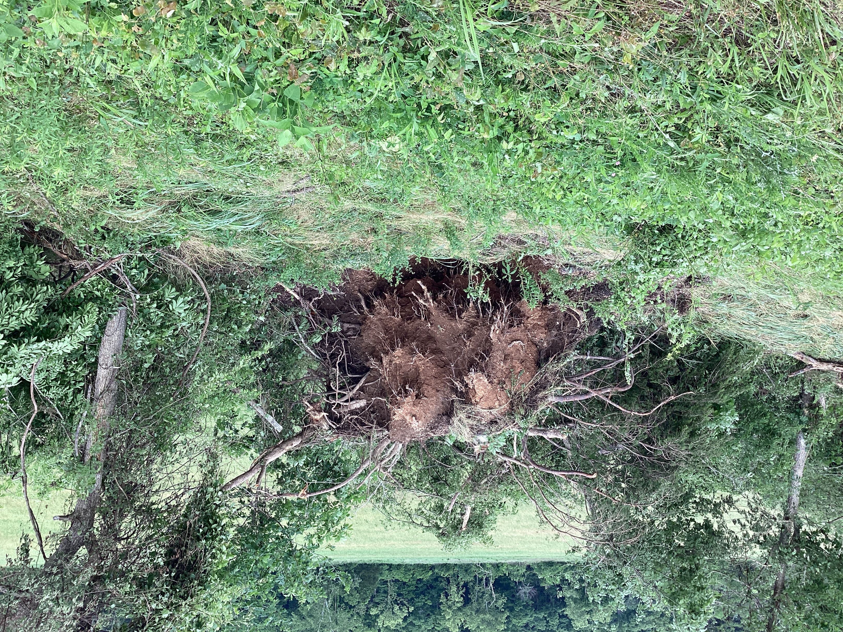
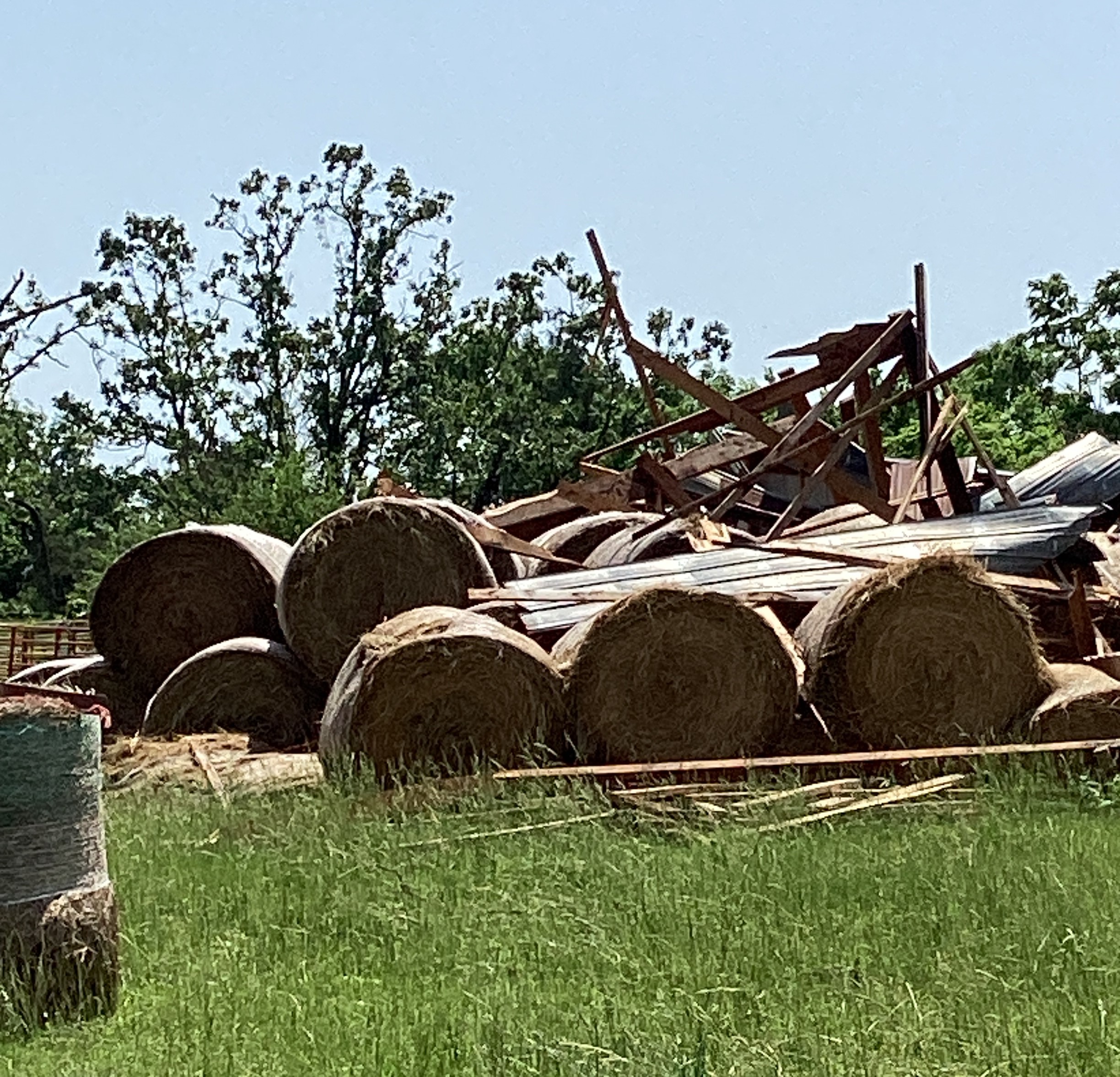
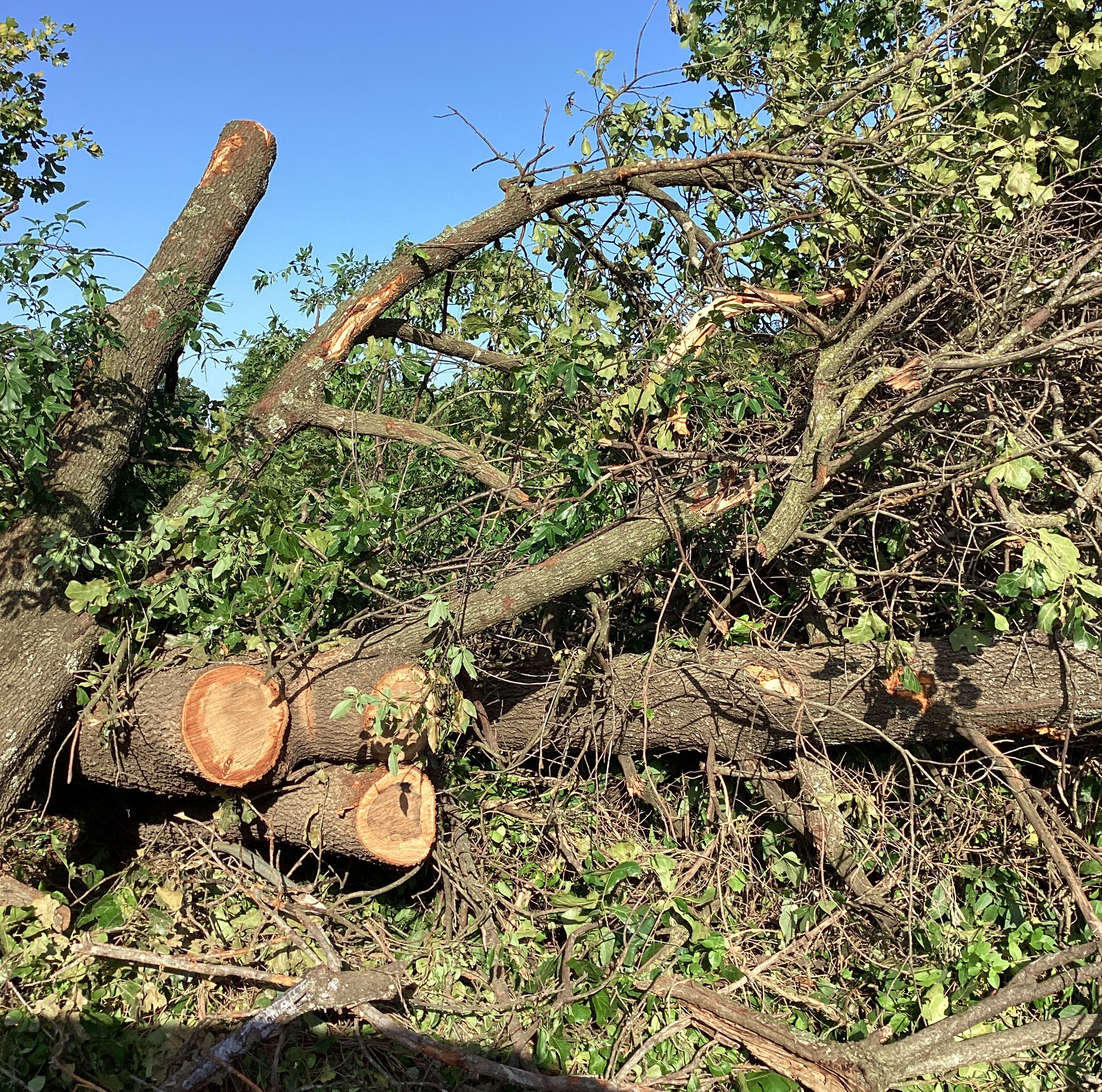
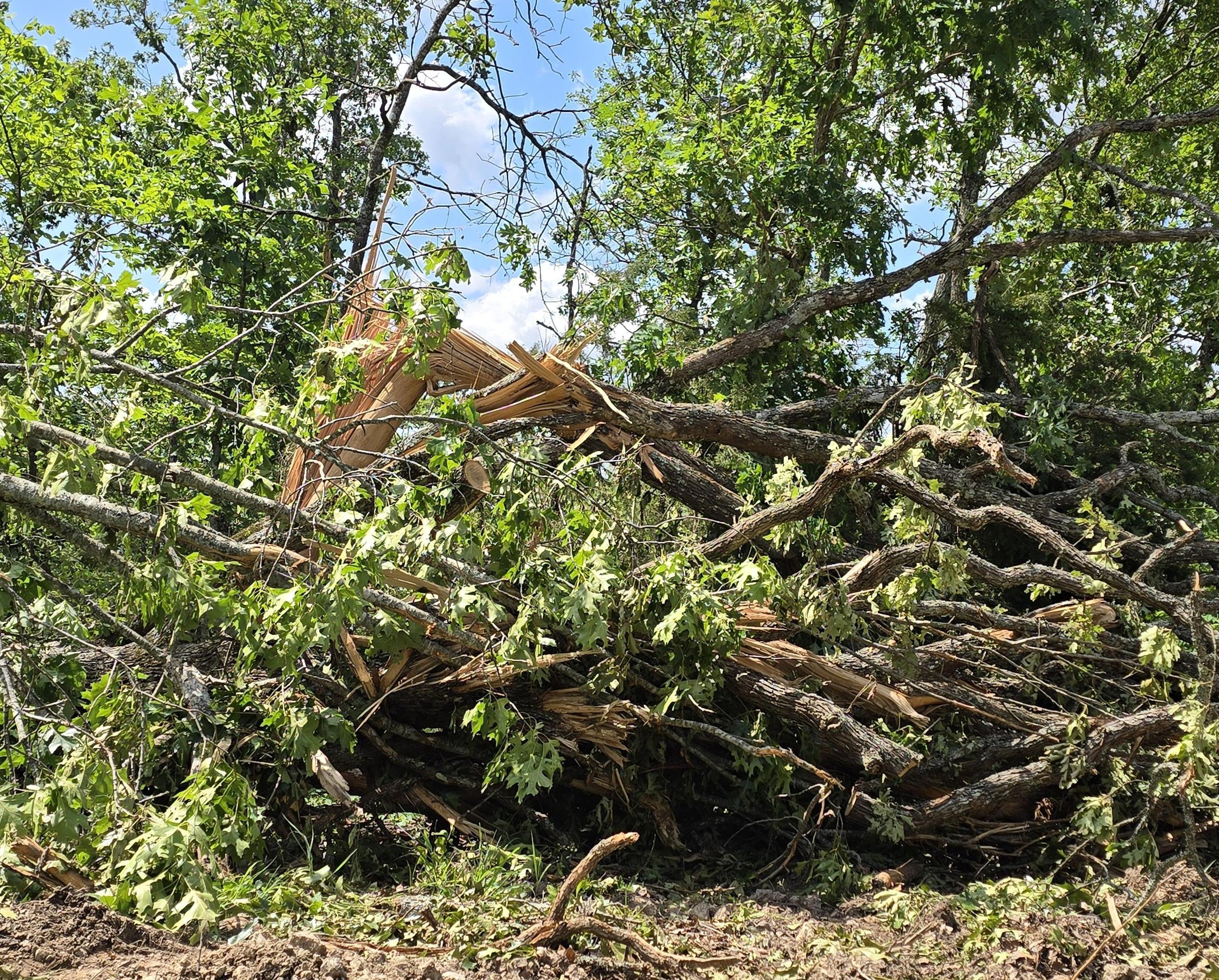
While damaging wind gusts were reported throughout the event, between 3 and 5 AM, a particular strong cluster of severe thunderstorms in far southwest Missouri produced a macroburst with wind gusts up to 70 to 80 mph. These wind gusts uprooted many trees along its path, including near a COOP site in Cassville, MO. The widespread swath of damaging winds extended from the Exeter/Cassville area over to Eagle Rock, including Roaring River State Park. Two injuries occurred in Cassville when a tree fell on a house.
 |
 |
 |
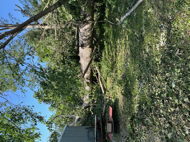 |
| Trees uprooted near COOP site in Cassville, MO | Large branches snapped near COOP site in Cassville, MO | More trees down near COOP site in Cassville, MO | Large tree down near COOP site in Cassville, MO |
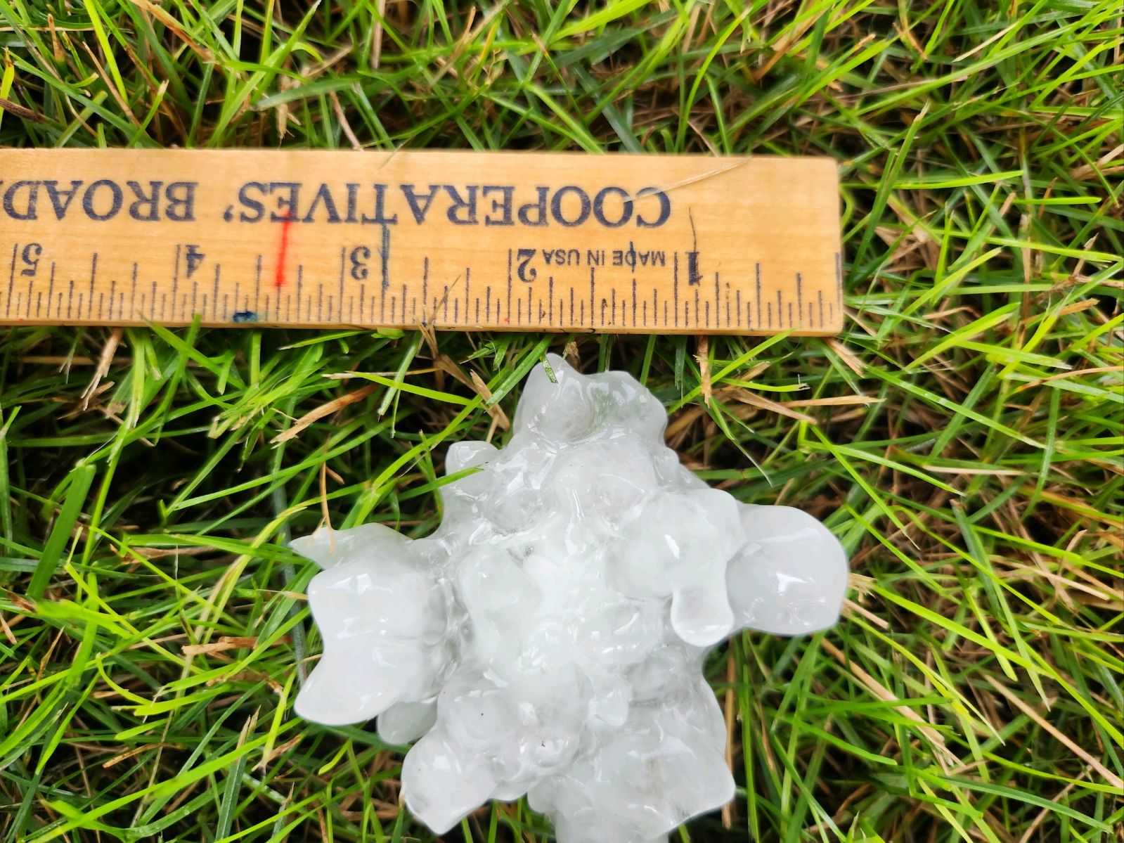
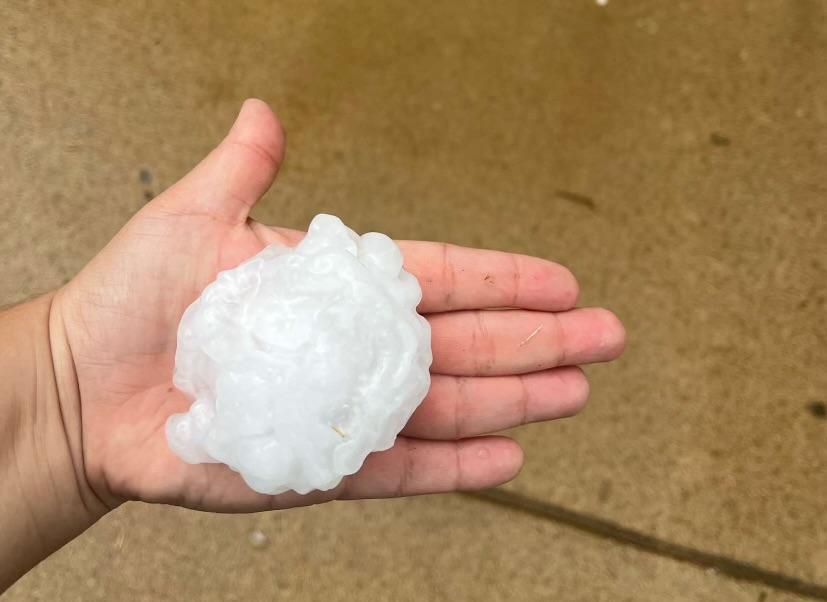
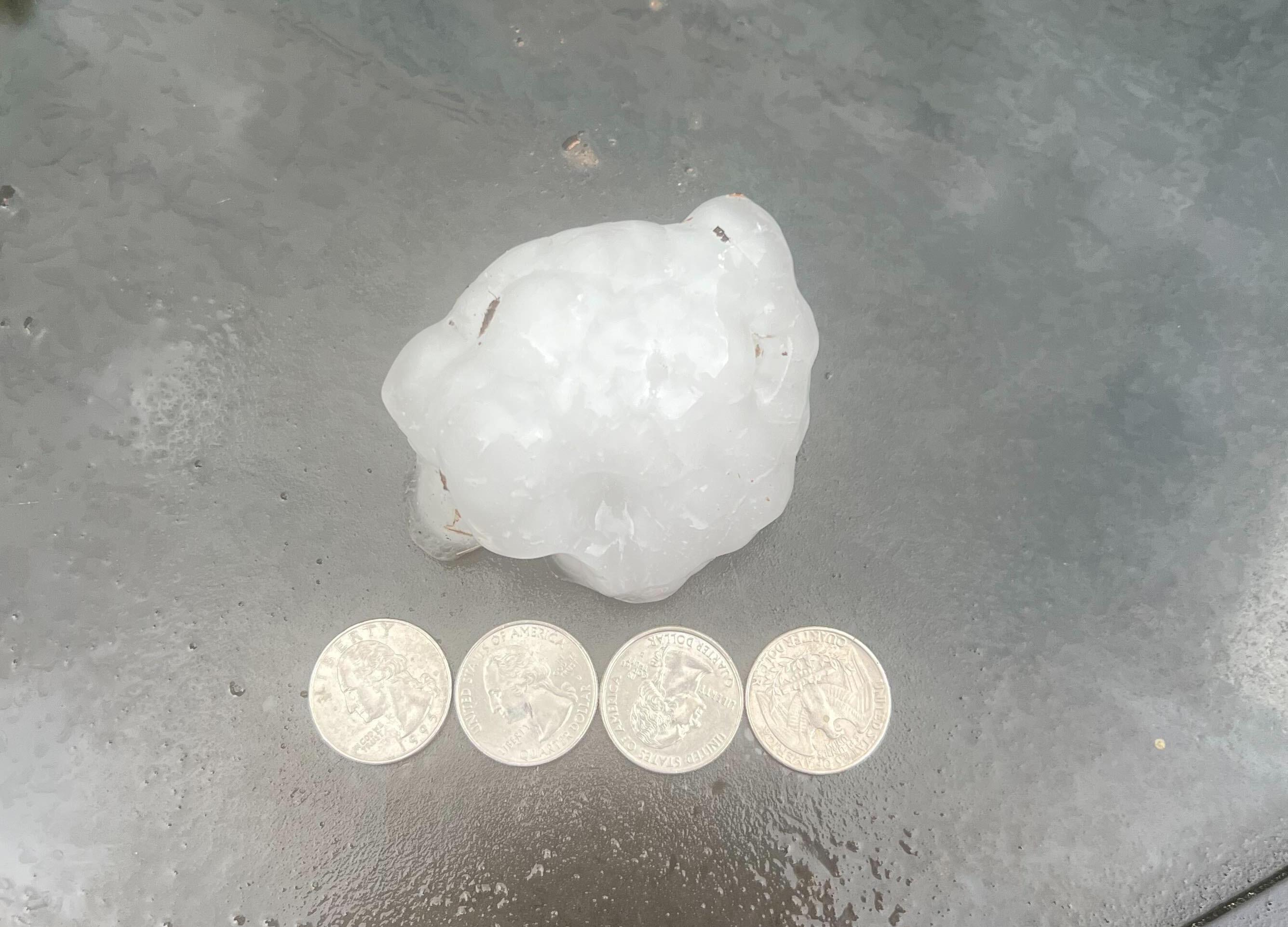
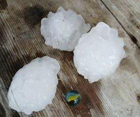
Hail
Multiple reports of baseball (2.75 inch) to softball (4.00 inch) sized hail came from the afternoon round of storms. These reports came from areas including Marshfield, Lebanon, and Wright, MO, with the largest hailstone estimated to be 4.00 inches north of Marshfield.
 |
 |
 |
 |
| 3.00 inch hail 1 mile north of Marshfield, MO | Baseball-sized hail east of Marshfield, MO | Approximately 3.00 inch hail north of Lebanon, MO | Large hail near Marshfield, MO |
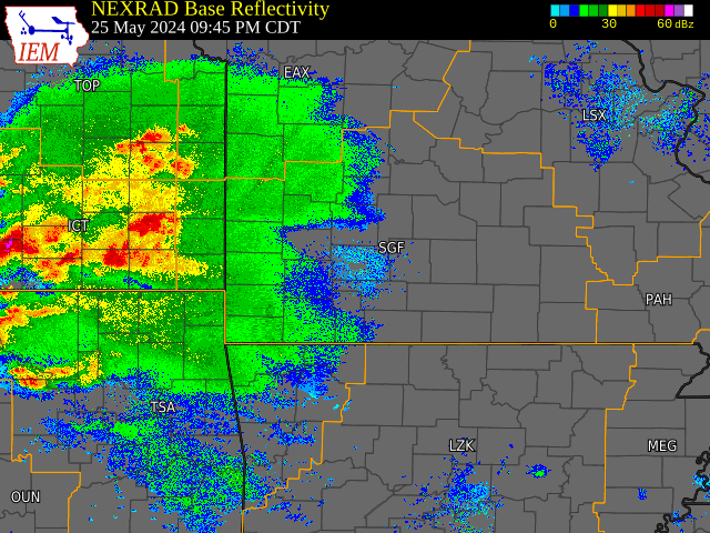
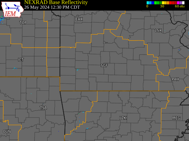
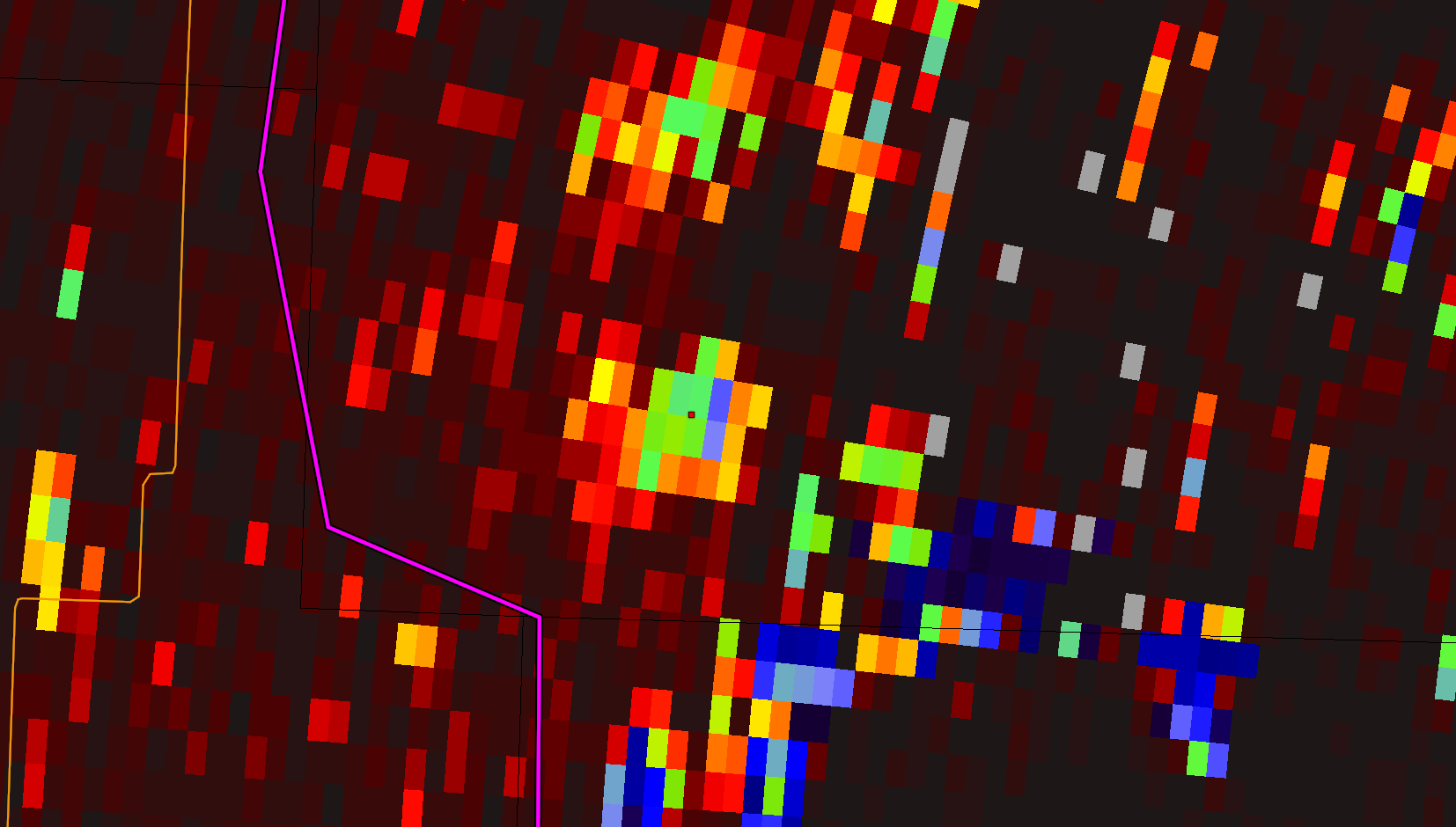
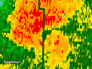
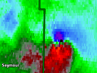
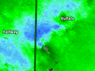
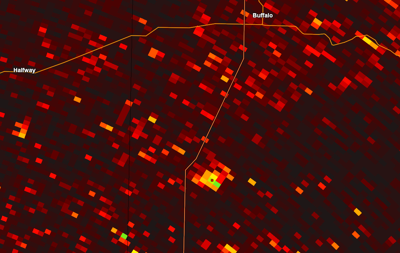
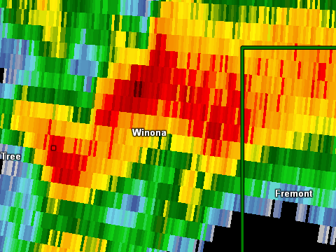
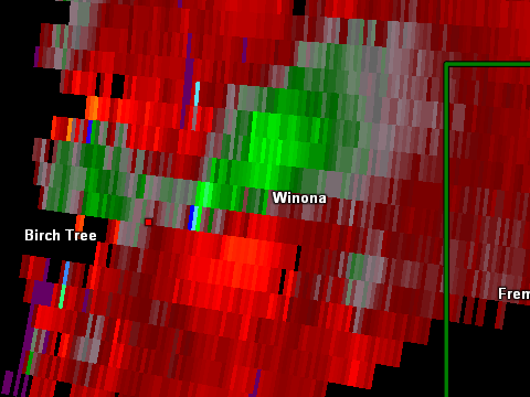
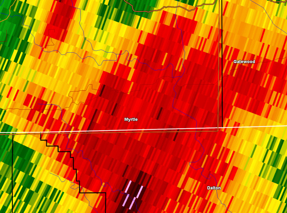
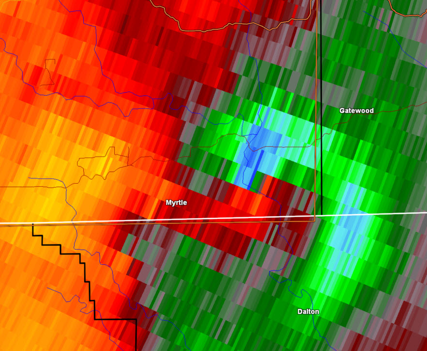
Radar
Round 1 of Severe Weather
Round 2 of Severe Weather
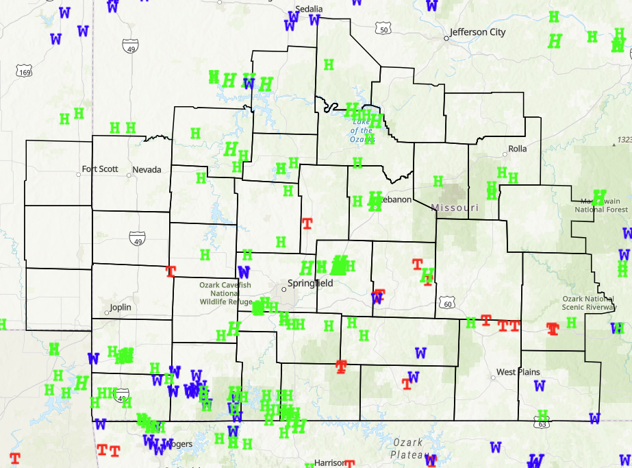
Storm Reports
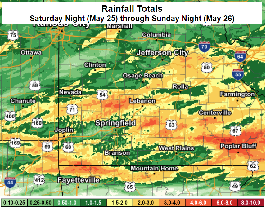
Rain Reports
 |
Media use of NWS Web News Stories is encouraged! Please acknowledge the NWS as the source of any news information accessed from this site. |
|


 Weather Story
 Weather Map
 Local Radar