A large storm system which lingered over several days brought a variety of weather to the Missouri Ozarks and extreme southeast Kansas during the February 1st through 4th timeframe.
A deep trough of low pressure well to the west of the area helped to bring in ample moisture both from the Gulf of Mexico to the south and the Pacific Ocean to the southwest. Thermal profiles and surface temperatures were initially warm enough early in the event for showers to develop over the area. Several areas received over an inch of rainfall during this initial wave of precipitation. Behind the surface cold front, temperatures quickly dropped below freezing, however temperatures remained above freezing above the ground for much of southern Missouri.
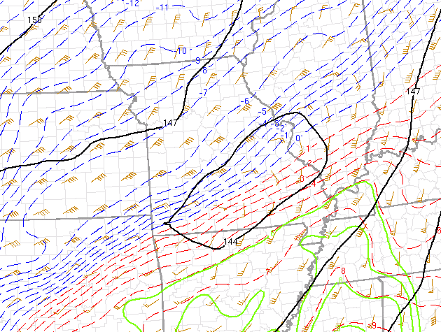
Several thousand feet above the surface showing the transition zone between above freezing
and below freezing temperatures.
As this transition zone aloft moved through the area, the rain changed to freezing rain and sleet, with this zone of mixed precipitation remaining over south central Missouri the longest.
Much of the central Missouri counties received the heaviest snow with the first wave of precipitation that occurred from the 1st into the 2nd.
The second wave began during the evening of the 2nd and continued into the 3rd. This wave moved in from the southwest and brought the majority of the snow and mixed precipitation to the southern portion of Missouri.
A third wave of snow brought some additional snow to the area during the late evening of the 3rd into the early morning of the 4th. This last wave brought up to an additional 2 inches of snow for some locations.
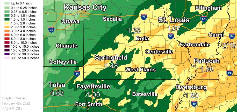
Rainfall along with melted ice and snow (water equivalent) for the event time period.
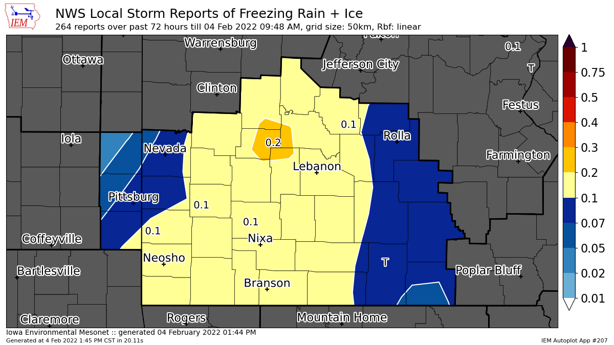
Freezing rain totals over the area for this event. South central Missouri had the highest ice totals with amounts of a half inch to three quarters of an inch.
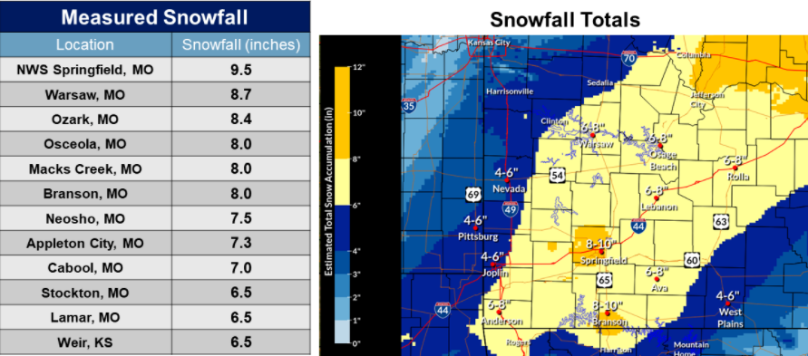
Snow and sleet totals over the area with this event.
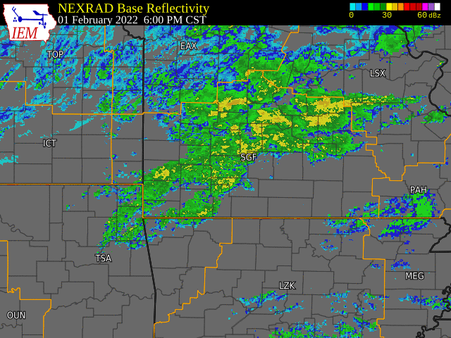
Loop of radar with this event (frame every 2 hours)


 Weather Story
 Weather Map
 Local Radar