Springfield, MO
Weather Forecast Office
Overview
|
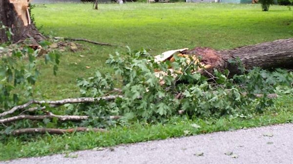
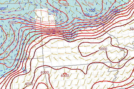
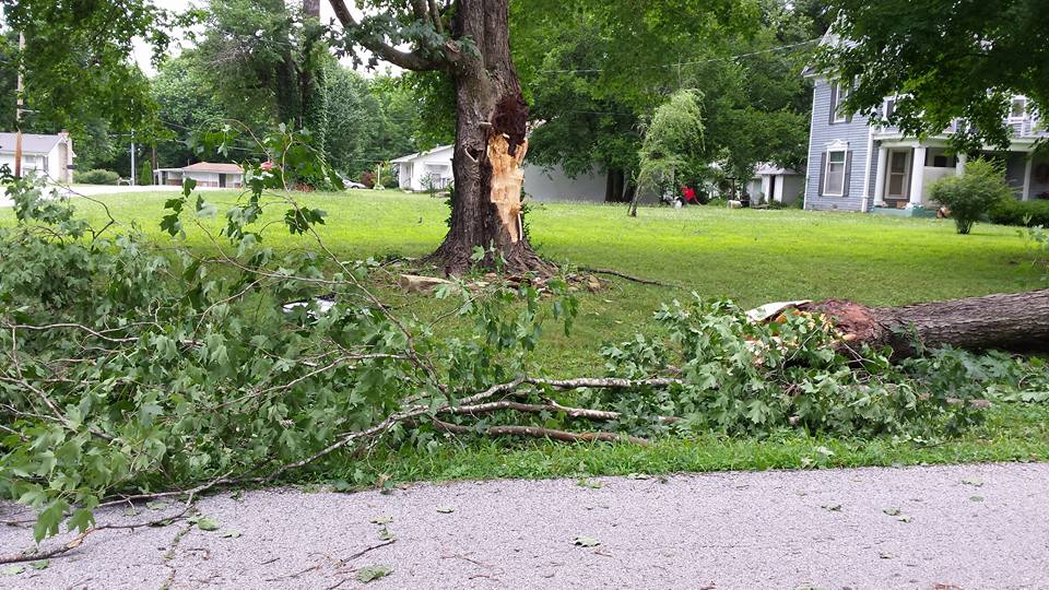
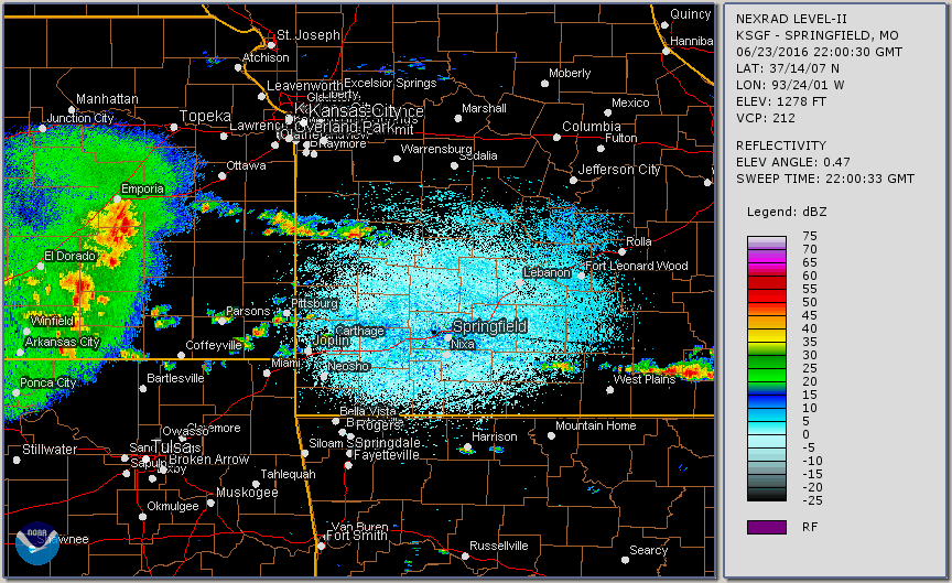
Upper level energy associated with remnants of an earlier thunderstorm complex over Kansas, along with a nearly stationary front interacted with a very unstable atmosphere to produce a round of severe storms and localized flooding during the afternoon and evening of June 23rd, 2016. Afternoon surface based CAPES were around 5000 j/kg over southern Missouri indicating a highly unstable atmosphere. Damaging wind gusts in excess of 60 mph were the main severe weather events along with some localized flooding with slow moving thunderstorms which dropped over three to four inches of rain in a short period of time in some areas. |
 Tree down from thunderstorm winds |
 |
 |
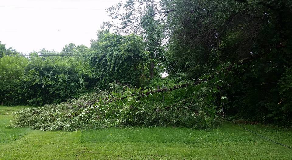 |
| Surface based CAPE | Tree down from thunderstorm winds | Tree branch down from thunderstorm winds |
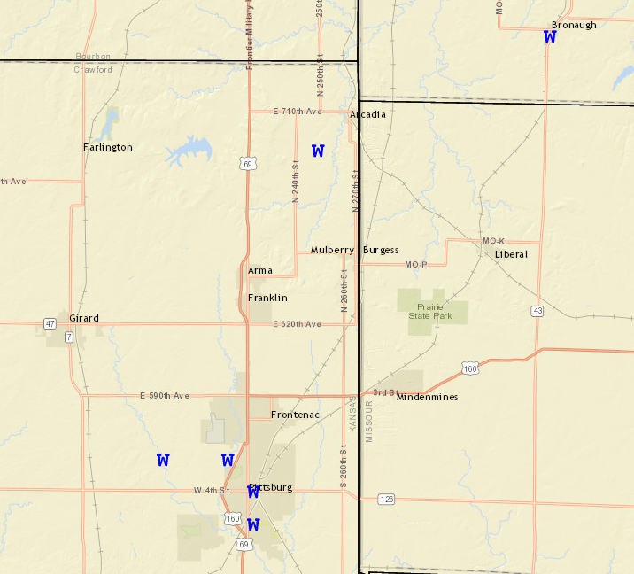
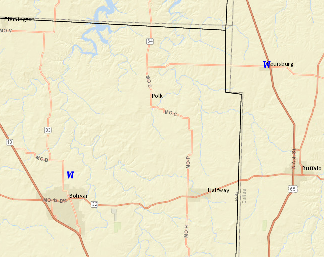
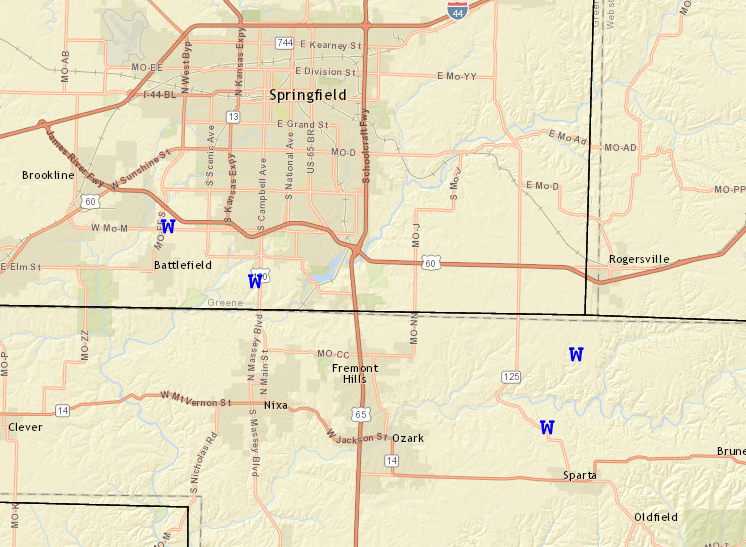
Storm Reports
Radar
 |
Media use of NWS Web News Stories is encouraged! Please acknowledge the NWS as the source of any news information accessed from this site. |
|
Current Hazards
Experimental Graphical Hazardous Weather Outlook
Submit a storm report
Local Storm Reports
Current Conditions
Observations
Lake Levels
Snowfall Analysis
Road Conditions
Satellite
CoCoRaHS
Graphical Conditions
Precip. Analysis
Forecasts
Forecast Discussion
Fire Weather
Aviation
GIS Forecast Maps
Activity Planner
Severe Weather
Winter Weather
Hurricanes
FAA Center Weather
Space Weather
Climatology
Records and Normals
Monthly Climate Summary
Local
National
Drought
Climate Science
Astronomical Data
US Dept of Commerce
National Oceanic and Atmospheric Administration
National Weather Service
Springfield, MO
Springfield-Branson National Airport
5805 West Highway EE
Springfield, MO 65802-8430
Business: 417-863-8028 Recording: 417-869-4491
Comments? Questions? Please Contact Us.


 Weather Story
 Weather Map
 Local Radar