A dangerous heat wave will continue into the weekend with highs in the mid to upper 90s and heat index values in the 100 to 110 degree range through Sunday.
A large summertime ridge of high pressure was centered and will remain over the central U.S. through the weekend, creating a dangerous and deadly heat wave. High temperatures will be in the mid to upper 90s, with heat index values from 100 to 110 each day through Sunday. The prolonged heat and humidity will increase the potential for heat related illnesses.
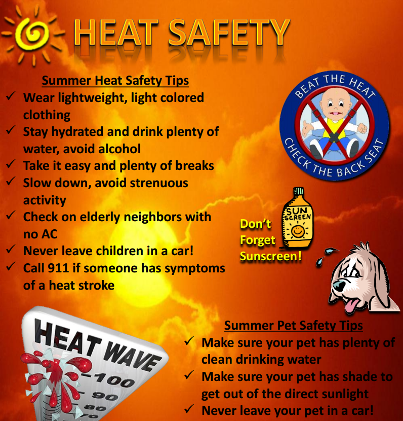
Remember to stay hydrated, stay in air-conditioned rooms, stay out of the sun and check on the elderly.
 |
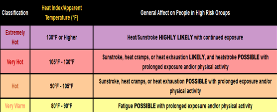
Hazards: Excessive heat with heat index values between 100-110 on a daily basis. |
 |
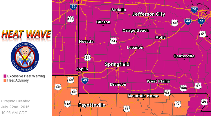
Areas: All of the Missouri Ozarks and southeast Kansas. Excessive heat warning has been expanded further south and west to include areas of southeast Kansas and southwest Missouri. |
 |
Timing and Duration: Excessive heat index values will persist on a daily basis through Sunday afternoon with highest values between 12 pm and 6 pm daily. |
 |
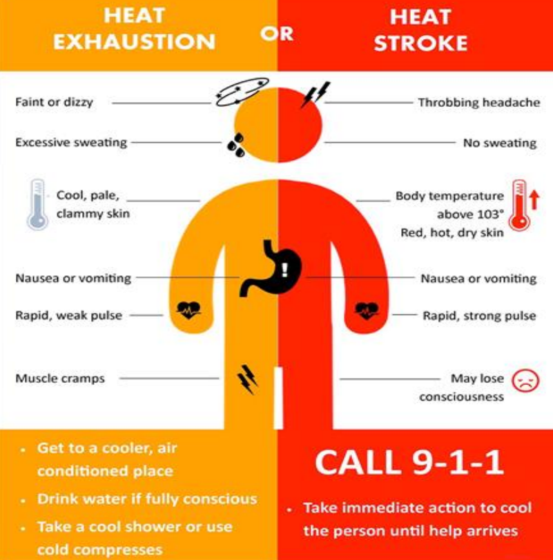
Impacts: Excessive heat can have health related impacts on everyone, but especially: young children, the elderly, outdoor workers, pets and individuals without air conditioning. |
 |
Confidence: Confidence is high that dangerous heat will occur through the weekend. |


 Weather Story
 Weather Map
 Local Radar