Springfield, MO
Weather Forecast Office
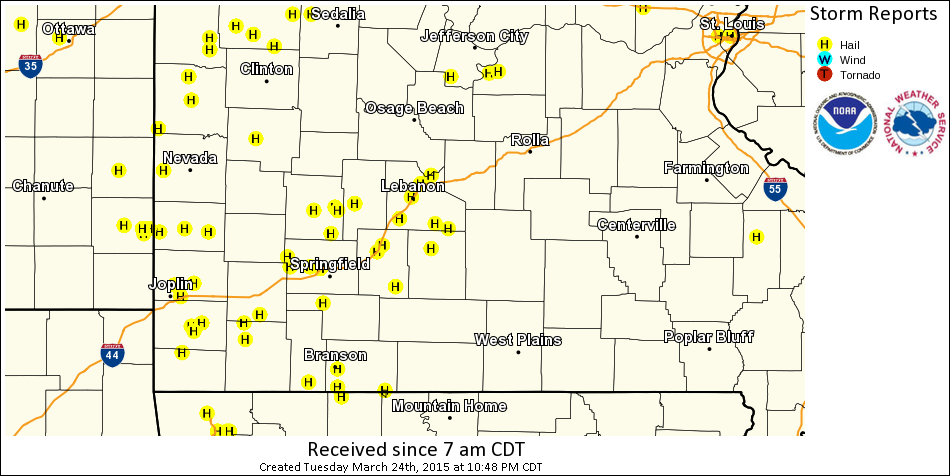
Supercell thundestorms developed along the Missouri/Kansas border during mid-afternoon hours Tuesday, March 24 as a vigorous shortwave trough tracked into northern Missouri and an accompanying surface low and attendant dry line pushed into southern Missouri. Storms moved rapidly to the east and diminished in the eastern Ozarks by mid evening Tuesday. The storms were efficient hail producers with many reports. At 33 hail reports were received with the largest hail the size of ping pong balls. The storms produced a few wall clouds with one readily apparent in the Springfield area.
Here is map depicting the storm reports across the area.
Current Hazards
Experimental Graphical Hazardous Weather Outlook
Submit a storm report
Local Storm Reports
Current Conditions
Observations
Lake Levels
Snowfall Analysis
Road Conditions
Satellite
CoCoRaHS
Graphical Conditions
Precip. Analysis
Forecasts
Forecast Discussion
Fire Weather
Aviation
GIS Forecast Maps
Activity Planner
Severe Weather
Winter Weather
Hurricanes
FAA Center Weather
Space Weather
Climatology
Records and Normals
Monthly Climate Summary
Local
National
Drought
Climate Science
Astronomical Data
US Dept of Commerce
National Oceanic and Atmospheric Administration
National Weather Service
Springfield, MO
Springfield-Branson National Airport
5805 West Highway EE
Springfield, MO 65802-8430
Business: 417-863-8028 Recording: 417-869-4491
Comments? Questions? Please Contact Us.


 Weather Story
 Weather Map
 Local Radar