 |
Extreme Heavy Rainfall and Flooding - August 3rd-10th, 2013National Weather Service, Springfield, MO |
 |
Extreme heavy rainfall occurred on an every night basis in differing locations across the Missouri Ozarks and southeast Kansas from August 3rd through August 10th, 2013. Rainfall rates of around two inches per hour occurred with these storms each night and trained across the same locations for several hours. High 24 hour precipitation totals were the result with some locations receiving between 8 to 10 inches of rain in a short window of time. This extreme amount of rainfall led to dangerous flash flooding, many water rescues, hundreds of flooded roadways and 3 deaths.
There was widespread 5 to 6 inches of rainfall across the Missouri Ozarks and southeast Kansas for the week with a large area of greater than 10 inches in parts of central and south central Missouri. There was also a decent area of greater than 15 inches from the southern half of Pulaski county in to Wright county.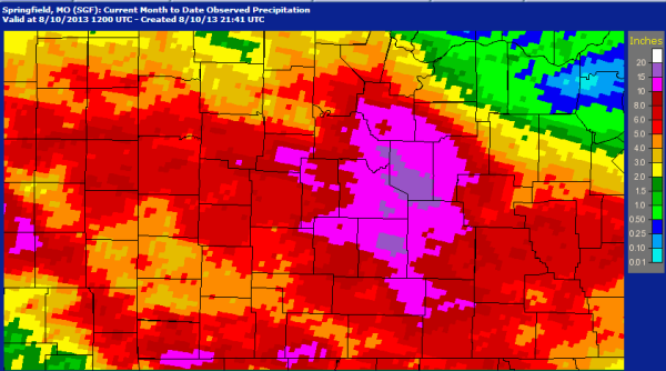
Several rounds of showers and thunderstorms impacted southeastern Kansas and the Missouri Ozarks the first couple of weeks of August as a persistent upper pattern remained in place. An unusually strong upper trough of low pressure was located over the Hudson Bay area of Canada while an upper ridge of high pressure remained anchored across the southwest U.S. This resulted in a steady west to northwest flow aloft that brought a series of upper level disturbances across the region. 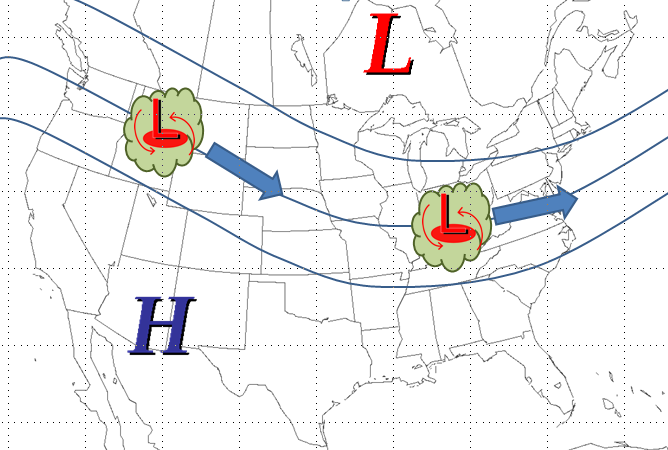
Meanwhile a front became nearly stationary and oscillated only slight to the north and south underneath the persistent west to northwest flow aloft. A flow of deep moisture from the Gulf of America interacted with this boundary to aid the development of thunderstorms that trained along the boundary. The exceptionally moist atmosphere resulted in torrential rainfall rates. 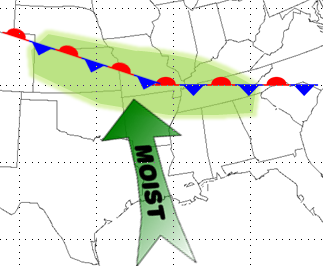
Here is a radar loop from the week long extreme heavy rain and flash flooding event.
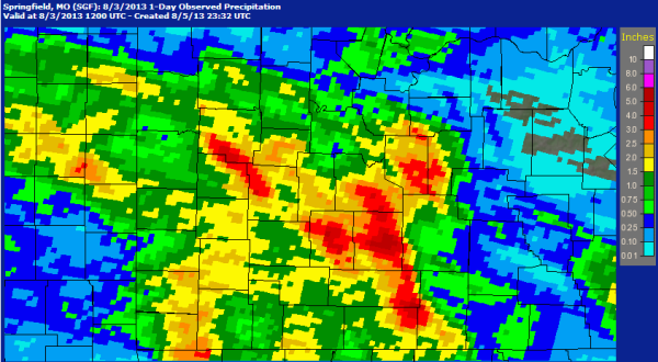
Precipitation from 7 AM Aug 2nd to 7 AM Aug 3rd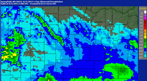
Precipitation from 7 AM Aug 3rd to 7 AM Aug 4th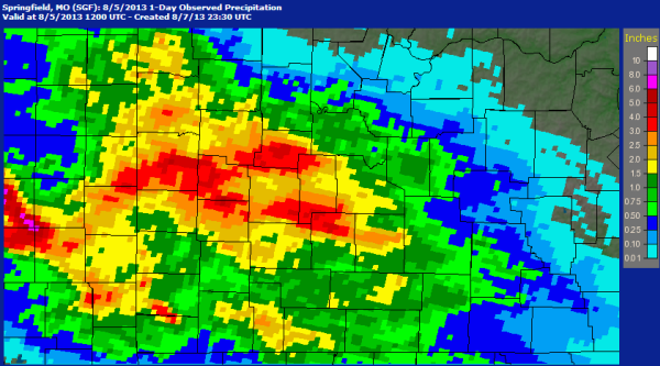
Precipitation from 7 AM Aug 4th to 7 AM Aug 5th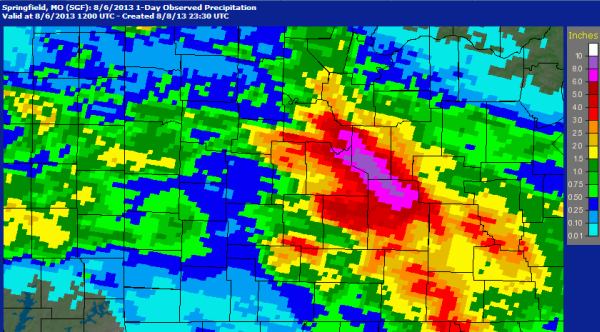
Precipitation from 7 AM Aug 5th to 7 AM Aug 6th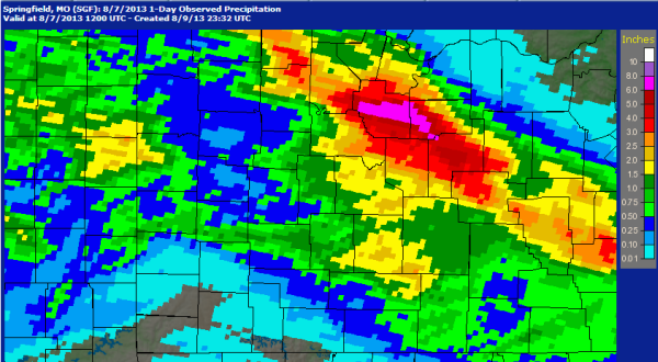
Precipitation from 7 AM Aug 6th to 7 AM Aug 7th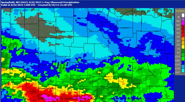
Precipitation from 7 AM Aug 7th to 7 AM Aug 8th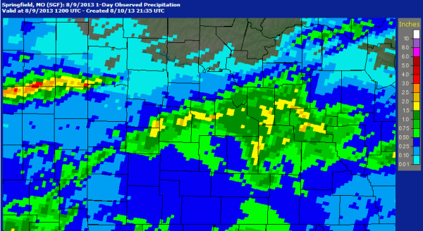
Precipitation from 7 AM Aug 8th to 7 AM Aug 9th
Precipitation from 7 AM Aug 9th to 7 AM Aug 10th
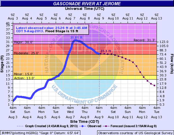
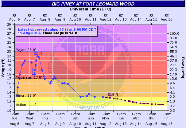
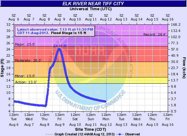
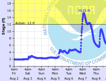
The following river hydrographs depict the stages of several area rivers during the flood event.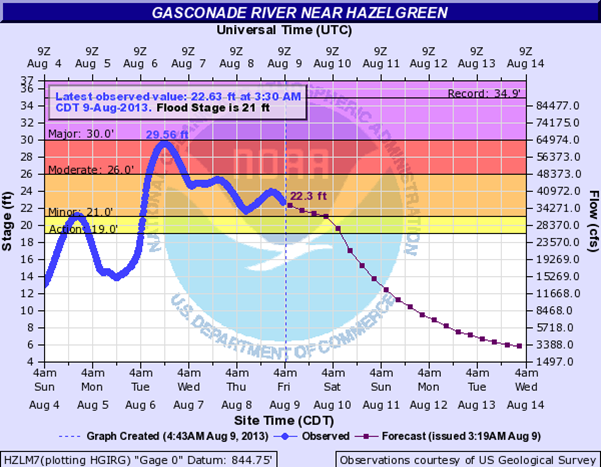
Roubidoux River near Waynesville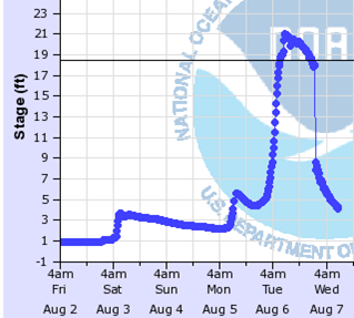
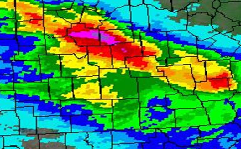
Rainfall Tuesday Morning August 6th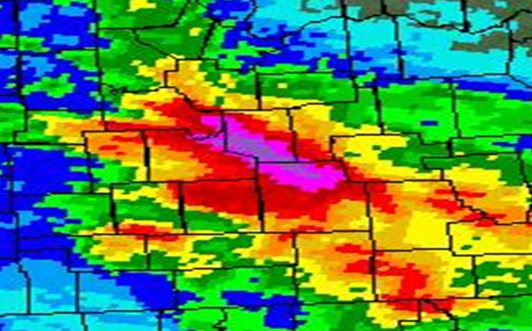  |
Roubidoux River Hydrograph |
Topographic Map of Roubidoux River Valley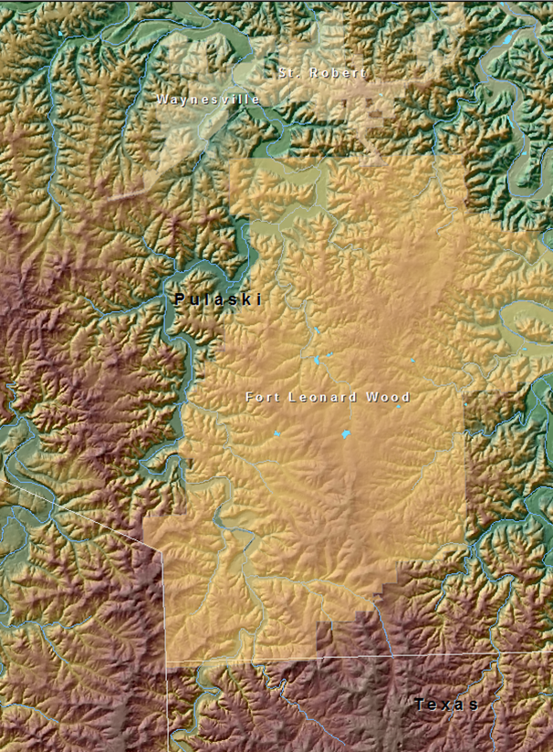 |
Topographic Map of Waynesville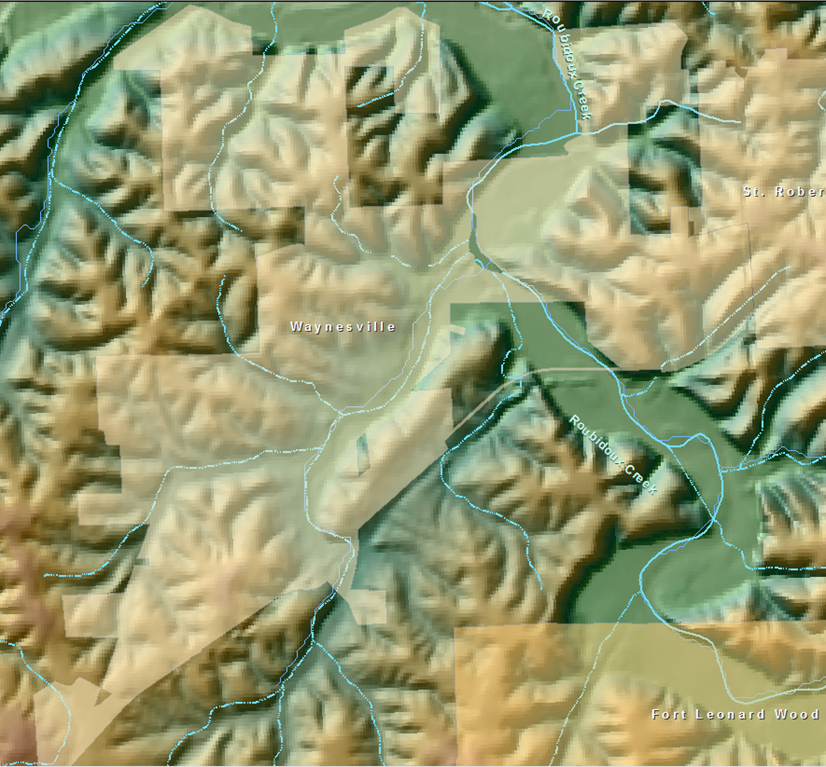 |
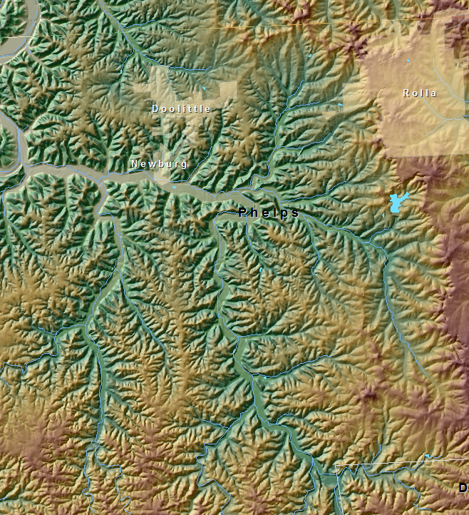
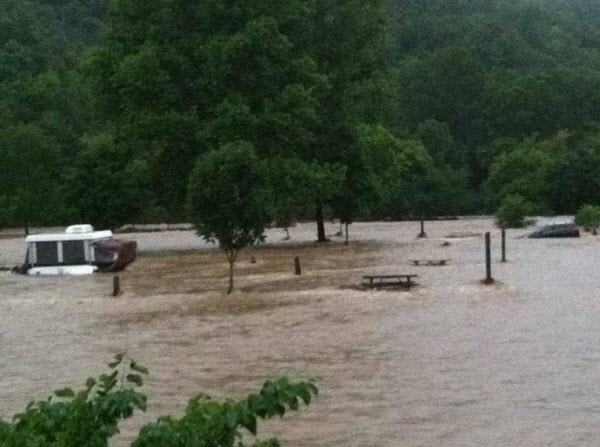
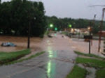
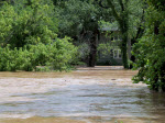
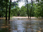
Newburg and Phelps / Maries / Miller Counties - August 7
5 to 8 inches of rainfall fell during the early morning hours of August 7 from Miller County southeast into Phelps County resulting in serious flash flooding particulary in the Newburg area of Phelps County along with eastern Miller and western Maries Counties. Signifcant flash flooding impacted Newburg with at least 15 homes evacuated. Many roads were flooded or washed out
 |
 |
 |
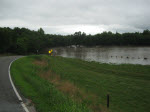
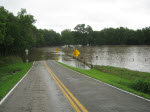
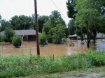
Hollister / Taney County - August 8
Extreme rainfall amounts and rates impacted far southern Missouri along the Araknas border from McDonald County into Taney County resulting in serious flash flooding. Rainfall totals ranged from 5 to 9 inches. Hollister, MO (just south of Branson) experienced significant flooding as a large flood wave came down Turkey creek which cuts through Hollister.
 |
 |
Roaring River - Barry County / Blue Eye - Stone County / McDonald County - August 8
Extreme rainfall amounts and rates impacted far southern Missouri along the Araknas border from McDonald County into Taney County resulting in serious flash flooding. Rainfall totals ranged from 6 to 9 inches.
Topographic Map of Roaring River State Park |
Topographic Map of Blue Eye Area |
 |
Big Sugar Creek Hydrograph Little Sugar Creek Hydrograph  |


 Weather Story
 Weather Map
 Local Radar