 ​
​
Here is your National Weather Service forecast for Truman Lake
Tonight, partly cloudy this evening, then becoming mostly
cloudy. Lows in the lower 50s. North winds 10 to 15 mph.
Saturday, mostly cloudy. Highs in the upper 60s. East winds 5 to
10 mph.
Saturday Night, cloudy. A chance of showers in the evening, then
showers likely after midnight. Lows in the mid 50s. East winds
5 to 10 mph. Chance of rain 60 percent.
Sunday, a chance of thunderstorms. Showers likely, mainly in the
morning. Highs in the lower 70s. Southeast winds 5 to 10 mph with
gusts up to 20 mph. Chance of rain 70 percent.
Sunday Night, mostly cloudy in the evening, then becoming partly
cloudy. Lows in the mid 60s. Southeast winds 5 to 10 mph with
gusts up to 20 mph.
Monday, mostly sunny. Warmer with highs in the lower 80s.
Monday Night, mostly cloudy with a chance of thunderstorms. A
chance of showers in the evening, then showers likely after
midnight. Lows in the mid 60s. Chance of rain 60 percent.
Tuesday, partly sunny. Showers likely in the morning, then a
chance of showers and thunderstorms in the afternoon. Highs in
the mid 70s. Chance of rain 60 percent.
Tuesday Night, mostly cloudy with a chance of showers. A chance
of thunderstorms after midnight. Lows in the mid 50s. Chance of
rain 50 percent.
Wednesday, mostly cloudy with a chance of showers. Highs in the
upper 60s. Chance of rain 50 percent.
Wednesday Night, mostly cloudy. A chance of showers in the
evening, then showers likely after midnight. Lows in the upper
50s. Chance of rain 60 percent.
Thursday, showers likely, mainly in the morning. Highs in the
lower 70s. Chance of rain 60 percent.
Thursday Night, partly cloudy. A chance of showers and
thunderstorms in the evening. Lows in the lower 50s. Chance of
rain 40 percent.
Friday, mostly sunny. Highs in the lower 70s.
​

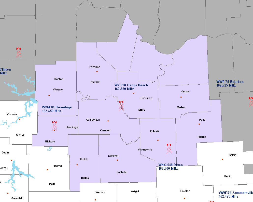
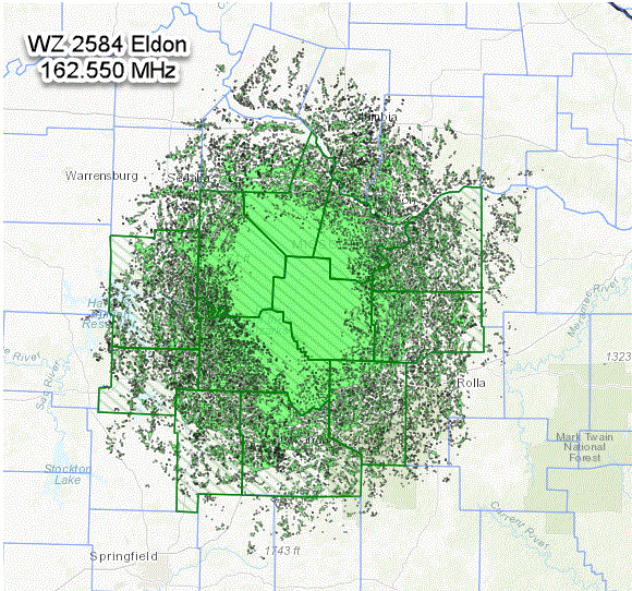
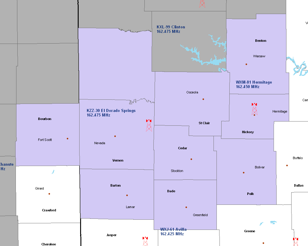
FIPS Codes for your Programmable NOAA All Hazards Weather Radio
When severe weather occurs, the routine broadcasting will be interrupted to provide the listener with frequent updates on severe weather warnings or statements for your area. When a severe weather warning is issued and you are within 40 miles of the transmitter, a weather tone will alert on specially built receivers, with warning and safety information following directly after the tone. With the new Specific Area Message Encoder (SAME) weather radios, you can program your weather radio to only receive warnings for the county you program into the radio.
More information on NOAA All Hazards Weather Radio


 Weather Story
 Weather Map
 Local Radar