Thunderstorms are expected to develop Sunday afternoon in North or Central Texas then move into South Central Texas sometime late afternoon into Sunday night. Some storms may be strong to severe with the main hazards of large hail and damaging wind gusts. Always have a way to receive warning information!
Low clouds and areas of fog this morning will begin to clear by late morning or early afternoon with drier conditions returning through tomorrow. Warm highs in the mid and upper 80s are expected today.
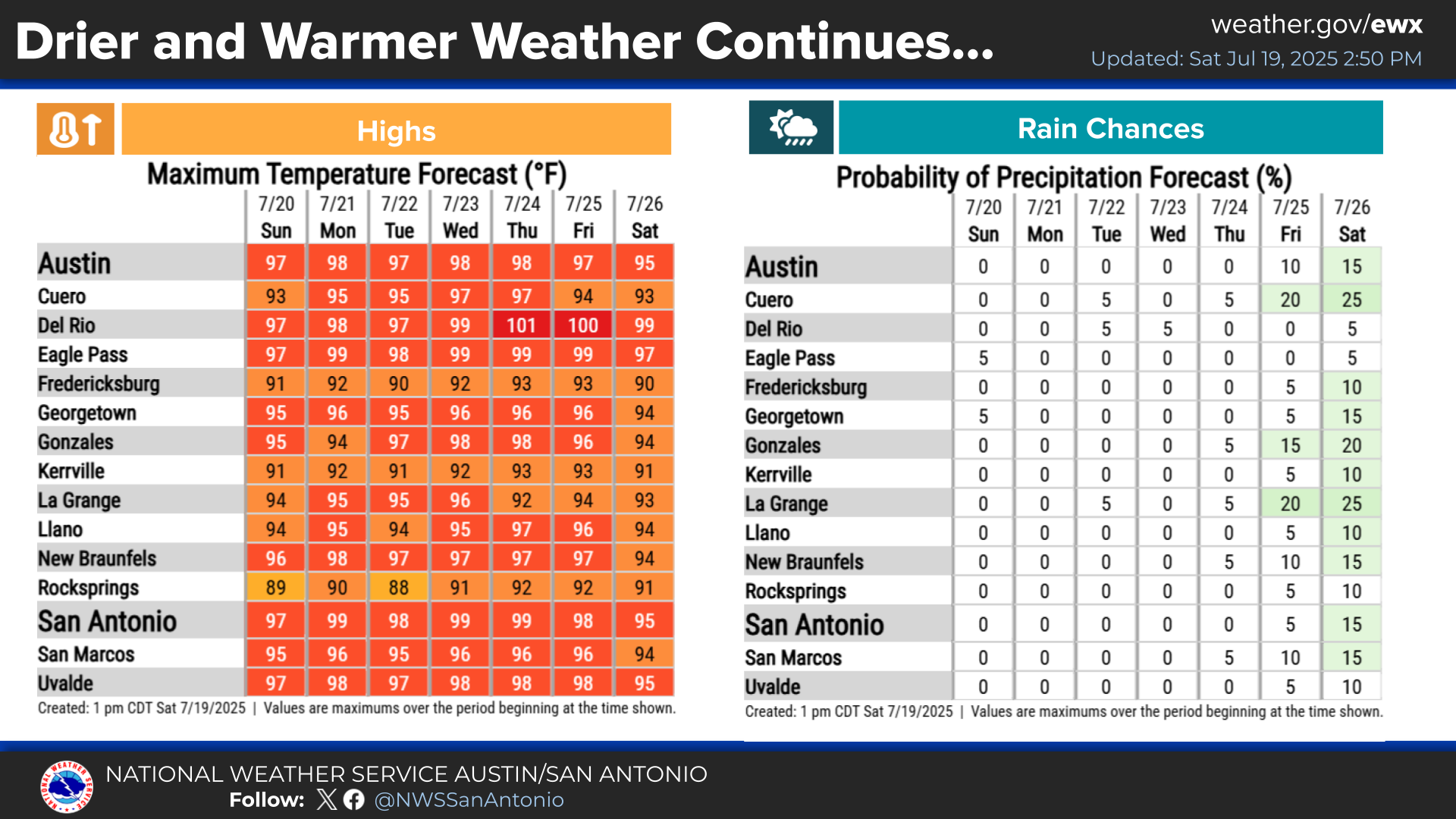
Warmer temperatures in the 80s and low 90s are forecast for the weekend. Rain chances increase for Sunday into Monday. A slight cool down is expected Monday, then another warming trend begins with dry weather for most of next week.


 Austin/San Antonio Radar
 Weather Map
 Satellite Imagery
 Del Rio Radar
 Digital Forecast Map
 Tropical Outlook
 Drought Status
 Air Quality
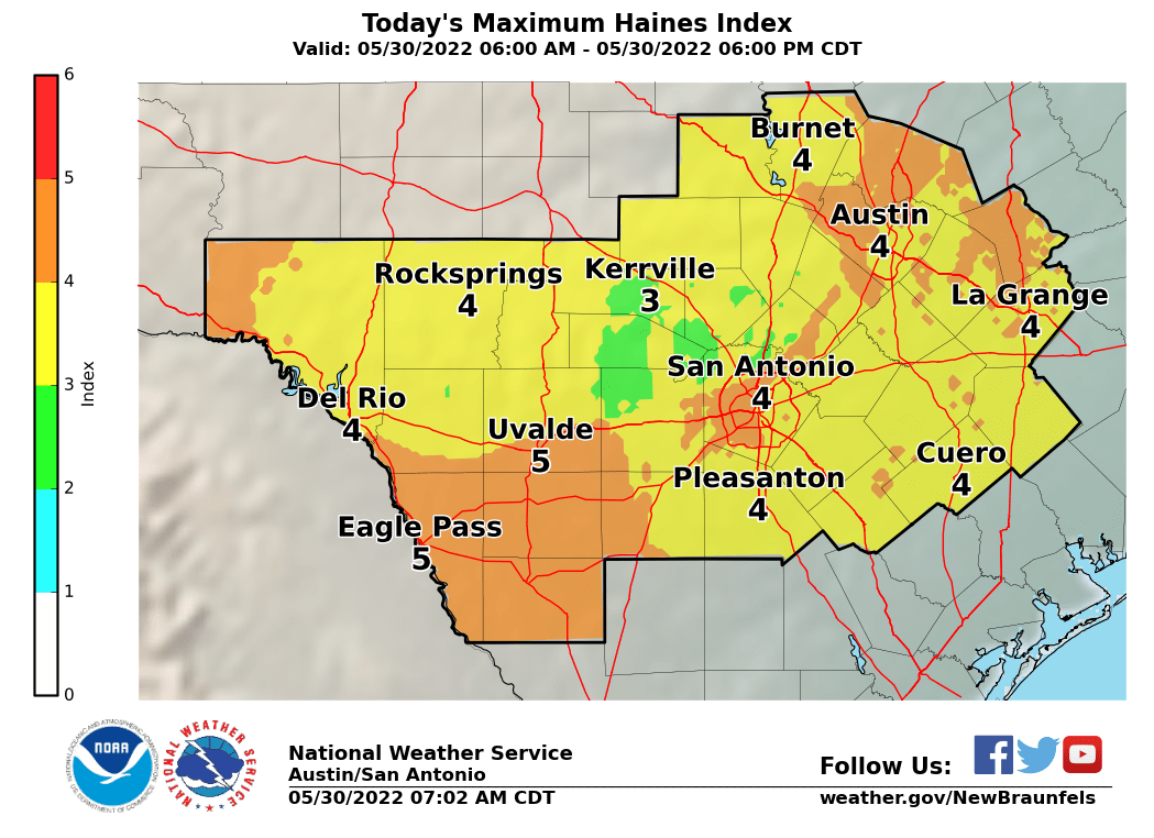 Fire Weather Forecasts
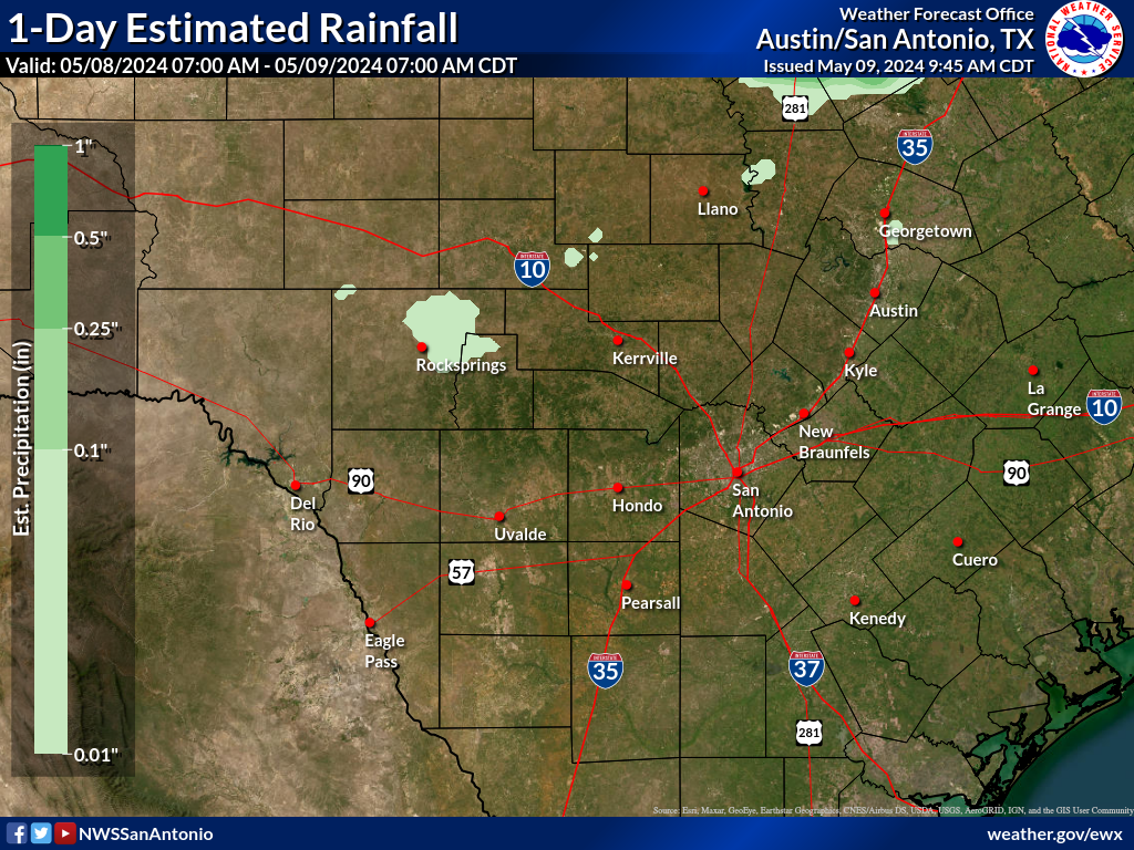 Observed Rainfall
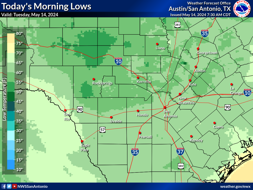 Observed Temperatures
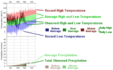 Daily Climate Graphs