Pueblo, CO
Weather Forecast Office
Overview
|
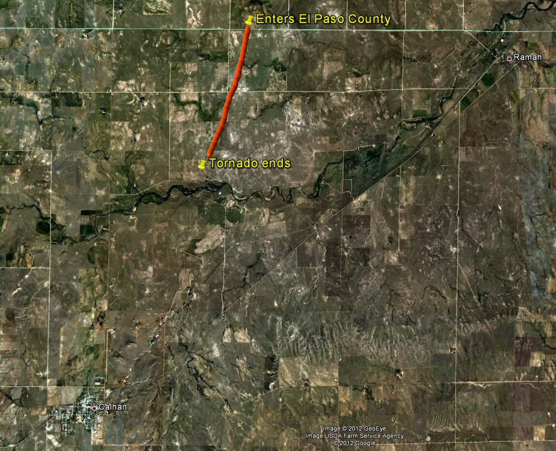
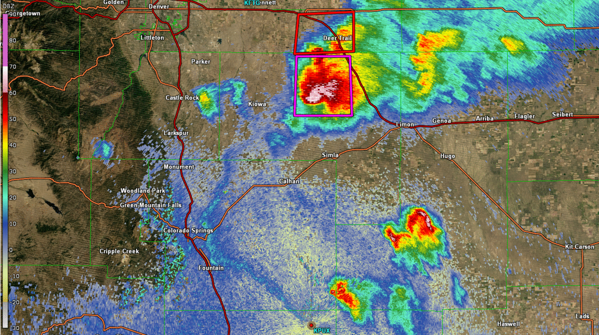
A preliminary damage survey was conducted after a severe supercell thunderstorm passed through eastern El Paso County the evening of June 7th. There was much wind and hail damage in eastern El Paso County. It was determined that two tornadoes occurred, one north of Calhan and another south of Ramah. North of Calhan a tornado crossed the Elbert-El Paso County line, moving south-southwest. Below is a map of the 2.6 mile path of the tornado, which was around 200 yards wide at its maximum. |
|
Photos & Video:
 |
 |
 |
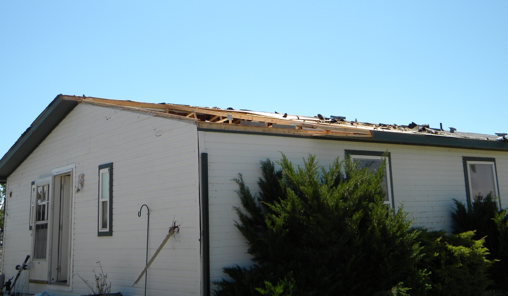 |
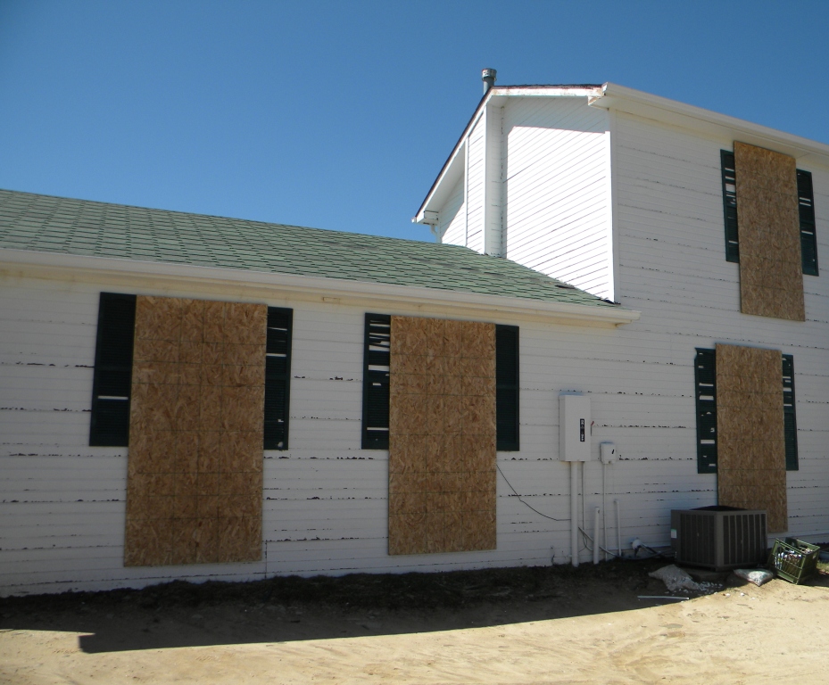
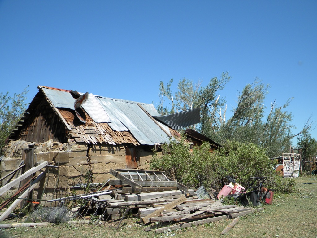
| Just north of the County Line, a Heavily Damaged House | Tornado Snapped off Large Tree Limbs | Damaged on an Old Building | Roof Damage |
 |
 |
 |
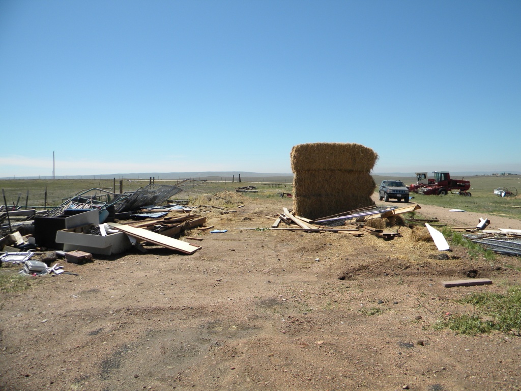 |
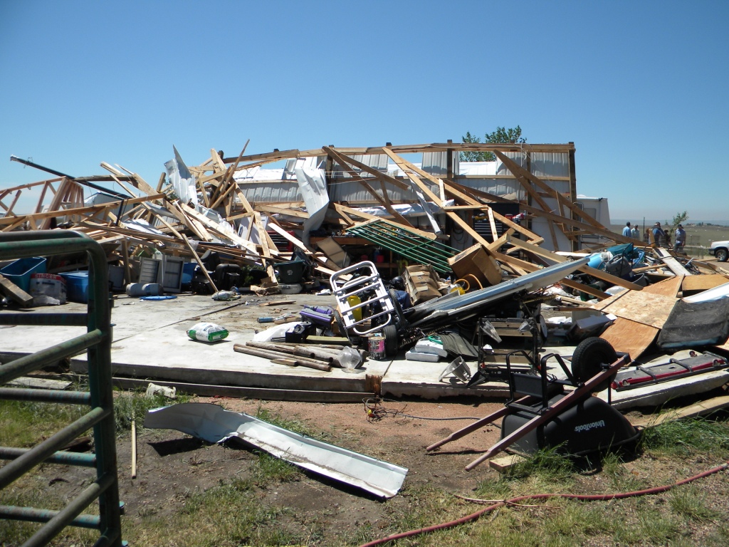
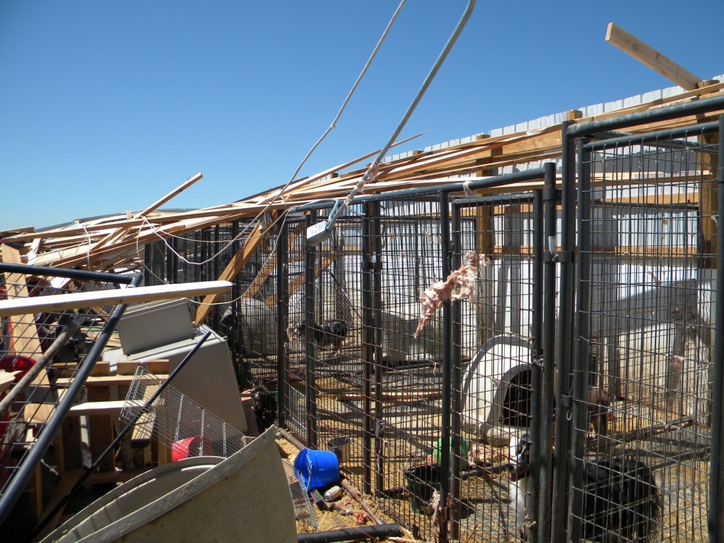
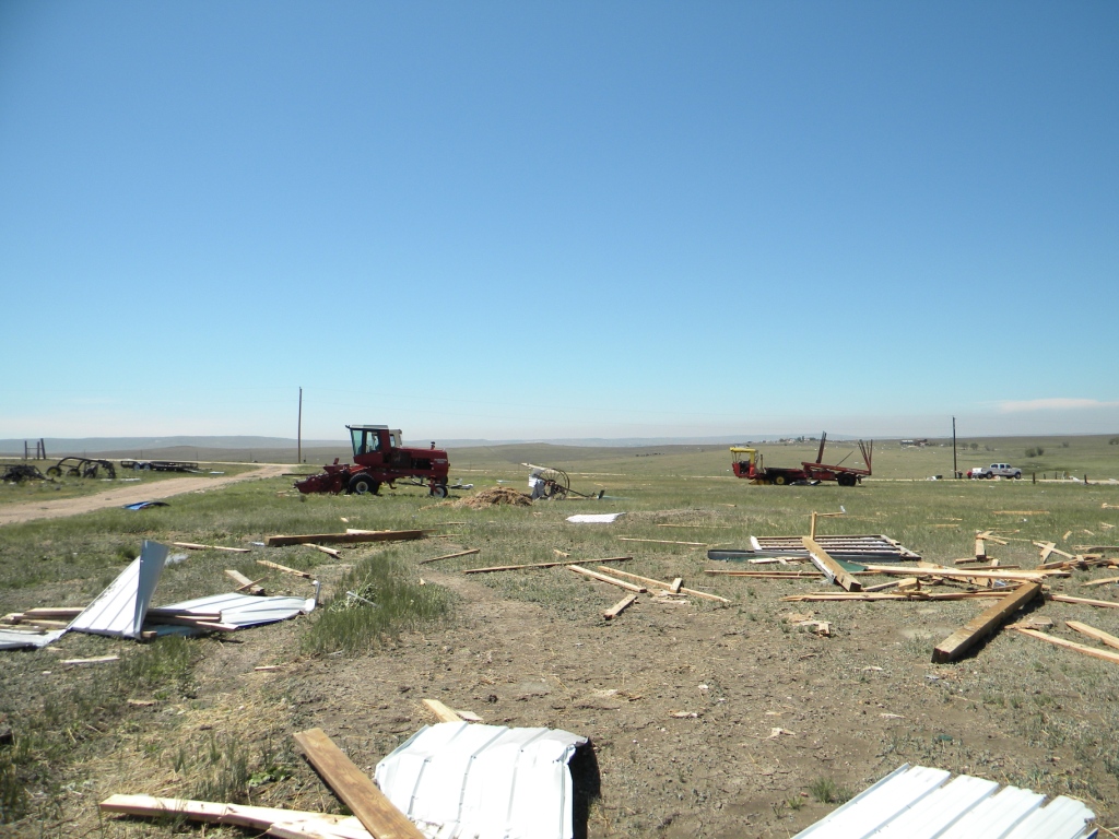
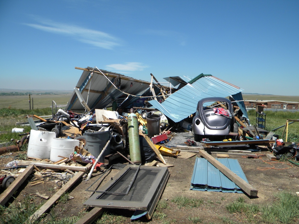
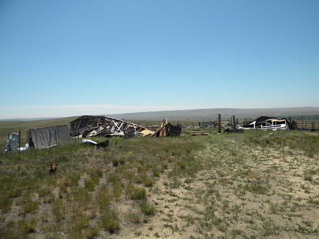
| 40x60 Foot Building Destroyed in El Paso County | 30x50 Foot Dog Kennel Destroyed, One Dog Fatality | Destroyed Garage | 40x60 Foot Building Destroyed, yet the Hay Inside Didn't Move |
 |
 |
 |
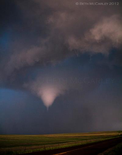 |
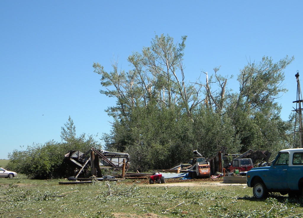
| Farm Equipment Moved 70 Feet to the west | Large Shed Destroyed | Shed Destroyed | Rare Anticyclonic Tornado South of Ramah, Colorado |
The anticyclonic tornado did not hit any man-made structures, it is rated an EF0. The photo above was taken by the storm chase team of Verne Carlson and Beth McCarley. It was reported to have been a tornado for about 2 minutes.
Meanwhile, another supercell developed on the east side of Colorado Springs, and brought large, damaging hail to that area. The storm took a similar path to the damaging hailstorm of the night before.
Radar:
Reflectivity and Velocity Volume Scans
 |
.gif) |
| Radar Base Reflectivity Volume Scan of the Event, NWS Warnings also Shown | Radar Base Velocity Volume Scan of the Event, NWS Warnings also Shown |
ACTIVE ALERTS
Warnings by State - click ATOM button
Excessive Rainfall Forecasts
River Flooding
Convective Outlooks
Hurricanes
Fire Weather Outlooks
UV Alerts
Space Weather
Winter Winter Forecasts
Enhanced Data Display(EDD)
PAST WEATHER
Climate Monitoring
Astronomical Data
Certified Weather Data
CURRENT CONDITIONS
Radar
River Levels
Observed Precipitation
Surface Weather
Upper Air
Marine and Buoy Reports
Climate Monitoring
Snow Cover
Satellite
Space Weather
Enhanced Data Display(EDD)
FORECAST
Severe Weather
Drought
Fire Weather
Front/Precipitation Maps
Graphical Foreast Maps
Rivers
Marine
Offshore and High Seas
Hurricanes
Aviation Weather
Climate Outlook
Enhanced Data Display(EDD)
WEATHER SAFETY
Owlie Skywarn - for kids
NOAA Weather Radio
StormReady
Natural Weather Hazard Statistics
Red Cross
Federal Emergency Management Agency(FEMA)
National Weather Service SafetyBrochures
US Dept of Commerce
National Oceanic and Atmospheric Administration
National Weather Service
Pueblo, CO
3 Eaton Way
Pueblo, CO 81001-4856
(719) 948-9429
Comments? Questions? Please Contact Us.