|
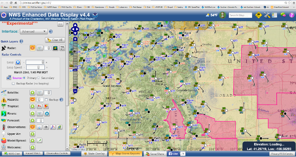
Enhanced Data Display Set for Fire Weather Data (click image to go to Colorado EDD Fire Weather)
| SPC Fire Weather Products | ||
|---|---|---|
 Day 1 Fire Weather Outlook |
 Day 2 Fire Weather Outlook |
 Day 3-8 Fire Weather Outlook |
| SPC Risk Categories | ||
| CPC Climate Outlooks | ||
|---|---|---|
 6-10 Day Outlook |
 8-14 Day Outlook |
 30 Day Outlook |
| WFAS Fuel Moistures | ||
|---|---|---|
 10 Hour FM 1/4" - 1" diameter |
 100 Hour FM 1" - 3" diameter |
 1000 Hour FM 3" - 8" diameter |
|
|
|
Drought Index |
|
|
|
Assessment System |
|
|
NWS National Fire Weather Page
Rocky Mountain Area Coordination Center - Predictive Services
Pueblo Interagency Fire Dispatch Center


