
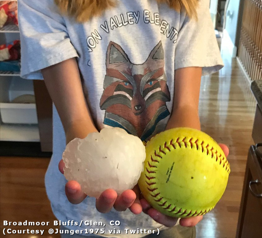
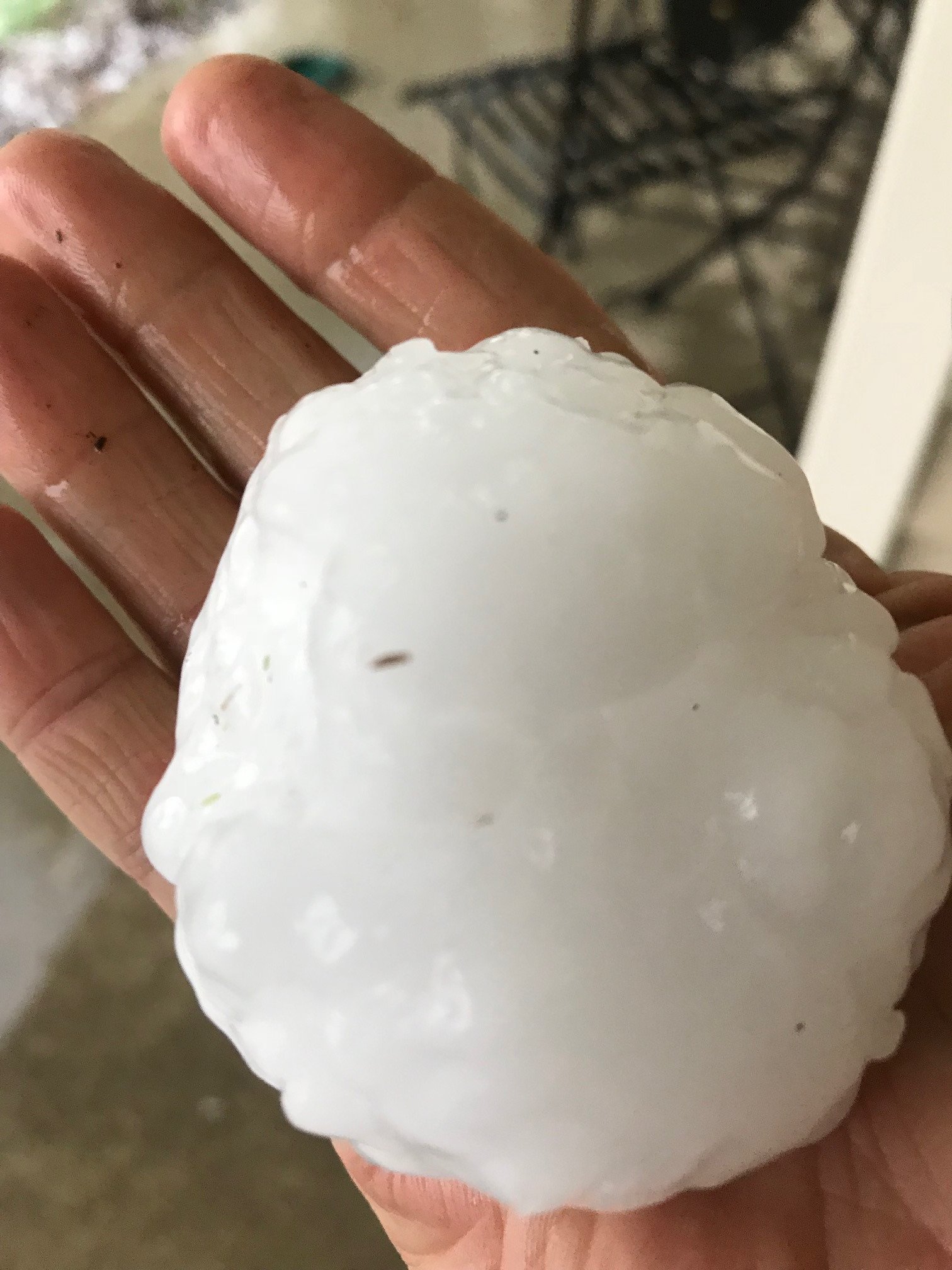
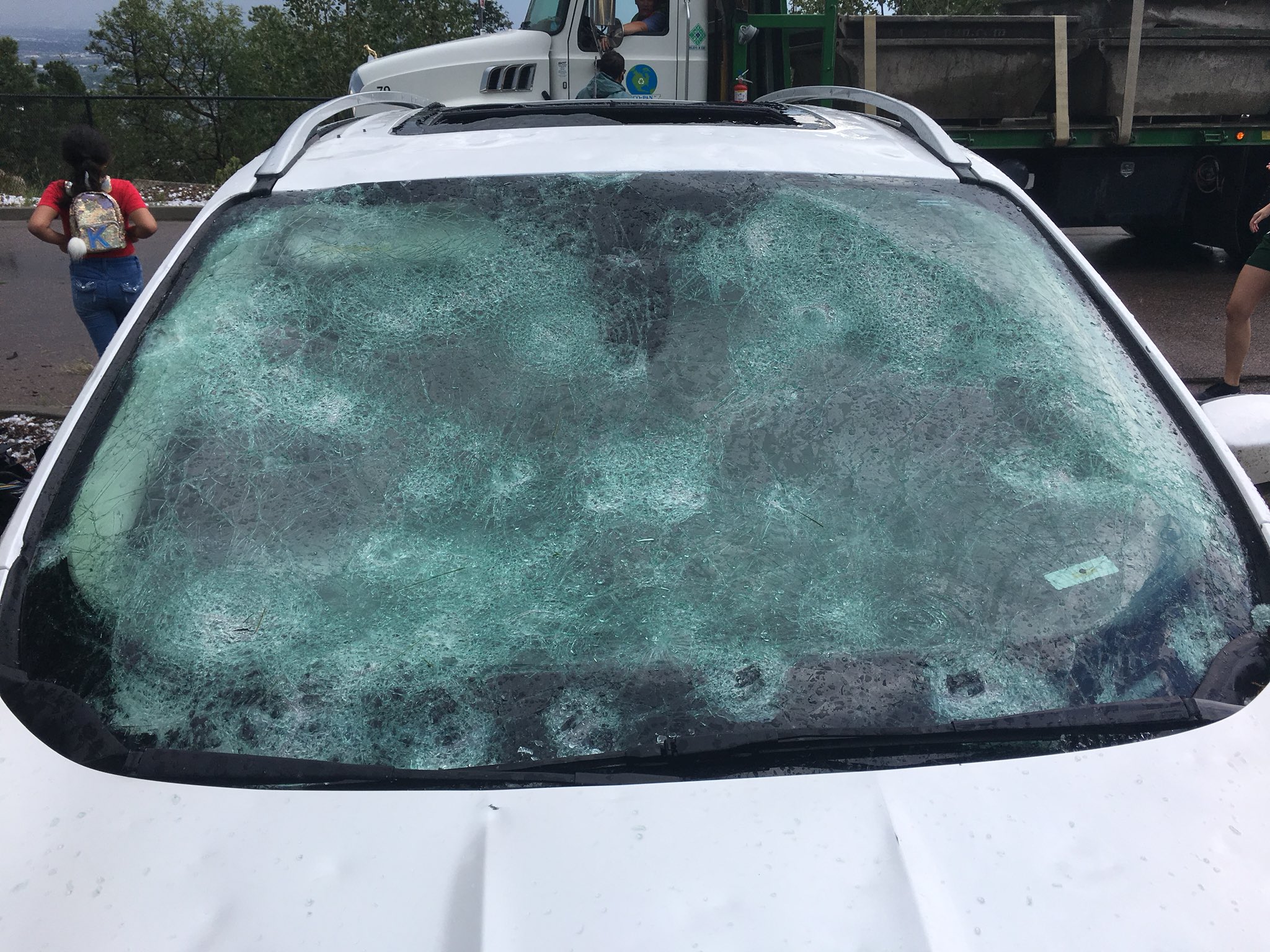
During Monday afternoon 6 August 2018, a very strong and deadly severe thunderstorm produced hail up to softball size across west central El Paso County, including Colorado Springs, the Broadmoor area, the Cheyenne Mountain Zoo and the city of Fountain. Below is an example of the destructive hailstorm, NWS warning and weather messaging during the event, as it moved through Cheyenne Mountain Zoo. Also, below are resource links about NWS weather information and how to get it.
Event
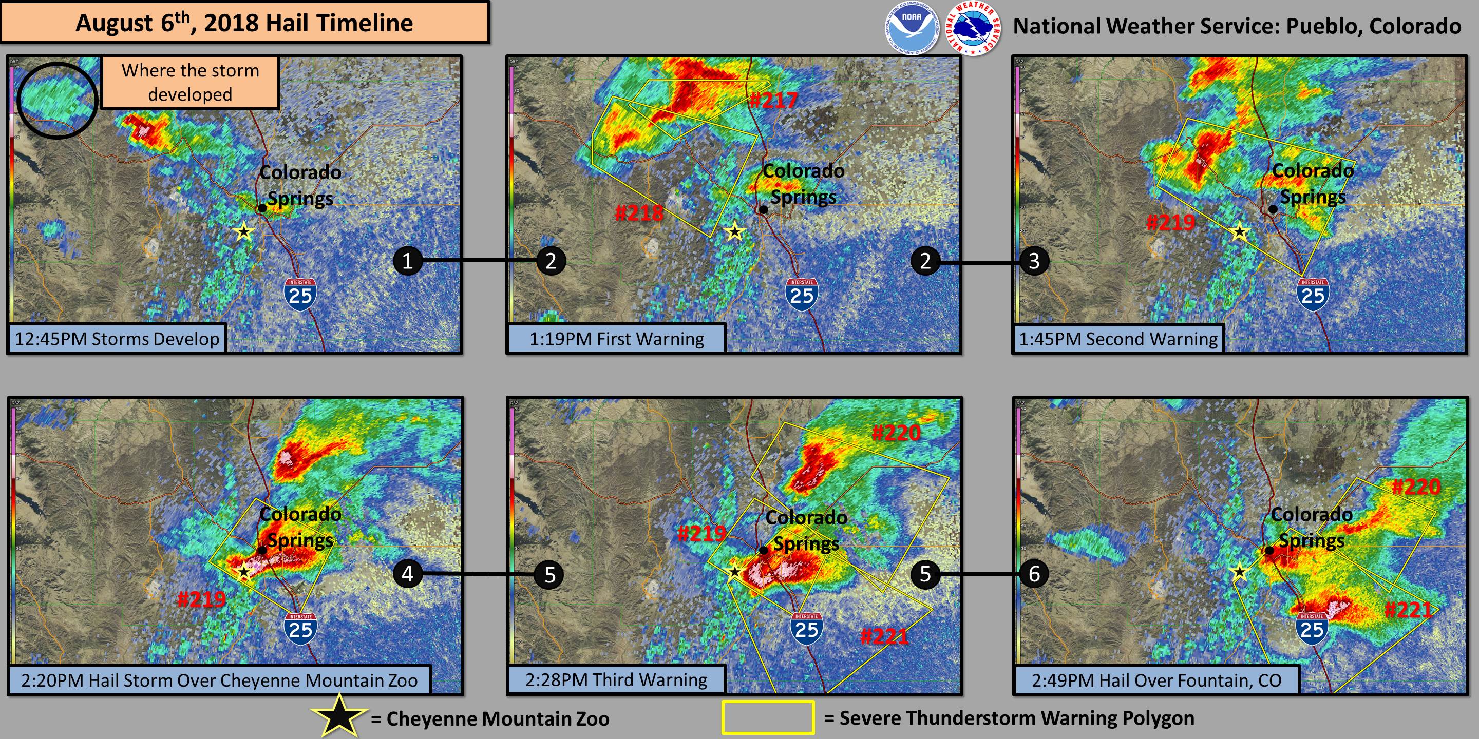
Figure 1: Radar and Warning Polygons Timeline for Cheyenne Mountain Zoo (click image to enlarge)
In Figure 1, Panel 1, showers and thunderstorms were developing on Teller County around 1245 pm MDT. As time elapsed in Panel 2 through 6, thunderstorms became severe and produced very large hail as they moved through the Colorado Springs area, including the Broadmoor and Cheyenne Mountain Zoo areas.
Messaging
Figure 2 is a timeline of NWS watch, warning, and statement messaging, including hail storm reports, for the Cheyenne Mountain Zoo hailstorm event. The timeline image, also, includes when NOAA Weather Radio tone alerts, and commercial vendors notifications, would have been received.

Figure 2: NWS Warning and Weather Messaging for Cheyenne Mountain Zoo Hailstorm (click image to enlarge)
There are several ways to monitor weather information: 1) https://www.weather.gov/ (or https://www.weather.gov/pub/ for south central/southeast Colorado), 2) NOAA Weather Radio(NWS) which is our entry point into the Emergency Alert System (EAS), 3) a commercial vendor who provides weather alert notifications via EMail or cell phone text messages, or 4) commercial TV or radio stations who automatically relay NWS warnings through EAS.
At 321 AM MDT Monday 6 Aug 2018, the National Weather Service Forecast Office in Pueblo issued its suite of digital and text forecast products. The Zone Forecast Product(ZFP) mentioned the potential for severe thunderstorms during the day and in the evening.
COZ085-062215-
Colorado Springs Vicinity/Southern El Paso County/Rampart Range
Below 7400 Feet-
INCLUDING Colorado Springs and Peterson AFB
321 AM MDT Mon Aug 6 2018

.TODAY...Severe thunderstorms are possible. A 50 percent chance
of thunderstorms. Partly sunny. Highs 75 to 86. Northeast winds
10 to 15 mph.
.TONIGHT...Severe thunderstorms are possible until midnight.
Chance of thunderstorms until midnight, then slight chance of
thunderstorms after midnight. Mostly cloudy. Lows in the mid to
upper 50s. North winds up to 10 mph. Chance of precipitation
50 percent.
In Figure 2, the Watch County Notification Watch #333 was disseminated for a Severe Thunderstorm Watch at 105 PM MDT Monday 6 Aug 2018, and there was an audible alarm on NOAA Weather Radio. If people had a commercial vendor weather notification service, then they would have received a message alert about the watch. At 119 PM MDT, a Severe Thunderstorm Warning #218 was issued just west-northwest of the Cheyenne Mountain Zoo for the developing severe thunderstorm. Severe Thunderstorm Warning #219 was issued at 145 PM MDT was the first warning polygon to include the Cheyenne Mountain Zoo. NOAA Weather Radio and commercial vendor weather notification service would have alerted a person about the warning in and around the Cheyenne Mountain Zoo. Reports of ping pong to tennis ball size hail, around the Cheyenne Mountain Zoo, started between 200 PM and 220 PM MDT. Another Severe Thunderstorm Warning #221 was issued at 228 PM MDT, and more alerts would have been received via NOAA Weather Radio and any commercial vendor weather notification service. Some commercial vendor services may have alerted for each follow-up NWS Severe Weather Statement updating the latest warning.
Wireless Emergency Alerts (WEA) are provided by your cell phone provider. WEA does NOT include Severe Thunderstorm Warnings issued by the National Weather Service. WEA relays Tornado Warnings, Flash Flood Warnings, Dust Storm Warnings, and other weather messages (see link below for more information on WEA). Remember that the National Weather Service issues Severe Thunderstorm Warnings for severe thunderstorms that are producing damaging wind gusts of 60 mph or stronger and/or hail of 1 inch in diameter or larger. In this case, the hail was much larger than 1 inch in diameter. Oftentimes, severe thunderstorms can produce as much or more damage than weak tornadoes, so it is important to be aware when Severe Thunderstorm Warnings are issued for your location. Ensure that you have multiple ways to receive warnings issued by the National Weather Service.
Photos
 |
 |
 |
 |
 |
Click images to enlarge
Resources
EMail and SMS(Text Message) Weather Alert Services