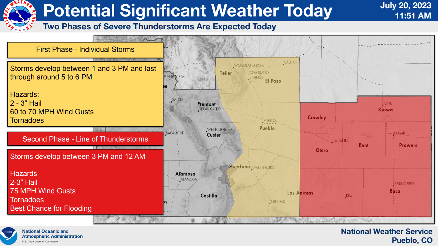
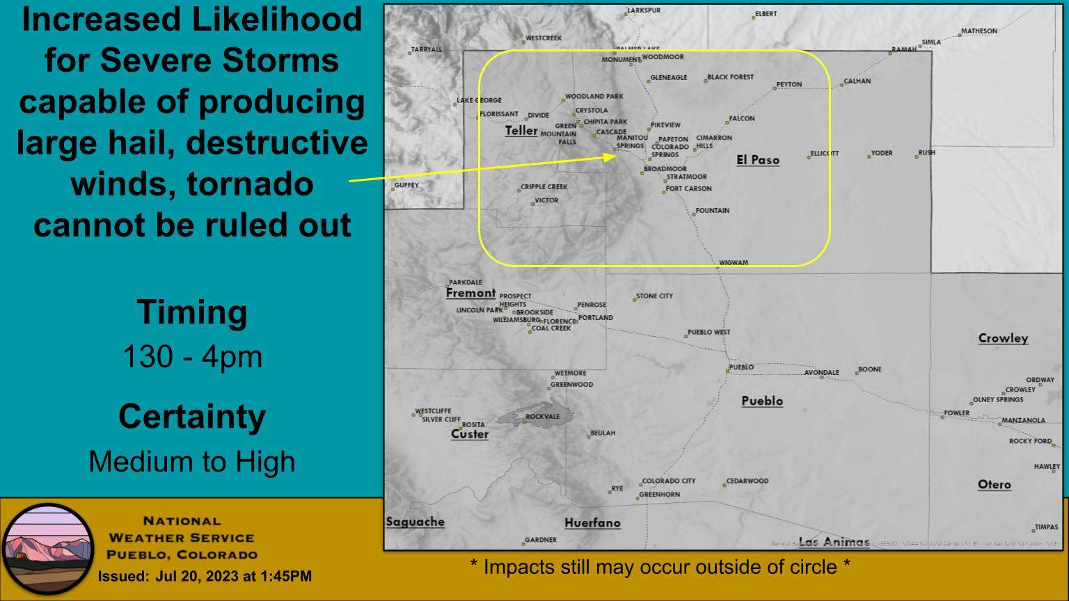
Overview
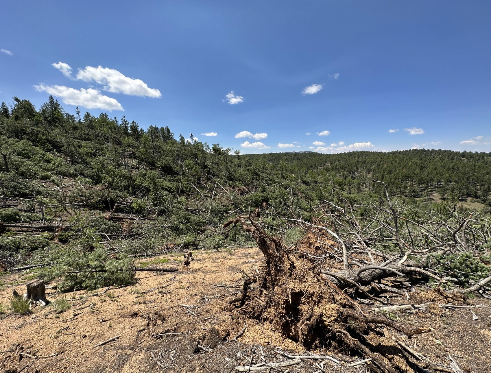
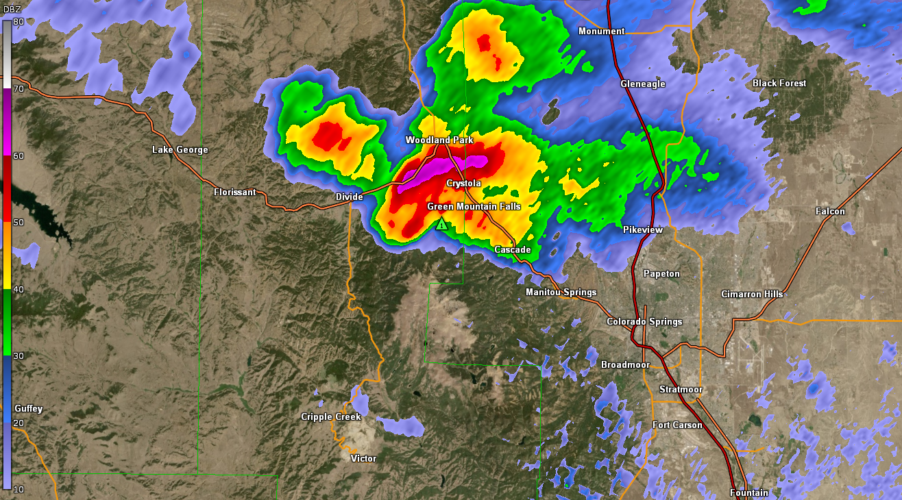
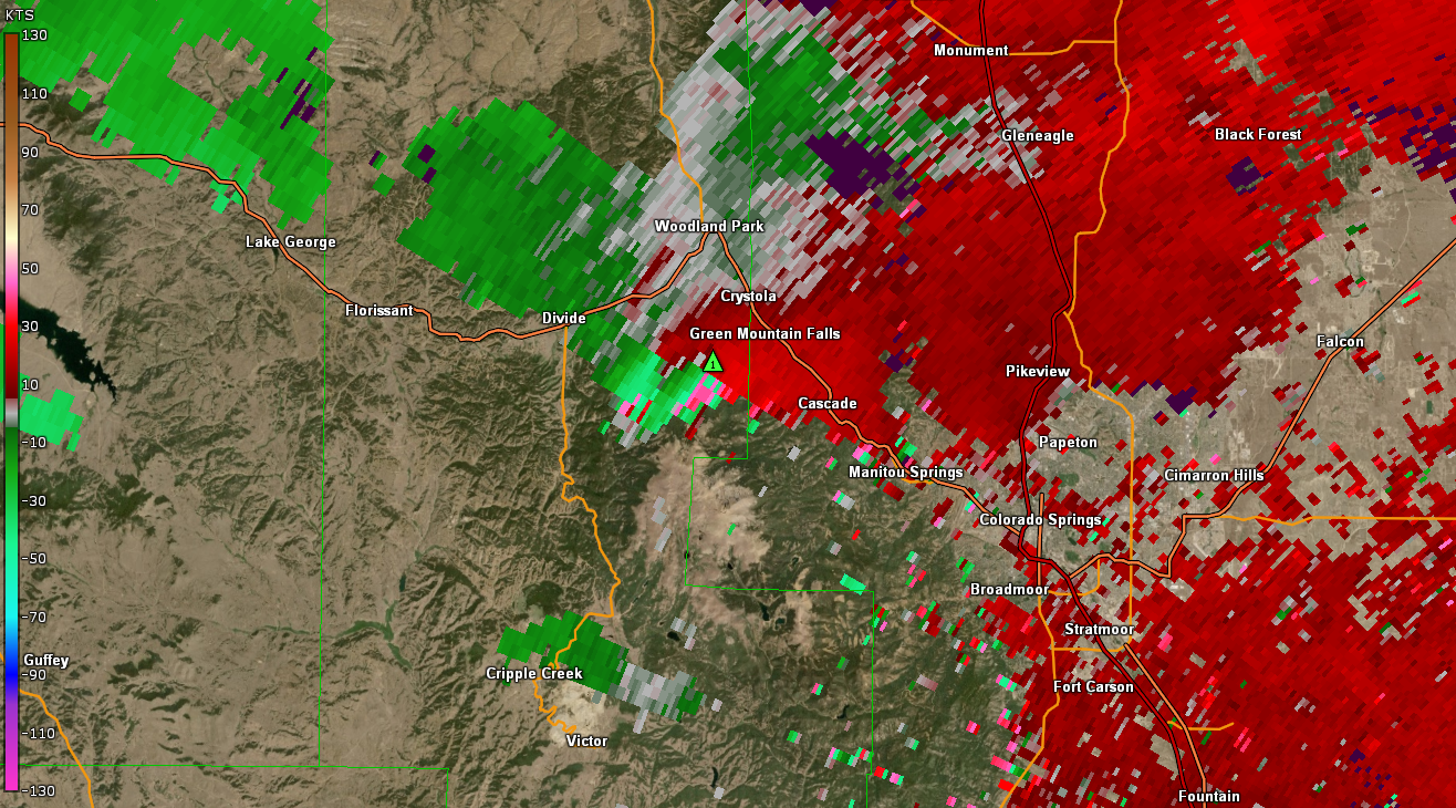
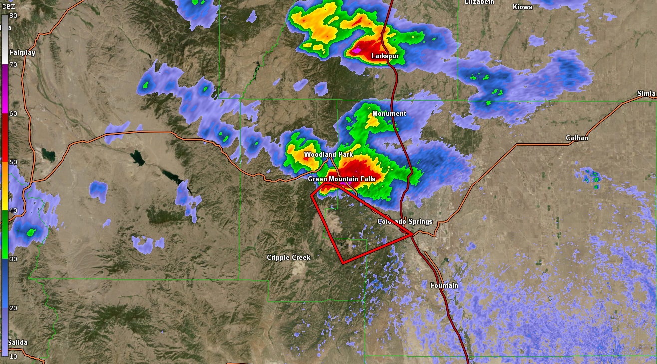
During the early afternoon of July 20th, a supercell thunderstorm developed over western Teller County. As this storm tracked eastward, it quickly developed a tornado on the northern slopes of Pikes Peak. This tornado caused extensive tree damage just west of the Pikes Peak Highway, with numerous large and healthy softwood uprooted trees observed. The tornado then crossed the Pikes Peak Highway in between mile markers 8 and 9, where it increased in intensity. Once again, extensive tree damage with numerous uprooted softwood trees along with sporadic snapped softwood trees. At this point, the tornado was likely at peak intensity given the extent of the tree damage. Damage in this area was consistent, with the degree of damage indicating the highest estimated winds were up to 108 mph. Clear convergent and cyclonic damage patterns were well noted in this area. The tornado continued east crossing the Crystal Creek Reservoir, where additional uprooted softwood trees were observed. The tornado then proceeded to cross the Pikes Peak Highway two more times causing similar tree damage, before lifting close to the Pikes Peak Highway near mile marker 5.Tornadoes:
|
Tornado - LOCATION
Track Map 
|
The Enhanced Fujita (EF) Scale classifies tornadoes into the following categories:
| EF0 Weak 65-85 mph |
EF1 Moderate 86-110 mph |
EF2 Significant 111-135 mph |
EF3 Severe 136-165 mph |
EF4 Extreme 166-200 mph |
EF5 Catastrophic 200+ mph |
 |
|||||
Photos & Video
Header
 |
 |
 |
 |
| Tree Damage | Aspen Tree Damage | Additional Tree Damage | Snapped Tree |
Radar
Header
 |
 |
|
| Reflectivity | Velocity |
Service
The Forecast
 |
 |
 |
|
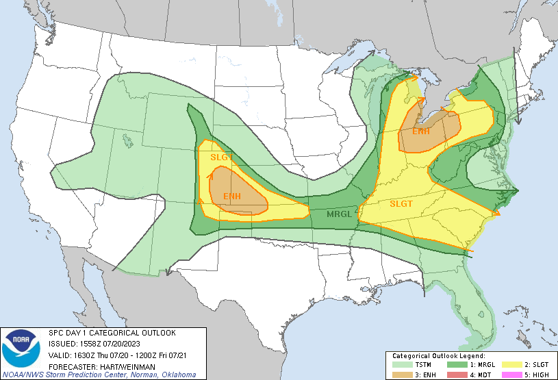
| SPC Day 1 Categorical Outlook | Morning Briefing | Mesographic | |
 |
 |
 |
|
| SPC Day 1 Tornado Outlook | Pikes Peak & I-25 Briefing | Tornado Warning |
 |
Media use of NWS Web News Stories is encouraged! Please acknowledge the NWS as the source of any news information accessed from this site. |
|


