Overview
|
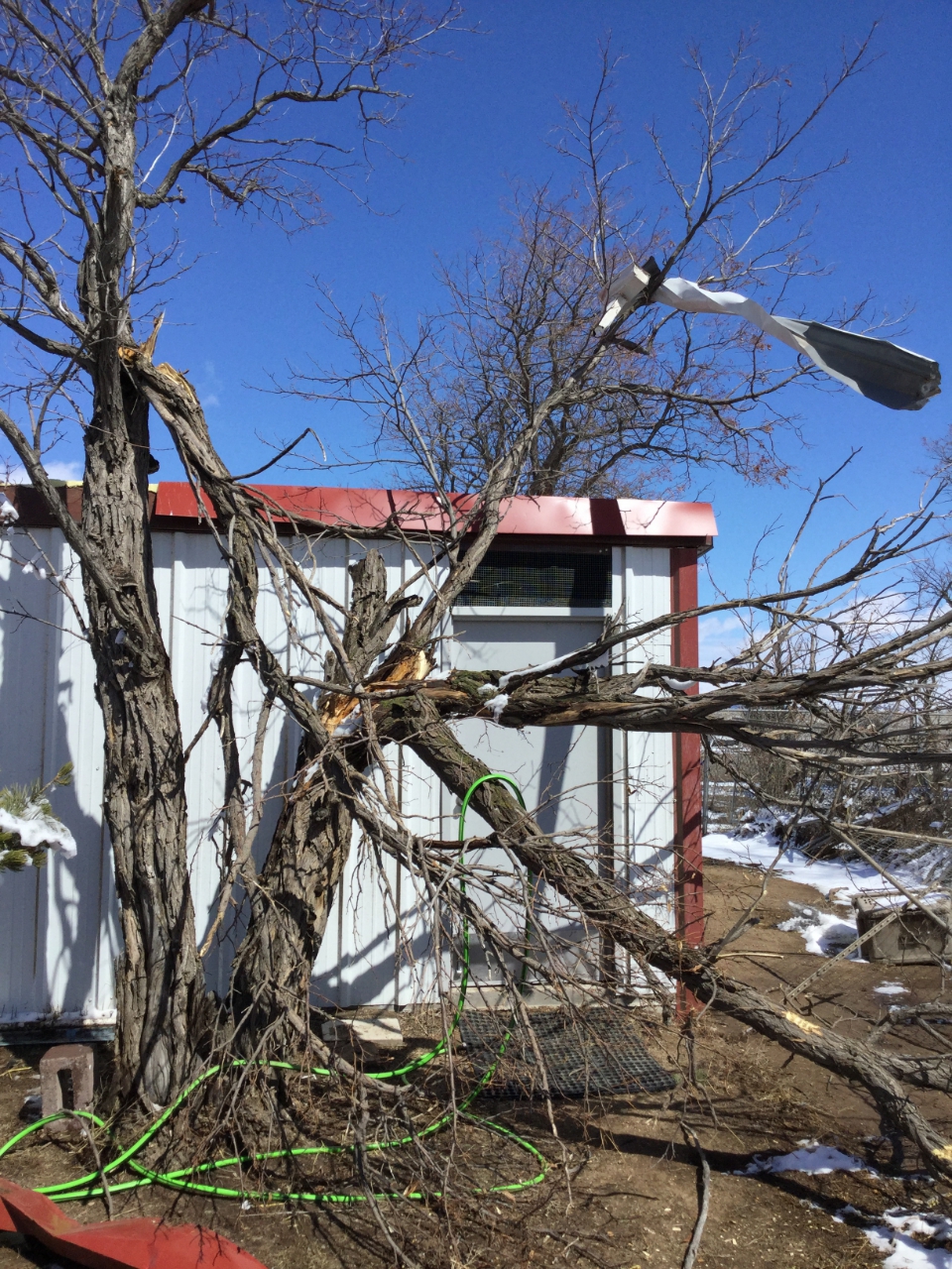
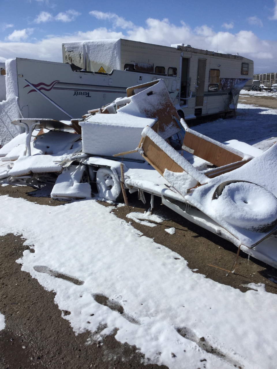
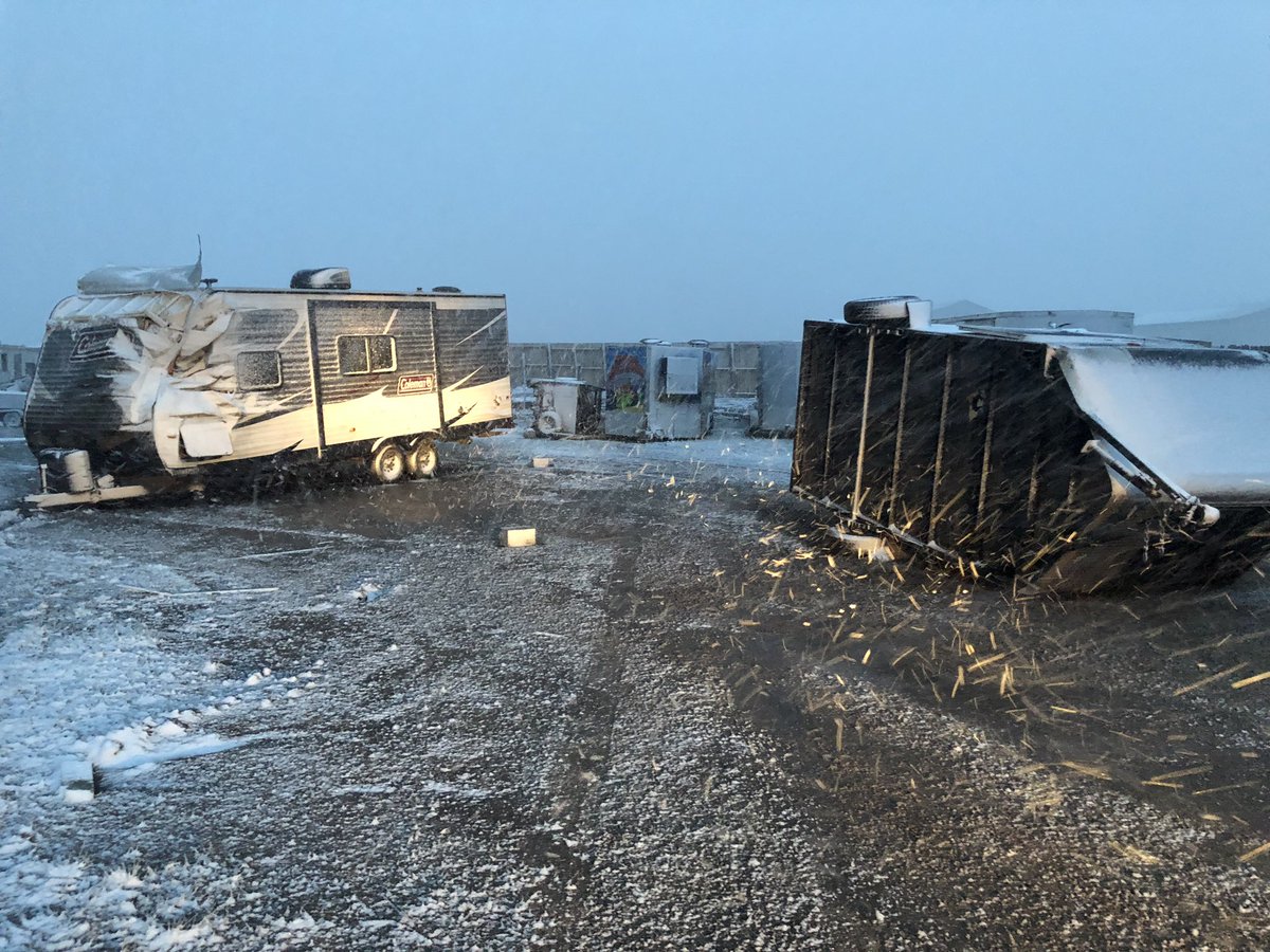
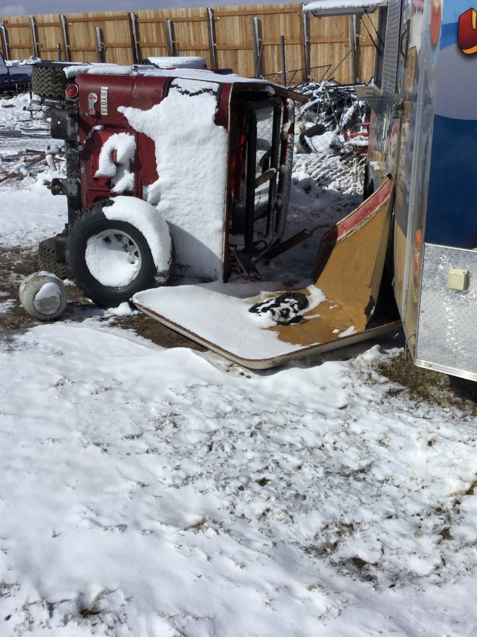
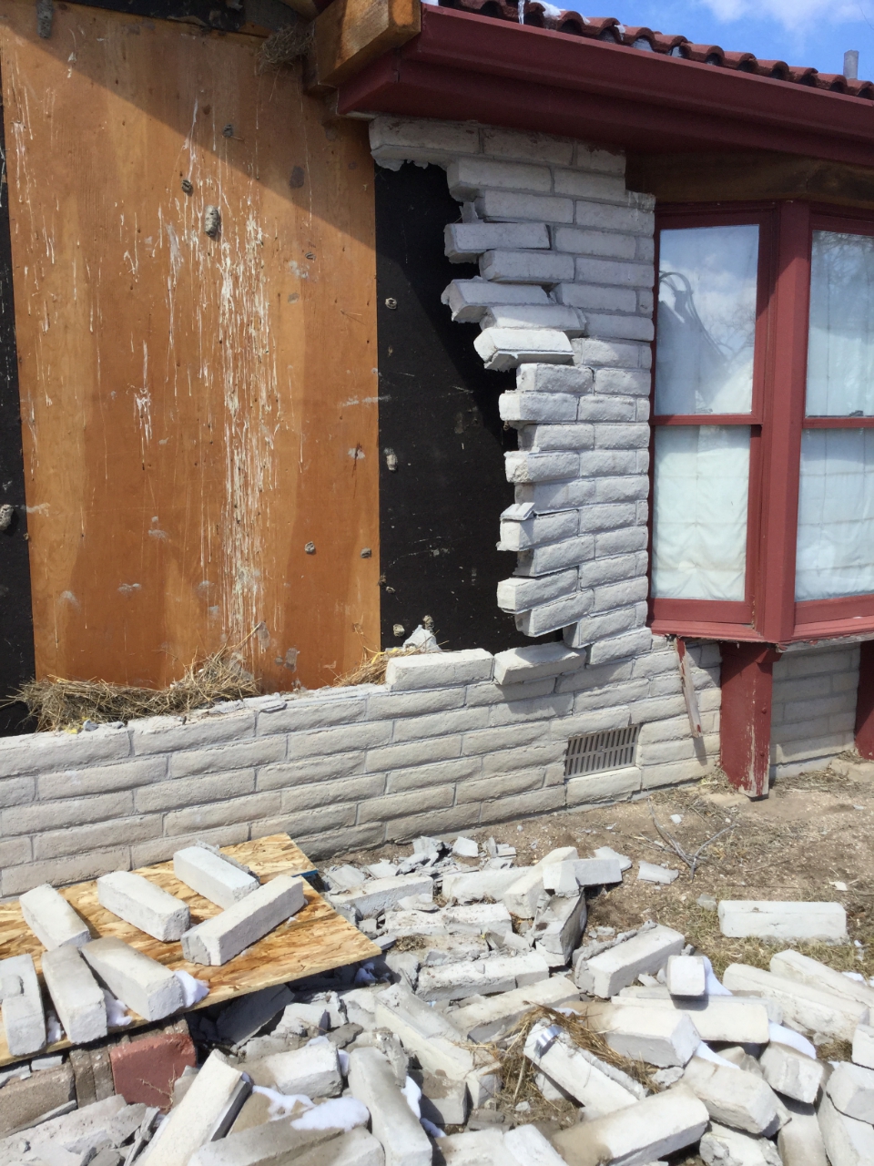
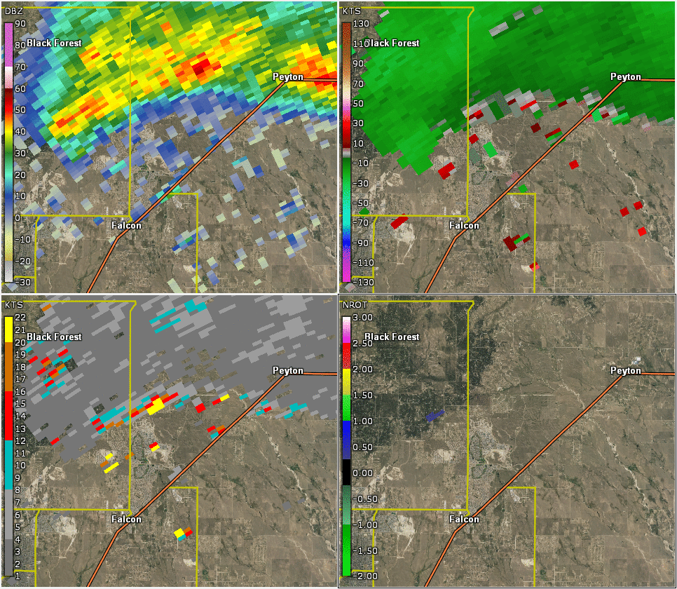
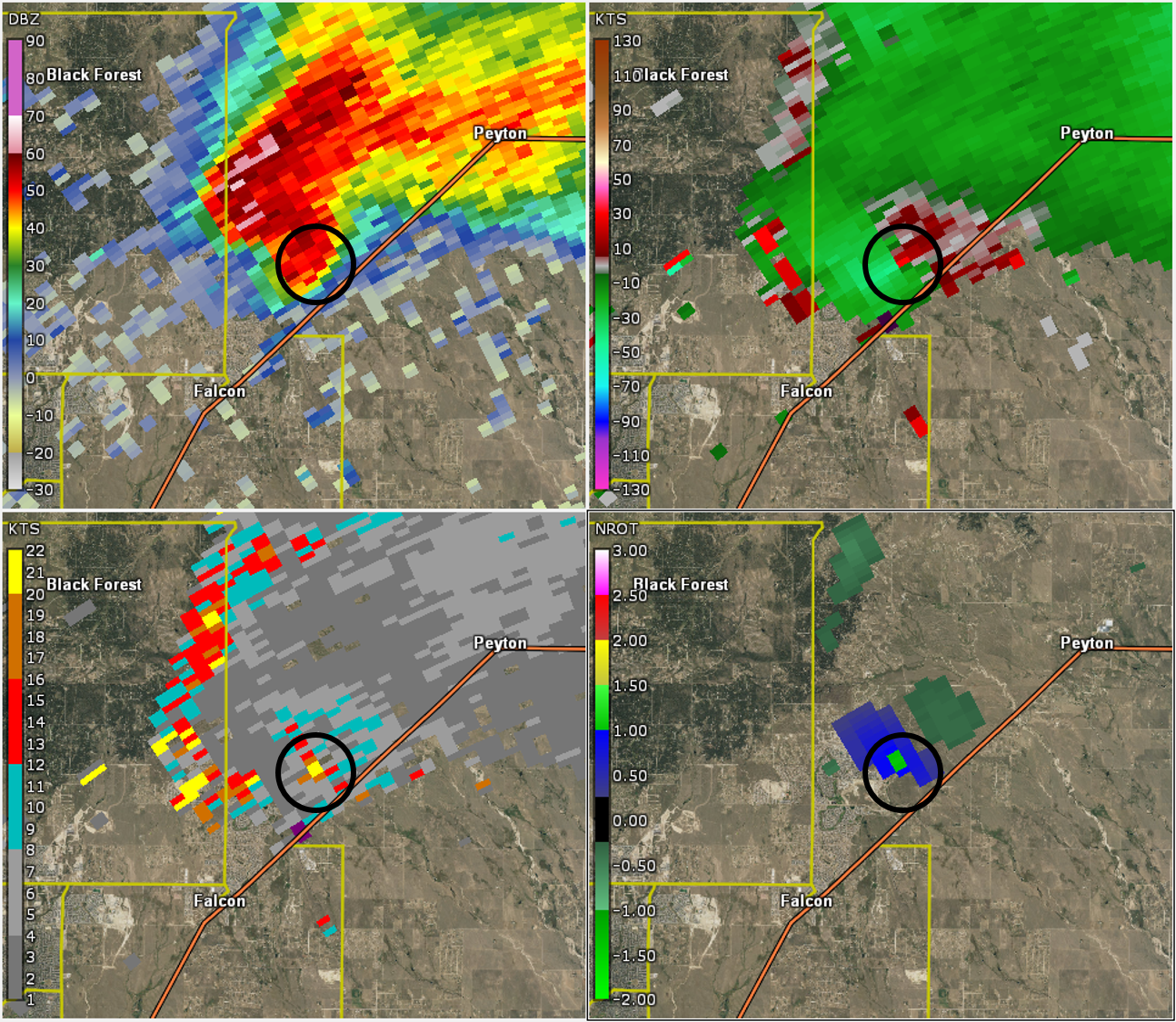
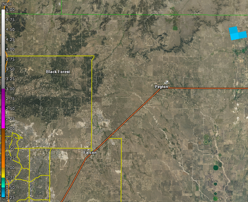
Summary of the storm that occurred Friday afternoon, March 29th: The morning after the episode occurred, the Warning Coordination Meteorologist and the Meteorologist-in-Charge from the National Weather Service in Pueblo traveled to Falcon, Colorado to conduct a damage survey. A relatively weak supercell thunderstorm developed over north-central El Paso County, Colorado after 3:00 PM on March 29th. Thereafter, as mid-level rotation increased in the storm, it advanced southeast between Falcon and Peyton. A severe thunderstorm warning with a "tornado possible" tag was issued at 4:06 PM by the NWS in Pueblo, CO. By around 4:15 PM, the storm had produced a weak mesocyclone tornado in northern parts of Falcon, as was evidenced by numerous photos and videos. The greatest tornado damage was limited to flipped RVs/campers and damage to the wall of a residence. No severe hail was reported with this storm. The damage survey concluded EF-0 tornado damage with estimated wind speeds up to 85 mph. According to data archives dating back to 1951, this appears to be the first reported tornado in El Paso County in the month of March. Temperatures were only in the mid 40s ahead of the tornado, and snow fell across the tornado path shortly after the storm moved through. |
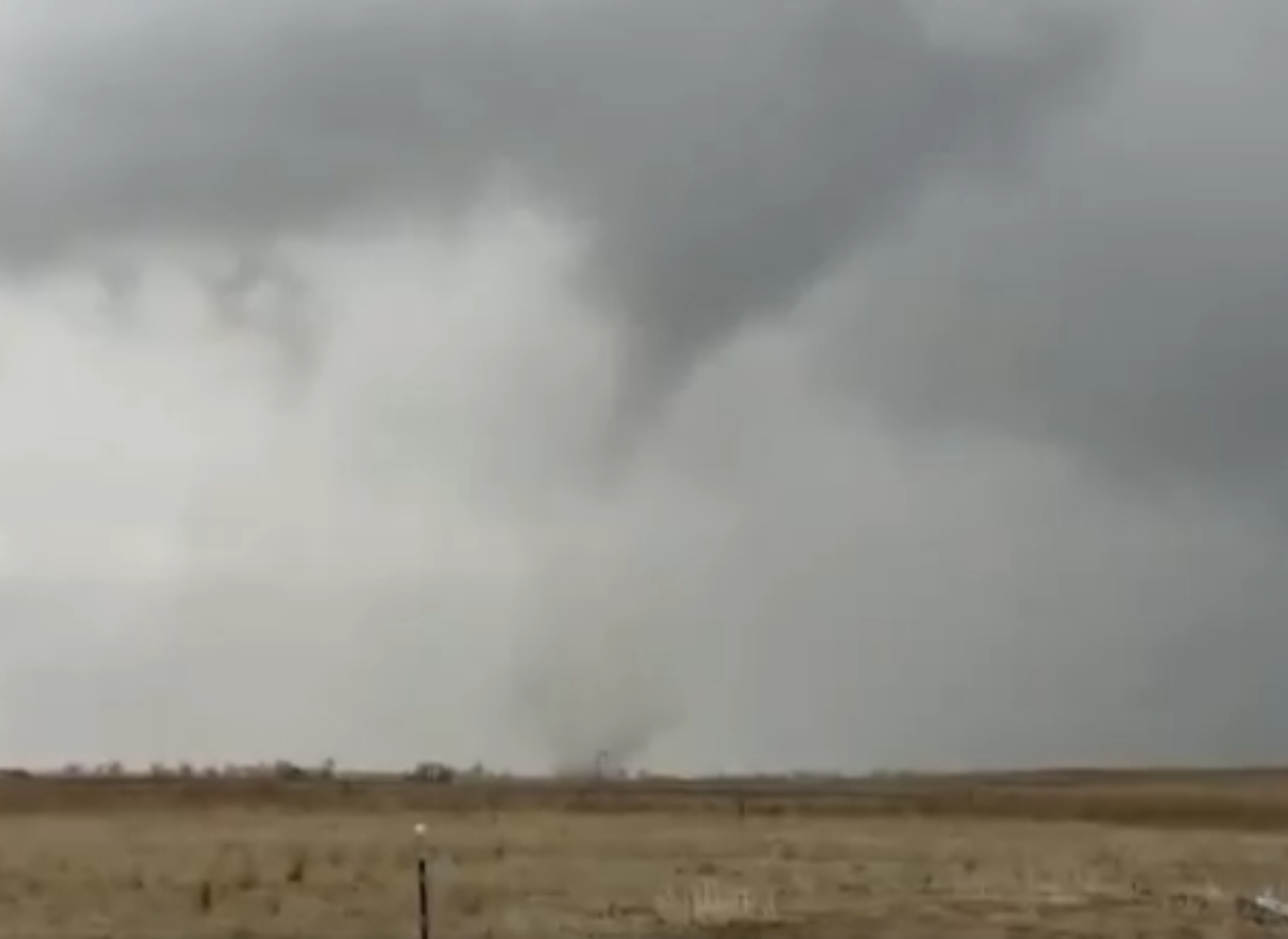 Mesocyclone Tornado near Falcon, Colorado Photo Courtesy of Kerry Louise Boucher |
Tornado:
|
Tornado - Falcon, CO
Track Map  
|
||||||||||||||||
The Enhanced Fujita (EF) Scale classifies tornadoes into the following categories:
| EF0 Weak 65-85 mph |
EF1 Moderate 86-110 mph |
EF2 Significant 111-135 mph |
EF3 Severe 136-165 mph |
EF4 Extreme 166-200 mph |
EF5 Catastrophic 200+ mph |
 |
|||||
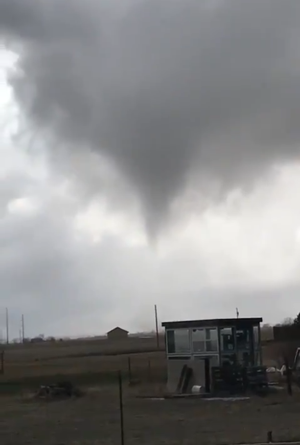
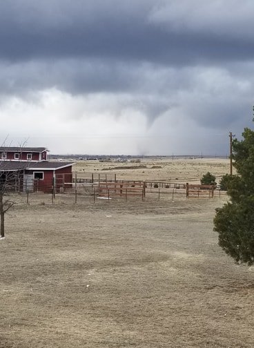
Photos & Video:
Various Photos of the Mesocyclone Tornado and Resulting Damage
 |
 |
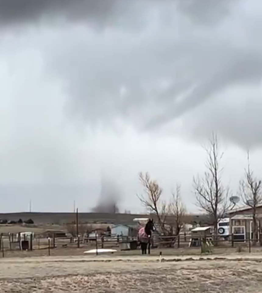 |
| Tornado, Stacey Aigner | Tornado, Jay Baumiller | Tornado, Grace Reno |
|
 |
 |
| Tornado, Kerry Louise Boucher | Damage, NWS Pueblo | Damage, NWS Pueblo |
 |
 |
 |
| Damage, Sam Kraemer | Damage, NWS Pueblo | Damage, NWS Pueblo |
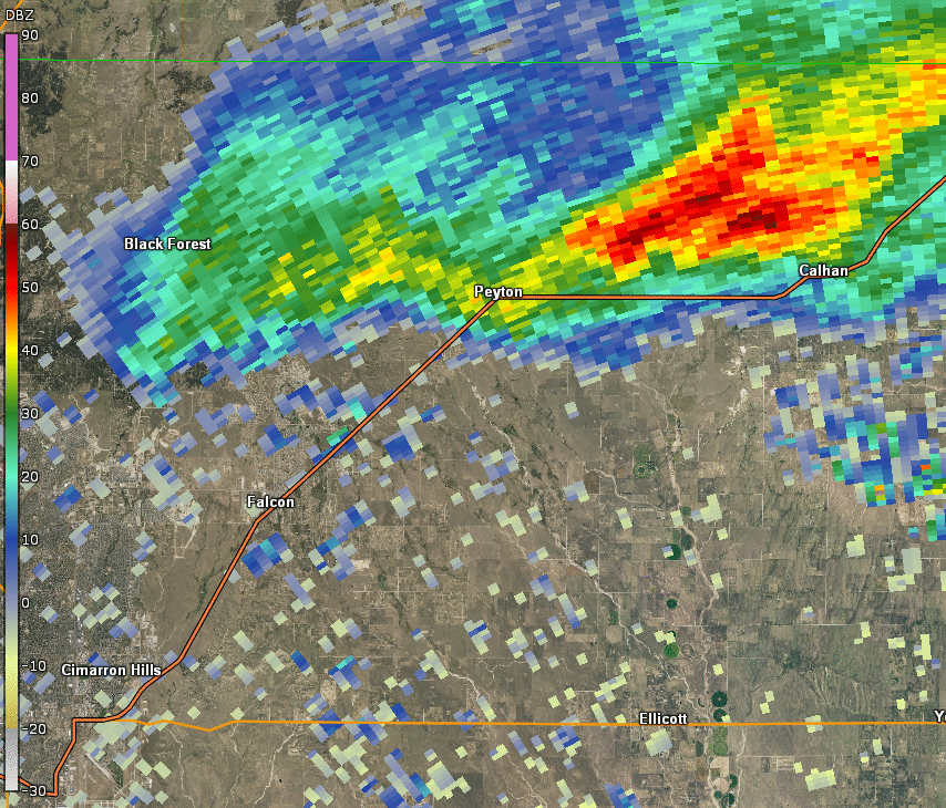
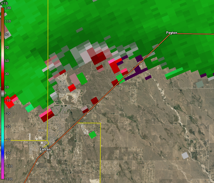
Radar Imagery
 |
 |
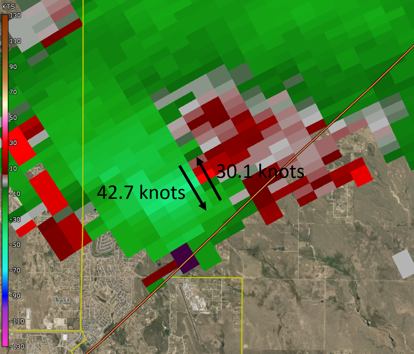 |
| Base Reflectivity, 3:44 PM - 4:40 PM | Base Velocity, 3:54 PM - 4:22 PM | Annotated Base Velocity Image at 4:03 PM |
 |
 |
 |
| Base Reflectivity (TL), Base Velocity (TR), NROT (BR), SW (BL) all 0.5º Tilt, 3:49 PM - 4:22 PM | Base Reflectivity (TL), Base Velocity (TR), NROT (BR), SW (BL) all 0.5º Tilt, 4:03 PM | MESH, 3:44 PM - 4:17 PM |
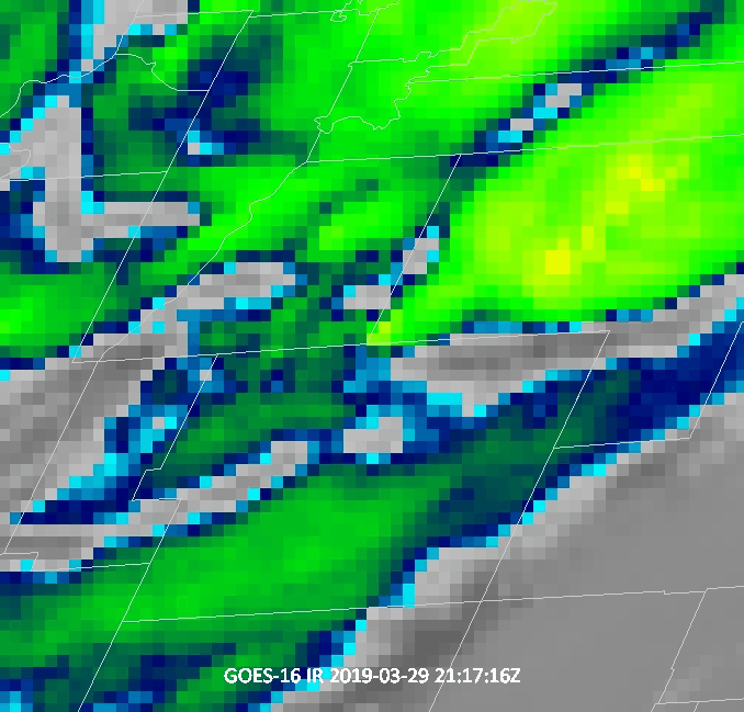
Satellite Imagery
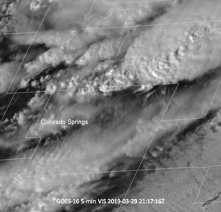
Water vapor imagery from the morning and early afternoon reveal the shortwave trough progressing across the Great Basin into Colorado. Brief clearing apparent in visible imagery ahead of the surface boundary allowed surface temperatures to warm enough for marginal instability to be realized. Upon convective initiation, fairly quick cooling of cloud tops in IR imagery, expansion of the anvil once reaching the tropopause, and texture in the VIS, all indicate at least a marginally strong updraft. However, a lack of an obvious overshooting top with this storm point to likely limited updraft strength. Satellite imagery highlights the subsequent rapid decay of the storm per warming the IR and loss of texture in the VIS.
 |
 |
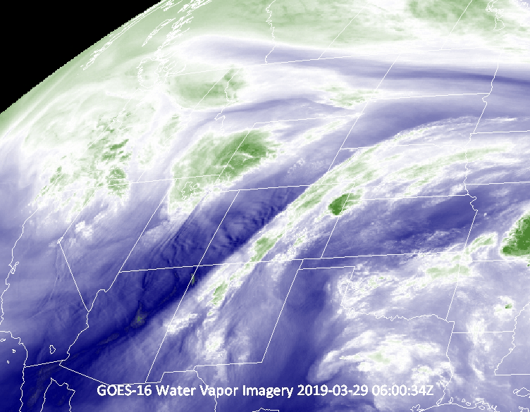 |
| GOES-16 Visible Satellite Imagery, 3:22 PM - 5:12 PM | GOES-16 Infrared Window Satellite Imagery, 3:22 PM - 5:12 PM | GOES-16 Water Vapor Satellite Imagery |
Environment
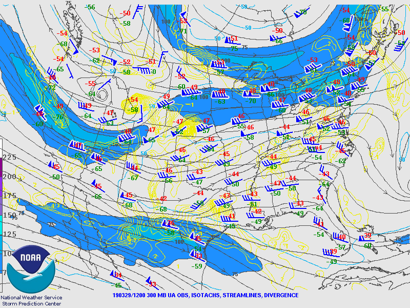
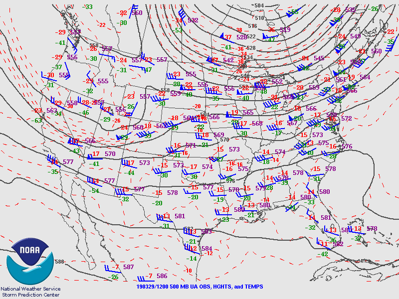
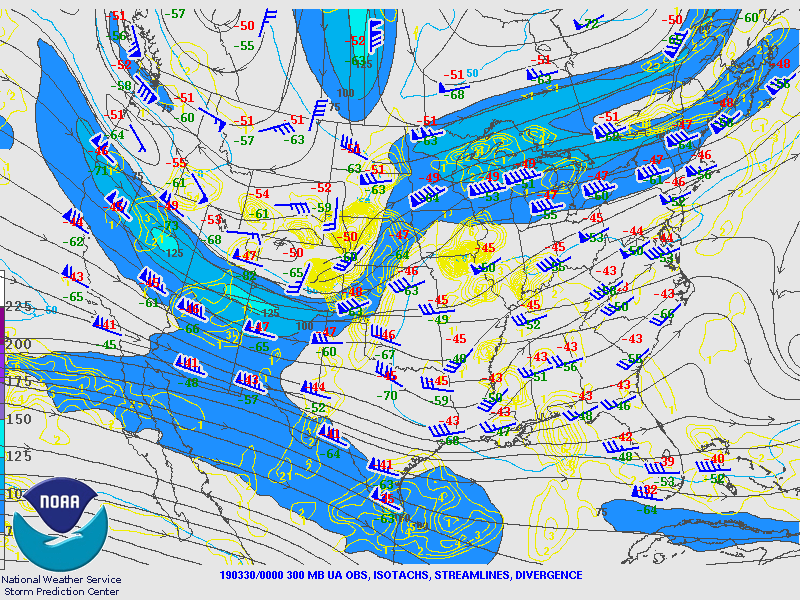
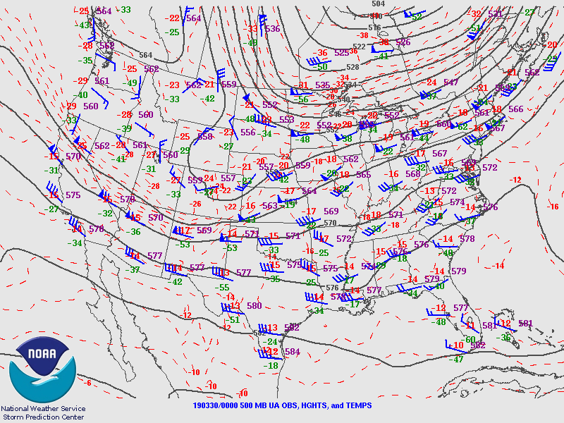
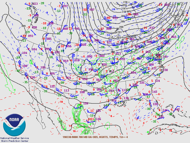
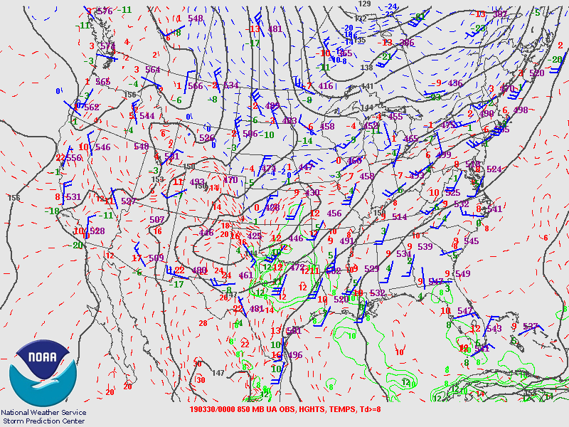
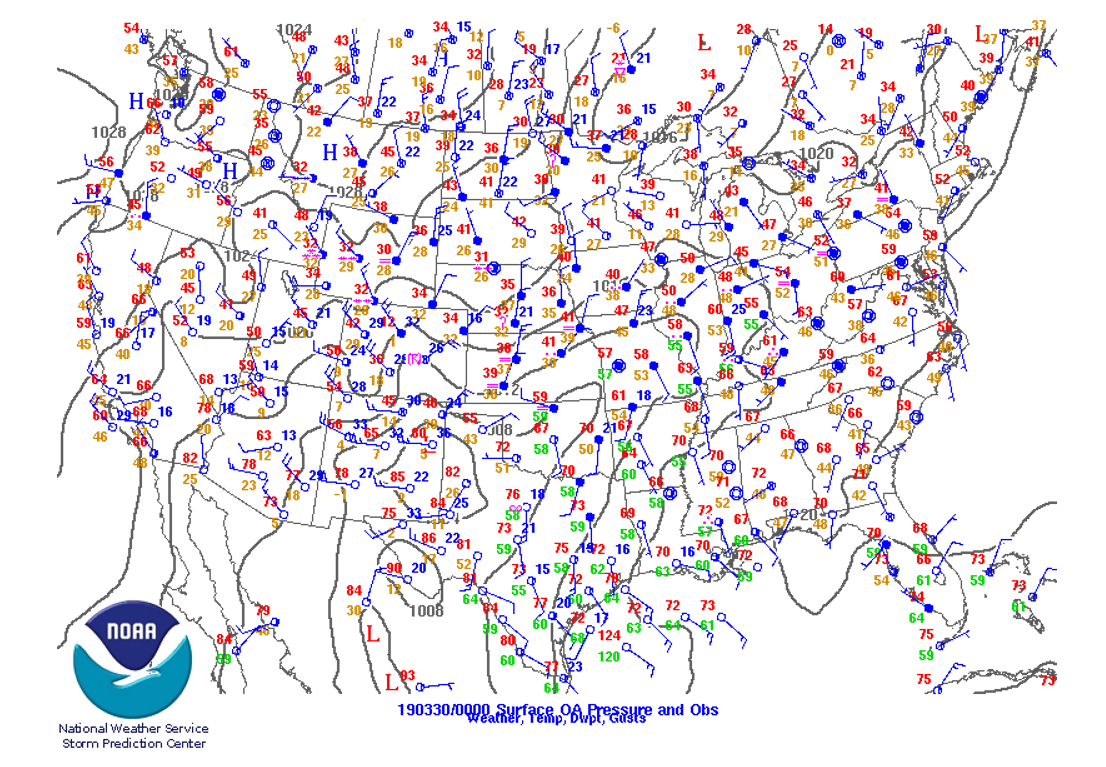
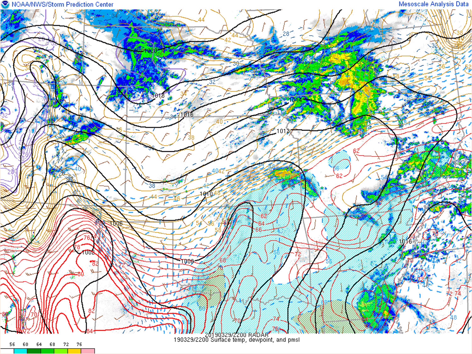
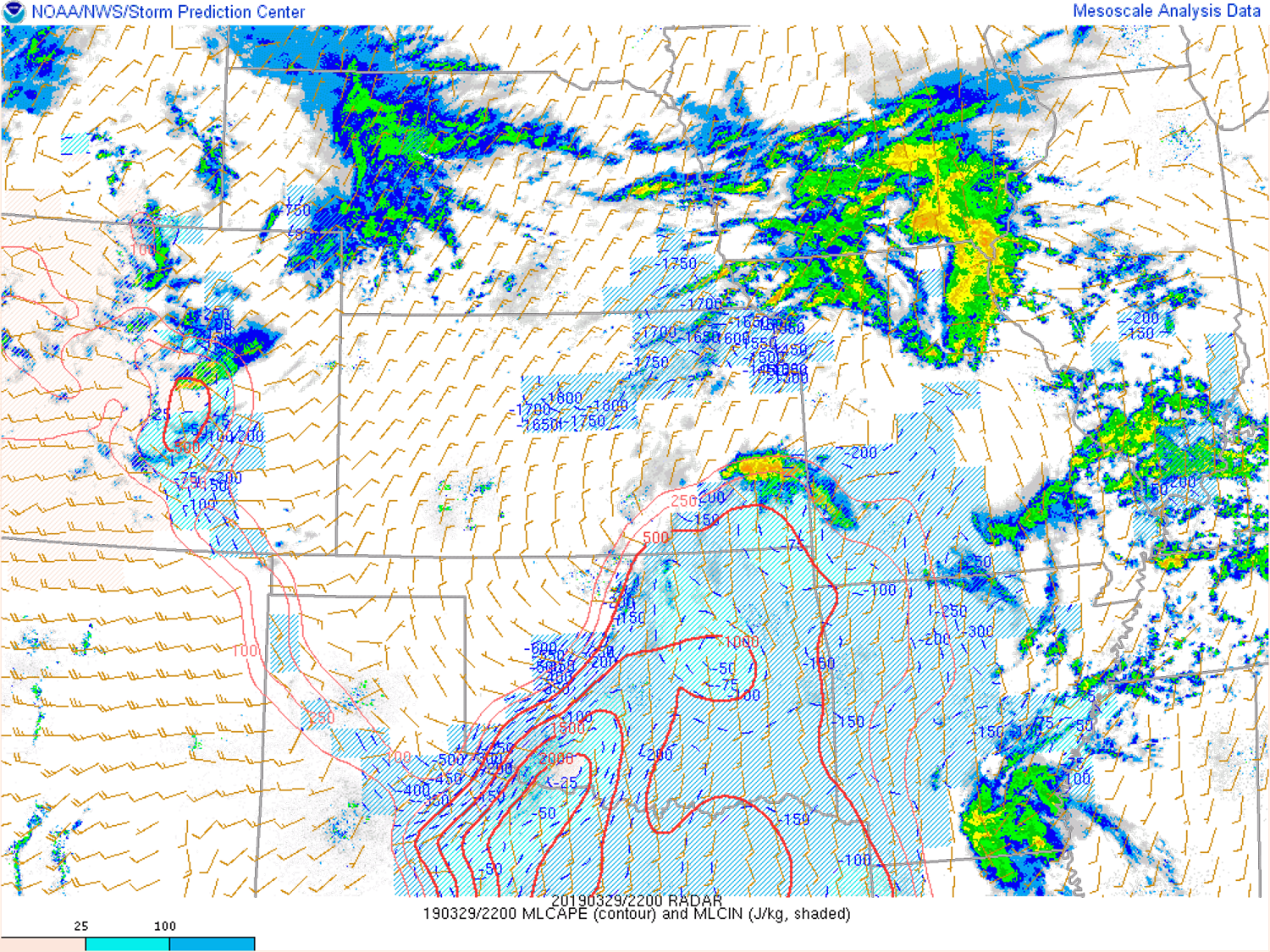
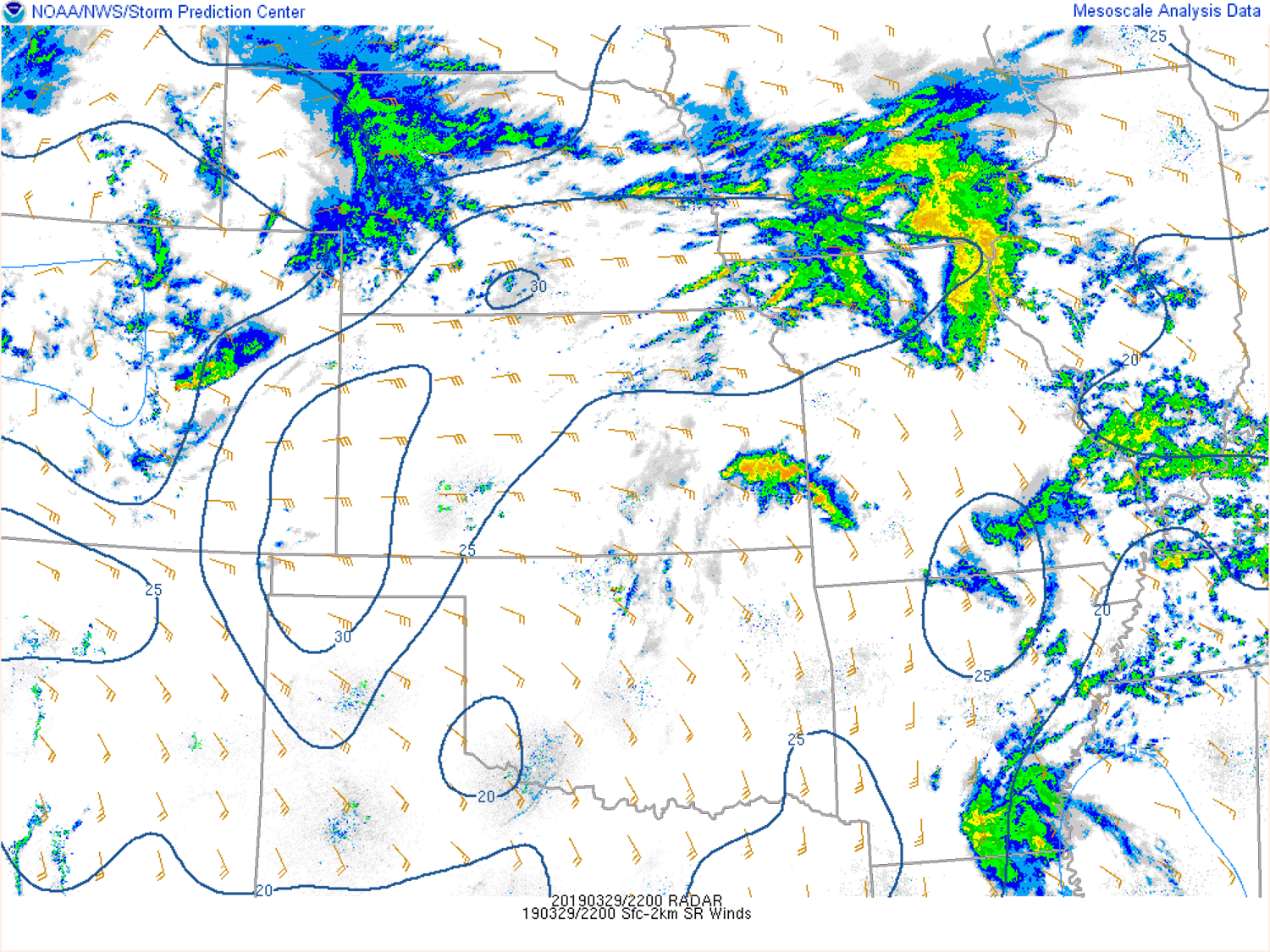
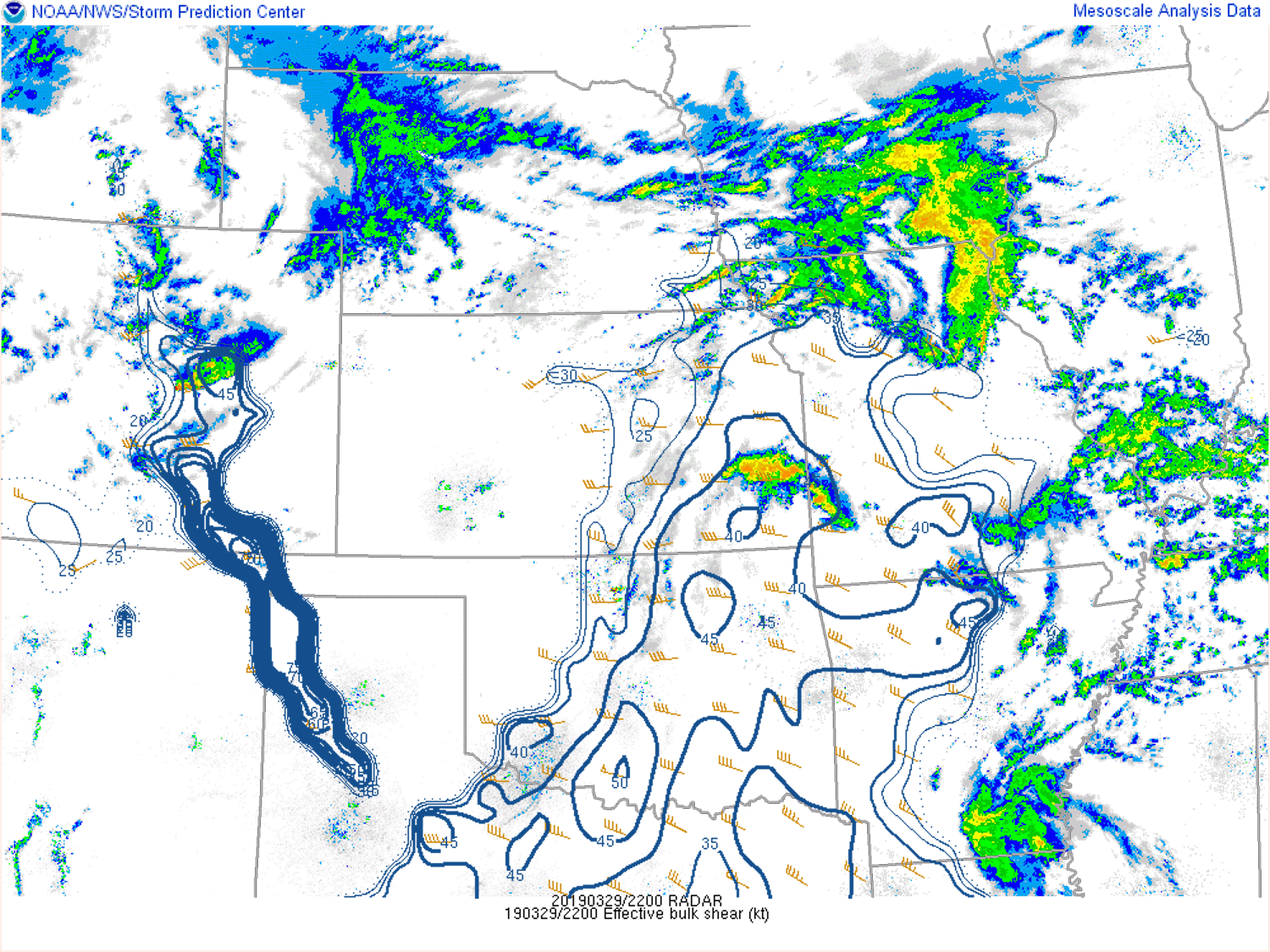
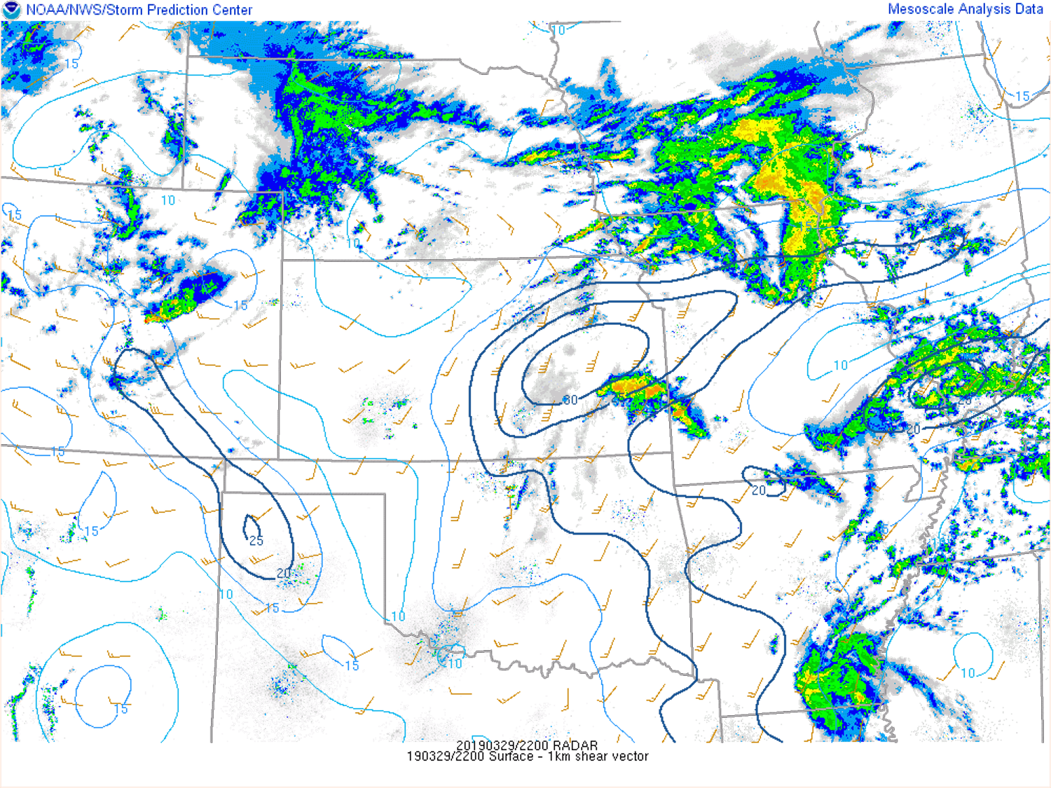
In the upper levels, a compact shortwave trough was advancing out of the Great Basin and across Colorado. The trough was accompanied by a 125 knot, 300 mb jet along its southern semicircle over the CO/NM border. Associated Differential Cyclonic Vorticity Advection and ascent within the left jet exit region resulted in abundant large scale upward vertical motion across eastern Colorado and western Kansas. The upper trough acted to deepen a low from 700 mb to the surface across eastern Colorado into Kansas. Lee side troughing was also diagnosed at the surface across the I-25 corridor during the afternoon, increasing southeasterly flow into El Paso County. On the backside of the Kansas low, northeasterly to northerly flow increased across eastern Colorado through the low levels, tightening a boundary across the central Colorado plains. Convergence along the tightening low level boundary served as a focus for convective development across northern El Paso County, aided by the strong large scale forcing for ascent.
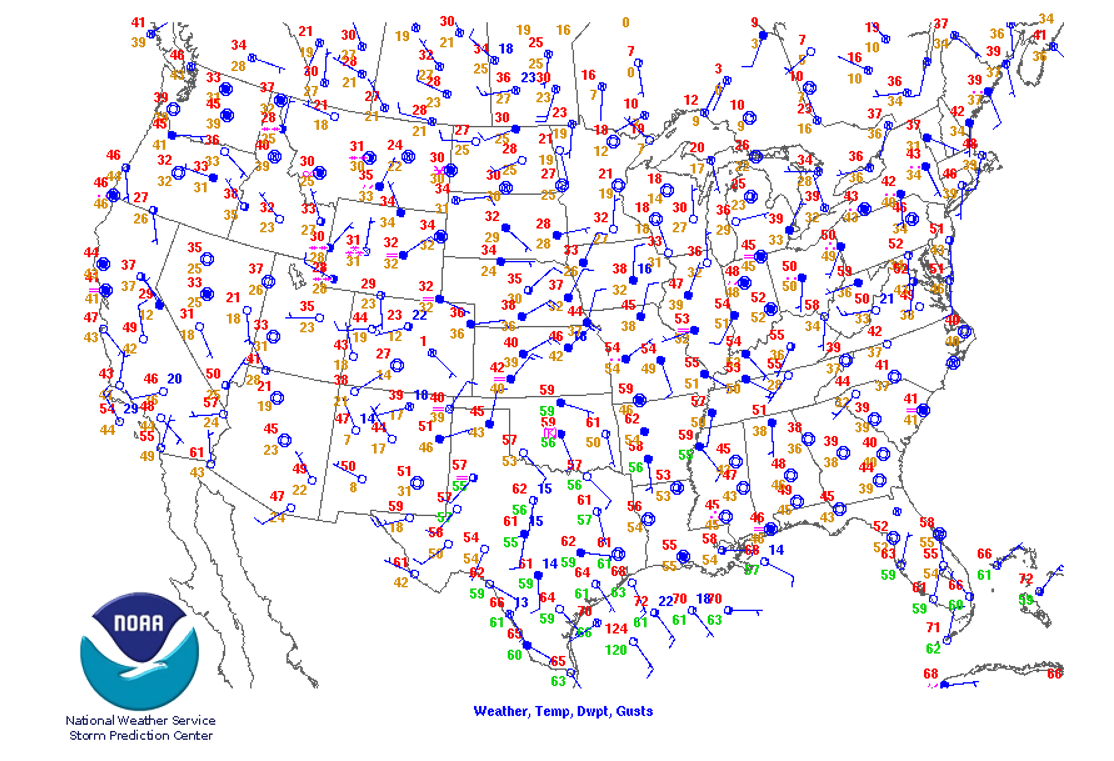
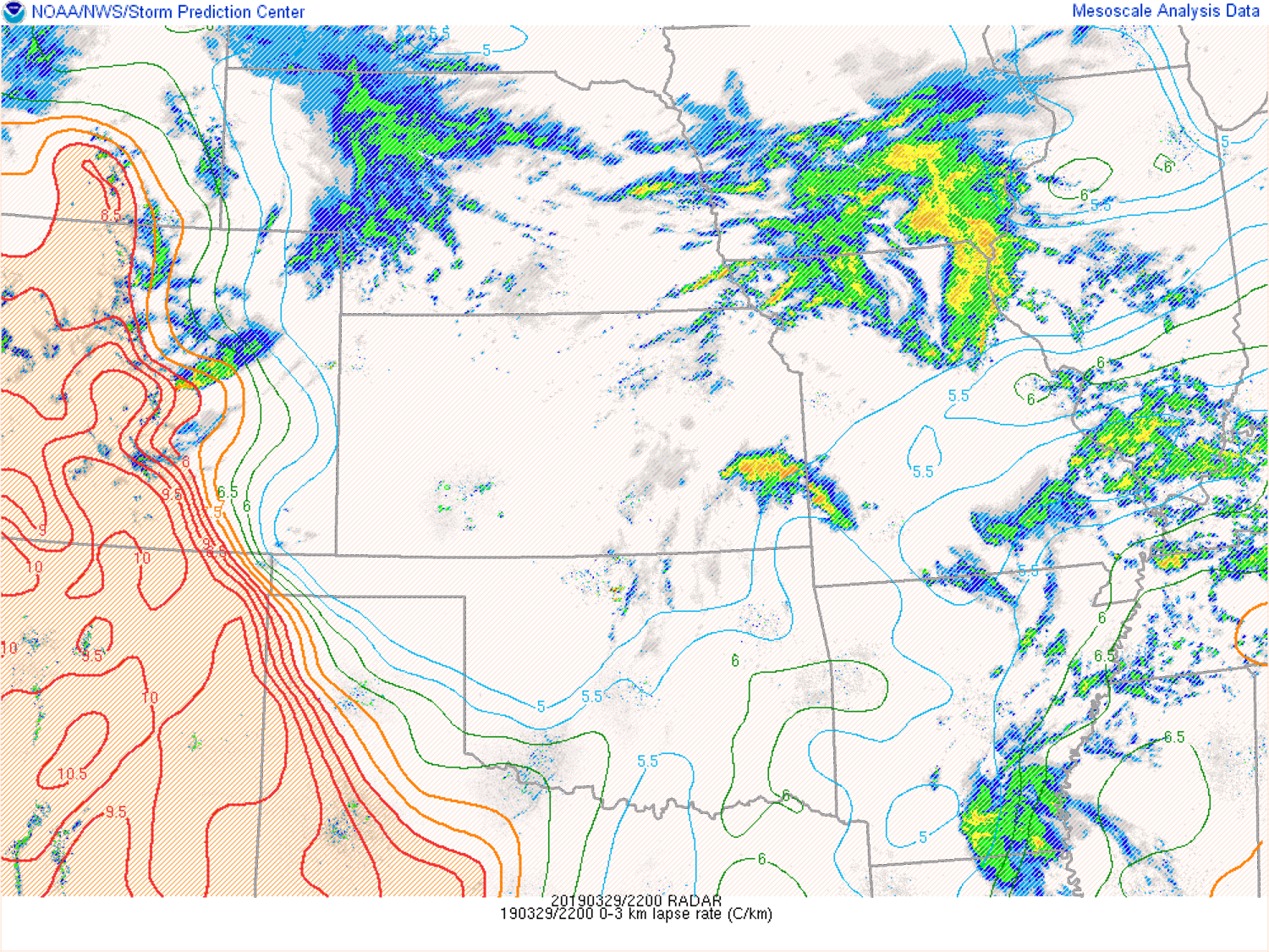
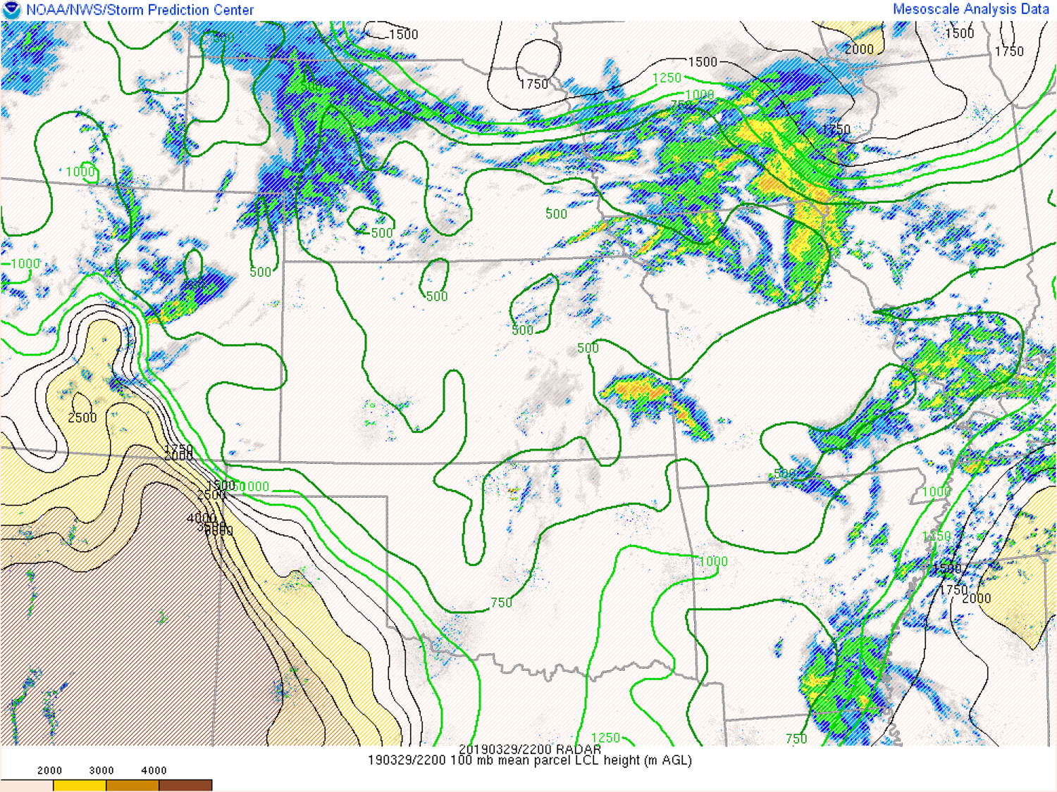
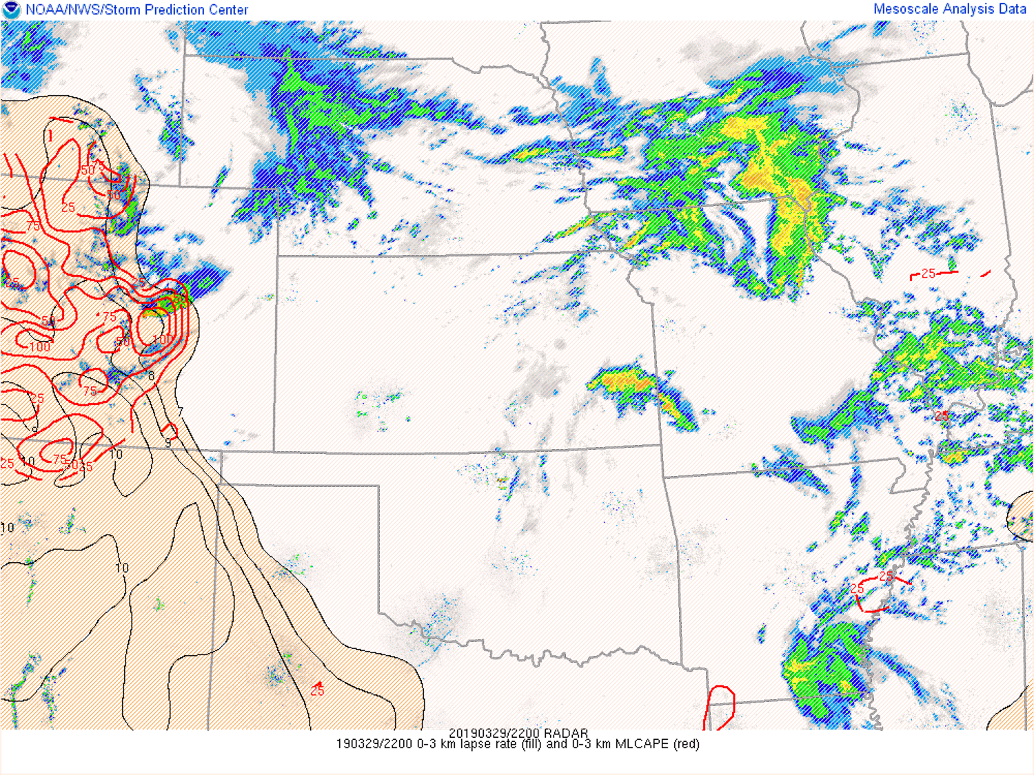
Ahead of the northerly surge in northern El Paso County, surface temperatures had only risen into the mid to upper 40s during the afternoon, with dew points in the mid to upper 30s. However, very cold air aloft in association with the shortwave yielded steep low and mid level lapse rates and marginal SBCAPE and MLCAPE of 500-1000 j/kg. Increasing southwesterly flow aloft and southeasterly flow at the surface resulted in EBSHEAR of around 45 knots. The combination of marginal instability and strong deep layer shear supported the development of a supercell thunderstorm along the convergence zone in northern El Paso County. The development of a tornado was made possible by enhanced stretching potential as a result of steep low level lapse rates (up to 9 C/km) and elevated low level instability (>100 j/kg 0-3 km MLCAPE) along the surface convergence zone and associated vorticity. The supercell tornado potential was further enhanced by favorable low-level shear (15-20 knots) and a low LCL (around 750 m). Storm inflow between 15 and 20 knots helped to allow the supercell to sustain itself long enough to produce a tornado. The 18Z, 3 hr NAM forecast sounding valid at 21Z over northern El Paso County is likely a decent representation of the actual environment at the time, indicating the steep lapse rates, marginal instability, and strong shear.
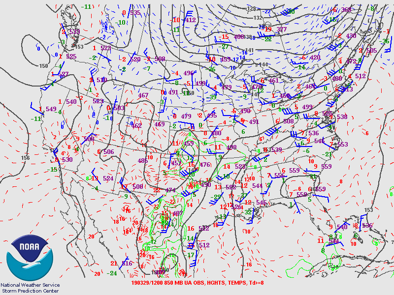
SPC Upper-Air Maps:
March 29th, 2019 at 6:00AM MDT
 |
 |
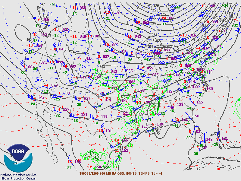 |
| 300-hPa Analysis | 500-hPa Analysis | 700-hPa Analysis |
 |
 |
| 850-hPa Analysis | Surface Analysis |
March 29th, 2019 at 6:00PM MDT
 |
 |
 |
| 300-hPa Analysis | 500-hPa Analysis | 700-hPa Analysis |
 |
 |
| 850-hPa Analysis | Surface Analysis |
Forecast Soundings:
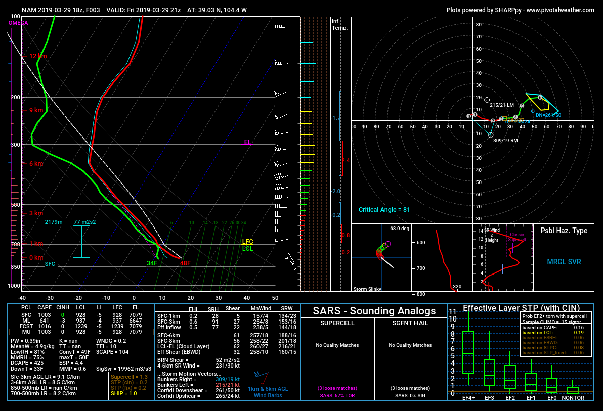 |
| March 29, 2019 18Z NAM, 3 hour forecast valid at 21Z, or 3 PM, near location of tornado. |
SPC Mesoanalysis:
 |
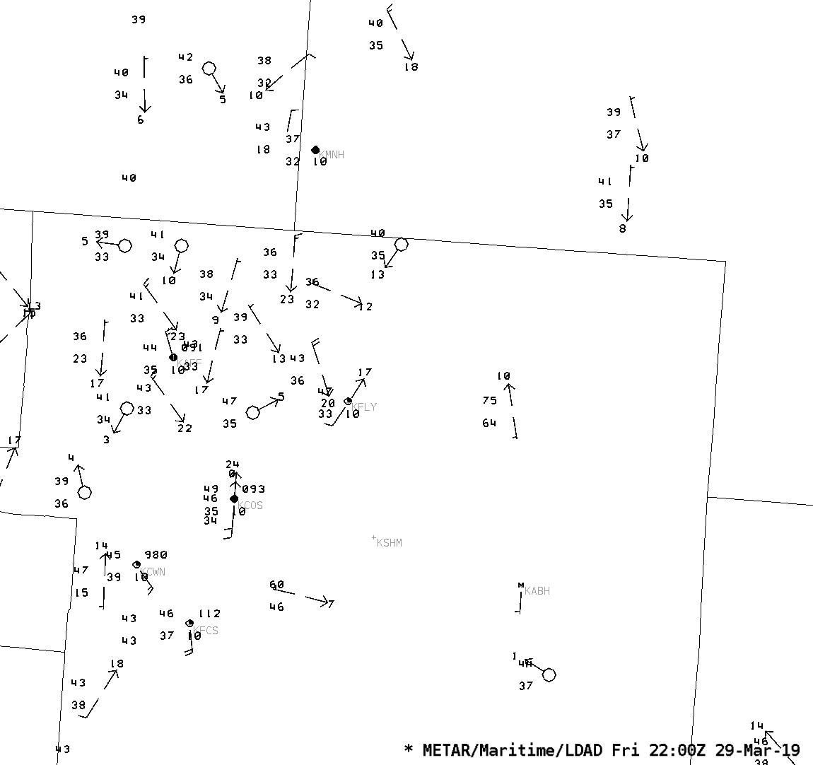 |
 |
| Surface Observations across Colorado | Surface Observations across El Paso County and adjacent counties | Surface Vorticity and Convergence/Divergence at 2:00PM MDT |
 |
 |
 |
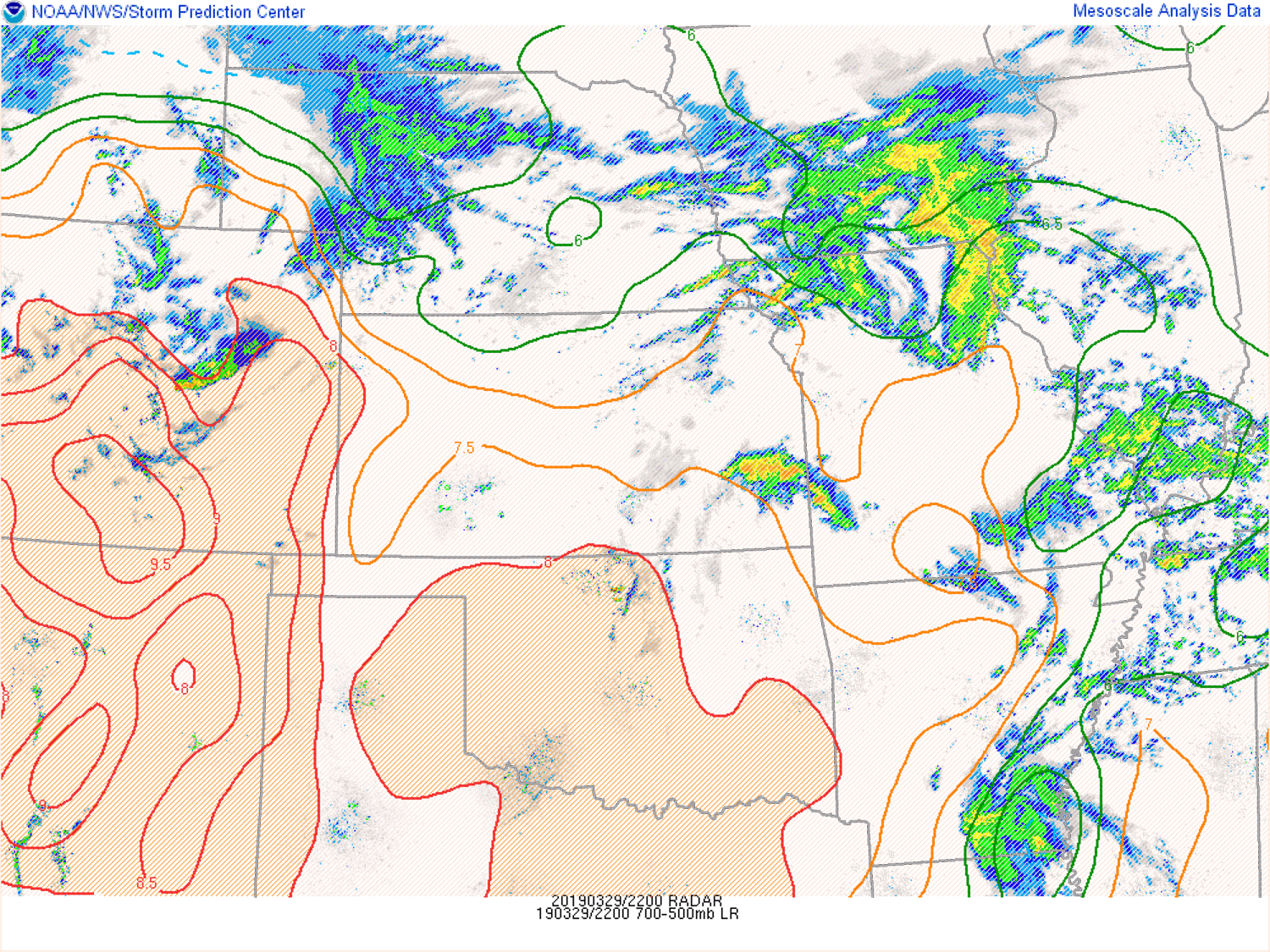
| MLCAPE, MLCIN | Mid-Level Lapse Rates |
Low-Level Lapse Rates |
 |
 |
 |
| ML LCL | Low-level Lapse Rates, Low-level MLCAPE | Low-level Storm Relative Winds |
 |
 |
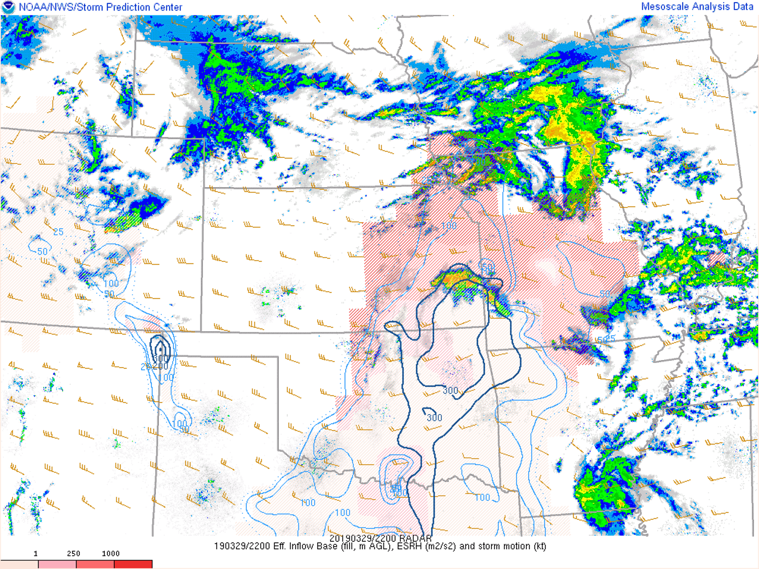 |
| Effective Bulk Shear | 0-1 km Shear | Effective Storm Relative Helicity |
 |
Media use of NWS Web News Stories is encouraged! Please acknowledge the NWS as the source of any news information accessed from this site. |
|

