
Thunderstorms, some severe, may produce heavy to excessive rainfall and isolated flooding over portions of the Southern Plains through Saturday. Widespread showers and thunderstorms will spread east into the Great Lakes, Ohio Valley, Mid Atlantic and Northeast. Dry conditions, combined with gusty winds will continue to support an elevated fire weather threat in the Desert Southwest. Read More >
Overview
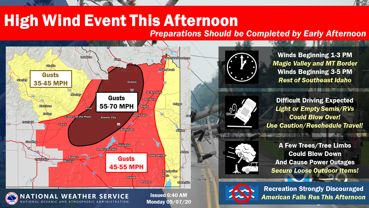
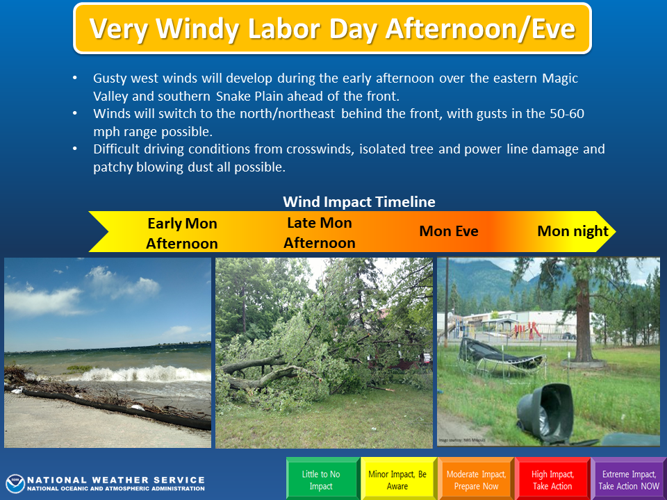
Lead up: In the days leading up to this event, it became apparent that an unusual event was looming on the horizon as forecast models were increasingly hinting that a very strong Canadian cold front would develop over western Canada and plunge south across eastern Idaho. In fact, this is what indeed occurred. A cold front developed off of a westward extending tail that emanated from a Polar Vortex located south of Hudson Bay, Canada. Unusually cold air built up behind the front, and a tremendous amount of wind was developing in association with this system. The National Weather Service in Pocatello began to ramp up messaging in advance of this system once forecaster confidence became high. Two days before the event, forecasters created and sent targeted emails, social media posts and additional detailed posts in an Emergency Management portal. In addition, we partnered with the Idaho Transportation Department and Idaho State Communications to activate overhead message signs of the incoming winds, in an effort to encourage Labor Day travelers to reach their destinations early, prior to the onset of strong winds.
The event: During the early afternoon hours of Monday, September 7, the cold front entered Idaho from the north. The front then rapidly raced south, reaching the Arco Desert and Idaho Falls by 4PM, Pocatello by 5PM, then the eastern Magic Valley and Utah border by 7PM. Strong, damaging winds developed behind the front, pouring first through gaps in the Continental Divide then surging south behind the front. Widespread wind gusts out of the north/northeast in the 50-75 mph range were recorded along and behind the front, across all but Teton, Caribou and Bear Lake counties. Winds then continued through the night, with a secondary surge just after midnight. Although still remaining breezy, the damaging winds ceased around sunrise. Widespread tree and power line damage was reported, with thousands still without power 24 hours later. Structural damage occurred to outbuildings and some homes. In addition, several schools cancelled classes due to the power outages. This event contained many highly unusual factors, including the shear strength of the winds, the direction of the winds, the large area across which they occurred as well as how long they lasted. All these things combined suggest that there may not be another event comparable to this in eastern Idaho's climate history. We hope those that lost power and sustained damage can return to normal quickly.
Peak Wind Gusts
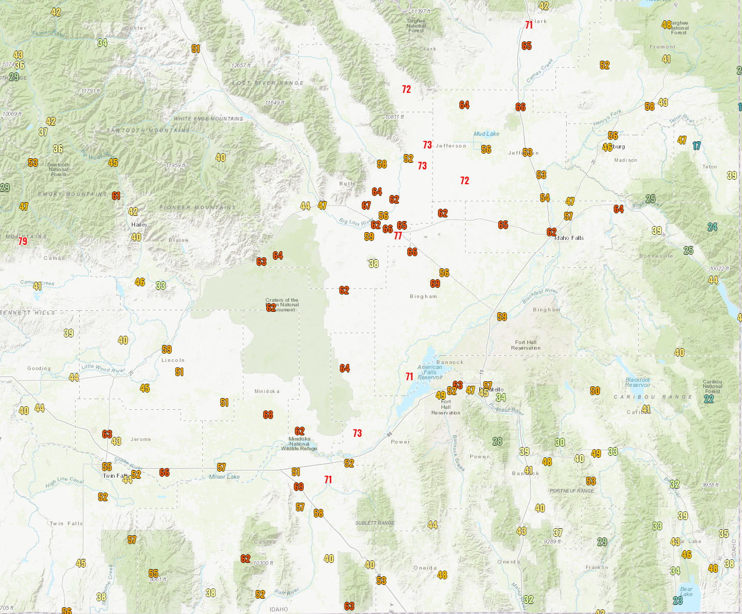
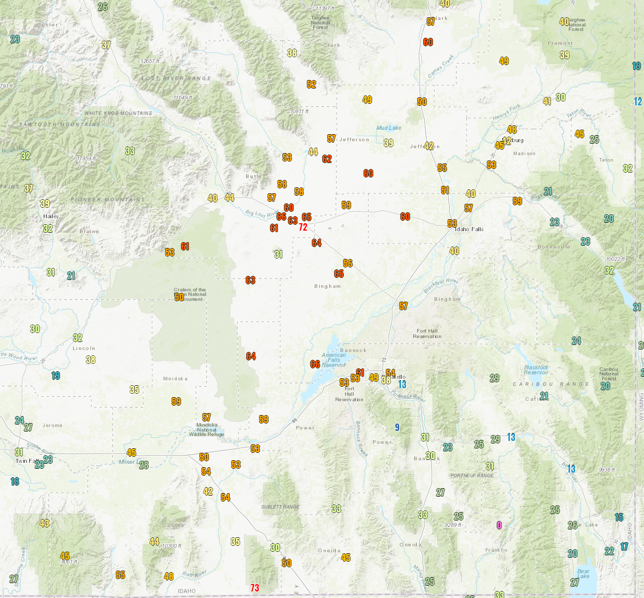
Winds peaked along and behind the front, and widespread 50-75 mph wind gusts occurred across much of eastern Idaho in the wake of this extremely strong cold front. The strength, duration, intensity and widespread nature of these winds were unprecedented.
 |
 |
 |
 |
|
Peak Wind Gusts on Monday, September 7. Source: NWS Weather and Hazards Data Viewer |
Peak Wind Gusts on Tuesday, September 8. Source: NWS Weather and Hazards Data Viewer |
Pocatello ASOS Display showing 55 knot (63 mph) wind gust along the cold front.
|
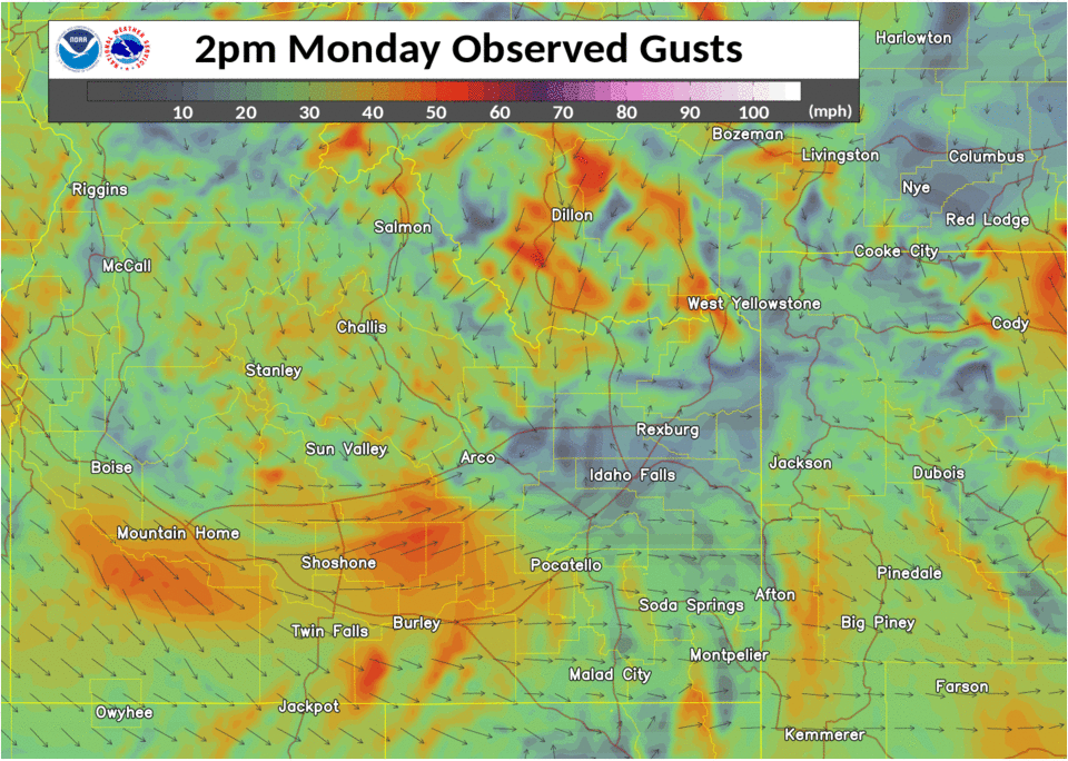
Visualization of Wind Gusts through the event. Source: Weather Analysis and Visualization Environment
|
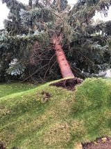
Photos
 |
 |
 |
 |
|
This uprooted tree fell on a home in American Falls NWS Pocatello Facebook via Leola Kimbler Hulet |
Damage to a Home's Roof west of Blackfoot NWS Pocatello Facebook via Alicia Clark |
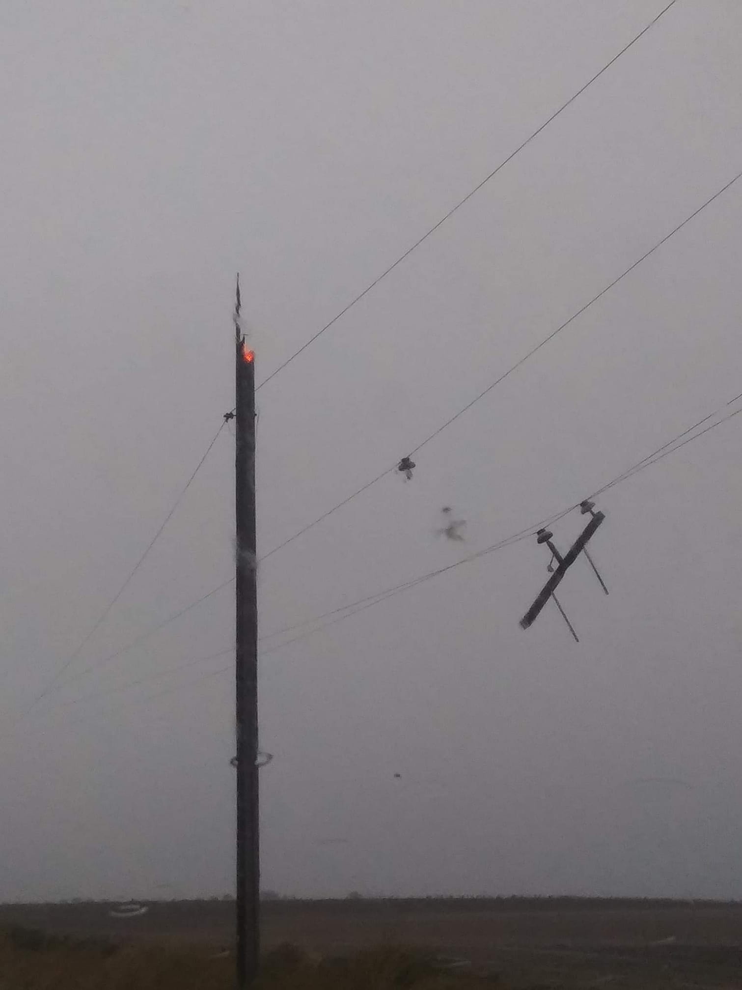
Snapped power pole 600N and 1300W - Blackfoot NWS Pocatello Facebook via Tiare Johnson Clement |
Pocatello Monte Vista Hill area NWS Pocatello Facebook via Tammy Kunz Parker |
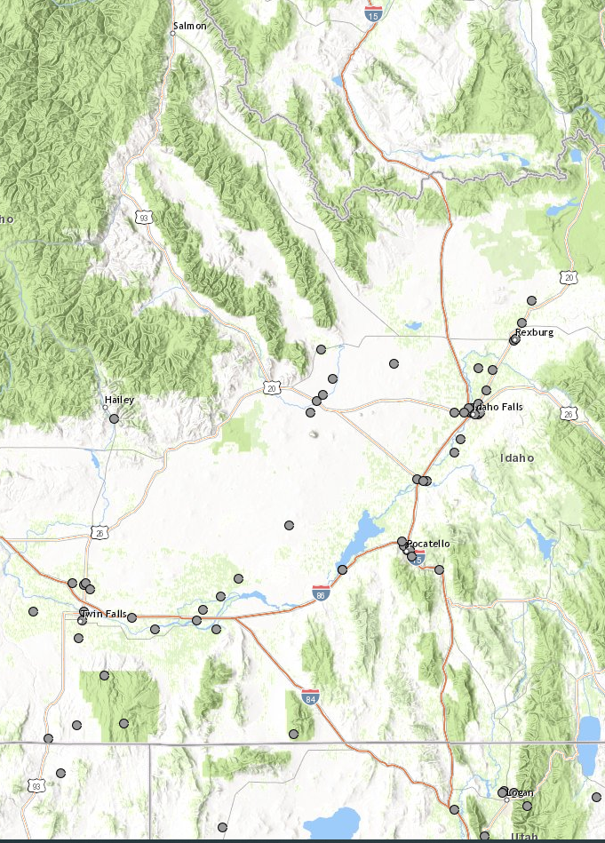
Storm Reports
https://nwschat.weather.gov/p.php?pid=202009120116-KPIH-NWUS55-LSRPIH
http://mesonet.agron.
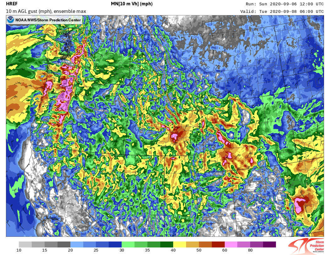
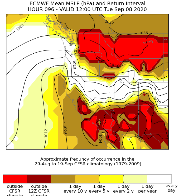
Environment
 |
 |
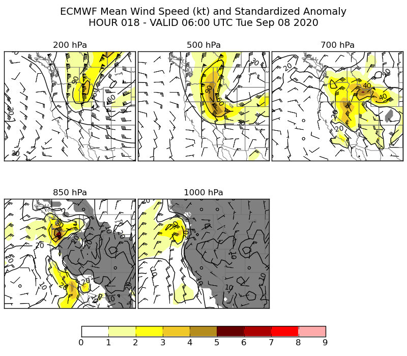 |
| Figure 1: HREF Model Ensemble Wind Forecast | Figure 2: ECMWF Surface Pressure Anomaly relative to climatology - red areas indicate areas outside of previously measured values | Figure 3: ECMWF Wind Anomalies - 700 mb bullseye over east Idaho +7 standard anomalies or well outside of any previously observed wind value |
Additional environmental data:
 |
 |
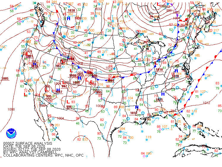 |
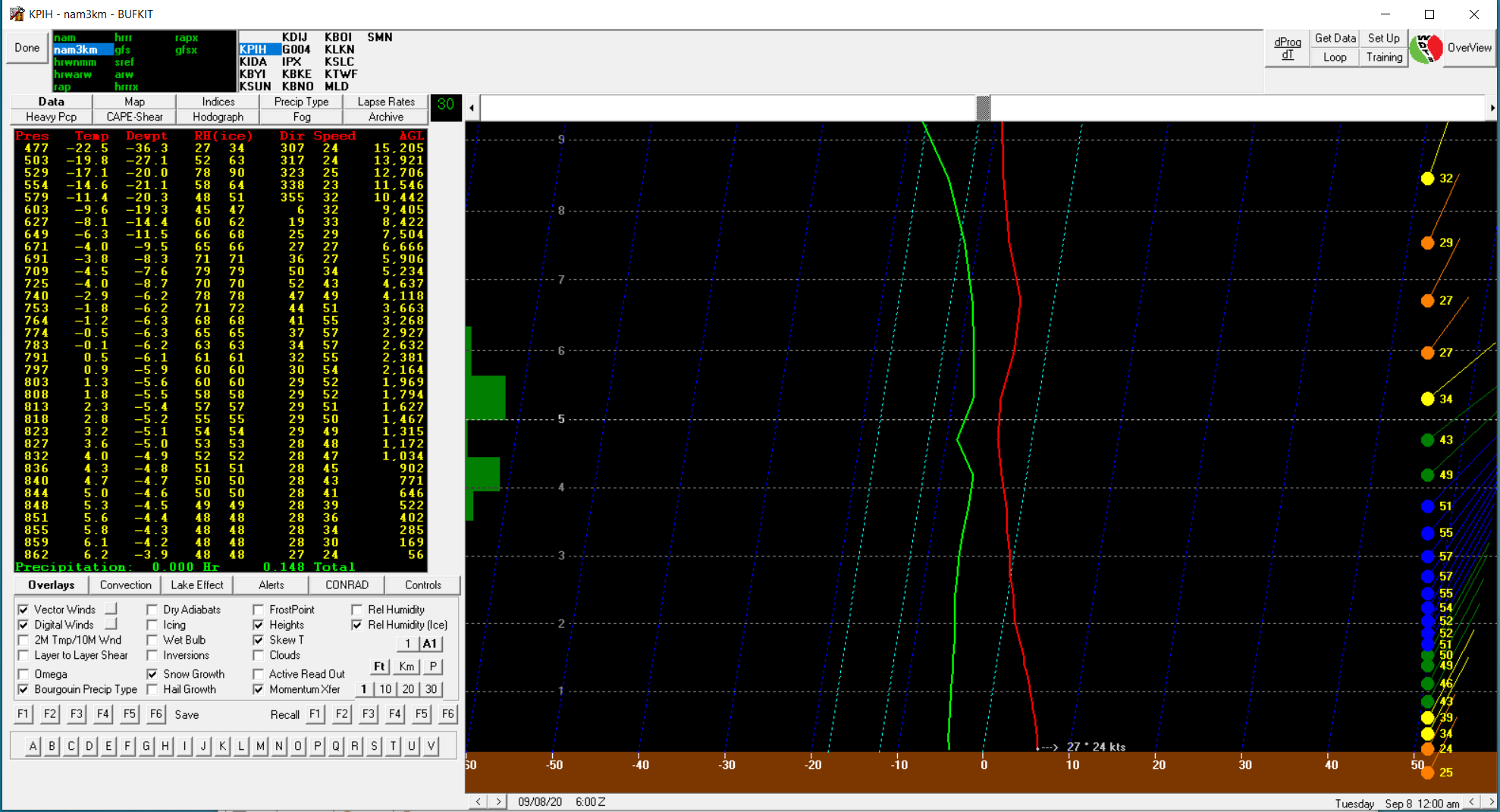
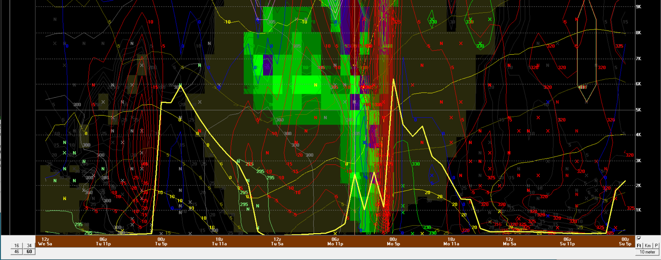
| Figure 7: BUFKIT Profile showing extreme winds over Pocatello at Midnight Monday night | Figure 8: BUFKIT profile over Pocatello showing extreme vertical motion | Figure 9: WPC Surface analysis at 6PM MDT Monday, September 7 as cold front moves through east Idaho |
Additional Impacts, Messaging & Social Media
 |
 |
 |
 |
|
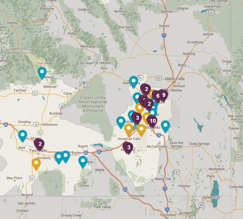
Idaho Power Outage Map 11:15 AM MDT September 8 |
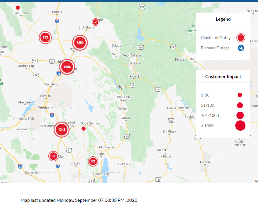
Rocky Mountain Pwr Outage Map 8:30 PM MDT September 7 |
Downed Traffic Light in Pocatello - Corner of Gould and Main Source: Pocatello Traffic Ops |
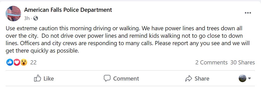
Cautionary Facebook Post from American Falls Police Department |
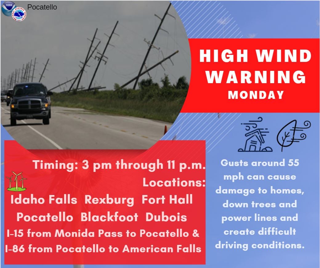 |
 |
 |
| Wind Messaging issued by NWS Pocatello ahead of the event | Wind Messaging issued by NWS Pocatello ahead of the event | Wind Messaging issued by NWS Pocatello ahead of the event |
Watch/Warning Lead Time
| Counties & Issuance Time | Lead Time |
| High Wind Watch Issued For all of East Idaho Saturday Afternoon | 48 hours |
| High Wind Warning Issued for Arco/Mud Lake/Upper Snake Plain/Lower Snake Plain Sunday Afternoon | 24 hours |
| Wind Advisory Issued for eastern Magic Valley, south hills, Teton Valley Sunday Afternoon | 24 hours |
 |
Media use of NWS Web News Stories is encouraged! Please acknowledge the NWS as the source of any news information accessed from this site. |
|

